Bad River (WI) (Click on an image to go to hydrograph webpage)
ODAW3:
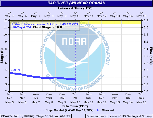
BDOW3:

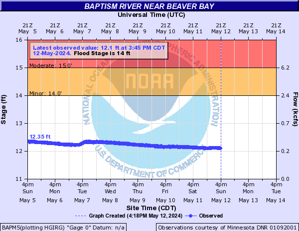
Baptism River (Click on an image to go to hydrograph webpage)
BAPM5:
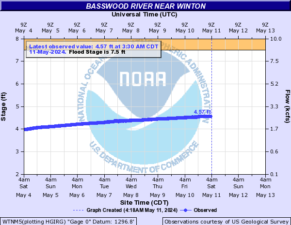
Basswood River (Click on an image to go to hydrograph webpage)
WTNM5:
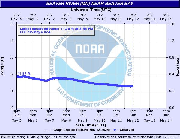
Beaver River (MN) (Click on an image to go to hydrograph webpage)
BRBM5:
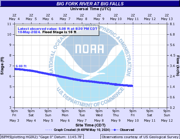
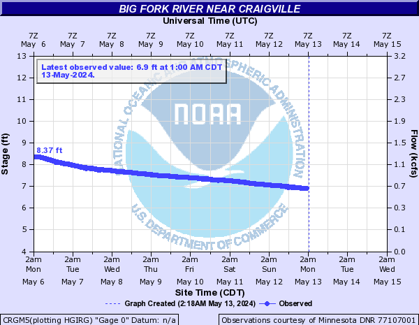
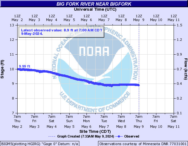
Big Fork River (Click on an image to go to hydrograph webpage)
BIFM5:
CRGM5:
BIGM5:
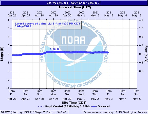
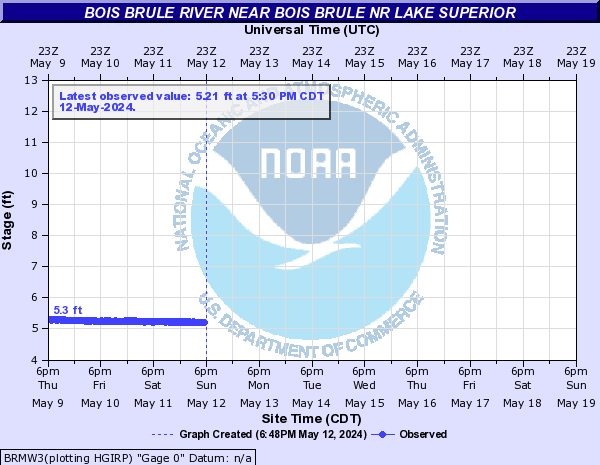
Bois Brule River (Click on an image to go to hydrograph webpage)
BRSW3:
BRMW3:
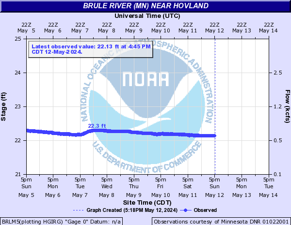
Brule River (MN) (Click on an image to go to hydrograph webpage)
BRLM5:
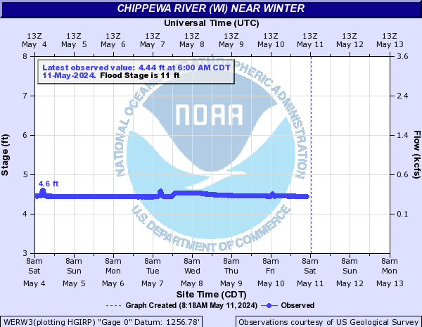
Chippewa River (WI) (Click on an image to go to hydrograph webpage)
WERW3:
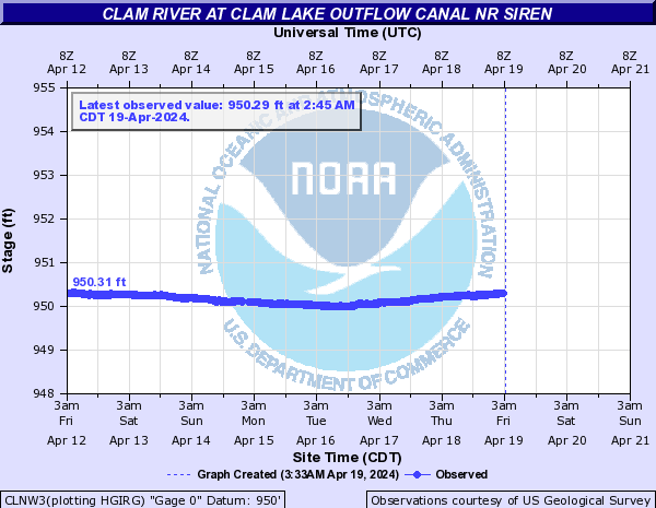
Clam River (Click on an image to go to hydrograph webpage)
CLNW3:
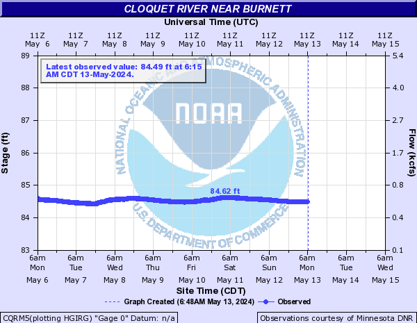
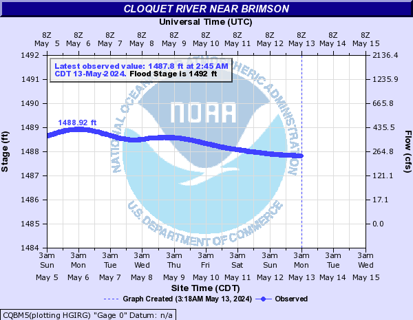
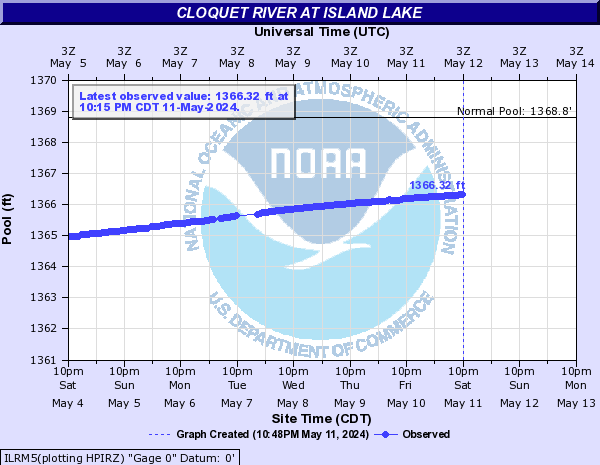
Cloquet River (Click on an image to go to hydrograph webpage)
CQRM5:
CQBM5:
ILRM5:
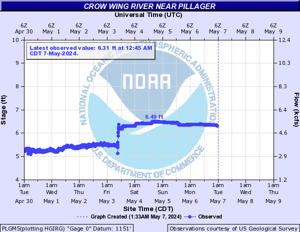
Crow Wing River (Click on an image to go to hydrograph webpage)
PLGM5:
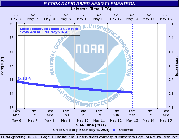
E Fork Rapid River (Click on an image to go to hydrograph webpage)
EFRM5:
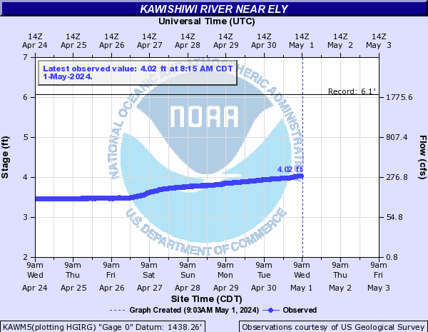
Kawishiwi River (Click on an image to go to hydrograph webpage)
KAWM5:
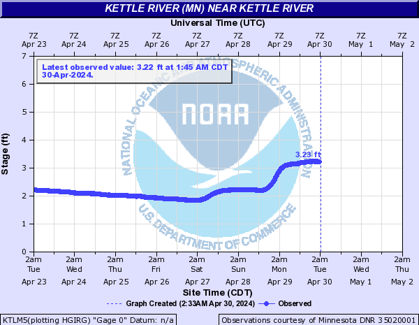
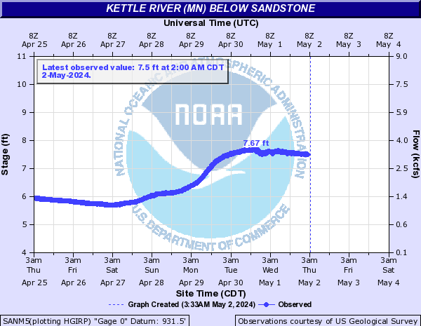
Kettle River (MN) (Click on an image to go to hydrograph webpage)
KTLM5:
SANM5:
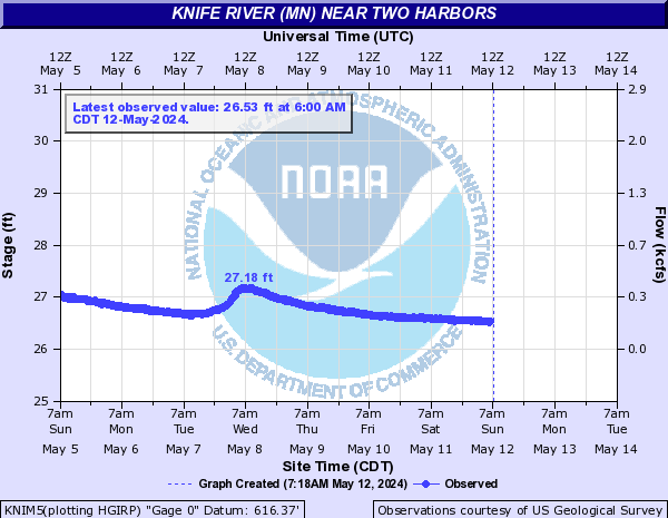
Knife River (MN) (Click on an image to go to hydrograph webpage)
KNIM5:
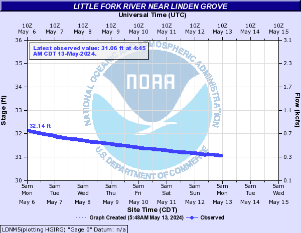
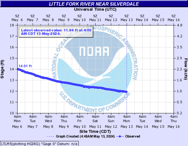
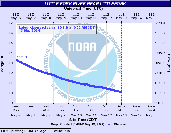
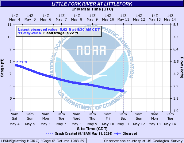
Little Fork River (Click on an image to go to hydrograph webpage)
LDNM5:
LTLM5:
LILM5:
LFKM5:
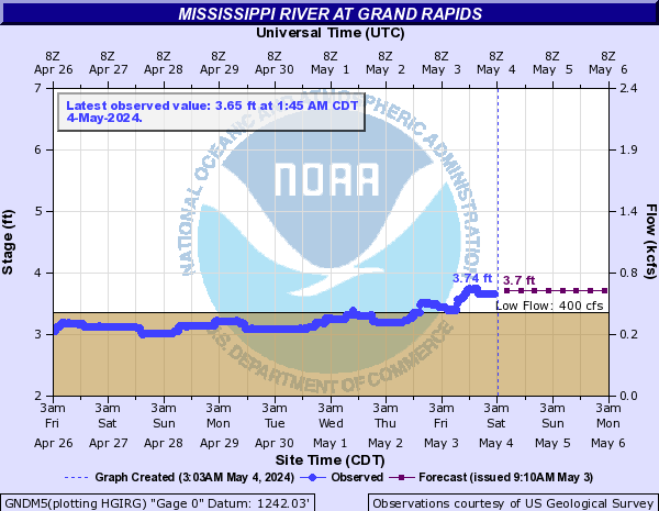
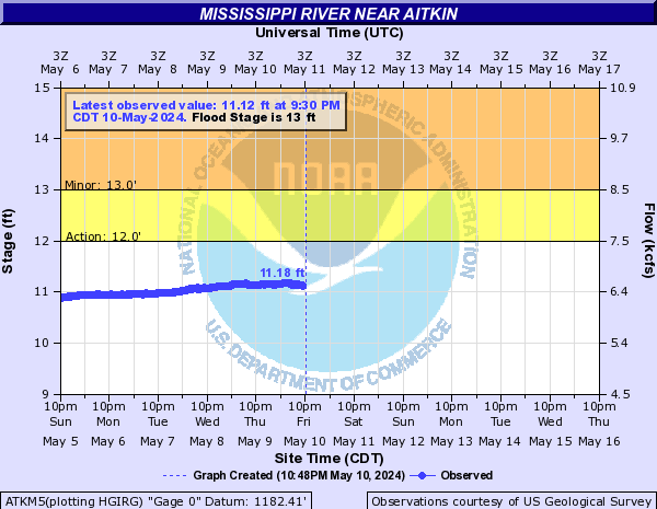
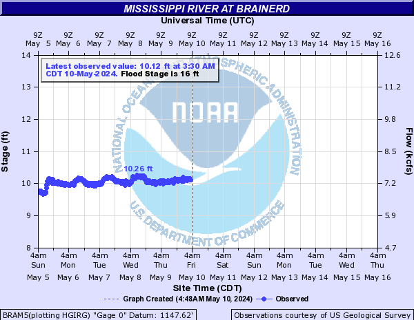
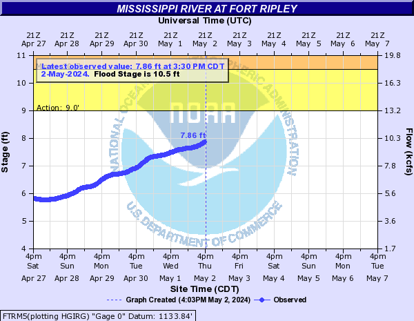
Mississippi River (Click on an image to go to hydrograph webpage)
GNDM5:
ATKM5:
BRAM5:
FTRM5:
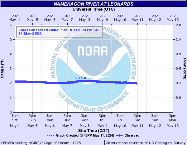
Namekagon River (Click on an image to go to hydrograph webpage)
LEOW3:
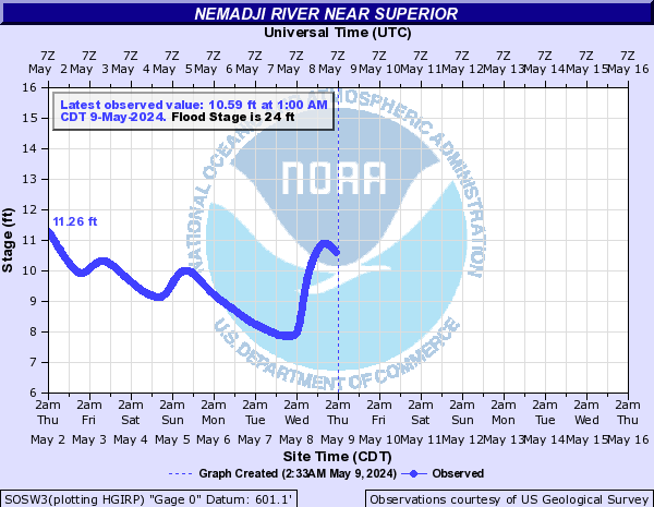
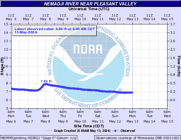
Nemadji River (Click on an image to go to hydrograph webpage)
SOSW3:
NEMM5:
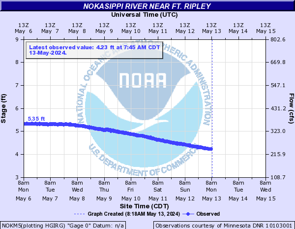
Nokasippi River (Click on an image to go to hydrograph webpage)
NOKM5:
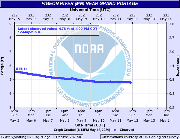
Pigeon River (MN) (Click on an image to go to hydrograph webpage)
GDPM5:
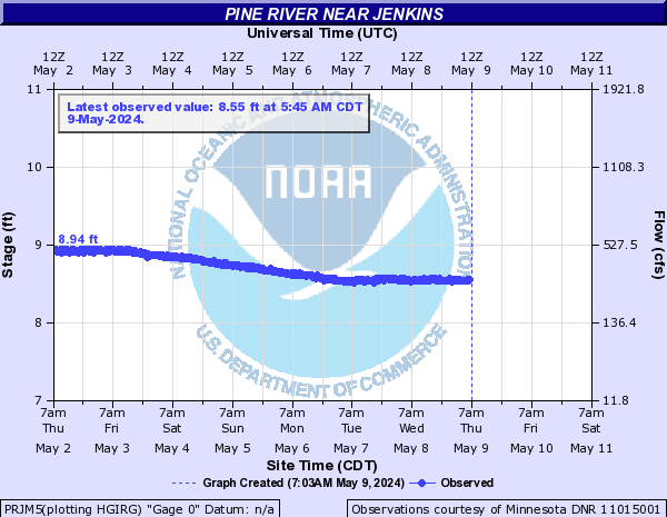
Pine River (Click on an image to go to hydrograph webpage)
PRJM5:
MISM5:

Poplar River (MN) (Click on an image to go to hydrograph webpage)
POPM5:

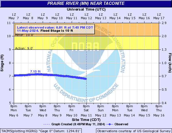
Prairie River (MN) (Click on an image to go to hydrograph webpage)
TACM5:
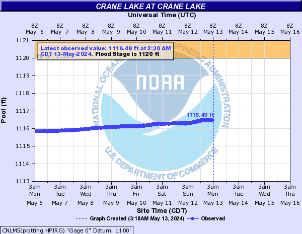
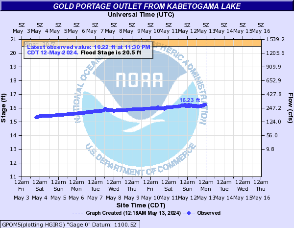
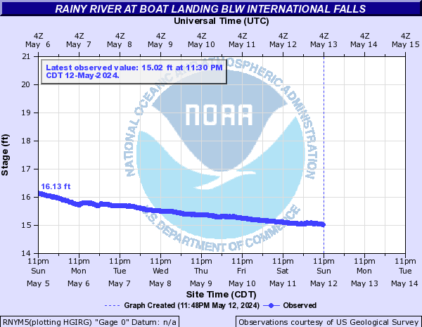
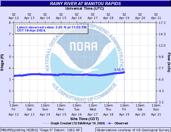
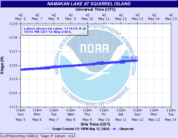
Rainy River (Click on an image to go to hydrograph webpage)
CNLM5:
GPOM5:
RNYM5:
MNUM5:
LLCM5:
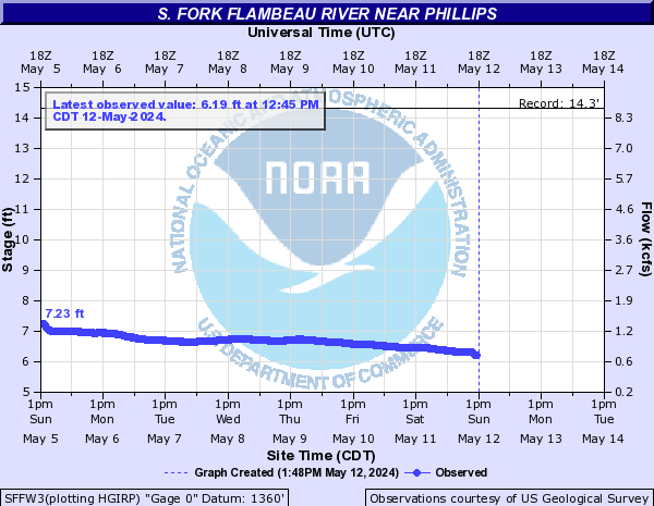
S. Fork Flambeau River (Click on an image to go to hydrograph webpage)
SFFW3:
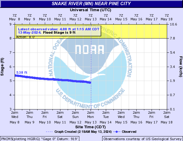
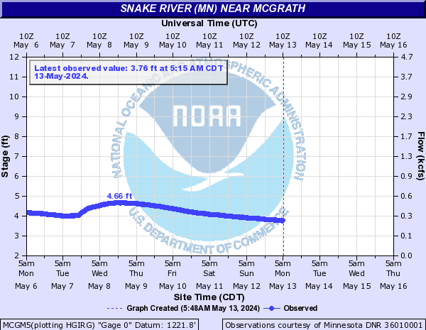
Snake River (MN) (Click on an image to go to hydrograph webpage)
PNCM5:
MCGM5:
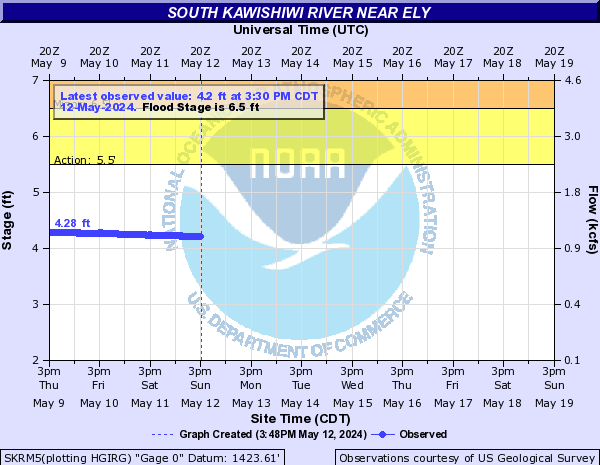
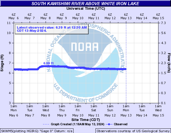
South Kawishiwi River (Click on an image to go to hydrograph webpage)
SKRM5:
SKWM5:
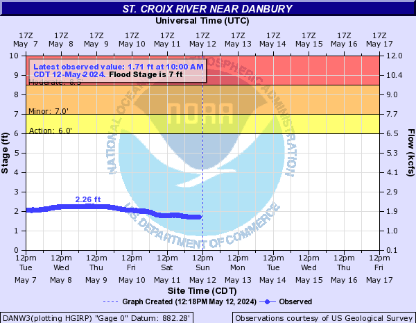
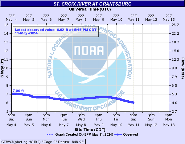
St. Croix River (Click on an image to go to hydrograph webpage)
DANW3:
GTBW3:
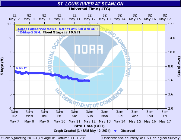
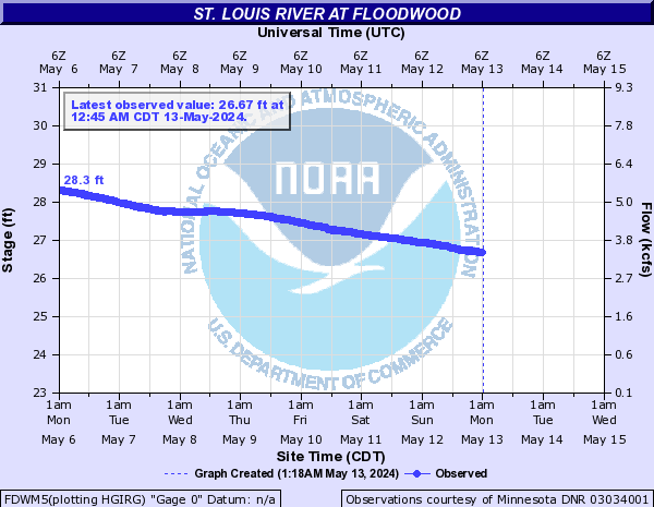
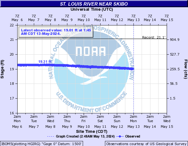
St. Louis River (Click on an image to go to hydrograph webpage)
SCNM5:
FDWM5:
IBOM5:
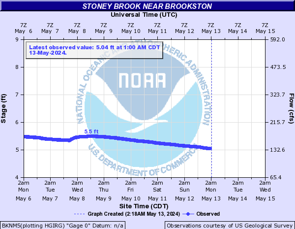
Stoney Brook (Click on an image to go to hydrograph webpage)
BKNM5:
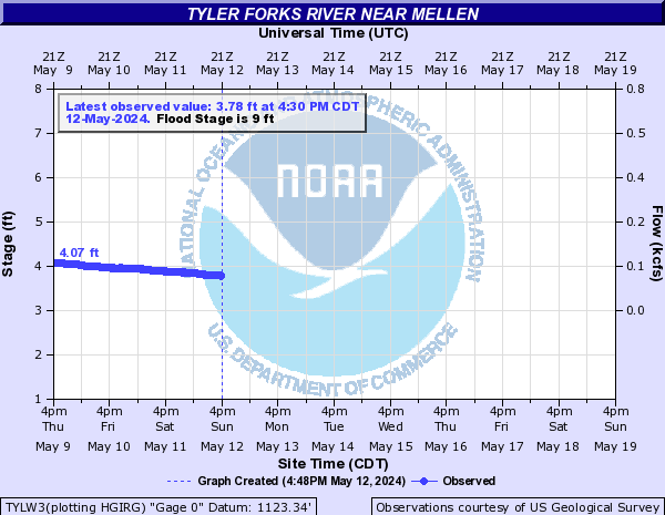
Tyler Forks River (Click on an image to go to hydrograph webpage)
TYLW3:
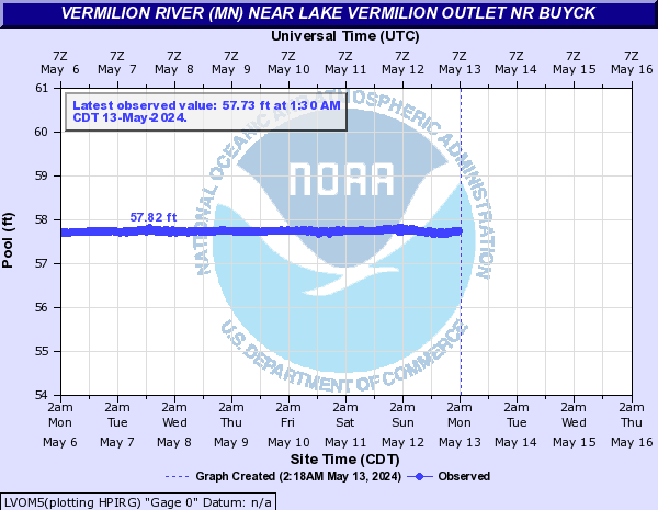
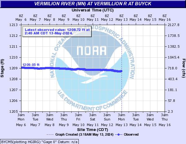
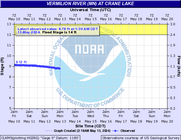
Vermilion River (MN) (Click on an image to go to hydrograph webpage)
LVOM5:
BYCM5:
CLKM5:
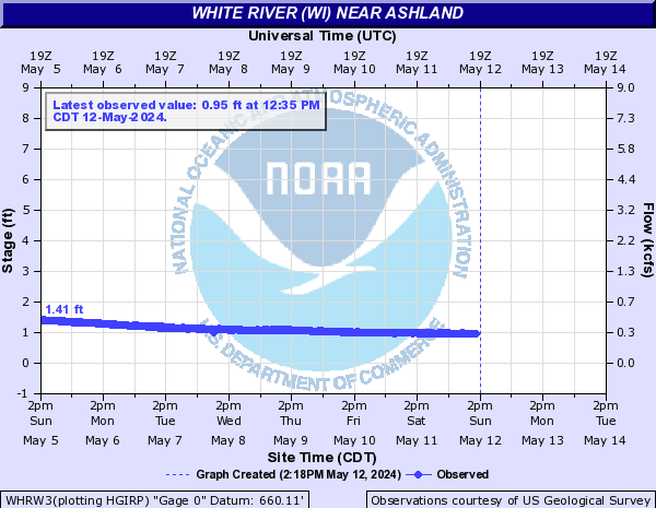
White River (WI) (Click on an image to go to hydrograph webpage)
WHRW3:
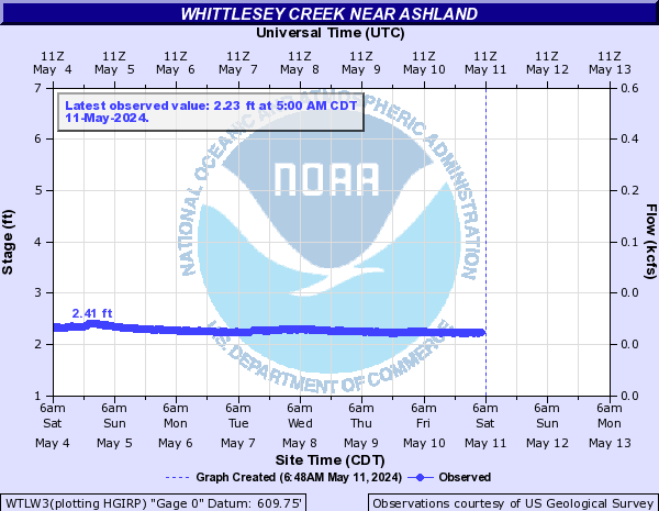
Whittlesey Creek (Click on an image to go to hydrograph webpage)
WTLW3:
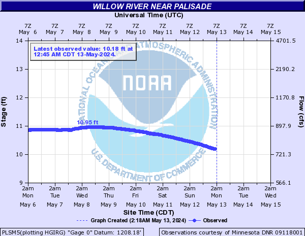
Willow River (Click on an image to go to hydrograph webpage)
PLSM5: