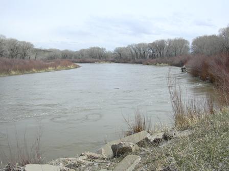
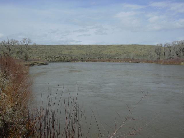
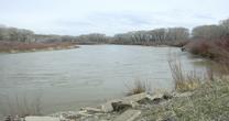
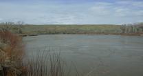
North Platte River near Sinclair
Future / Actual / Minor
OWP 2.0 WWA Modal Title
01/11/2021, 10:04 PM UTC through 01/11/2021, 10:04 PM UTC
Sender
Sent
- Warning: no valid ratings curve available. Transformations to and from FEET/CFS/KCFS will not happen.
Traces and Thresholds Click to turn on/off display
Observed (OBS) 04/07/2025 6:45 PM MDTRecord: 11.6 ftCATEGORY STAGE 
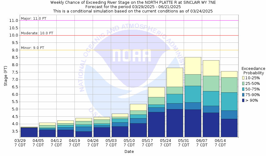
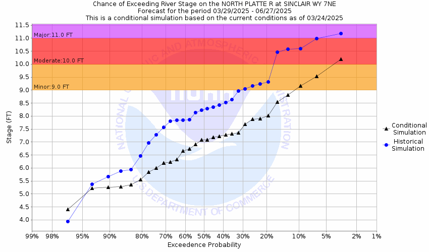
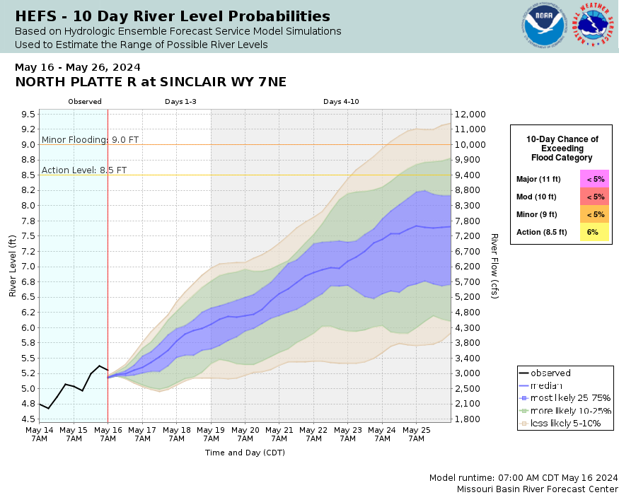
Major Flooding 11 ft Moderate Flooding 10 ft Minor Flooding 9 ft Action 8.5 ft Reliability of the Forecast: Based on unobstructed flow
NOTE: Forecasts are issued as needed during times of high water, but are not routinely available.
National Water Model Hydrograph
Official NWS streamflow forecasts are produced by NWS hydrologic forecasters for river gauge locations using hydrologic models which are calibrated to that location. This process considers additional guidance and information, including local expertise and experience, to produce the best forecast possible. The NWM output provides supplemental guidance to NWS forecasters and should not be considered an official NWS river forecast.
Flood Impacts
- 12 - The Fort Steele state historic site becomes totally inundated with high water. A majority of the Sinclair Golf Club is totally submerged. High water may begin to encroach low lying areas near Interstate 80 at the Sinclair rest area and near the Fort Steele highway bridge.
- 11.64 - Record stage and flow of 16,700 cfs established on June 14 2010.
- 11 - Lowland areas along the left river bank near the Fort Steele state historic site become totally inundated. Low lying areas at the Sinclair Golf Club become totally submerged.
Gauge Info
| Coordinates | 41.8722, -107.058 |
| RFC | MBRFC |
| State | WY |
| WFO | CYS |
| County | Carbon |
| Data Provider(s) | |
| US Geological Survey | USGS--Water Resources of the United States |
| USGS | 06630000 |
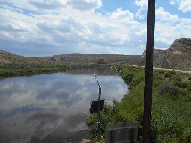
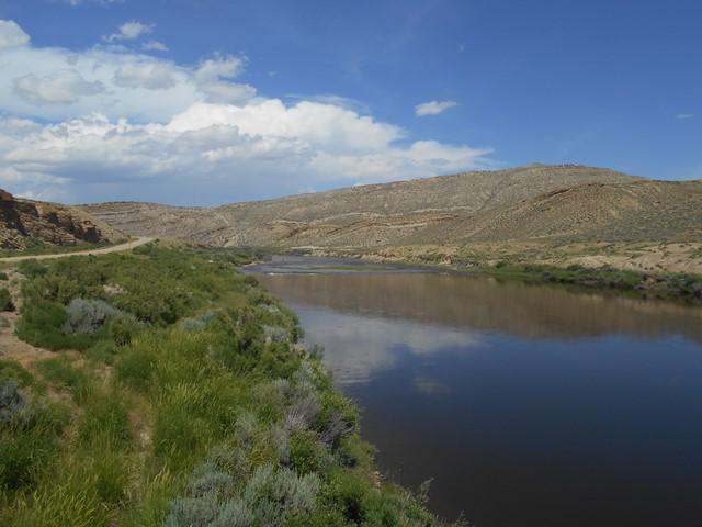
Gauge Location
Recent Crests
| 1. | 9.60 ft | on 06-25-2019 | (P) |
| 2. | 6.04 ft | on 05-29-2018 | |
| 3. | 7.33 ft | on 06-11-2017 | |
| 4. | 8.41 ft | on 06-09-2016 | |
| 5. | 7.01 ft | on 06-13-2015 |
Recent Crests
| 1. | 9.60 ft | on 06-25-2019 | (P) |
| 2. | 6.04 ft | on 05-29-2018 | |
| 3. | 7.33 ft | on 06-11-2017 | |
| 4. | 8.41 ft | on 06-09-2016 | |
| 5. | 7.01 ft | on 06-13-2015 | |
| 6. | 10.50 ft | on 05-29-2014 | |
| 7. | 6.00 ft | on 05-18-2013 | |
| 8. | 4.69 ft | on 04-03-2012 | |
| 9. | 11.46 ft | on 06-09-2011 | |
| 10. | 11.64 ft | on 06-14-2010 | |
| 11. | 8.62 ft | on 06-05-2009 | |
| 12. | 8.89 ft | on 06-07-2008 | |
| 13. | 5.84 ft | on 05-22-2007 | |
| 14. | 7.23 ft | on 05-24-2006 | |
| 15. | 8.23 ft | on 06-07-2005 | |
| 16. | 4.80 ft | on 06-23-2004 | |
| 17. | 8.22 ft | on 06-02-2003 | |
| 18. | 4.23 ft | on 04-06-2002 | |
| 19. | 6.05 ft | on 05-17-2001 | |
| 20. | 6.80 ft | on 05-30-2000 | |
| 21. | 7.82 ft | on 05-31-1999 | |
| 22. | 7.49 ft | on 06-18-1998 | |
| 23. | 9.42 ft | on 06-07-1997 | |
| 24. | 8.32 ft | on 05-20-1996 | |
| 25. | 9.51 ft | on 06-19-1995 | |
| 26. | 5.93 ft | on 05-14-1994 | |
| 27. | 7.54 ft | on 06-19-1993 | |
| 28. | 5.17 ft | on 05-28-1992 | |
| 29. | 6.39 ft | on 06-02-1991 | |
| 30. | 6.30 ft | on 06-13-1990 | |
| 31. | 4.16 ft | on 04-24-1989 | |
| 32. | 6.46 ft | on 05-20-1988 | |
| 33. | 4.66 ft | on 05-02-1987 | |
| 34. | 11.30 ft | on 06-11-1986 | |
| 35. | 7.15 ft | on 05-12-1985 | |
| 36. | 10.84 ft | on 05-26-1984 | |
| 37. | 9.86 ft | on 06-26-1983 | |
| 38. | 7.80 ft | on 06-27-1982 | |
| 39. | 5.24 ft | on 06-09-1981 | |
| 40. | 7.41 ft | on 05-25-1980 | |
| 41. | 7.35 ft | on 05-30-1979 | |
| 42. | 8.03 ft | on 06-17-1978 | |
| 43. | 4.84 ft | on 05-17-1977 | |
| 44. | 5.44 ft | on 05-24-1976 | |
| 45. | 6.76 ft | on 06-08-1975 | |
| 46. | 7.20 ft | on 06-10-1974 | |
| 47. | 8.28 ft | on 06-16-1973 | |
| 48. | 7.82 ft | on 06-10-1972 | |
| 49. | 8.47 ft | on 06-21-1971 | |
| 50. | 8.42 ft | on 10-01-1970 | |
| 51. | 8.42 ft | on 10-01-1969 | |
| 52. | 7.86 ft | on 06-08-1968 | |
| 53. | 6.69 ft | on 06-24-1967 | |
| 54. | 8.40 ft | on 06-15-1965 | |
| 55. | 6.01 ft | on 06-08-1964 | |
| 56. | 5.35 ft | on 06-04-1963 | |
| 57. | 7.92 ft | on 05-14-1962 | |
| 58. | 5.34 ft | on 06-02-1961 | |
| 59. | 5.96 ft | on 03-29-1960 | |
| 60. | 5.68 ft | on 06-15-1959 | |
| 61. | 7.86 ft | on 05-31-1958 | |
| 62. | 9.72 ft | on 06-15-1957 | |
| 63. | 6.80 ft | on 06-06-1956 | |
| 64. | 4.40 ft | on 06-18-1955 | |
| 65. | 4.52 ft | on 05-23-1954 | |
| 66. | 6.90 ft | on 06-20-1953 | |
| 67. | 9.00 ft | on 06-08-1952 | |
| 68. | 6.41 ft | on 05-31-1951 | |
| 69. | 6.68 ft | on 06-18-1950 | |
| 70. | 8.25 ft | on 06-14-1949 | |
| 71. | 6.49 ft | on 05-23-1948 | |
| 72. | 7.03 ft | on 06-22-1947 | |
| 73. | 5.97 ft | on 06-19-1946 | |
| 74. | 7.02 ft | on 06-07-1945 | |
| 75. | 5.52 ft | on 06-05-1944 | |
| 76. | 8.45 ft | on 06-03-1943 | |
| 77. | 7.04 ft | on 06-13-1942 | |
| 78. | 5.59 ft | on 05-14-1941 | |
| 79. | 4.99 ft | on 06-03-1940 |
Historic Crests
| 1. | 11.64 ft | on 06-14-2010 |
| 2. | 11.46 ft | on 06-09-2011 |
| 3. | 11.30 ft | on 06-11-1986 |
| 4. | 10.84 ft | on 05-26-1984 |
| 5. | 10.50 ft | on 05-29-2014 |
Historic Crests
| 1. | 11.64 ft | on 06-14-2010 | |
| 2. | 11.46 ft | on 06-09-2011 | |
| 3. | 11.30 ft | on 06-11-1986 | |
| 4. | 10.84 ft | on 05-26-1984 | |
| 5. | 10.50 ft | on 05-29-2014 | |
| 6. | 9.86 ft | on 06-26-1983 | |
| 7. | 9.72 ft | on 06-15-1957 | |
| 8. | 9.60 ft | on 06-25-2019 | (P) |
| 9. | 9.51 ft | on 06-19-1995 | |
| 10. | 9.42 ft | on 06-07-1997 | |
| 11. | 9.00 ft | on 06-08-1952 | |
| 12. | 8.89 ft | on 06-07-2008 | |
| 13. | 8.62 ft | on 06-05-2009 | |
| 14. | 8.47 ft | on 06-21-1971 | |
| 15. | 8.45 ft | on 06-03-1943 | |
| 16. | 8.42 ft | on 10-01-1970 | |
| 17. | 8.42 ft | on 10-01-1969 | |
| 18. | 8.41 ft | on 06-09-2016 | |
| 19. | 8.40 ft | on 06-15-1965 | |
| 20. | 8.32 ft | on 05-20-1996 | |
| 21. | 8.28 ft | on 06-16-1973 | |
| 22. | 8.25 ft | on 06-14-1949 | |
| 23. | 8.23 ft | on 06-07-2005 | |
| 24. | 8.22 ft | on 06-02-2003 | |
| 25. | 8.03 ft | on 06-17-1978 | |
| 26. | 7.92 ft | on 05-14-1962 | |
| 27. | 7.86 ft | on 06-08-1968 | |
| 28. | 7.86 ft | on 05-31-1958 | |
| 29. | 7.82 ft | on 05-31-1999 | |
| 30. | 7.82 ft | on 06-10-1972 | |
| 31. | 7.80 ft | on 06-27-1982 | |
| 32. | 7.54 ft | on 06-19-1993 | |
| 33. | 7.49 ft | on 06-18-1998 | |
| 34. | 7.41 ft | on 05-25-1980 | |
| 35. | 7.35 ft | on 05-30-1979 | |
| 36. | 7.33 ft | on 06-11-2017 | |
| 37. | 7.23 ft | on 05-24-2006 | |
| 38. | 7.20 ft | on 06-10-1974 | |
| 39. | 7.15 ft | on 05-12-1985 | |
| 40. | 7.04 ft | on 06-13-1942 | |
| 41. | 7.03 ft | on 06-22-1947 | |
| 42. | 7.02 ft | on 06-07-1945 | |
| 43. | 7.01 ft | on 06-13-2015 | |
| 44. | 6.90 ft | on 06-20-1953 | |
| 45. | 6.80 ft | on 06-06-1956 | |
| 46. | 6.80 ft | on 05-30-2000 | |
| 47. | 6.76 ft | on 06-08-1975 | |
| 48. | 6.69 ft | on 06-24-1967 | |
| 49. | 6.68 ft | on 06-18-1950 | |
| 50. | 6.49 ft | on 05-23-1948 | |
| 51. | 6.46 ft | on 05-20-1988 | |
| 52. | 6.41 ft | on 05-31-1951 | |
| 53. | 6.39 ft | on 06-02-1991 | |
| 54. | 6.30 ft | on 06-13-1990 | |
| 55. | 6.05 ft | on 05-17-2001 | |
| 56. | 6.04 ft | on 05-29-2018 | |
| 57. | 6.01 ft | on 06-08-1964 | |
| 58. | 6.00 ft | on 05-18-2013 | |
| 59. | 5.97 ft | on 06-19-1946 | |
| 60. | 5.96 ft | on 03-29-1960 | |
| 61. | 5.93 ft | on 05-14-1994 | |
| 62. | 5.84 ft | on 05-22-2007 | |
| 63. | 5.68 ft | on 06-15-1959 | |
| 64. | 5.59 ft | on 05-14-1941 | |
| 65. | 5.52 ft | on 06-05-1944 | |
| 66. | 5.44 ft | on 05-24-1976 | |
| 67. | 5.35 ft | on 06-04-1963 | |
| 68. | 5.34 ft | on 06-02-1961 | |
| 69. | 5.24 ft | on 06-09-1981 | |
| 70. | 5.17 ft | on 05-28-1992 | |
| 71. | 4.99 ft | on 06-03-1940 | |
| 72. | 4.84 ft | on 05-17-1977 | |
| 73. | 4.80 ft | on 06-23-2004 | |
| 74. | 4.69 ft | on 04-03-2012 | |
| 75. | 4.66 ft | on 05-02-1987 | |
| 76. | 4.52 ft | on 05-23-1954 | |
| 77. | 4.40 ft | on 06-18-1955 | |
| 78. | 4.23 ft | on 04-06-2002 | |
| 79. | 4.16 ft | on 04-24-1989 |
Vertical Datum Table
| type | NGVD29 |
|---|---|
| major Flooding | 6411.75 ft |
| moderate Flooding | 6410.75 ft |
| minor Flooding | 6409.75 ft |
| action | 6409.25 ft |
| Latest Value | 6404.27 ft |
| Gauge Zero | 6400.75 ft |


Unique Local Info
Collaborative Agencies
The National Weather Service prepares its forecasts and other services in collaboration with agencies like the US Geological Survey, US Bureau of Reclamation, US Army Corps of Engineers, Natural Resource Conservation Service, National Park Service, ALERT Users Group, Bureau of Indian Affairs, and many state and local emergency managers across the country. For details, please click here.