Skip Navigation Link weather.gov  
NOAA logo - Click to go to the NOAA homepage National Weather Service NWS logo - Click to go to the NWS homepage
Advanced Hydrologic Prediction Service
Image background of Navigation bar Left
Navigation Bar End Cap


This probabilistic forecast is issued by the Middle Atlantic River Forecast Center.
tab left off Hydrograph tab right off tab left off River at a Glance tab right off tab left off Download tab right off tab left on tab right on
Experimental Short Range Forecast Uncertainty (AHPS) - External Links: Product Description Document | Customer Survey
About this graph
Forecasts for the Canisteo River at West Cameron are issued routinely year-round.

Vertical datum height surveyed by the USGS

Return to Area Map

Zoom Level:16
Flood Categories (in feet)
Major Flood Stage: 21
Moderate Flood Stage: 18
Flood Stage: 17
Action Stage: 11
Low Stage (in feet): -9999

Historic Crests
(1) 23.48 ft on 06/23/1972
(2) 22.40 ft on 07/08/1935
(3) 20.91 ft on 01/19/1996
(4) 18.09 ft on 05/28/1946
(5) 17.55 ft on 09/26/1975
Show More Historic Crests

(P): Preliminary values subject to further review.

Recent Crests
(1) 17.20 ft on 08/19/2021
(2) 20.91 ft on 01/19/1996
(3) 17.55 ft on 09/26/1975
(4) 23.48 ft on 06/23/1972
(5) 17.19 ft on 03/07/1956
Show More Recent Crests

(P): Preliminary values subject to further review.

Low Water Records
(1) 3.27 ft on 09/03/1939
KML Image
Gauge LocationGauge Map Marker
Disclaimer
Latitude/Longitude Disclaimer: The gauge location shown in the above map is the approximate location based on the latitude/longitude coordinates provided to the NWS by the gauge owner.
Flood Impacts & Photos Collapse
If you notice any errors in the below information, please contact our Webmaster
23.48 This level represents the June 1972 record flood. Widespread catastrophic flooding occurs throughout the river basin.
21 Water covers most of the railroad tracks along the river. Railroad Street and the lower part of Bath Street in the Village of Cameron are likely inundated. Many parts of Canisteo-River Road (CR-119) are flooded at this level.
20.9 This level was the flood crest from the January 19, 1996 flood. FEMA flood insurance risk maps indicate that this also approximately marks the 100 year (1 percent) floodplain. Your property is at risk for flooding during a moderate to major flood event. A 100 year flood is a flood that has a 1 percent chance of occurring in any year.
18 Portions of Canisteo-River Road (CR-119) are flooded near the bridge west of the Village of Cameron. A few farms nearest the river are isolated by flood waters.
17 Flooding spreads in to the agricultural areas along the river from West Cameron to the Village of Cameron.
Photos
(1) looking upstream
(2) view of gagehouse
(3) looking downstream

Other Real-time and/or Archive Data Sources:

Additional Information Collapse
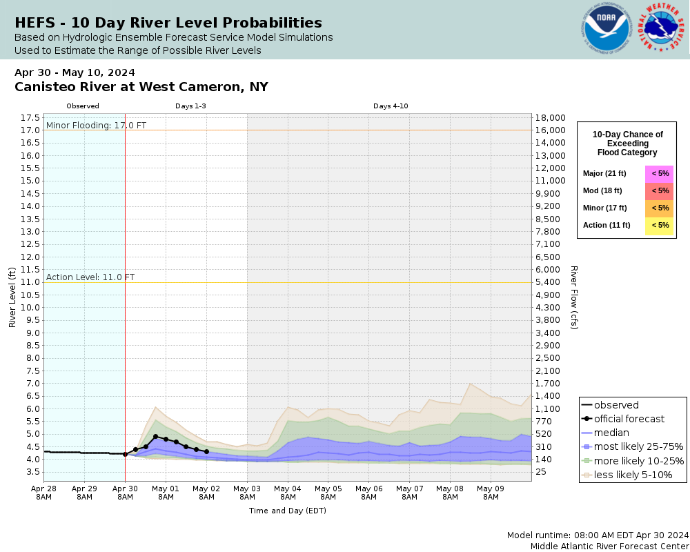
Potential River Levels - Used to
Potential River Levels
Used to Estimate the Chance of Flooding and the Range of Possible River Levels
10 Day (HEFS) 7 Day (NAEFS) 7 Day (GEFS)
HEFS Ensemble NAEFS Ensemble GEFS Ensemble

Note: Use the official hydrograph at the top of this web page for river levels within the next 72 hours.

Click individual graphics to enlarge.

Collaborative Agencies Collapse
The National Weather Service prepares its forecasts and other services in collaboration with agencies like the US Geological Survey, US Bureau of Reclamation, US Army Corps of Engineers, Natural Resource Conservation Service, National Park Service, ALERT Users Group, Bureau of Indian Affairs, and many state and local emergency managers across the country. For details, please click here.
NWS Information
National Weather Service
Binghamton Weather Forecast Office
32 Dawes Drive
Johnson City, NY 13790
(607) 729-1597
Ask Questions/Webmaster
Page last modified: 2-Nov-2020 7:30 PM
Disclaimer
Credits
Glossary
Privacy Policy
About Us
Career Opportunities