Flood ImpactsIf you notice any errors in the below information, please contact our Webmaster
13.5
Businesses and residences flood along the river in eastern Sterling.
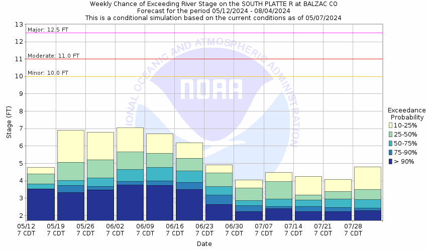
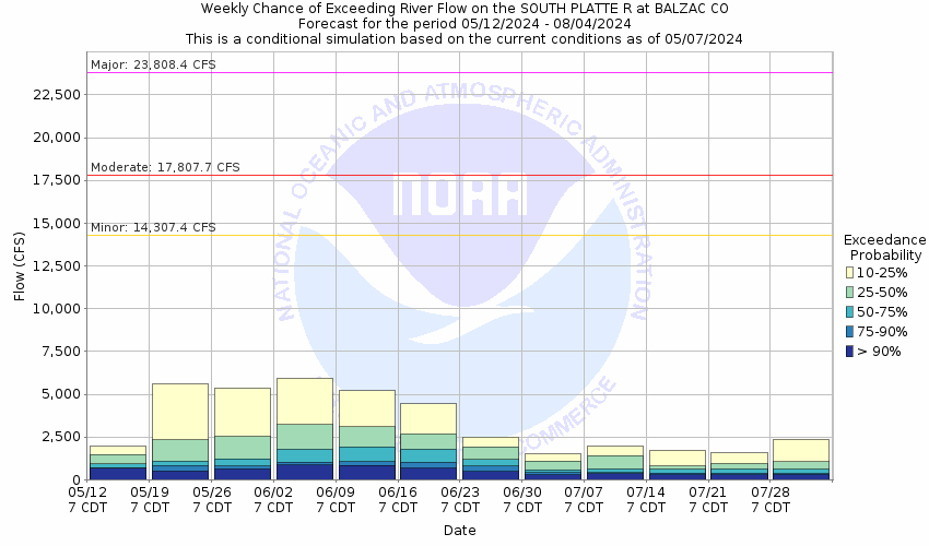
12.5
Numerous roads and structures flood along the river.
12
Water flows over Colorado Highway 71 near Snyder.
11
There is extensive flooding of agricultural land near the river. Water flows over State Highway 63 near Atwood.
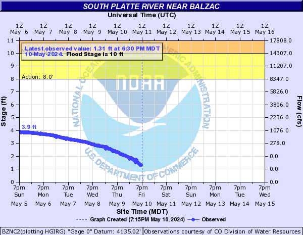
10
Agricultural land floods along the river near Sterling.
8
The river is out of its banks and into fields and meadows.
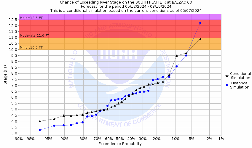
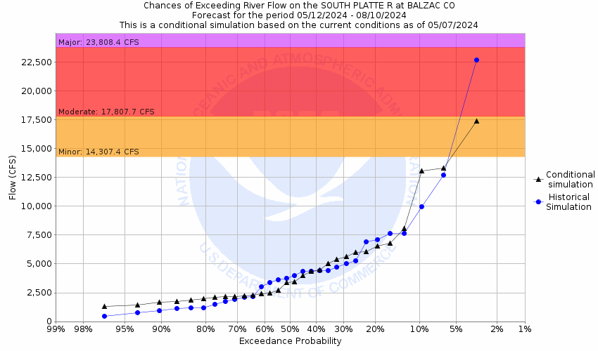
Flood Categories (in feet)
| Major Flood Stage: |
12.5 |
| Moderate Flood Stage: |
11 |
| Flood Stage: |
10 |
| Action Stage: |
8 |
| Low Stage (in feet): |
-9999 |
Historic Crests
(1) 13.71 ft on 09/15/2013
(2) 10.43 ft on 06/12/1995
(3) 10.39 ft on 05/13/2015
(4) 10.38 ft on 05/03/1999
(5) 9.75 ft on 06/17/2010
(6) 9.25 ft on 06/16/1997
(7) 9.06 ft on 07/17/2011
(8) 9.06 ft on 06/05/2014
(9) 7.51 ft on 06/14/2009
(10) 6.85 ft on 06/16/2016
Show More Historic Crests
(P): Preliminary values subject to further review.
Recent Crests
(1) 5.25 ft on 06/09/2021
(2) 3.50 ft on 03/22/2020
(3) 5.39 ft on 06/24/2019
(4) 4.12 ft on 05/21/2018
(5) 6.30 ft on 05/29/2017
(6) 6.85 ft on 06/16/2016
(7) 10.39 ft on 05/13/2015
(8) 9.06 ft on 06/05/2014
(9) 13.71 ft on 09/15/2013
(10) 3.95 ft on 02/08/2012
Show More Recent Crests
(P): Preliminary values subject to further review.
Low Water Records
Currently none available.