Flood ImpactsIf you notice any errors in the below information, please contact our Webmaster
137.5
Augusta Municipal Airport-Bush Field becomes flooded.
135.9
Approximate grade of the Augusta Levee in the vicinity of the New Savannah Bluff Lock and Dam.
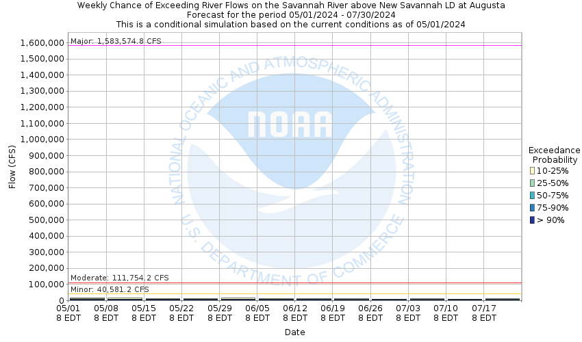
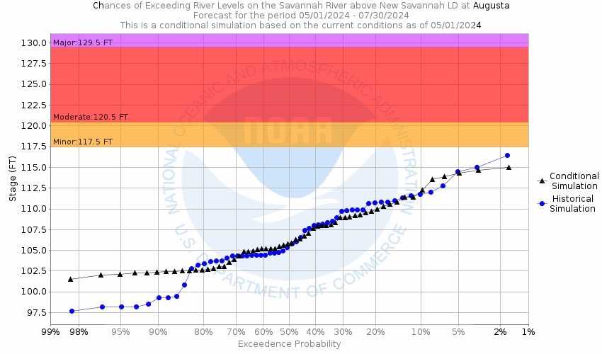
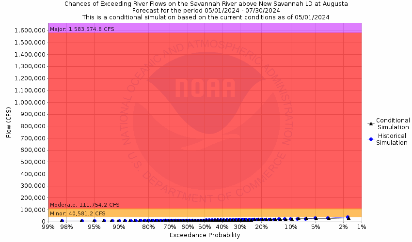
129.1
Water as much as 15 feet deep in adjacent farmland, 8 to 10 feet deep in the lowest areas of Augusta occurs. Sandbar Ferry Road bridge becomes submerged.
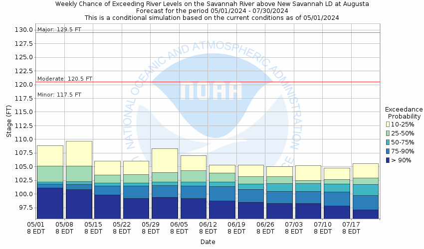
120.5
Extensive farmland outside protection of the Augusta levee on the Georgia side becomes flooded. Extensive farmland and developed areas near gum swamp on the South Carolina side become flooded.
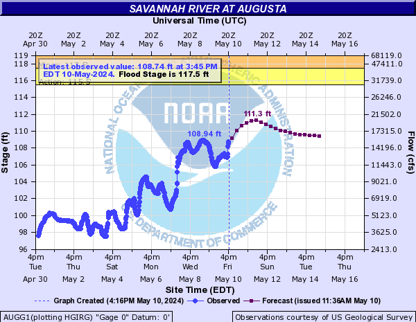
117.5
Flood stage. Extensive areas of New Savannah Bluff Lock and Dam Park including park roads and bridges become flooded. Low farm areas immediately adjacent to the river begin to flood.
115.4
Playground equipment and footbridge in the New Savannah Bluff Lock and Dam Park becomes flooded. Drainage ditches in the park are also flooded.
Flood Categories (in feet)
| Major Flood Stage: |
129.5 |
| Moderate Flood Stage: |
120.5 |
| Flood Stage: |
117.5 |
| Action Stage: |
115.5 |
| Low Stage (in feet): |
0 |
Historic Crests
(1) 125.98 ft on 08/15/1940
(2) 125.98 ft on 08/16/1940
(3) 123.18 ft on 11/30/1948
(4) 122.08 ft on 03/22/1944
(5) 121.69 ft on 01/20/1943
Show More Historic Crests
(P): Preliminary values subject to further review.
Recent Crests
(1) 113.24 ft on 02/01/2023
(2) 109.80 ft on 01/09/2023
(3) 117.98 ft on 04/08/2022
(4) 116.41 ft on 02/19/2021
(5) 112.84 ft on 01/03/2021
Show More Recent Crests
(P): Preliminary values subject to further review.