Flood ImpactsIf you notice any errors in the below information, please contact our Webmaster
17.5
the bridge on County Road M38 at the gage is overtopped.
16.5
the bridge south of the Ocheyedan WMA is overtopped.
14.5
water reaches the bottom of the bridges south of the Ocheyedan WMA and on County Road M38, and the bridge north of the Ocheyedan WMA is overtopped.
12.5
water reaches the bottom of the bridge north of the Ocheyedan WMA.
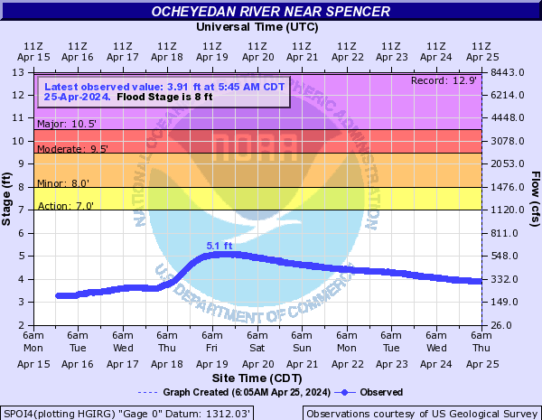
10.5
major agricultural flooding begins and some county roads are also flooded.
9.5
significant amounts of pasture and other farm land begin flooding.
8
minor flooding of pasture land begins.
7
minor flooding of some ditches begins.
Flood Categories (in feet)
| Major Flood Stage: |
10.5 |
| Moderate Flood Stage: |
9.5 |
| Flood Stage: |
8 |
| Action Stage: |
7 |
| Low Stage (in feet): |
-9999 |
Historic Crests
(1) 12.89 ft on 06/18/1953
(2) 12.77 ft on 09/21/2018
(3) 12.73 ft on 03/15/2019
(4) 12.70 ft on 06/21/2018
(5) 11.72 ft on 08/11/2010
Show More Historic Crests
(P): Preliminary values subject to further review.
Recent Crests
(1) 6.70 ft on 04/03/2023
(2) 6.46 ft on 05/31/2022
(3) 3.05 ft on 04/09/2021
(4) 8.57 ft on 05/27/2020
(5) 12.73 ft on 03/15/2019
Show More Recent Crests
(P): Preliminary values subject to further review.
Low Water Records
Currently none available.