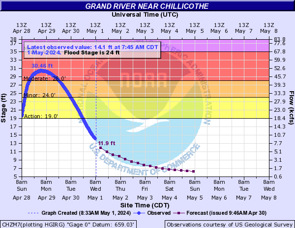
Flood Categories (in feet)
| Major Flood Stage: |
35 |
| Moderate Flood Stage: |
28 |
| Flood Stage: |
24 |
| Action Stage: |
19 |
| Low Stage (in feet): |
-9999 |
Historic Crests
(1) 39.60 ft on 07/25/1993
(2) 39.10 ft on 07/09/1993
(3) 38.18 ft on 05/30/2019
(4) 37.14 ft on 05/10/2007
(5) 37.00 ft on 10/10/2018
Show More Historic Crests
(P): Preliminary values subject to further review.
Recent Crests
(1) 30.94 ft on 08/05/2023
(2) 26.61 ft on 06/09/2022
(3) 24.35 ft on 05/01/2022
(4) 28.07 ft on 11/12/2021
(5) 25.10 ft on 07/11/2021
Show More Recent Crests
(P): Preliminary values subject to further review.