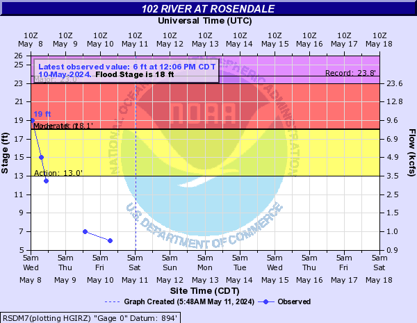
Flood Categories (in feet)
| Major Flood Stage: |
23 |
| Moderate Flood Stage: |
18.11 |
| Flood Stage: |
18 |
| Action Stage: |
13 |
| Low Stage (in feet): |
-9999 |
Historic Crests
(1) 24.19 ft on 05/30/2019
(2) 23.81 ft on 07/25/1993
(3) 23.50 ft on 05/07/2007
(4) 23.00 ft on 07/20/1965
(5) 22.60 ft on 06/13/2015
Show More Historic Crests
(P): Preliminary values subject to further review.
Recent Crests
(1) 19.00 ft on 06/25/2021
(2) 18.80 ft on 05/21/2021
(3) 19.00 ft on 03/15/2021
(4) 20.70 ft on 05/27/2020
(5) 24.19 ft on 05/30/2019
Show More Recent Crests
(P): Preliminary values subject to further review.
Low Water Records
Currently none available.