Crow Creek (Click on an image to go to hydrograph webpage)
FEWW4:

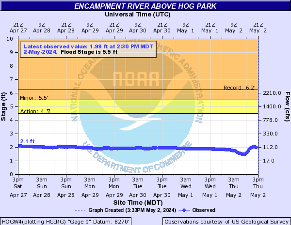
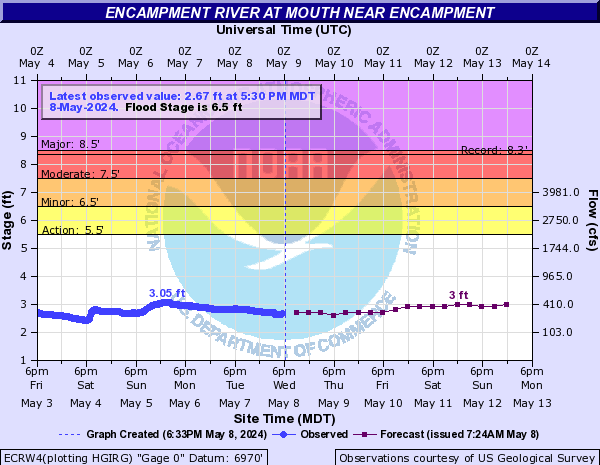
Encampment River (Click on an image to go to hydrograph webpage)
HOGW4:
ECRW4:
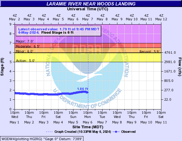
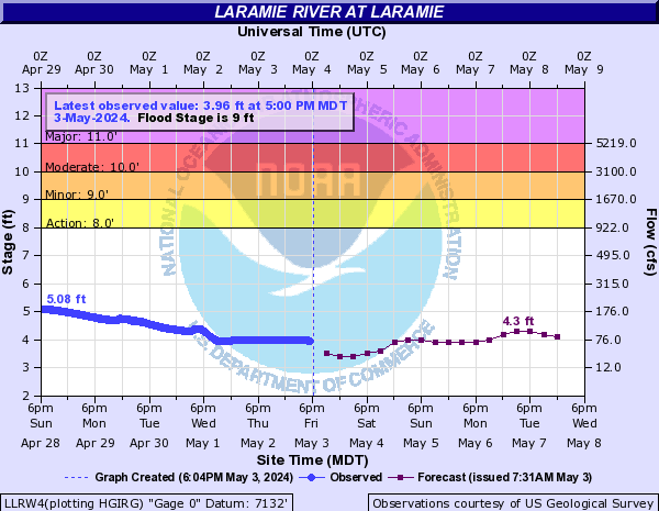
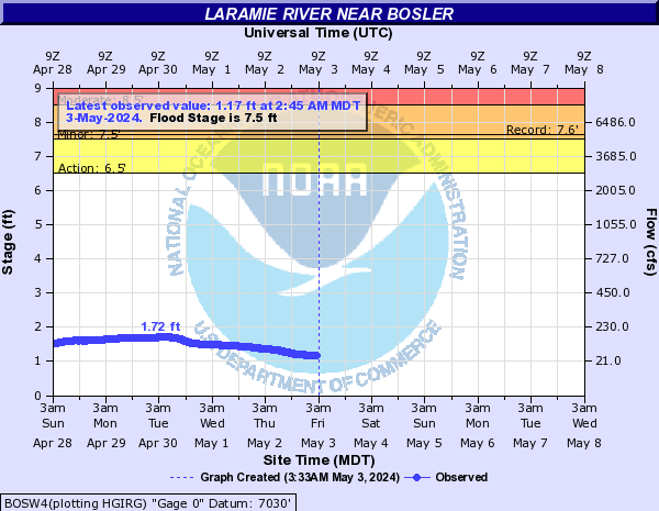
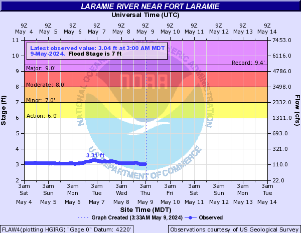
Laramie River (Click on an image to go to hydrograph webpage)
WODW4:
LLRW4:
BOSW4:
FLAW4:
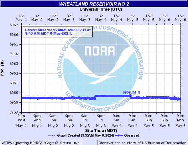
WTRW4:
Little Laramie River (Click on an image to go to hydrograph webpage)
SMTW4:

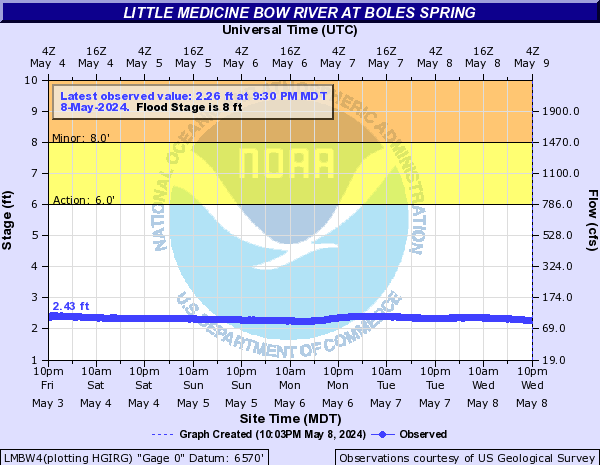
Little Medicine Bow River (Click on an image to go to hydrograph webpage)
LMBW4:
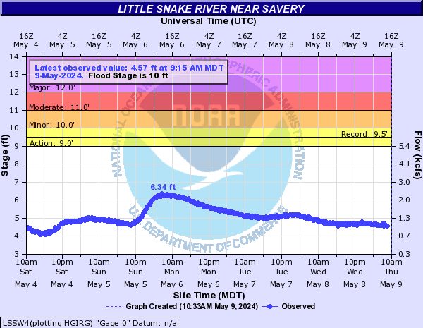
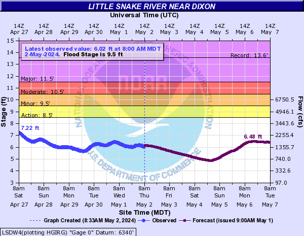
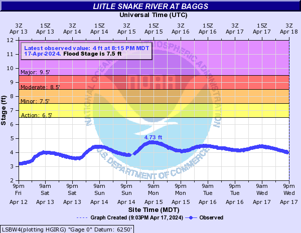
Little Snake River (Click on an image to go to hydrograph webpage)
LSSW4:
LSDW4:
LSBW4:
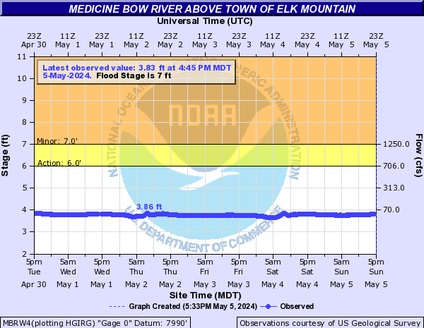
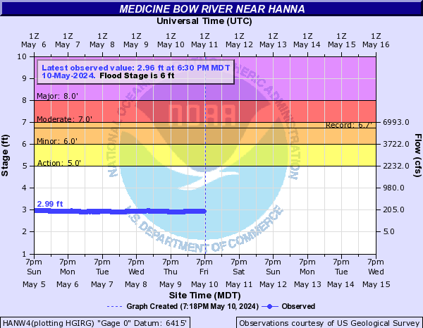
Medicine Bow River (Click on an image to go to hydrograph webpage)
MBRW4:
HANW4:
Niobrara River (Click on an image to go to hydrograph webpage)
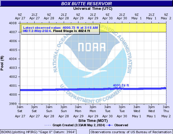
BOXN1:
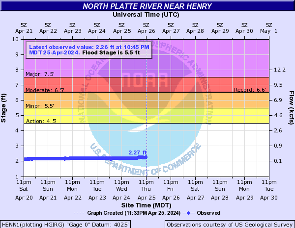
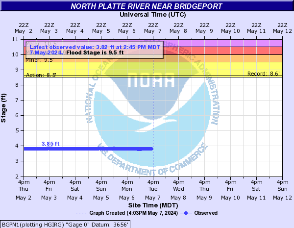
North Platte River (Click on an image to go to hydrograph webpage)
SRAW4:

SINW4:

GLNW4:

ORIW4:

HENN1:
MICN1:

SBRN1:

MNTN1:

BGPN1:
GLEW4:

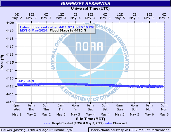
GNSW4:
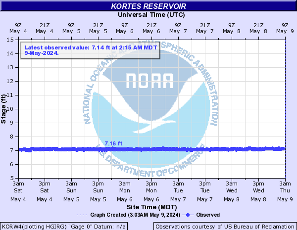
KORW4:
SETW4:
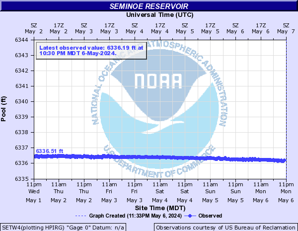
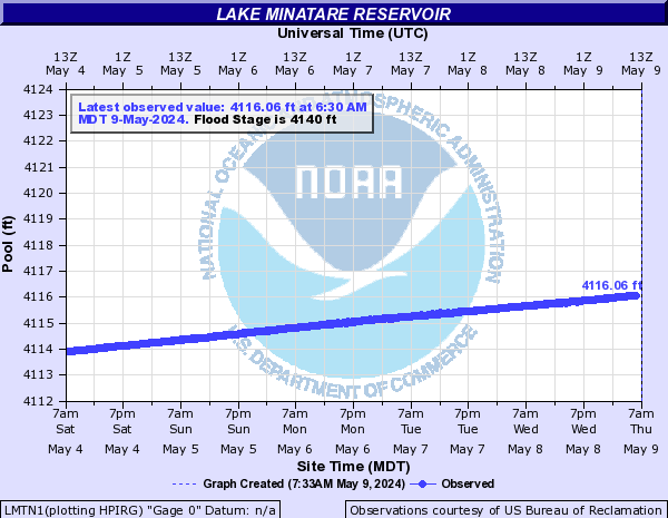
Reservoirs (Click on an image to go to hydrograph webpage)
LMTN1:
Rock Creek (Click on an image to go to hydrograph webpage)
KCRW4:

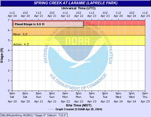
Spring Creek (WY) (Click on an image to go to hydrograph webpage)
SKLW4:
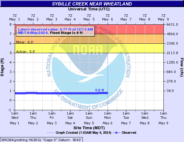
Sybille Creek (Click on an image to go to hydrograph webpage)
SMCW4:
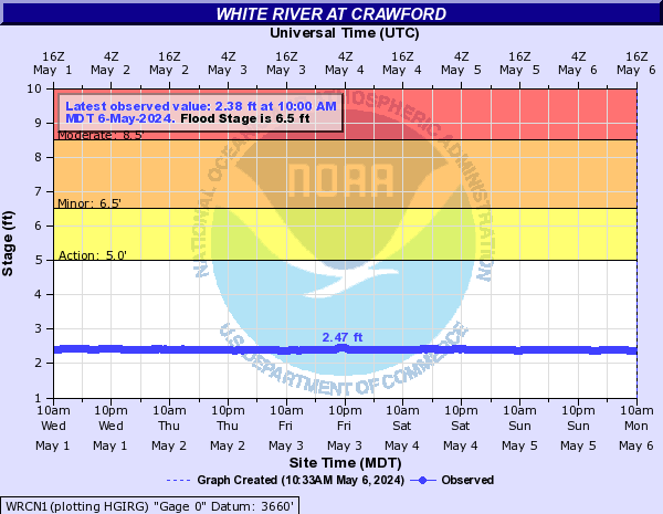
White River (WY) (Click on an image to go to hydrograph webpage)
WRCN1: