Ahoskie Creek (Click on an image to go to hydrograph webpage)
AHSN7:

Allen Creek (Click on an image to go to hydrograph webpage)
ALKV2:

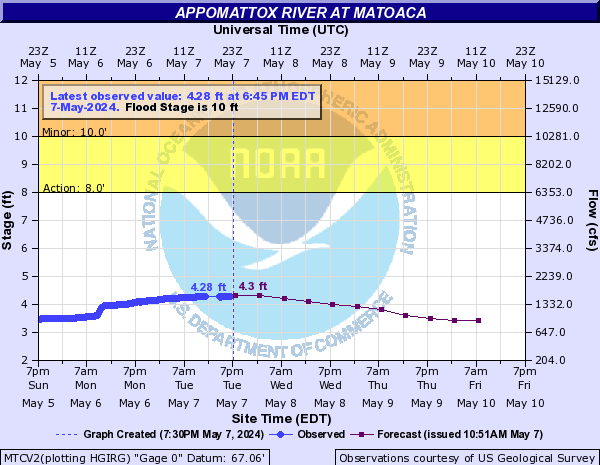
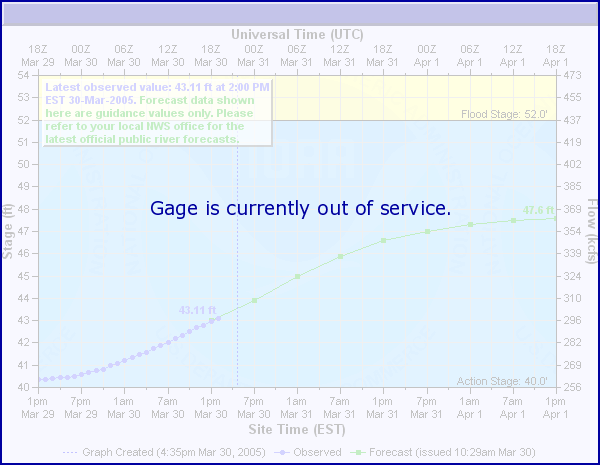
Appomattox River (Click on an image to go to hydrograph webpage)
FRMV2:

MTXV2:

MTCV2:
MNBV2:

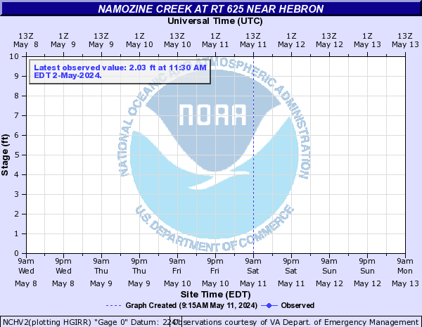
NCHV2:
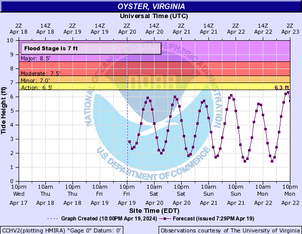
Atlantic Coast (Click on an image to go to hydrograph webpage)
OCIM2:

WAHV2:

CCHV2:
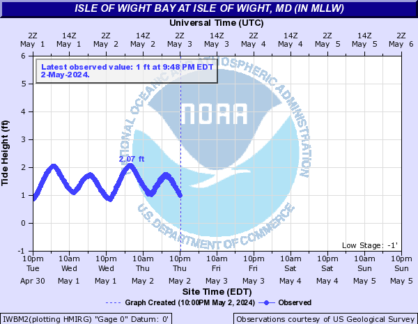
IWBM2:
Beaverdam Creek (Click on an image to go to hydrograph webpage)
BDCM2:
Beggars Bridge Creek (Click on an image to go to hydrograph webpage)
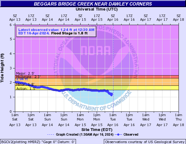
BGCV2:
Birch Branch (Click on an image to go to hydrograph webpage)
BBSM2:

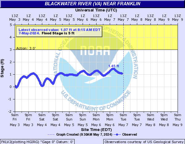
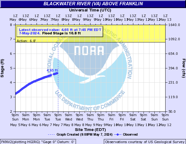
Blackwater River (VA) (Click on an image to go to hydrograph webpage)
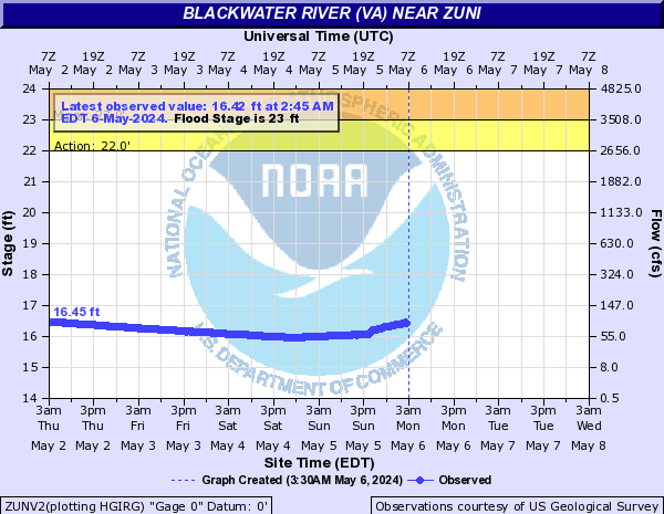
ZUNV2:
DNDV2:

FKLV2:
FKNV2:
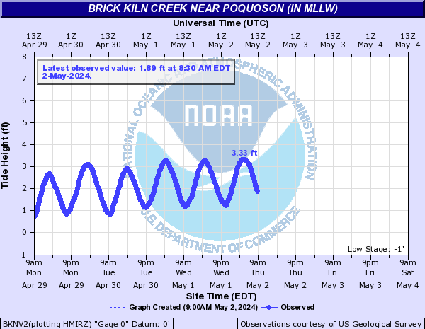
Brick Kiln Creek (Click on an image to go to hydrograph webpage)
BKNV2:
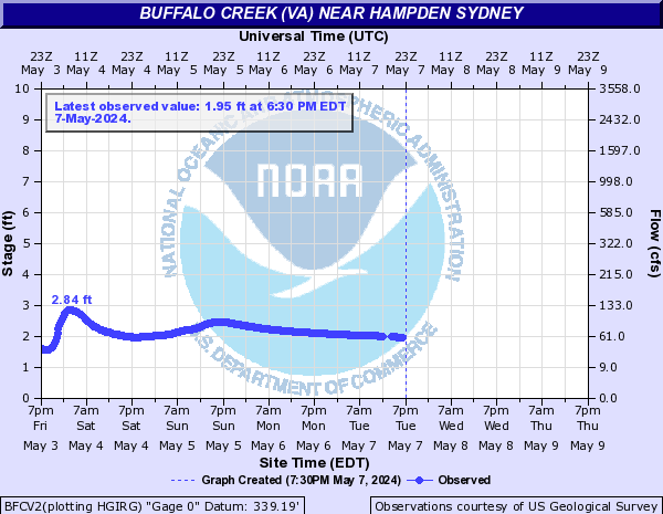
Buffalo Creek (VA) (Click on an image to go to hydrograph webpage)
BFCV2:
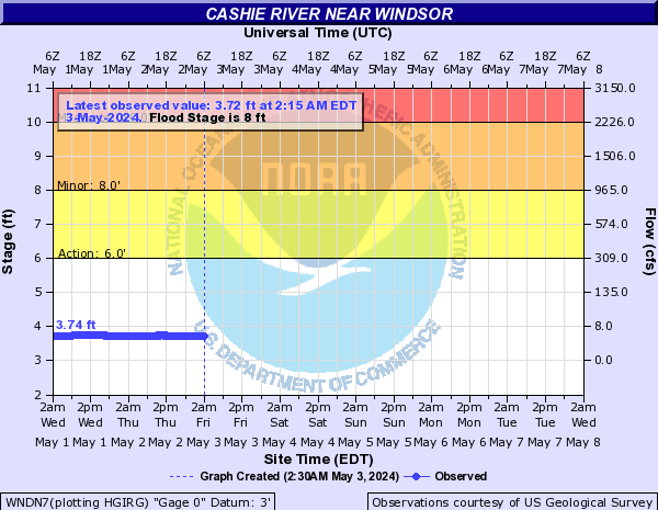
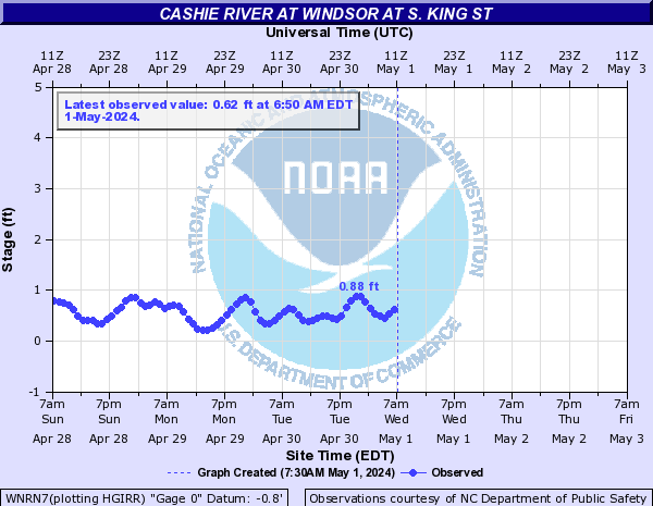
Cashie River (Click on an image to go to hydrograph webpage)
WNDN7:
WNRN7:
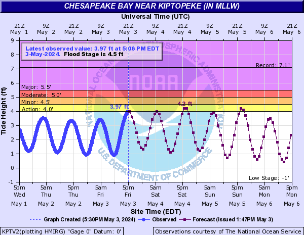
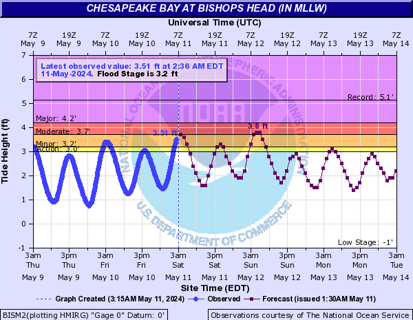
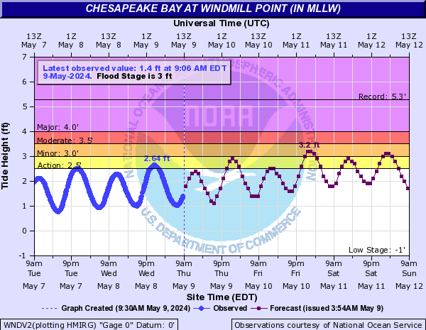
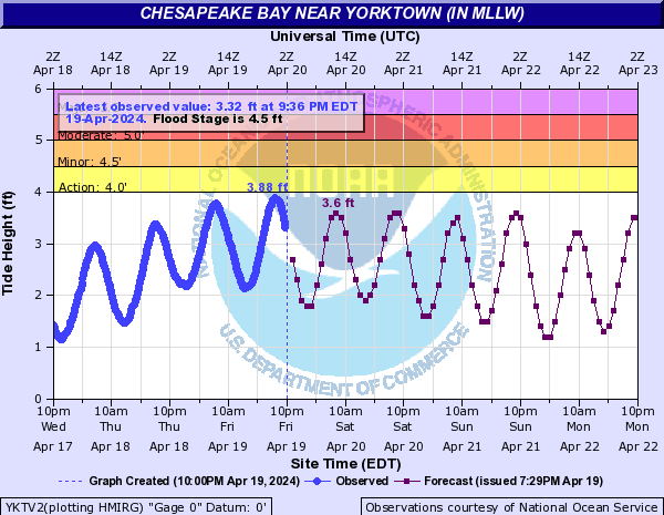
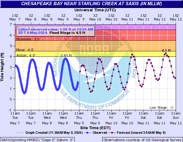
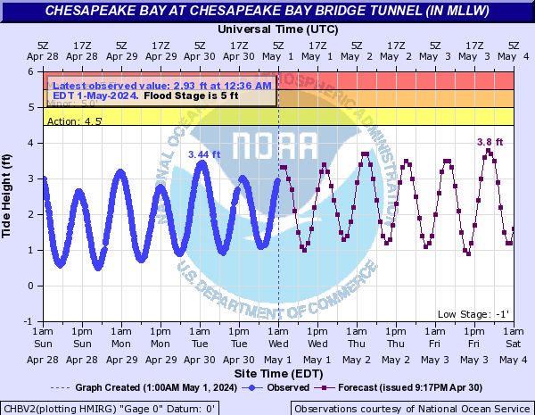
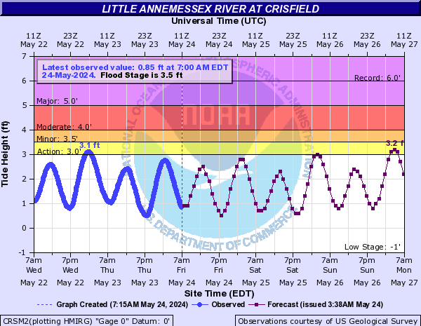
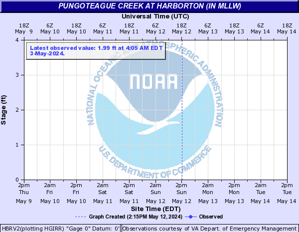
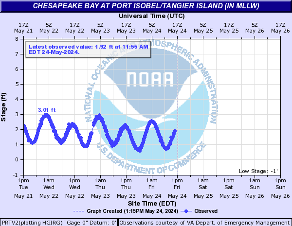
Chesapeake Bay (Click on an image to go to hydrograph webpage)
KPTV2:
BISM2:
CAMM2:

WNDV2:
YKTV2:
CBBV2:
MJBV2:

SAXV2:
CHBV2:
CPCV2:

CRSM2:
HBRV2:
PRTV2:
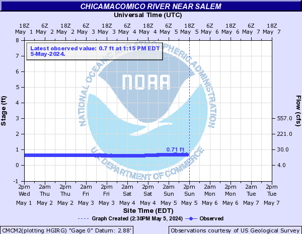
Chicamacomico River (Click on an image to go to hydrograph webpage)
CMCM2:
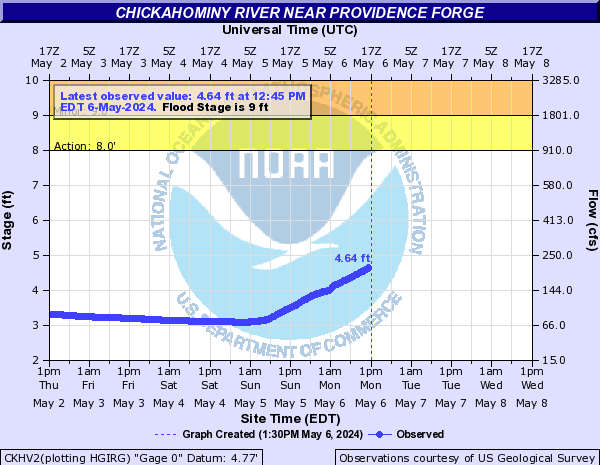
Chickahominy River (Click on an image to go to hydrograph webpage)
CKHV2:
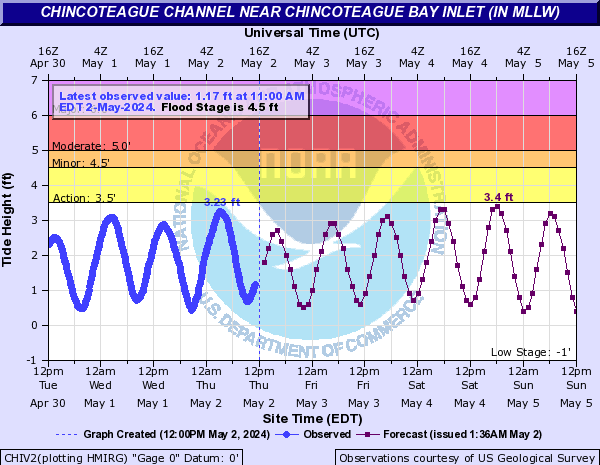
Chincoteague Channel (Click on an image to go to hydrograph webpage)
CHIV2:
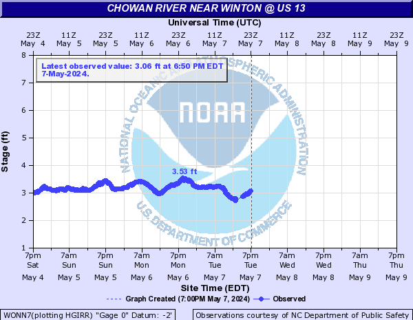
Chowan River (Click on an image to go to hydrograph webpage)
EWPN7:

WONN7:
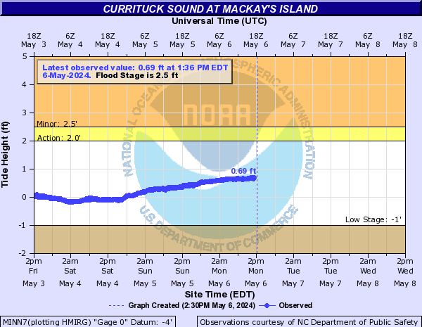
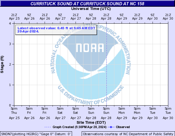
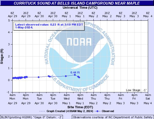
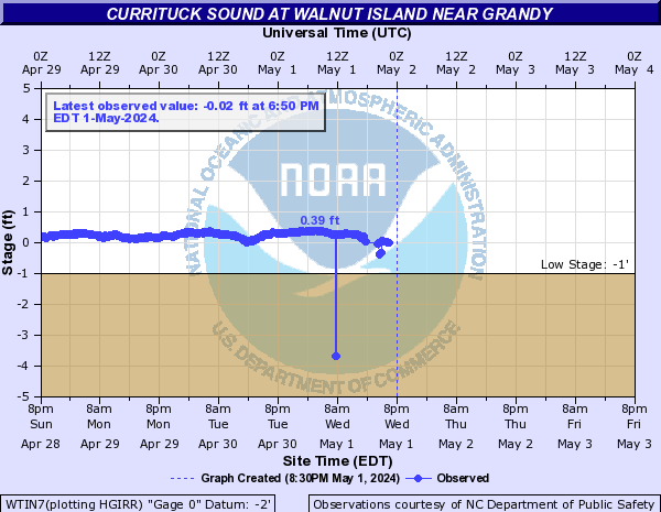
Currituck Sound (Click on an image to go to hydrograph webpage)
OBCN7:

PTHN7:

MINN7:
SNDN7:
BLIN7:
CBRN7:

WTIN7:
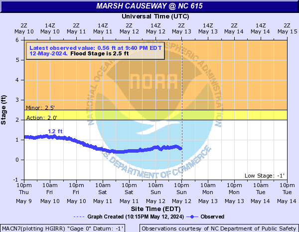
MACN7:
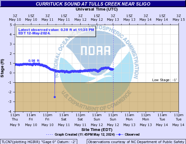
TLCN7:
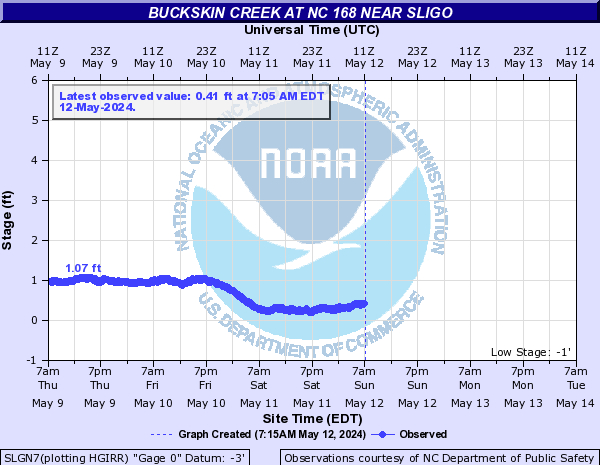
SLGN7:
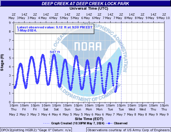
Deep Creek (Click on an image to go to hydrograph webpage)
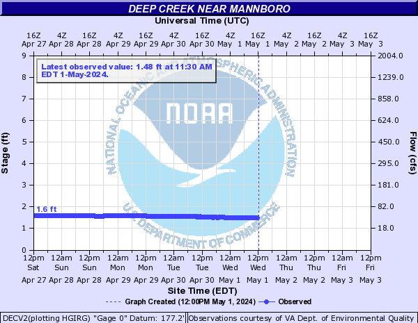
DECV2:
DPCV2:
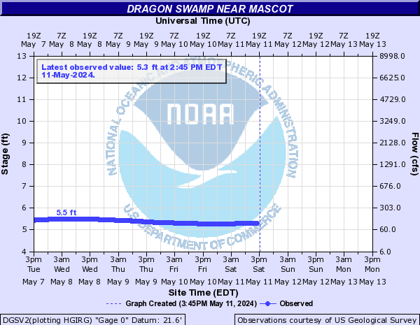
Dragon Swamp (Click on an image to go to hydrograph webpage)
DGSV2:
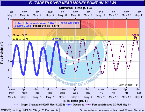
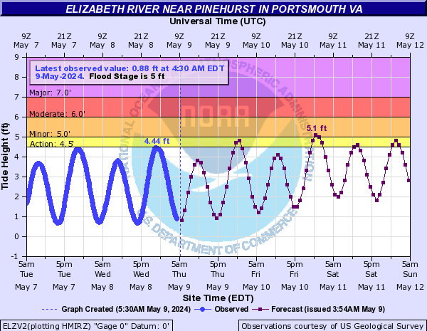
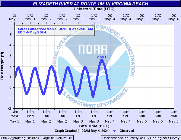
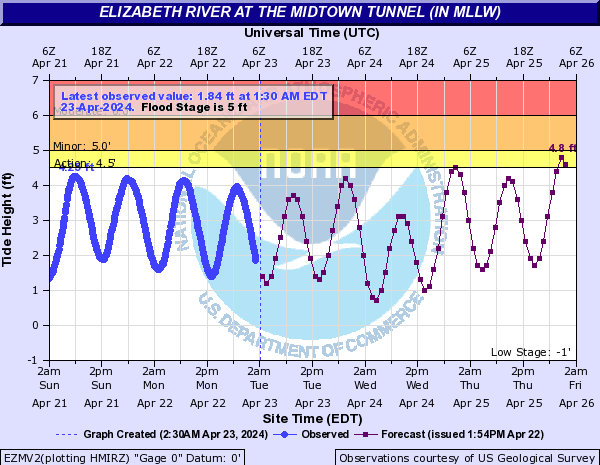
Elizabeth River (Click on an image to go to hydrograph webpage)
MNPV2:
ELZV2:
EBRV2:
HAGV2:
NMWV2:

ERCV2:

EZMV2:
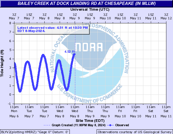
BLYV2:
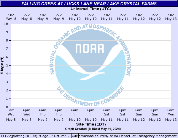
Falling Creek (Click on an image to go to hydrograph webpage)
FCLV2:
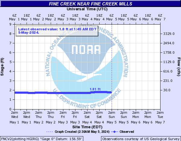
Fine Creek (Click on an image to go to hydrograph webpage)
FNCV2:
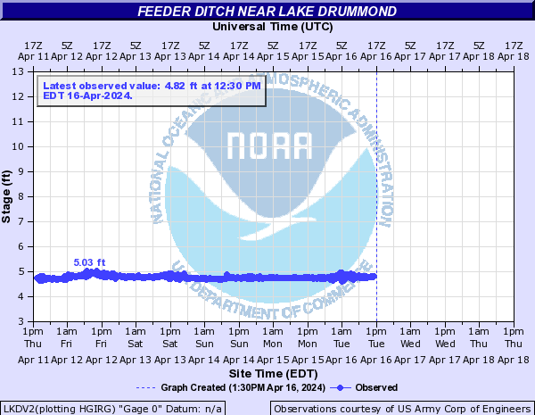
Great Dismal Swamp Canal (Click on an image to go to hydrograph webpage)
LKDV2:
SMLN7:

DSMV2:

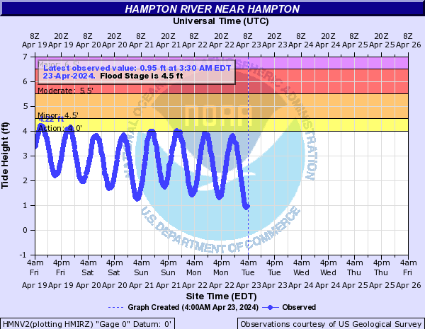
Hampton River (Click on an image to go to hydrograph webpage)
HMNV2:
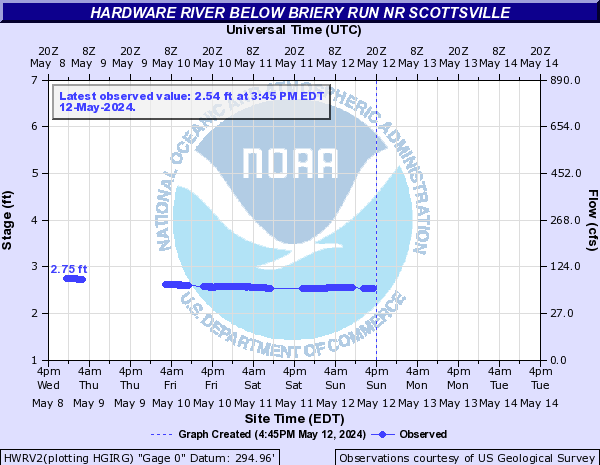
Hardware River (Click on an image to go to hydrograph webpage)
HWRV2:
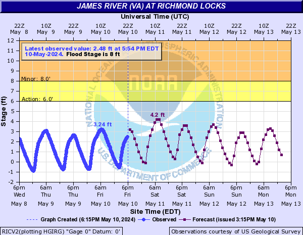
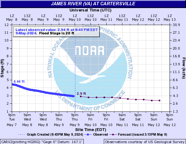
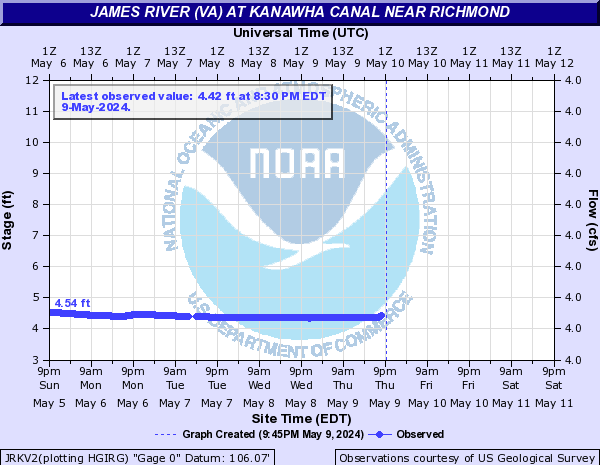
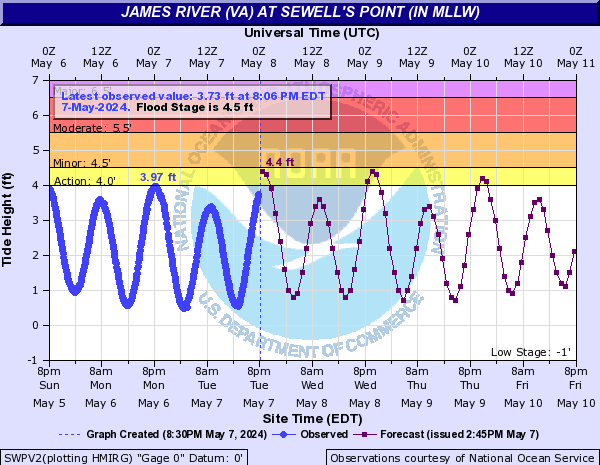
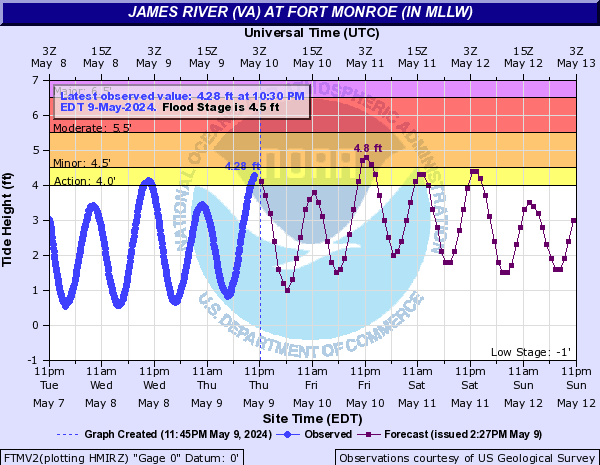
James River (VA) (Click on an image to go to hydrograph webpage)
RICV2:
CARV2:
JRKV2:
RMDV2:

SWPV2:
BREV2:
WYPV2:

FTMV2:
JSFV2:

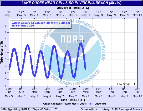
Lake Rudee (Click on an image to go to hydrograph webpage)
LRBV2:
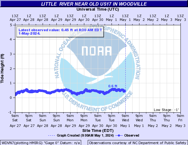
Little River (Click on an image to go to hydrograph webpage)
WDVN7:
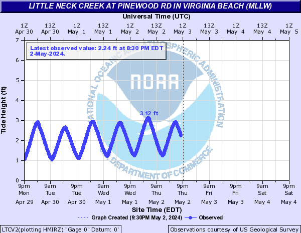
Little Neck Creek (Click on an image to go to hydrograph webpage)
LTCV2:
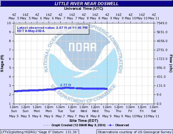
Little River (Click on an image to go to hydrograph webpage)
LTTV2:
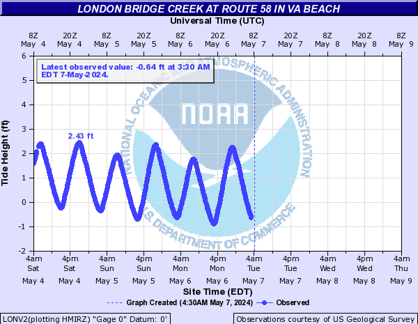
London Bridge Creek (Click on an image to go to hydrograph webpage)
LONV2:
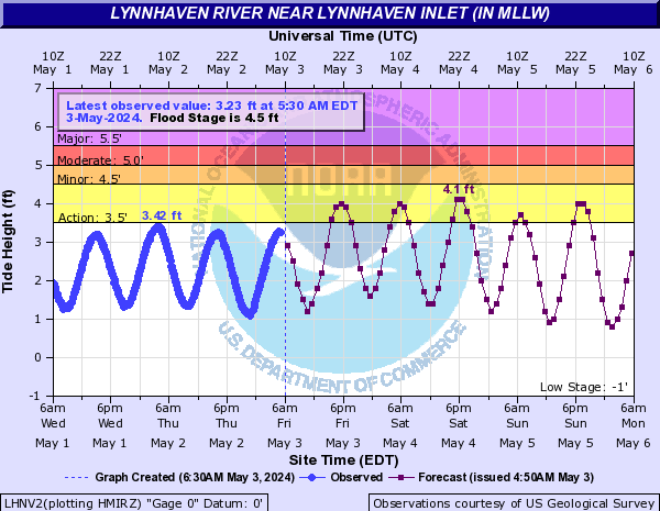
Lynnhaven River (Click on an image to go to hydrograph webpage)
LHNV2:
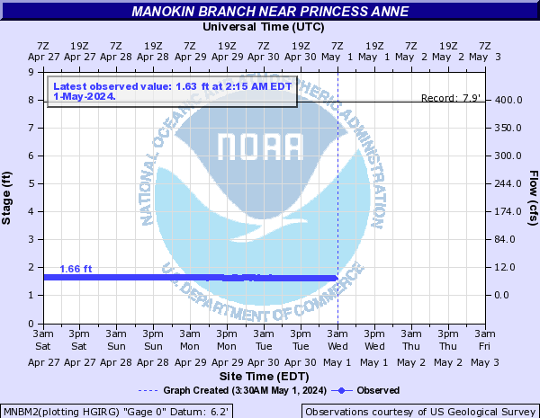
Manokin Branch (Click on an image to go to hydrograph webpage)
MNBM2:
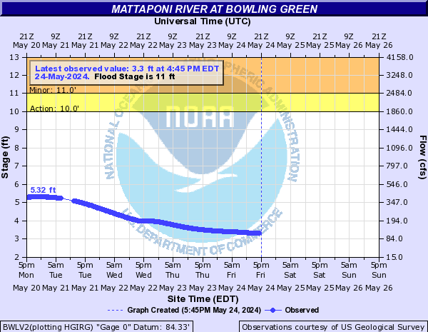
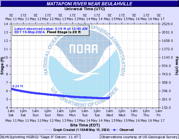
Mattaponi River (Click on an image to go to hydrograph webpage)
BWLV2:
BLHV2:
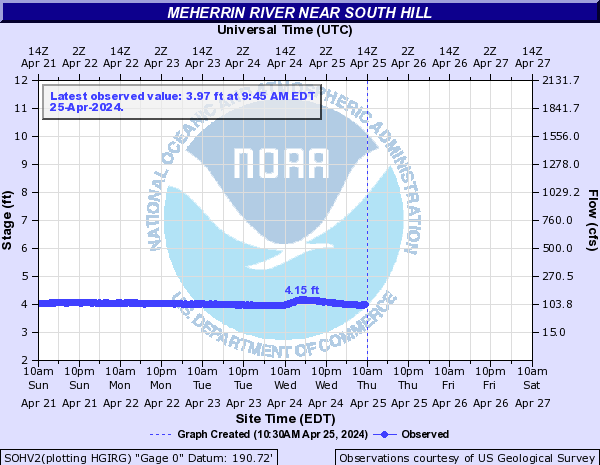
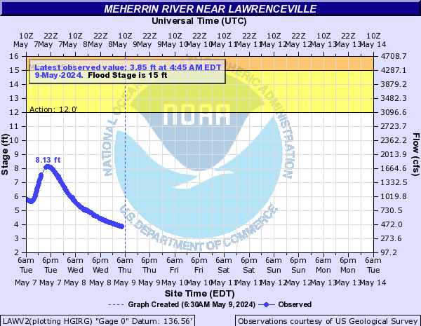
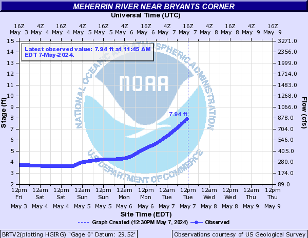
Meherrin River (Click on an image to go to hydrograph webpage)
SOHV2:
LAWV2:
EPOV2:

BRTV2:
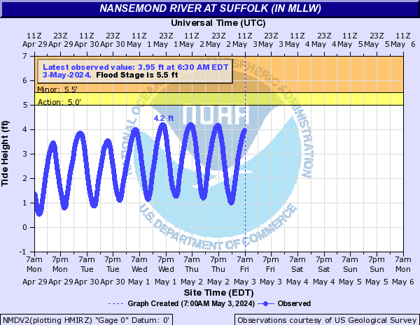
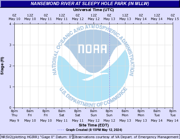
Nansemond River (Click on an image to go to hydrograph webpage)
NMDV2:
NRSV2:
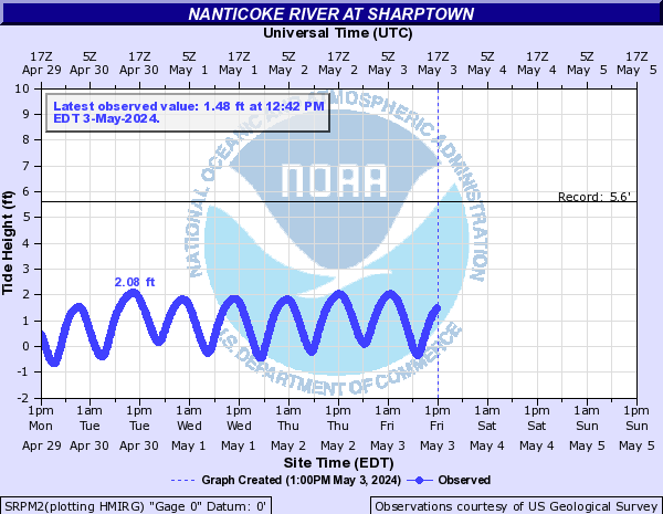
Nanticoke River (Click on an image to go to hydrograph webpage)
SRPM2:
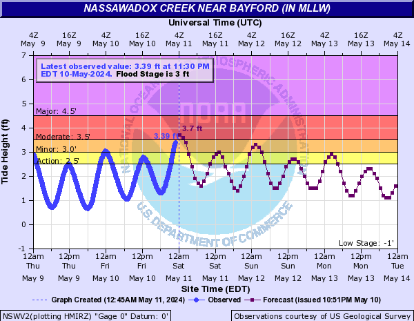
Nassawadox Creek (Click on an image to go to hydrograph webpage)
NSWV2:
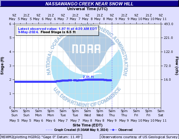
Nassawango Creek (Click on an image to go to hydrograph webpage)
NSWM2:
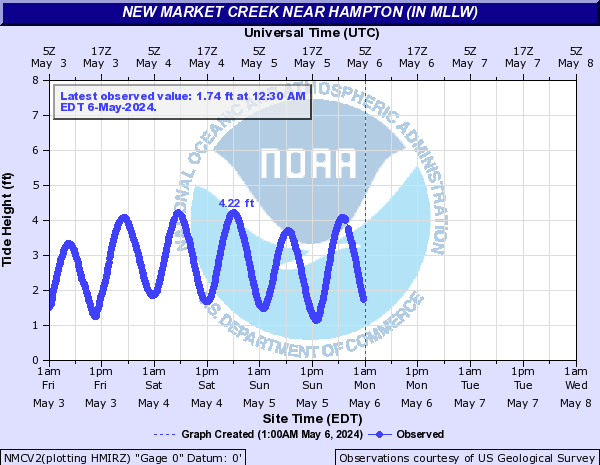
New Market Creek (Click on an image to go to hydrograph webpage)
NMCV2:
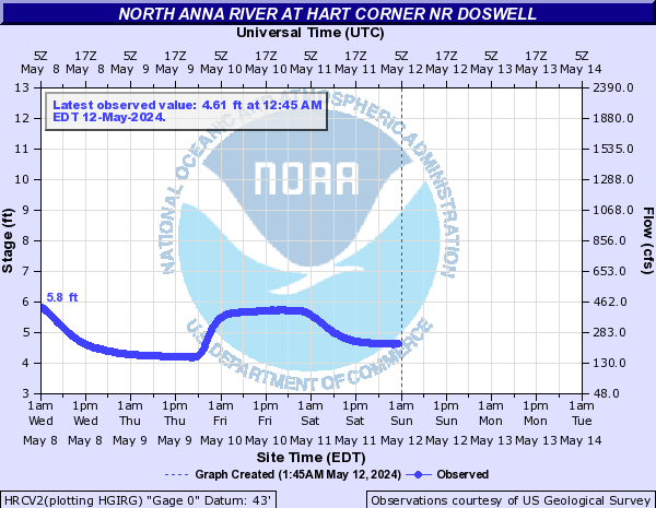
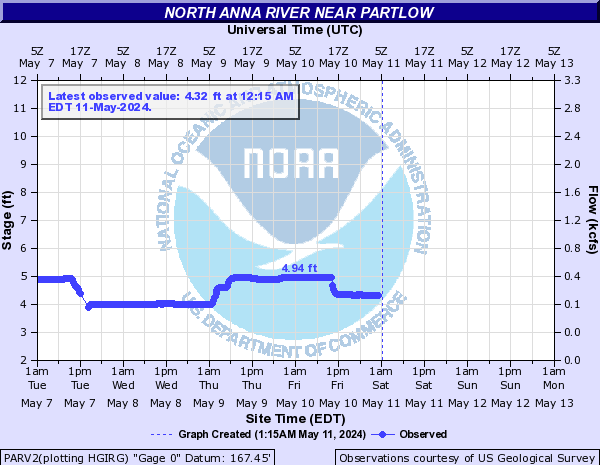
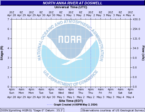
North Anna River (Click on an image to go to hydrograph webpage)
HRCV2:
PARV2:
DOSV2:
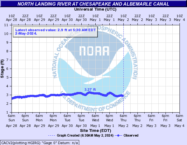
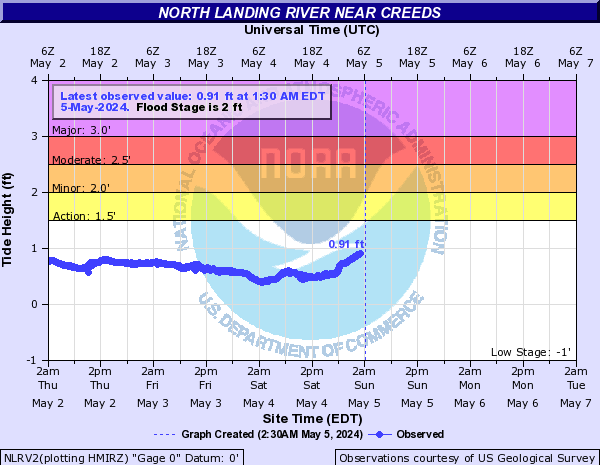
North Landing River (Click on an image to go to hydrograph webpage)
CACV2:
NLRV2:
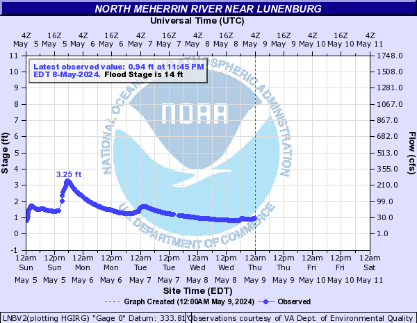
North Meherrin River (Click on an image to go to hydrograph webpage)
LNBV2:
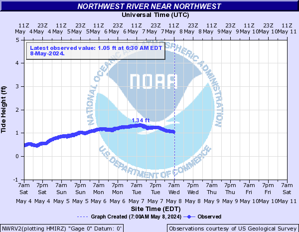
Northwest River (Click on an image to go to hydrograph webpage)
NWRV2:
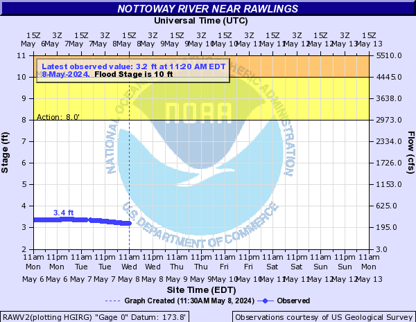
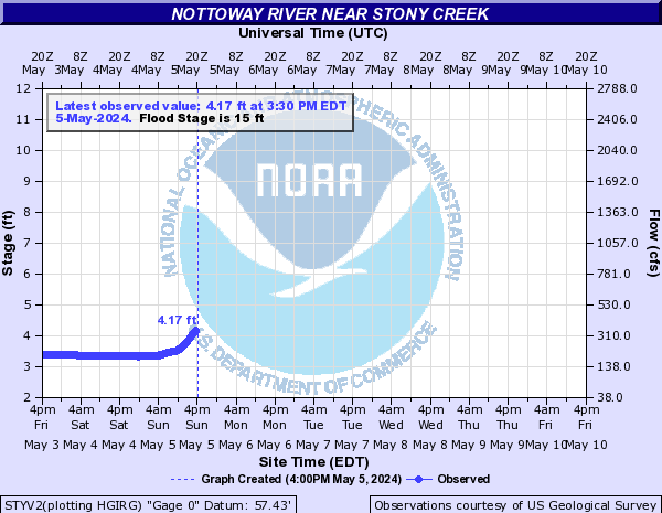
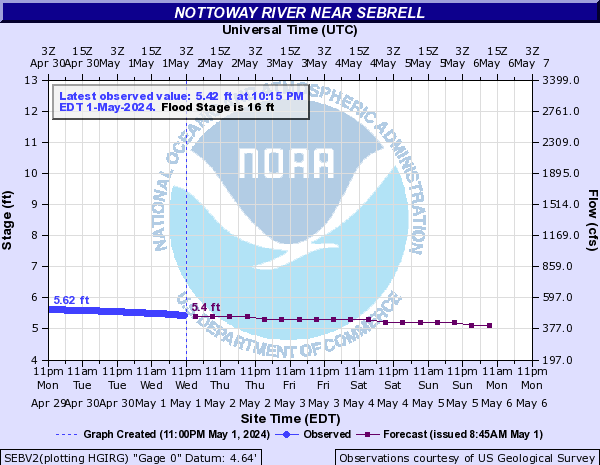
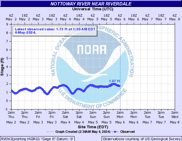
Nottoway River (Click on an image to go to hydrograph webpage)
RAWV2:
MKNV2:

STYV2:
SEBV2:
RVDV2:
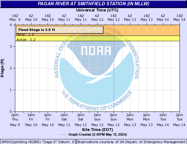
Pagan River (Click on an image to go to hydrograph webpage)
SMSV2:
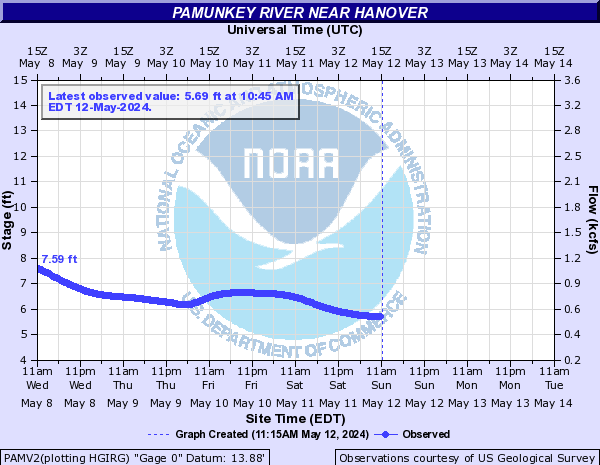
Pamunkey River (Click on an image to go to hydrograph webpage)
PAMV2:
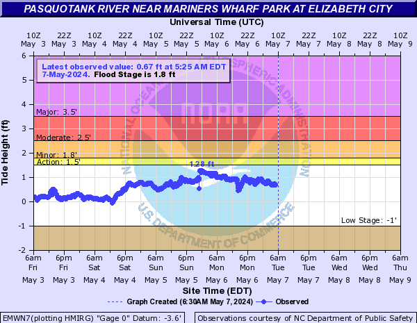
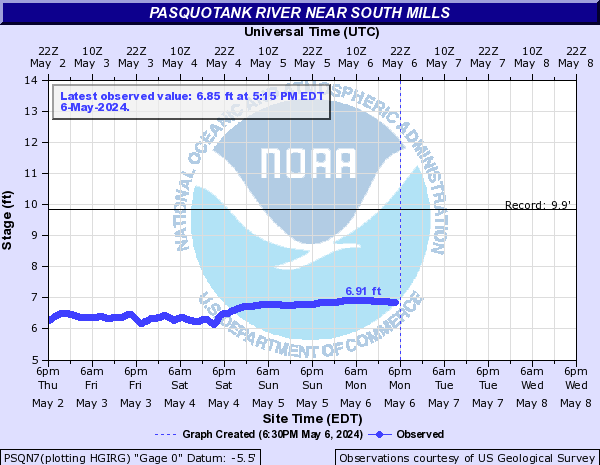
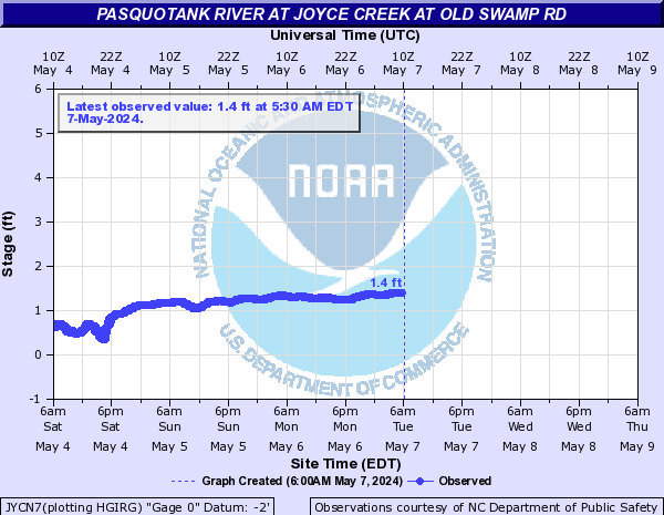
Pasquotank River (Click on an image to go to hydrograph webpage)
EMWN7:
PSQN7:
JYCN7:
Perquimans River (Click on an image to go to hydrograph webpage)
HTFN7:

HFDN7:

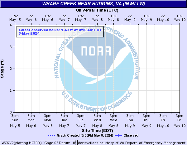
Piankatank River (Click on an image to go to hydrograph webpage)
WCKV2:
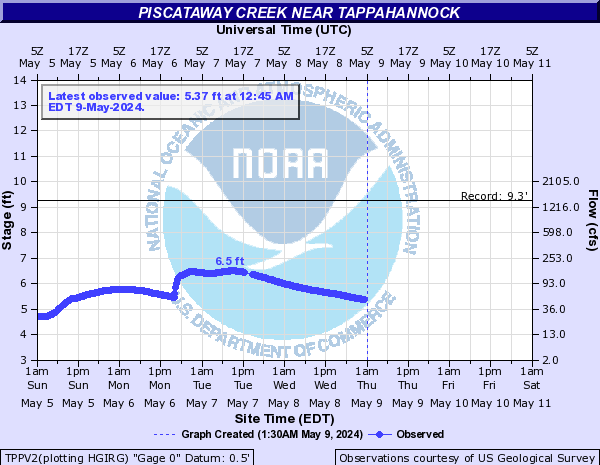
Piscataway Creek (Click on an image to go to hydrograph webpage)
TPPV2:
Pocomoke River (Click on an image to go to hydrograph webpage)
WLRM2:

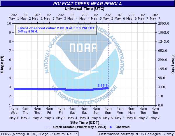
Polecat Creek (Click on an image to go to hydrograph webpage)
PCKV2:
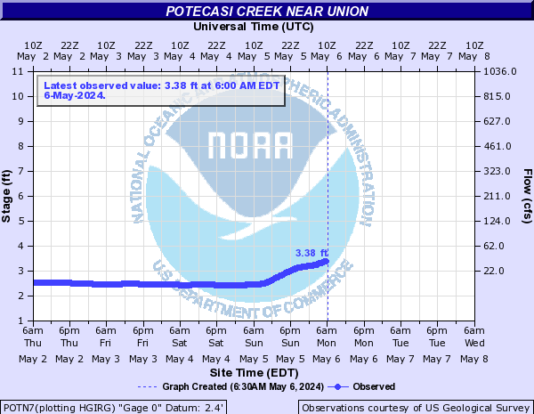
Potecasi Creek (Click on an image to go to hydrograph webpage)
POTN7:
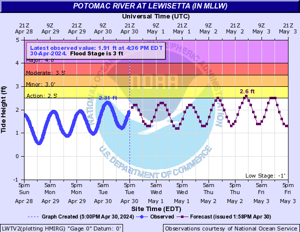
Potomac River (Click on an image to go to hydrograph webpage)
LWTV2:
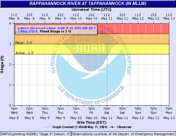
Rappahannock River (Click on an image to go to hydrograph webpage)
RAPV2:
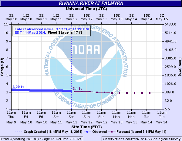
Rivanna River (Click on an image to go to hydrograph webpage)
PYAV2:
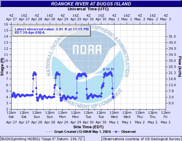
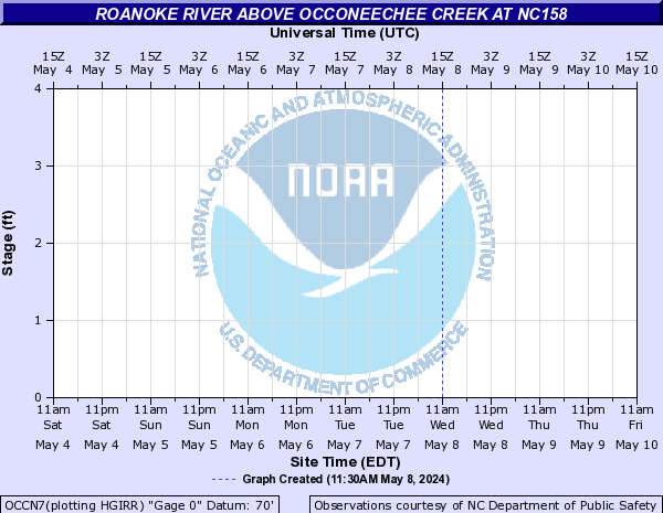
Roanoke River (Click on an image to go to hydrograph webpage)
KERV2:

BUGV2:
OCCN7:
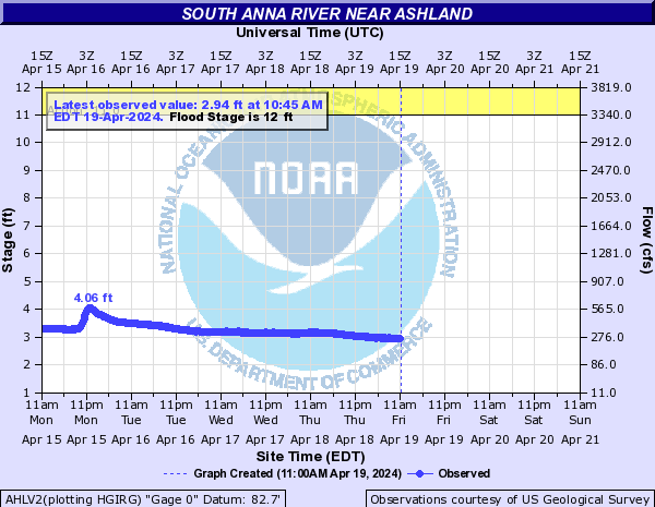
South Anna River (Click on an image to go to hydrograph webpage)
AHLV2:
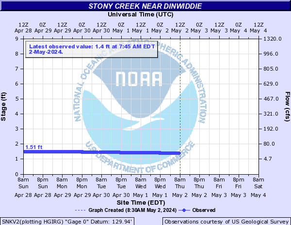
Stony Creek (Click on an image to go to hydrograph webpage)
SNKV2:
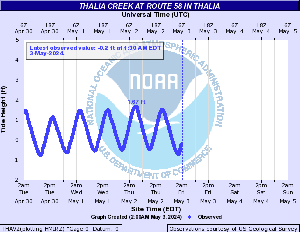
Thalia Creek (Click on an image to go to hydrograph webpage)
THAV2:
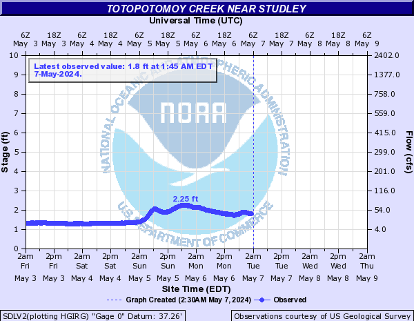
Totopotomoy Creek (Click on an image to go to hydrograph webpage)
SDLV2:
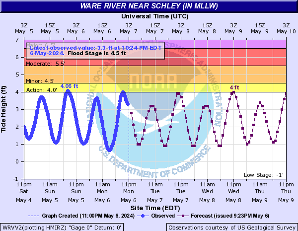
Ware River (Click on an image to go to hydrograph webpage)
WRVV2:
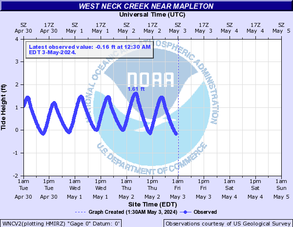
West Neck Creek (Click on an image to go to hydrograph webpage)
WNCV2:
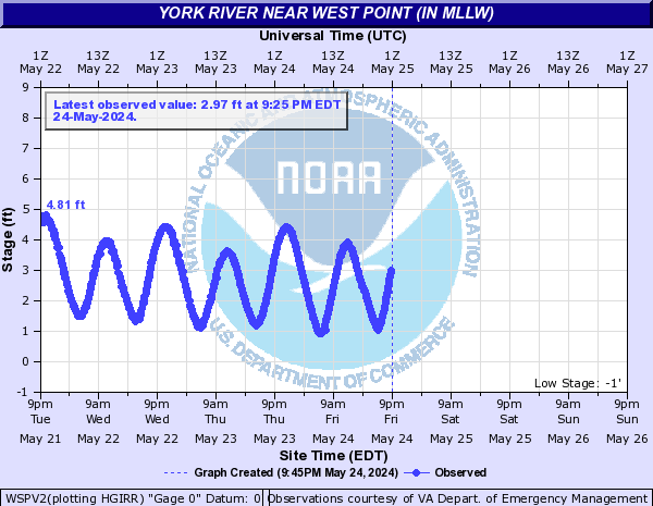
York River (Click on an image to go to hydrograph webpage)
WSPV2: