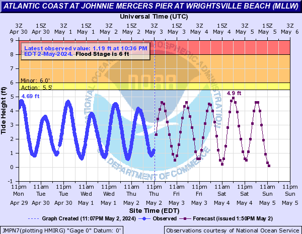
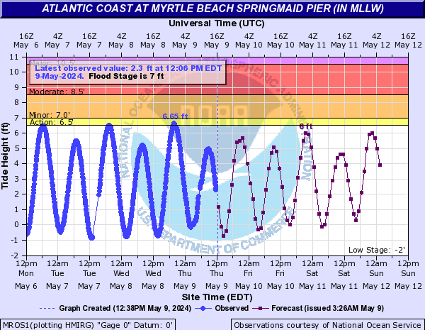
Atlantic Coast (Click on an image to go to hydrograph webpage)
JMPN7:
SNSN7:

MROS1:
NITS1:

CBCN7:

WBCN7:
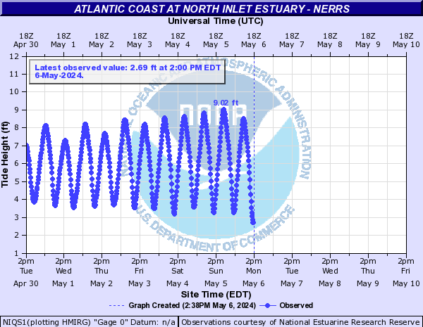
NIQS1:
ZBQN7:
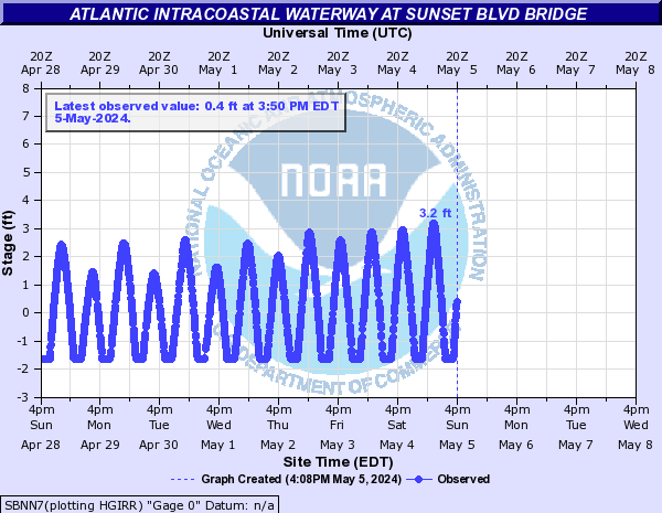
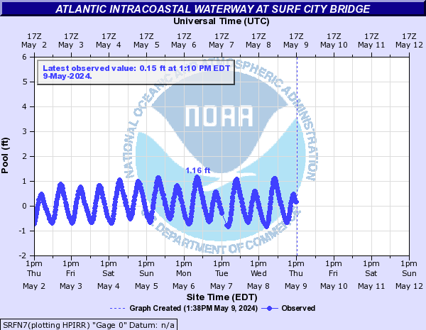
Atlantic Intracoastal Waterway (Click on an image to go to hydrograph webpage)
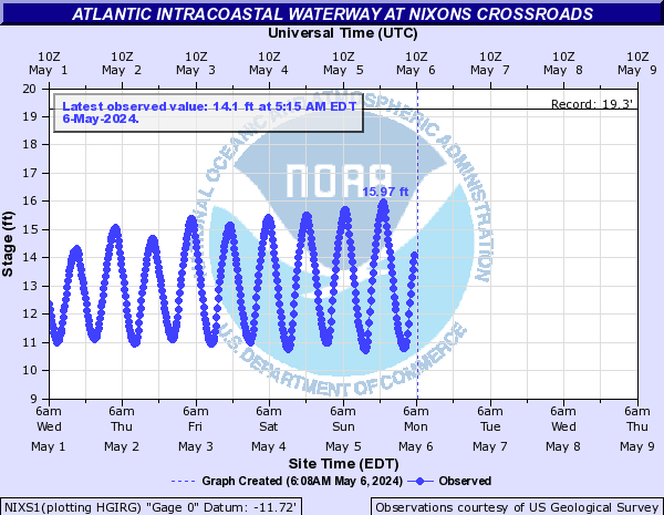
NIXS1:
MGCS1:
SCSS1:

SOCS1:

SBNN7:
SRFN7:
Big Swamp (Click on an image to go to hydrograph webpage)
BGSN7:

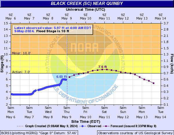
Black Creek (SC) (Click on an image to go to hydrograph webpage)
HTSS1:

BCRS1:
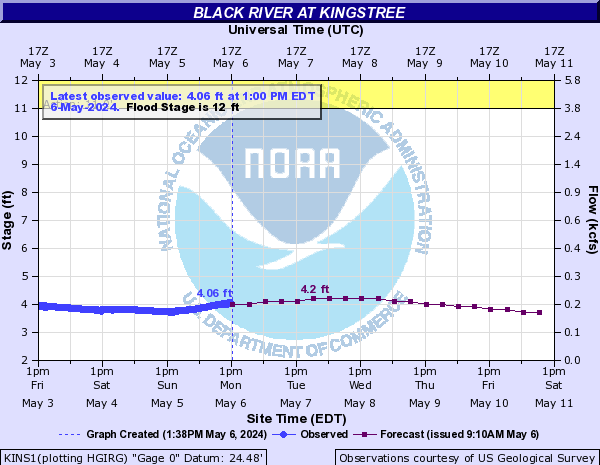
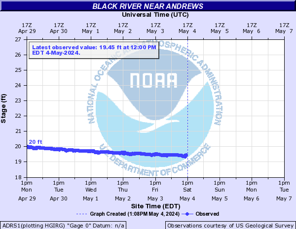
Black River (Click on an image to go to hydrograph webpage)
KINS1:
BDBS1:

ADRS1:
BRPS1:

BCUN7:

BRRS1:

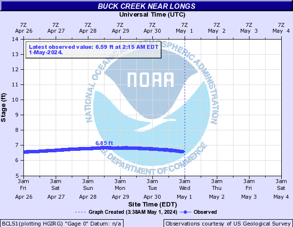
Buck Creek (Click on an image to go to hydrograph webpage)
BCLS1:
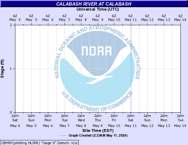
Calabash River (Click on an image to go to hydrograph webpage)
CBHN7:
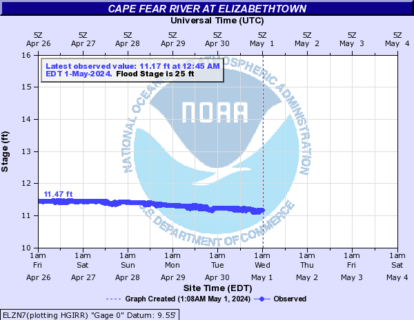
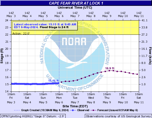
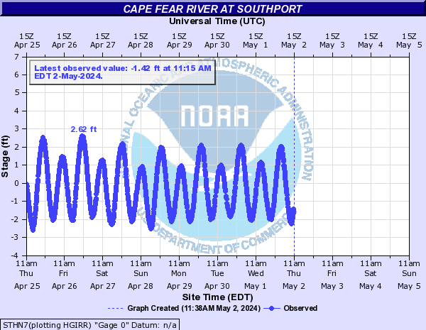
Cape Fear River (Click on an image to go to hydrograph webpage)
STPN7:

ELZN7:
CPFN7:
WLON7:

STHN7:
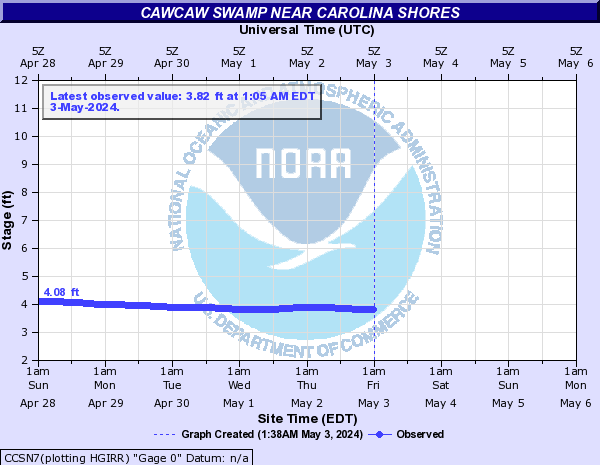
Cawcaw Swamp (Click on an image to go to hydrograph webpage)
CCSN7:
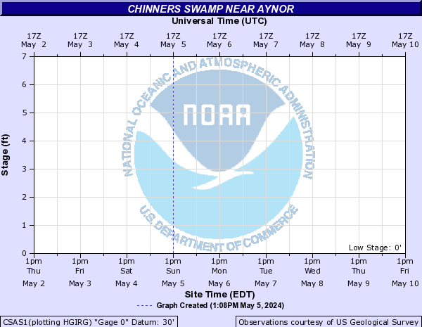
Chinners Swamp (Click on an image to go to hydrograph webpage)
CSAS1:
Crabtree Swamp (Click on an image to go to hydrograph webpage)
CSCS1:

Hood Creek (Click on an image to go to hydrograph webpage)
LELN7:

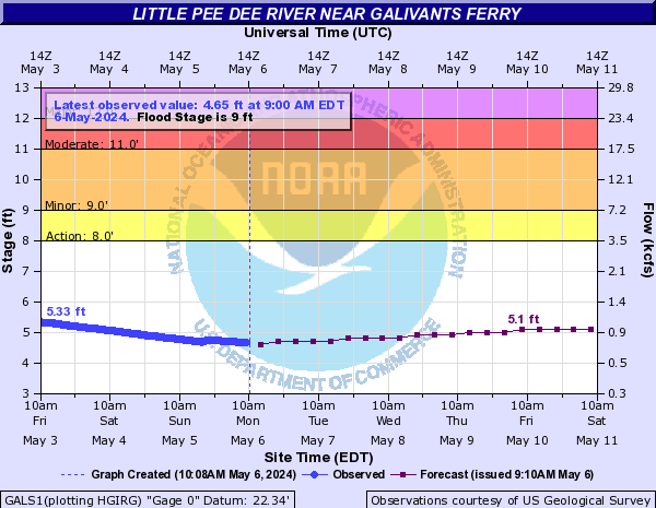
Little Pee Dee River (Click on an image to go to hydrograph webpage)
GALS1:
LPCS1:

NCHS1:

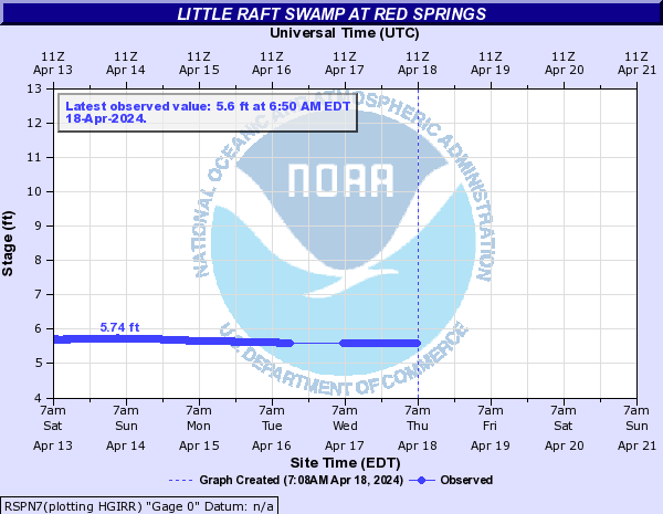
Little Raft Swamp (Click on an image to go to hydrograph webpage)
RSPN7:
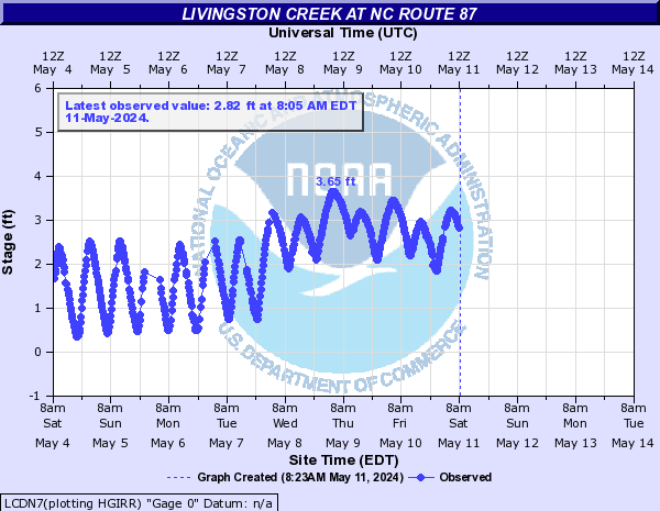
Livingston Creek (Click on an image to go to hydrograph webpage)
LCDN7:
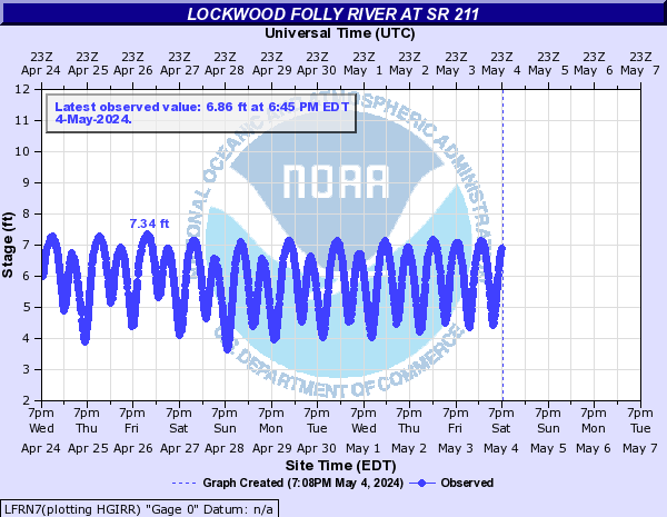
Lockwood Folly River (Click on an image to go to hydrograph webpage)
LFRN7:
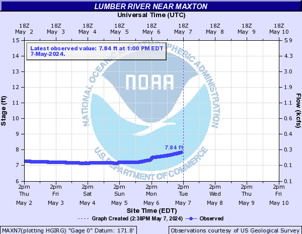
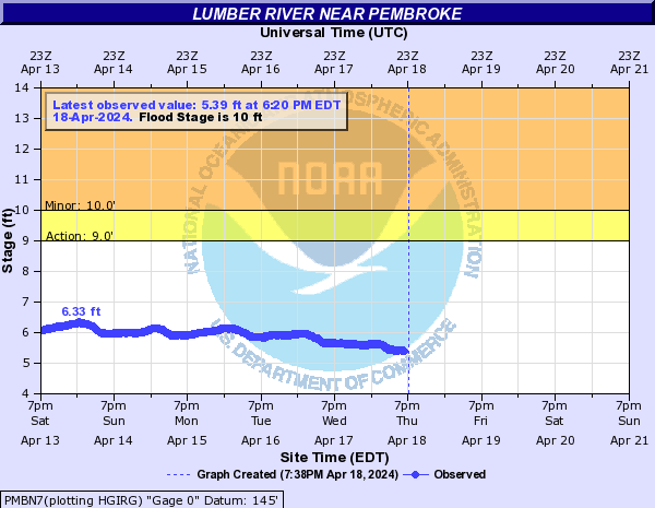
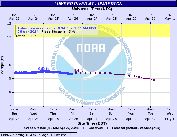
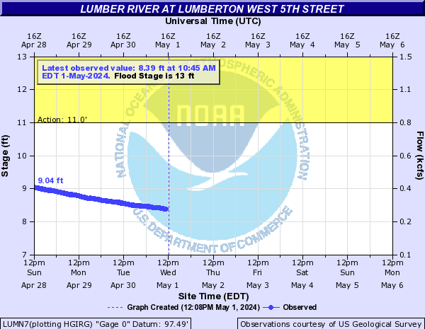
Lumber River (Click on an image to go to hydrograph webpage)
MAXN7:
PMBN7:
LBRN7:
LUMN7:
BRDN7:

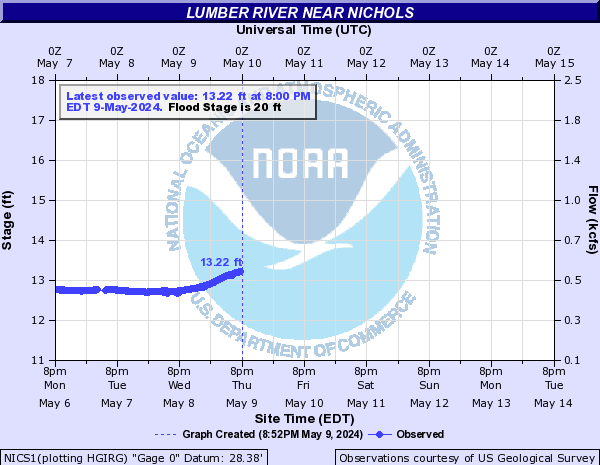
NICS1:
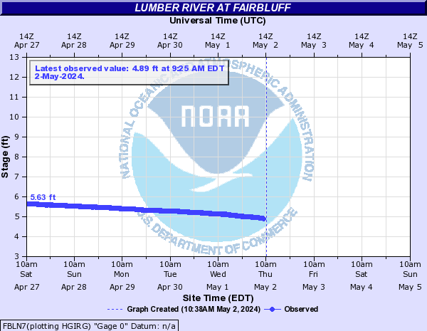
FBLN7:
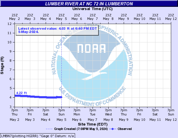
LMBN7:
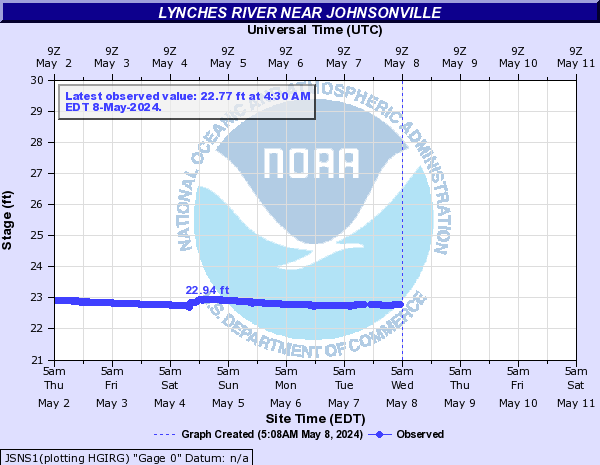
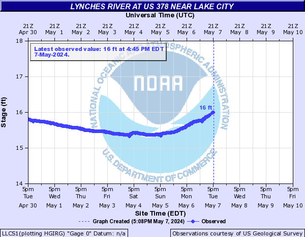
Lynches River (Click on an image to go to hydrograph webpage)
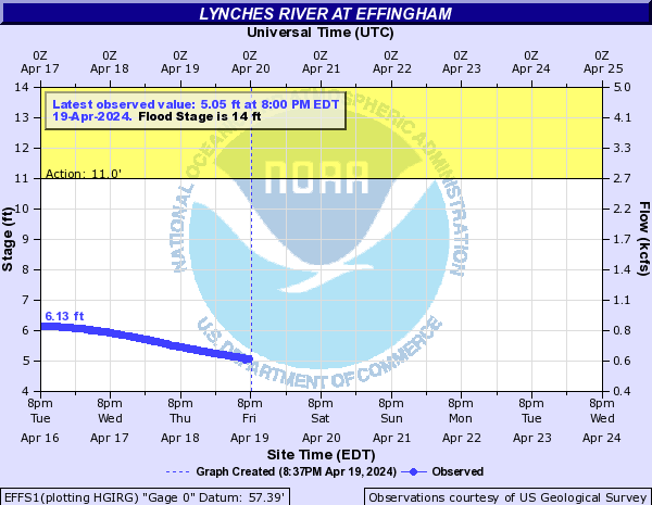
EFFS1:
JSNS1:
LLCS1:
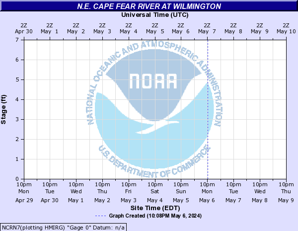
N.E. Cape Fear River (Click on an image to go to hydrograph webpage)
BGWN7:

NCRN7:
North Santee River (Click on an image to go to hydrograph webpage)
NSNS1:

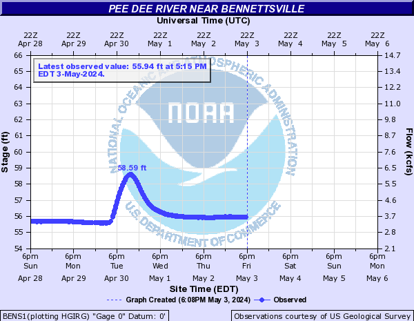
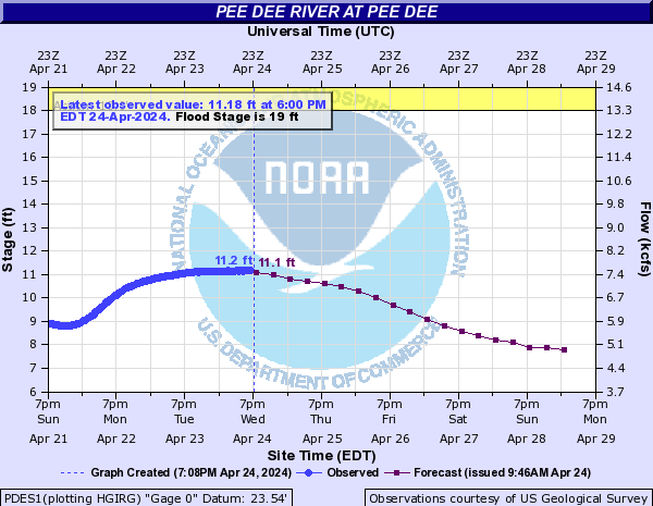
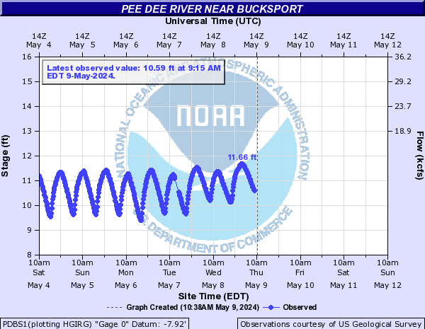
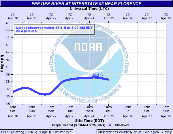
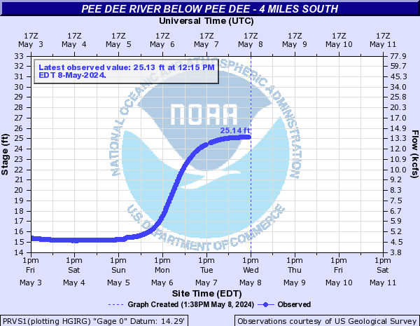
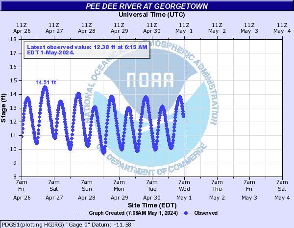
Pee Dee River (Click on an image to go to hydrograph webpage)
BENS1:
PDES1:
PDBS1:
PDFS1:
PRVS1:
PDGS1:
PDPS1:

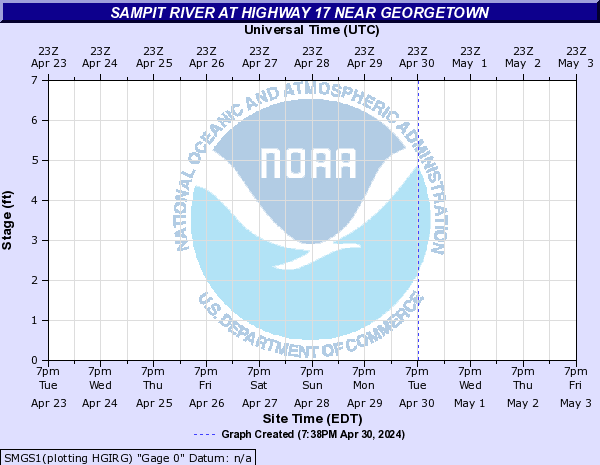
Sampit River (Click on an image to go to hydrograph webpage)
SMGS1:
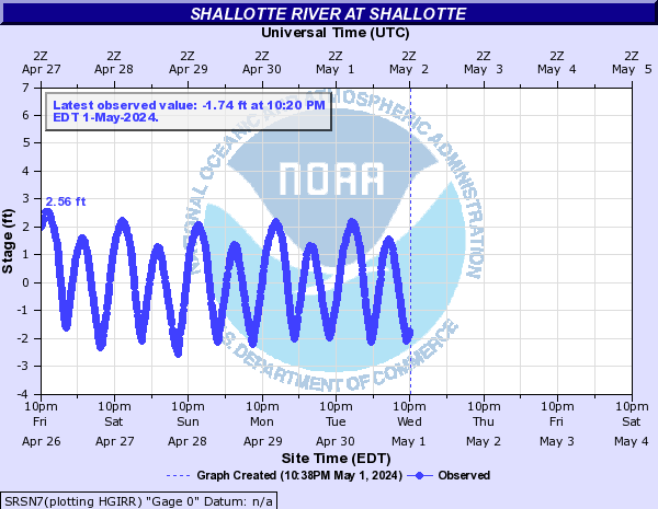
Shallotte River (Click on an image to go to hydrograph webpage)
SRSN7:
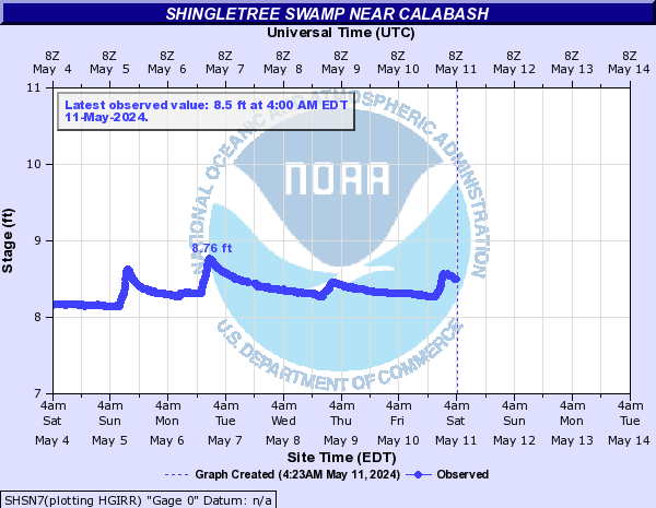
Shingletree Swamp (Click on an image to go to hydrograph webpage)
SHSN7:
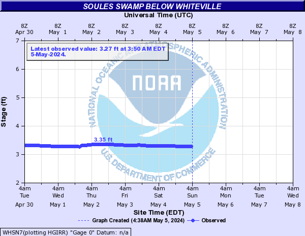
Soules Swamp (Click on an image to go to hydrograph webpage)
WHSN7:
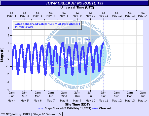
Town Creek (Click on an image to go to hydrograph webpage)
TCLN7:
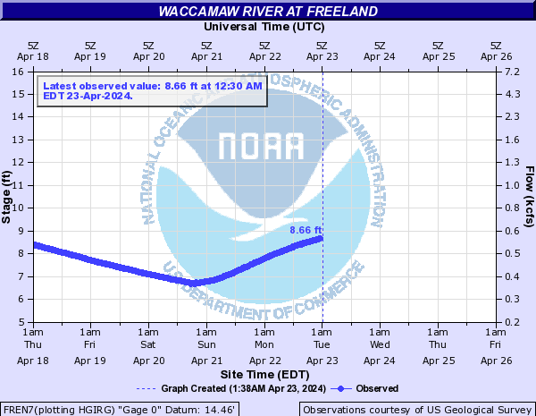
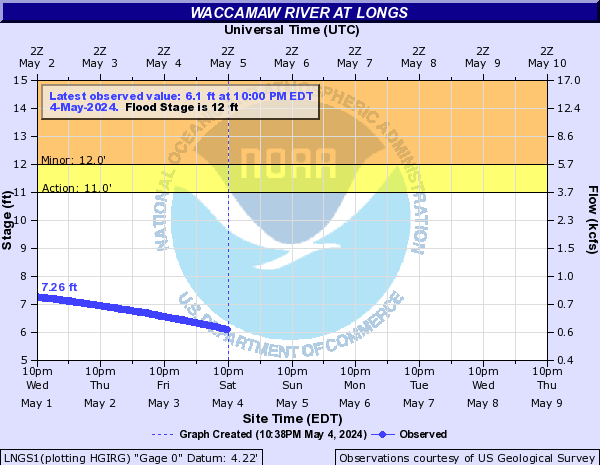
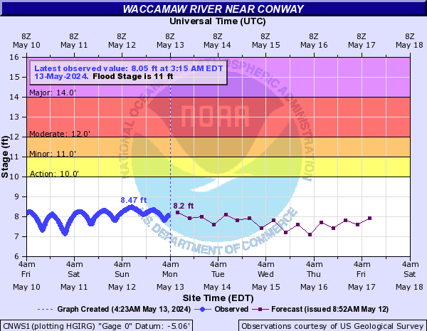
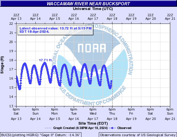
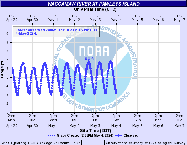
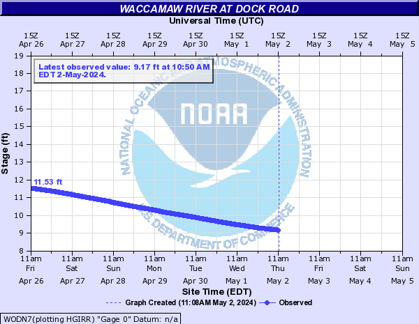
Waccamaw River (Click on an image to go to hydrograph webpage)
FREN7:
LNGS1:
ACWS1:

CNWS1:
BUCS1:
WPIS1:
HAGS1:

WODN7:
WRBS1:

White Marsh (Click on an image to go to hydrograph webpage)
WMWN7:

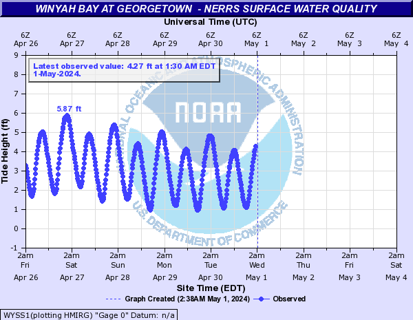
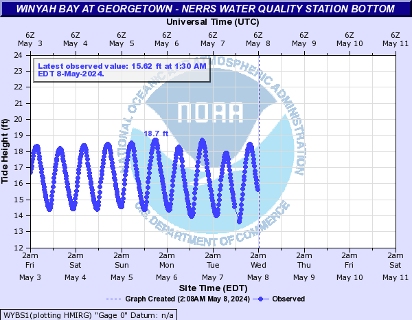
Winyah Bay (Click on an image to go to hydrograph webpage)
WYBS1:
WYSS1: