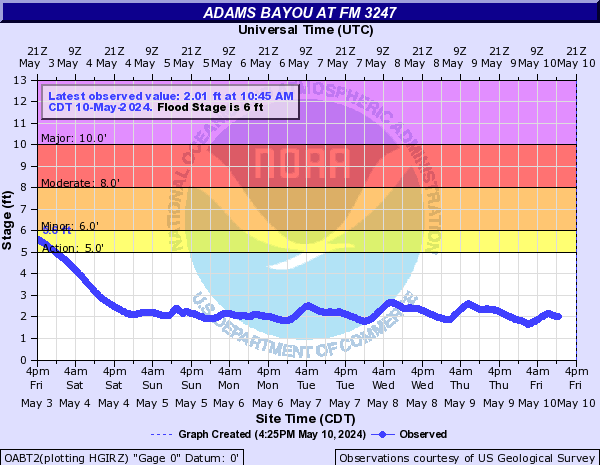
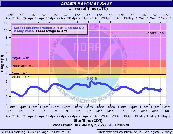
Adams Bayou (Click on an image to go to hydrograph webpage)
OABT2:
ADMT2:
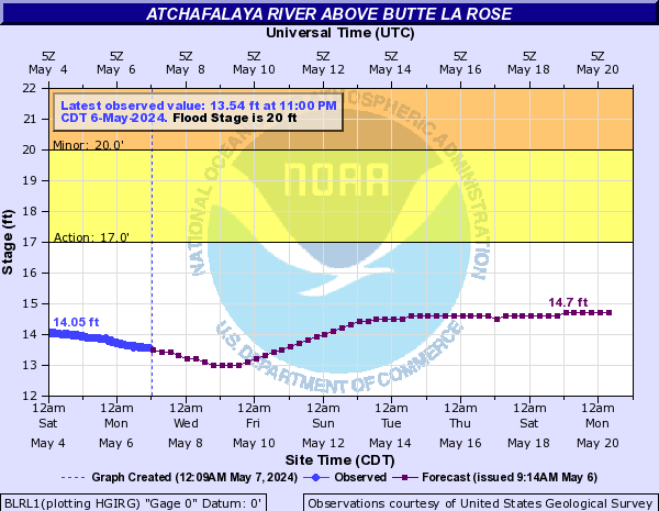
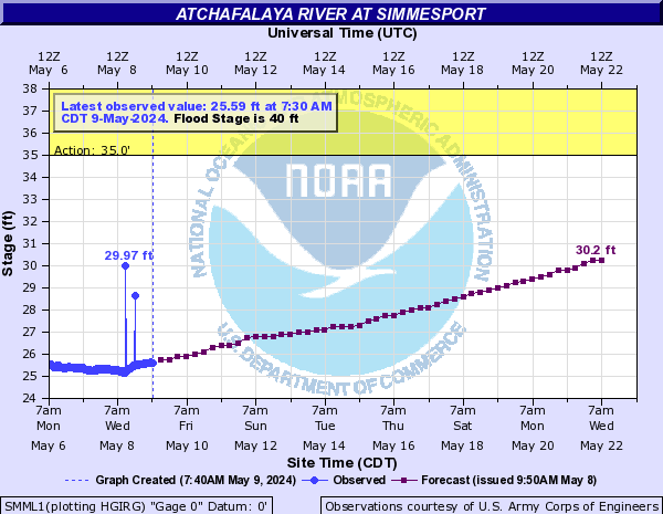
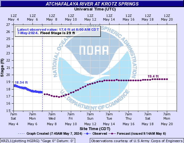
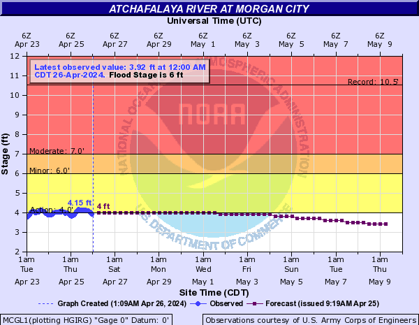
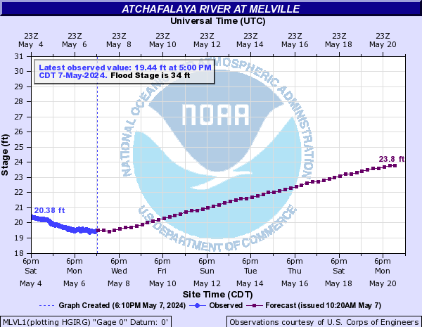
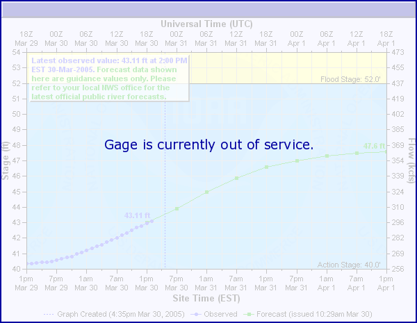
Atchafalaya River (Click on an image to go to hydrograph webpage)
BLRL1:
SMML1:
KRZL1:
MCGL1:
MLVL1:
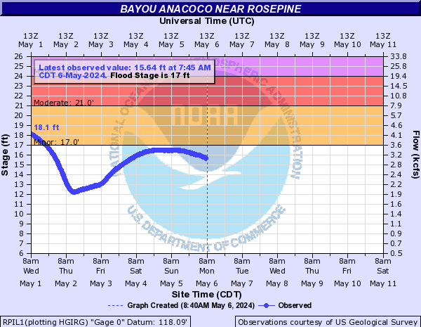
Bayou Anacoco (Click on an image to go to hydrograph webpage)
RPIL1:
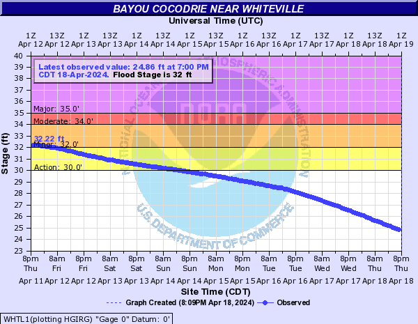
Bayou Cocodrie (Click on an image to go to hydrograph webpage)
CLWL1:

WHTL1:
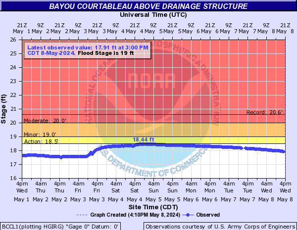
Bayou Courtableau (Click on an image to go to hydrograph webpage)
BCCL1:
WSHL1:

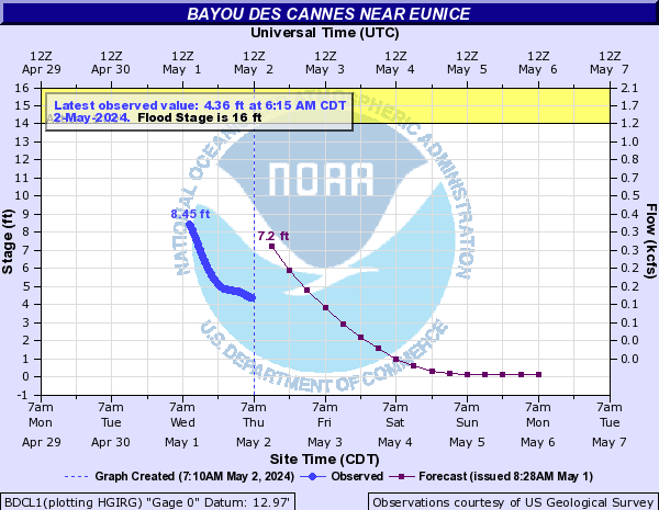
Bayou Des Cannes (Click on an image to go to hydrograph webpage)
BDCL1:
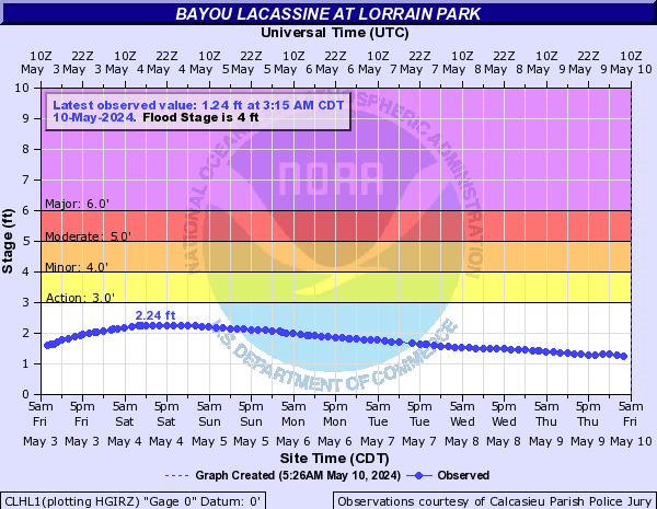
Bayou Lacassine (Click on an image to go to hydrograph webpage)
CLHL1:
Bayou Millhome (Click on an image to go to hydrograph webpage)
STVL1:

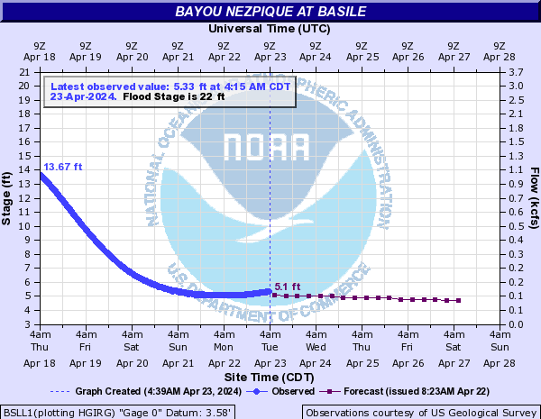
Bayou Nezpique (Click on an image to go to hydrograph webpage)
BSLL1:
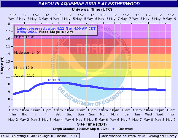
Bayou Plaquemine Brule (Click on an image to go to hydrograph webpage)
ESWL1:
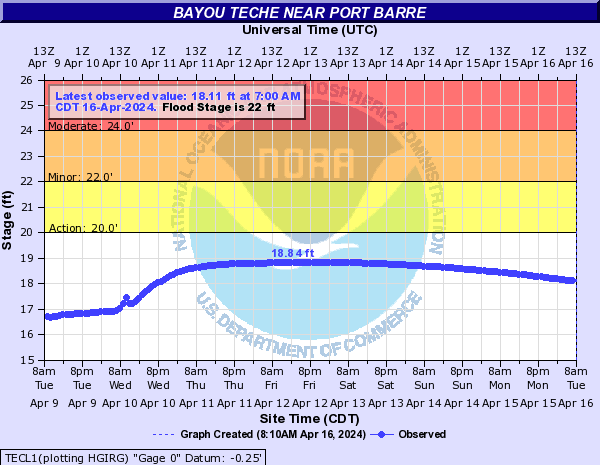
Bayou Teche (Click on an image to go to hydrograph webpage)
TECL1:
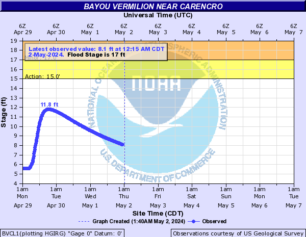
Bayou Vermilion (Click on an image to go to hydrograph webpage)
BVCL1:
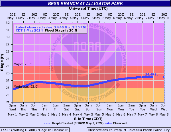
Bess Branch (Click on an image to go to hydrograph webpage)
CSSL1:
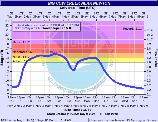
Big Cow Creek (Click on an image to go to hydrograph webpage)
NCCT2:
Black Creek (Click on an image to go to hydrograph webpage)
JYMT2:

Boggy Creek (E TX) (Click on an image to go to hydrograph webpage)
BOPT2:

Bundick Creek (Click on an image to go to hydrograph webpage)
BUNL1:

BKDL1:

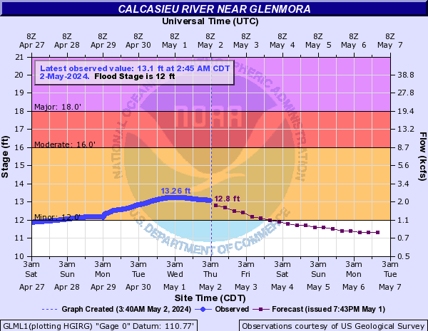
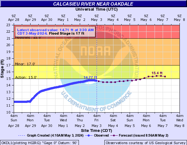
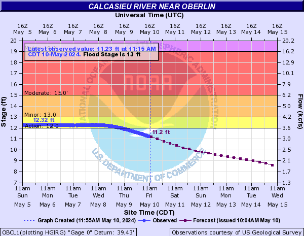
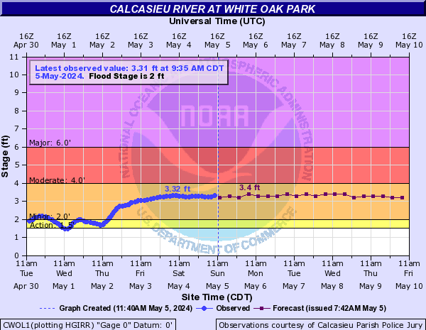
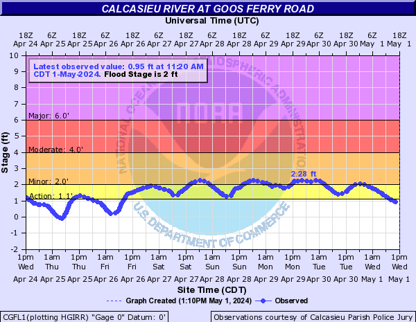
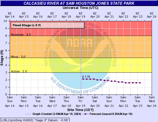
Calcasieu River (Click on an image to go to hydrograph webpage)
GLML1:
OKDL1:
OBCL1:
KDRL1:

CWOL1:
CGFL1:
LCRL1:
LCHL1:

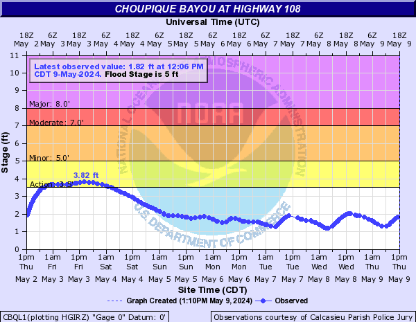
Choupique Bayou (Click on an image to go to hydrograph webpage)
CCDL1:
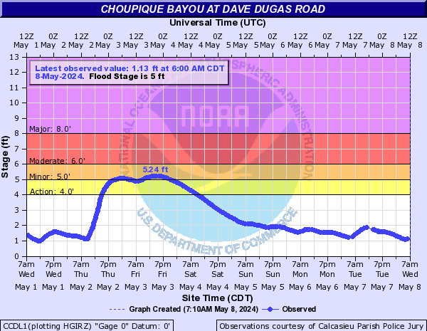
CBQL1:
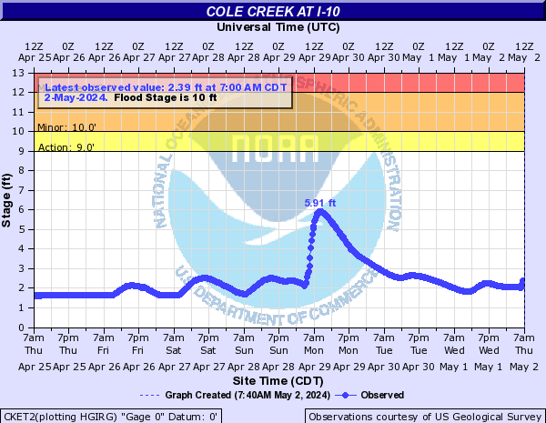
Cole Creek (Click on an image to go to hydrograph webpage)
CKET2:
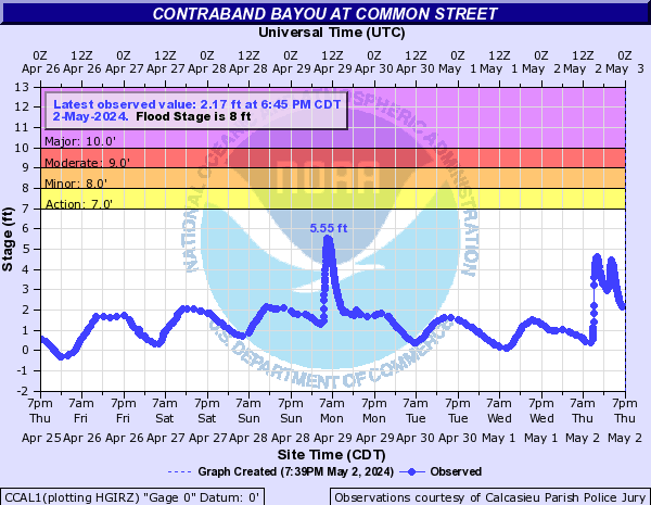
Contraband Bayou (Click on an image to go to hydrograph webpage)
CCAL1:
Coon Bayou (Click on an image to go to hydrograph webpage)
OCOT2:

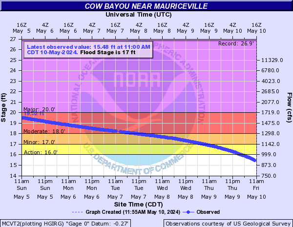
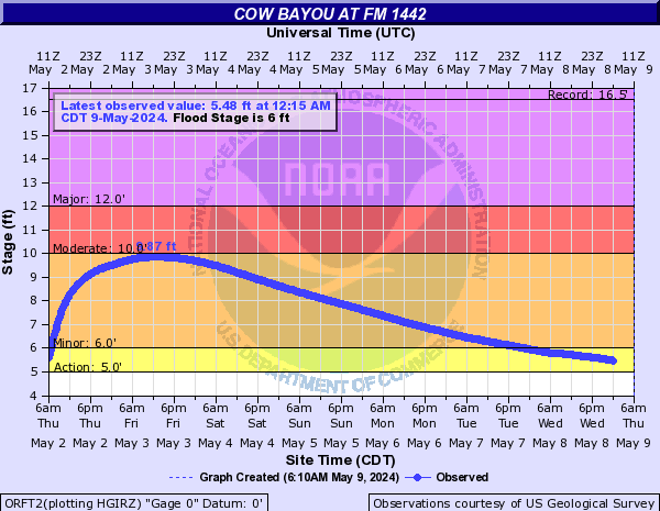
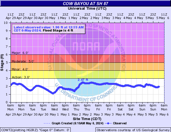
Cow Bayou (Click on an image to go to hydrograph webpage)
MCVT2:
ORFT2:
COWT2:
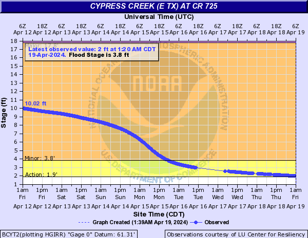
Cypress Creek (E TX) (Click on an image to go to hydrograph webpage)
BCYT2:
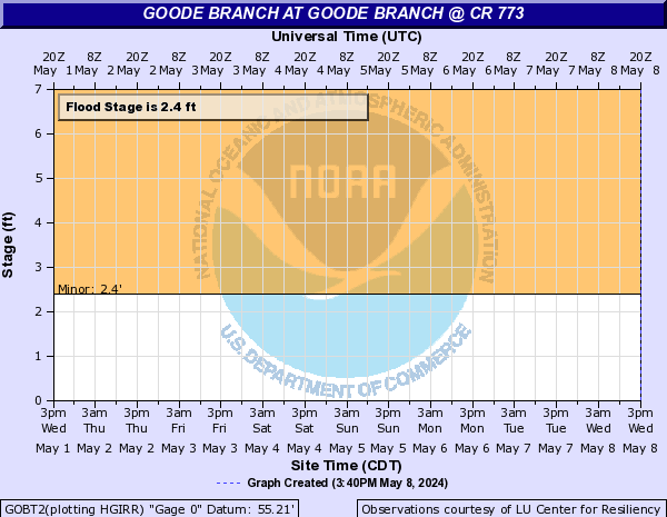
Goode Branch (Click on an image to go to hydrograph webpage)
GOBT2:
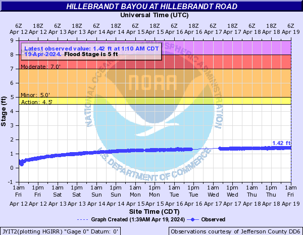
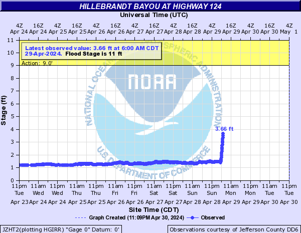
Hillebrandt Bayou (Click on an image to go to hydrograph webpage)
JYIT2:
JZHT2:
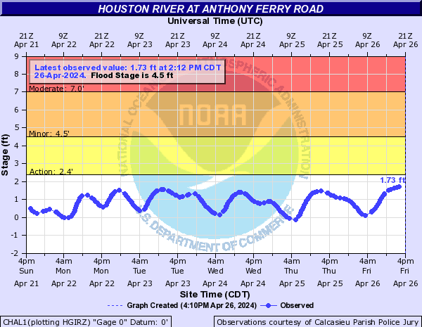
Houston River (Click on an image to go to hydrograph webpage)
CHAL1:
Indian Bayou (Click on an image to go to hydrograph webpage)
CIBL1:

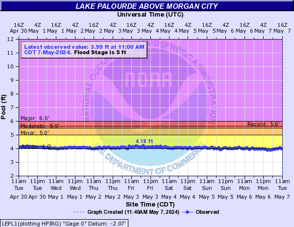
Lake Palourde (Click on an image to go to hydrograph webpage)
LEPL1:
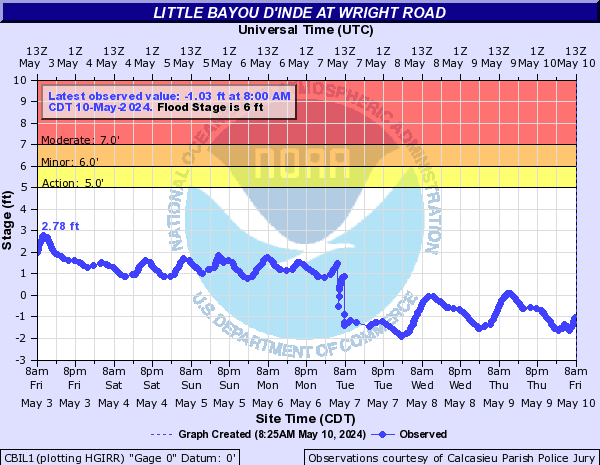
Little Bayou D'Inde (Click on an image to go to hydrograph webpage)
CBIL1:
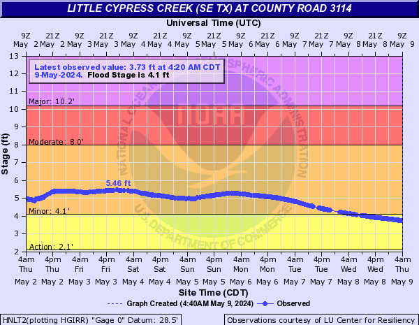
Little Cypress Creek (SE TX) (Click on an image to go to hydrograph webpage)
HNLT2:
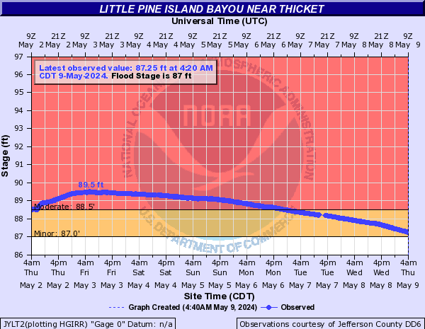
Little Pine Island Bayou (Click on an image to go to hydrograph webpage)
JYLT2:
PWET2:

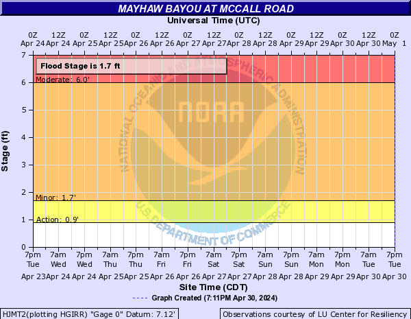
Mayhaw Bayou (Click on an image to go to hydrograph webpage)
HJMT2:
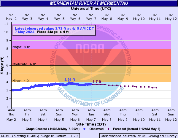
Mermentau River (Click on an image to go to hydrograph webpage)
MRML1:
LCSL1:

CFPL1:

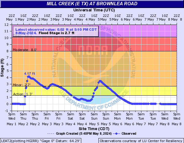
Mill Creek (E TX) (Click on an image to go to hydrograph webpage)
LEAT2:
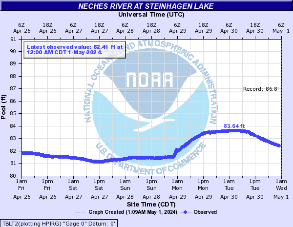
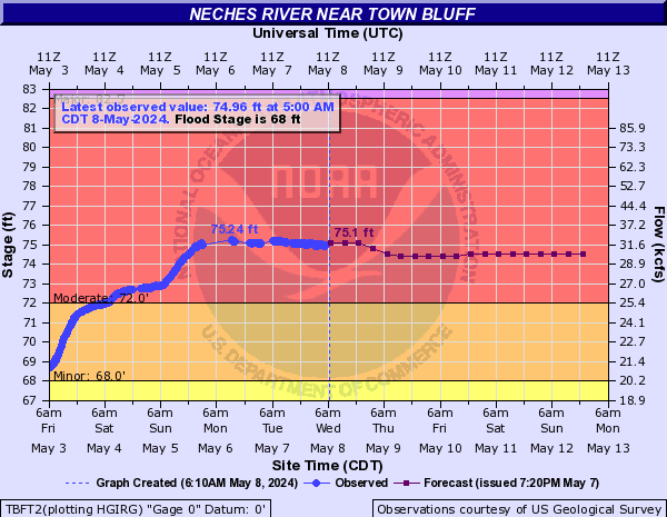
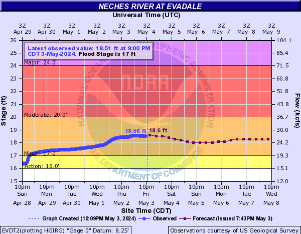
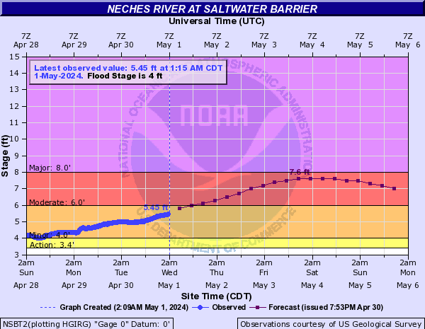
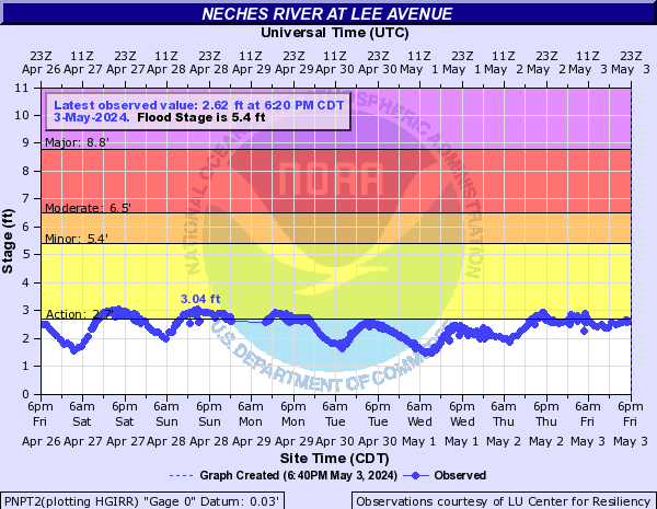
Neches River (Click on an image to go to hydrograph webpage)
TBLT2:
TBFT2:
EVDT2:
NSBT2:
JYBT2:

BEAT2:
PNPT2:
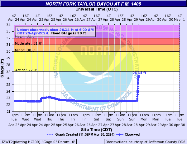
North Fork Taylor Bayou (Click on an image to go to hydrograph webpage)
JZWT2:
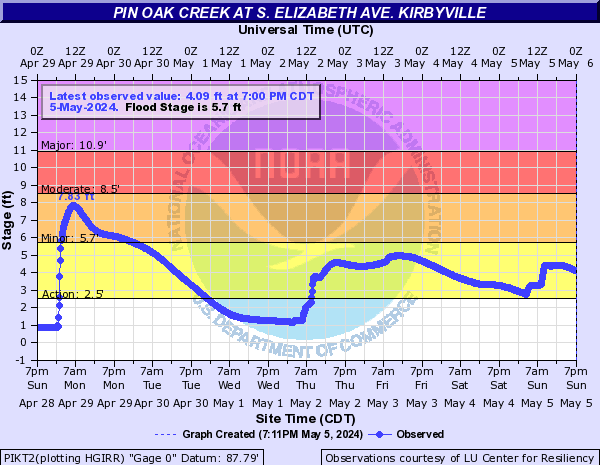
Pin Oak Creek (Click on an image to go to hydrograph webpage)
PIKT2:
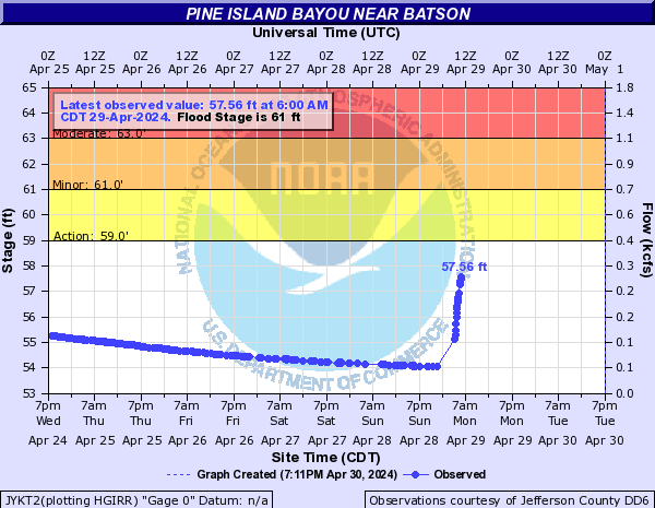
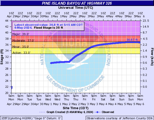
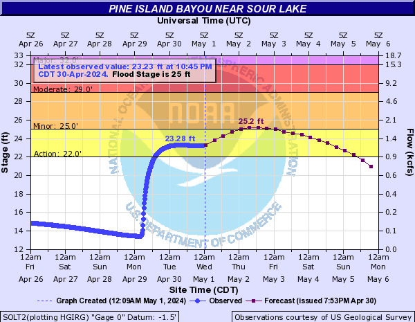
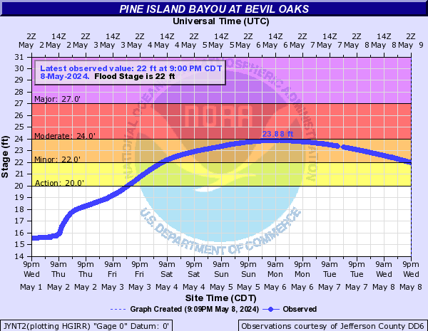
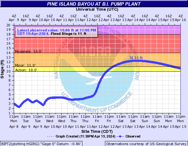
Pine Island Bayou (Click on an image to go to hydrograph webpage)
JYKT2:
JZBT2:
SOLT2:
JYNT2:
BIPT2:
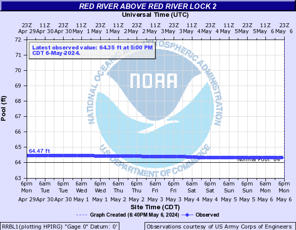
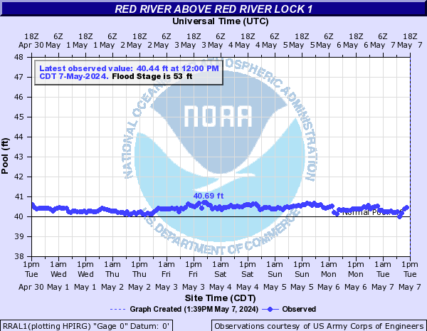
Red River (Click on an image to go to hydrograph webpage)
AEXL1:

RRBL1:
RRAL1:
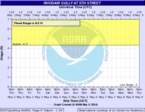
Rhodair Gully (Click on an image to go to hydrograph webpage)
RGIT2:
RGBT2:

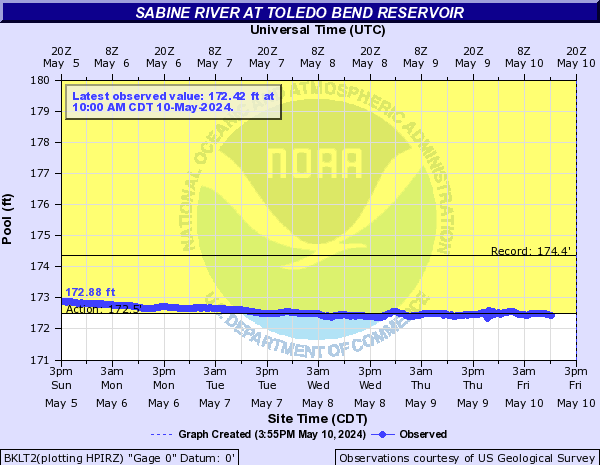
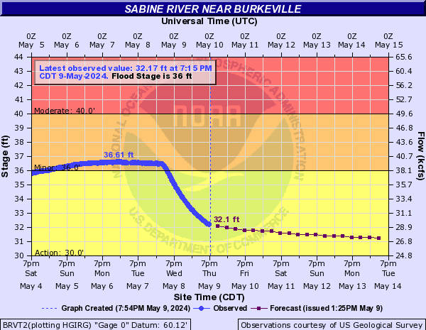
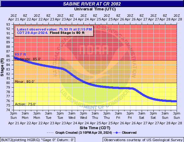
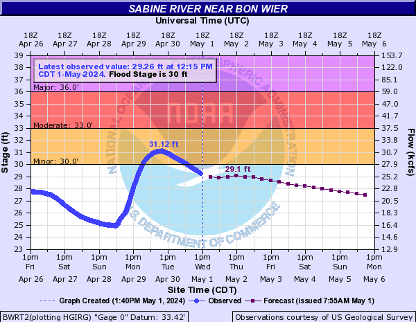
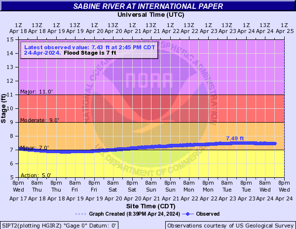
Sabine River (Click on an image to go to hydrograph webpage)
BKLT2:
BRVT2:
BUKT2:
BWRT2:
DWYT2:

SIPT2:
TMYT2:

ORNT2:

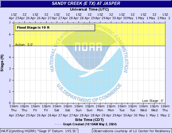
Sandy Creek (E TX) (Click on an image to go to hydrograph webpage)
HAJT2:
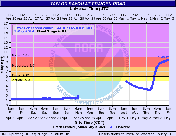
Taylor Bayou (Click on an image to go to hydrograph webpage)
JZYT2:

JAIT2:
Terry Gully (Click on an image to go to hydrograph webpage)
ODCT2:

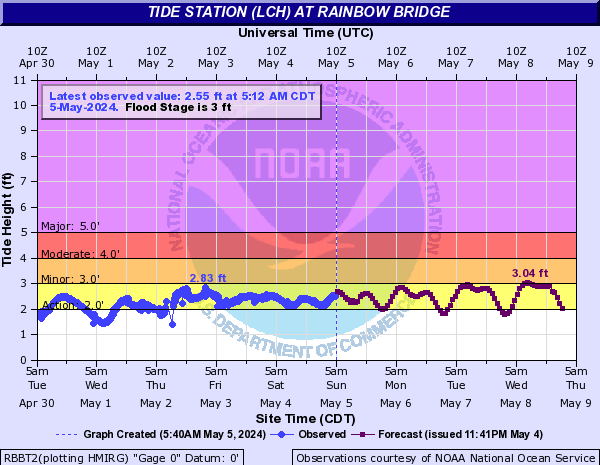
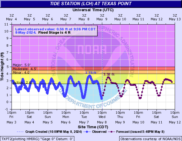
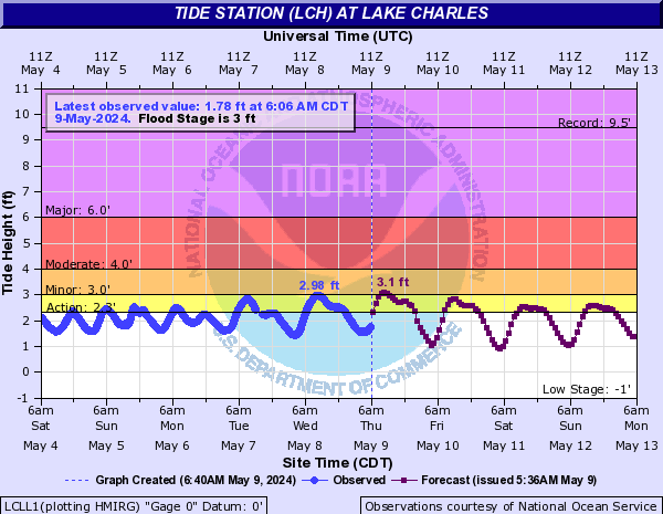
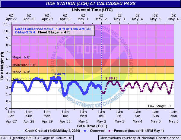
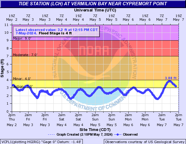
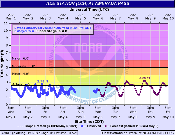
Tide Station (LCH) (Click on an image to go to hydrograph webpage)
RBBT2:
TXPT2:
LCLL1:
CAPL1:
FRWL1:

VCPL1:
AMRL1:
Vermilion River (Click on an image to go to hydrograph webpage)
VLSL1:

VRPL1:

VRLL1:

VRIL1:

Village Creek (Click on an image to go to hydrograph webpage)
KOUT2:

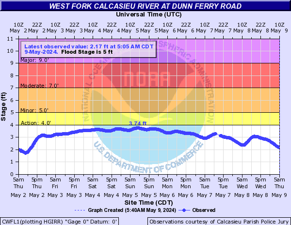
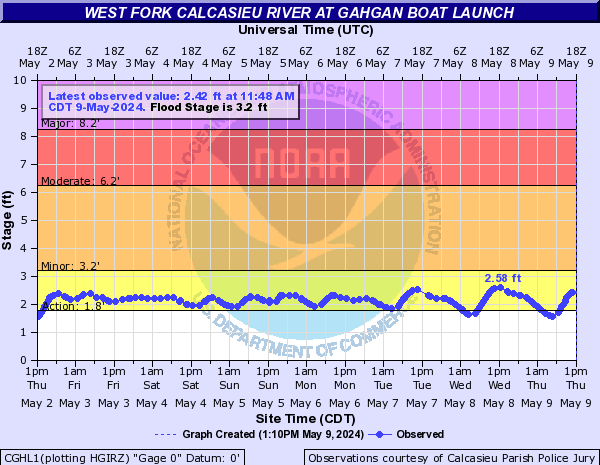
West Fork Calcasieu River (Click on an image to go to hydrograph webpage)
CWFL1:
CGHL1:
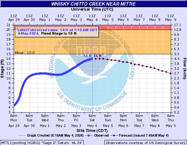
Whisky Chitto Creek (Click on an image to go to hydrograph webpage)
MTTL1:
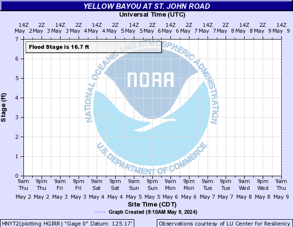
Yellow Bayou (Click on an image to go to hydrograph webpage)
HNYT2: