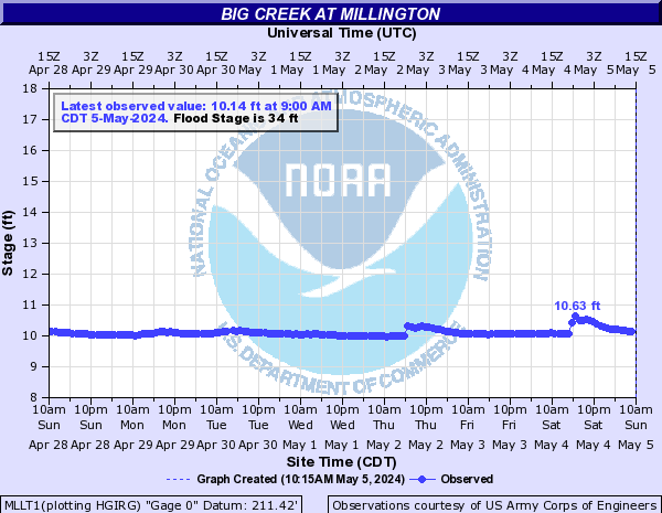
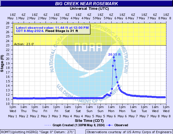
Big Creek (Click on an image to go to hydrograph webpage)
MLLT1:
ROMT1:
Big Sandy River (KY) (Click on an image to go to hydrograph webpage)
BIGT1:

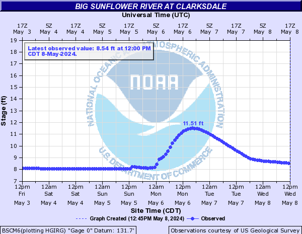
Big Sunflower River (Click on an image to go to hydrograph webpage)
BSCM6:
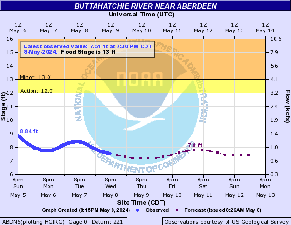
Buttahatchie River (Click on an image to go to hydrograph webpage)
ABDM6:
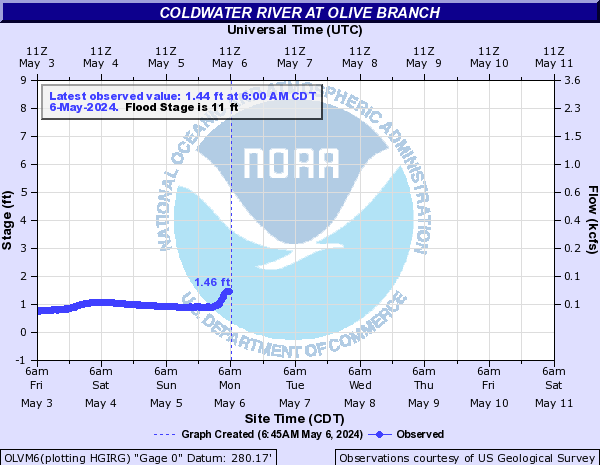
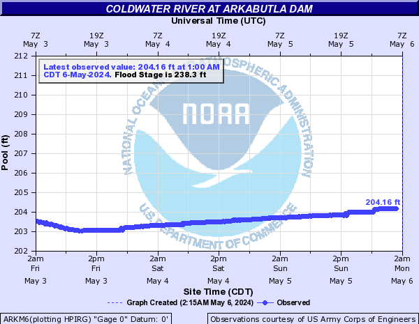
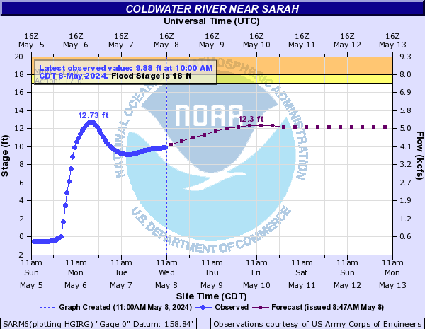
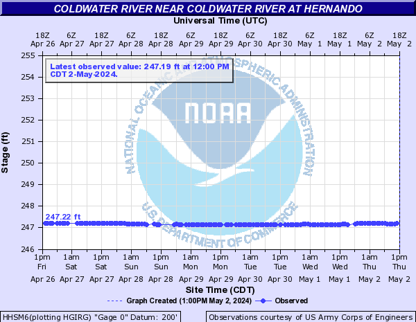
Coldwater River (Click on an image to go to hydrograph webpage)
OLVM6:
ARKM6:
SARM6:
MKSM6:

HHSM6:
Fletcher Creek (Click on an image to go to hydrograph webpage)
MPHT1:

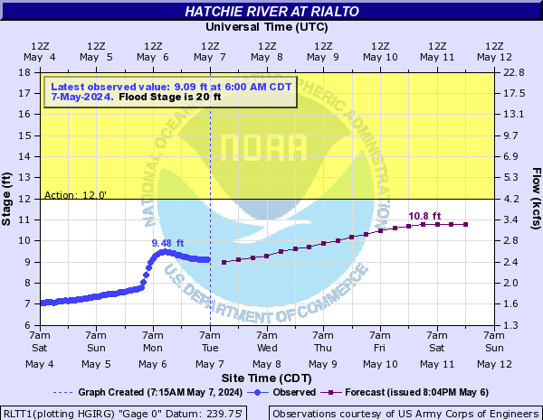
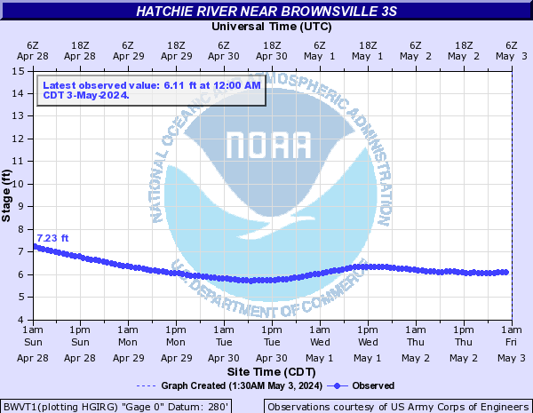
Hatchie River (Click on an image to go to hydrograph webpage)
WLNM6:

BVRT1:

RLTT1:
BWVT1:
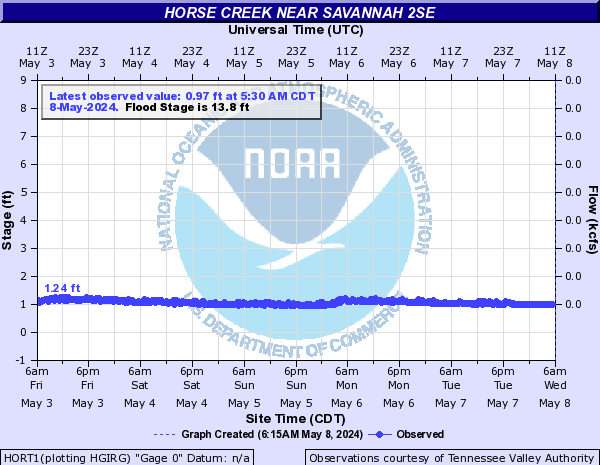
Horse Creek (Click on an image to go to hydrograph webpage)
HORT1:
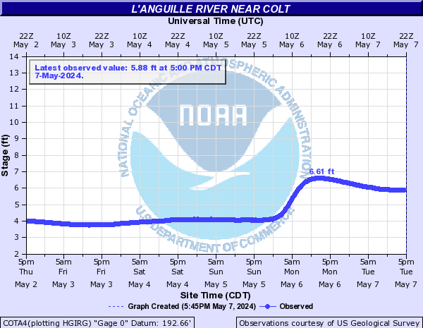
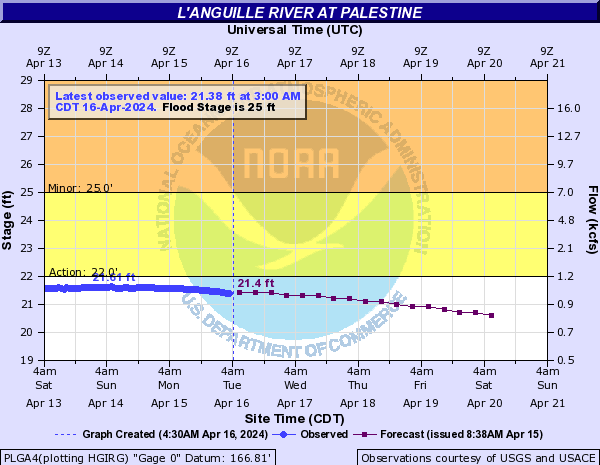
L'Anguille River (Click on an image to go to hydrograph webpage)
COTA4:
PLGA4:
LAMA4:

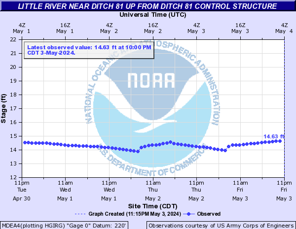
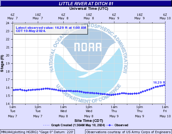
Little River (Click on an image to go to hydrograph webpage)
MDEA4:
MNUA4:
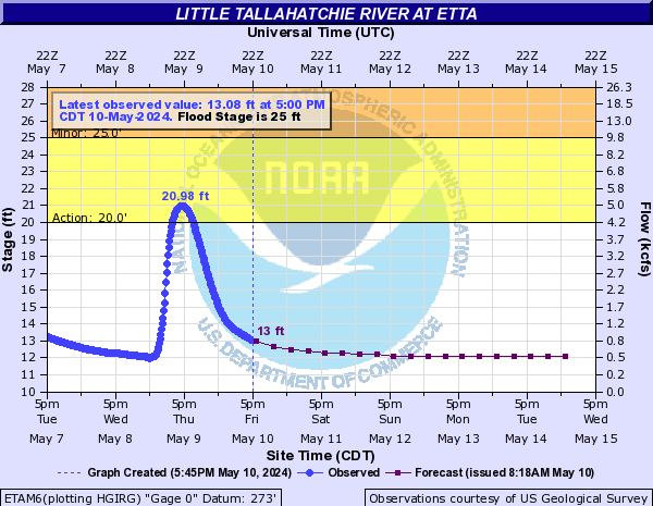
Little Tallahatchie River (Click on an image to go to hydrograph webpage)
ETAM6:
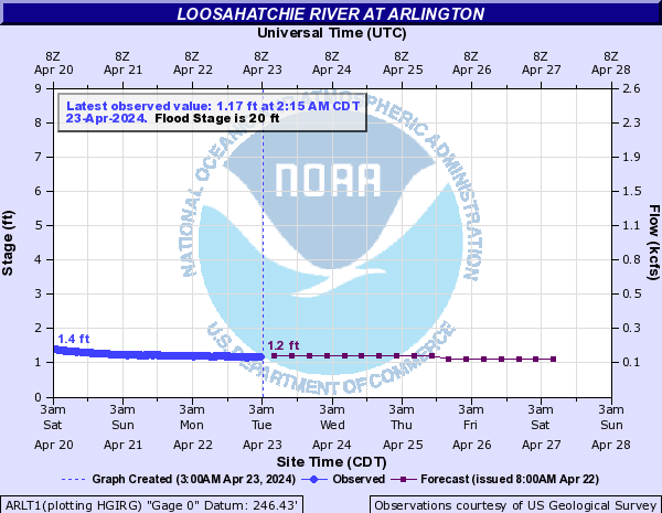
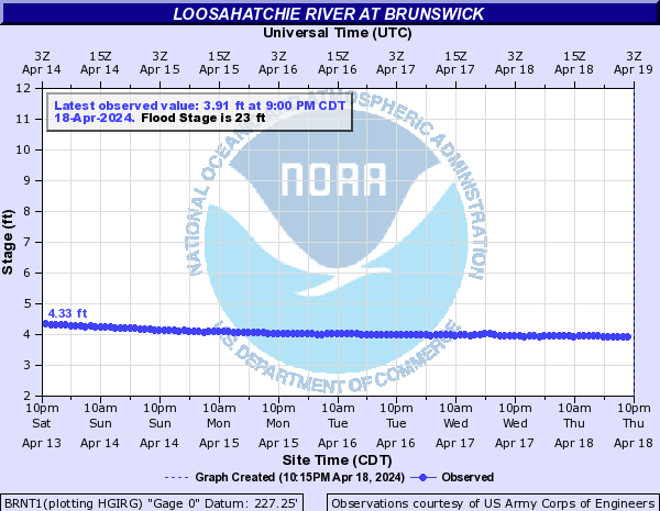
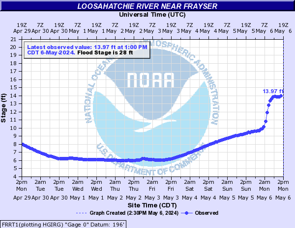
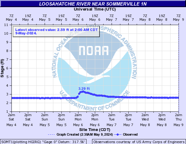
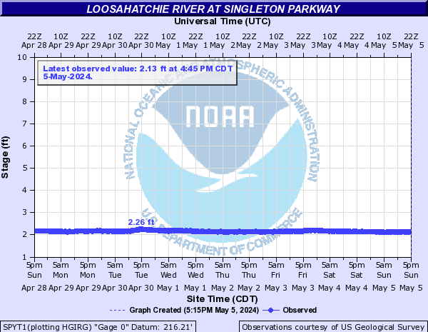
Loosahatchie River (Click on an image to go to hydrograph webpage)
ARLT1:
BRNT1:
FRRT1:
SOMT1:
SPYT1:
Middle Fork Forked Deer River (Click on an image to go to hydrograph webpage)
HUMT1:

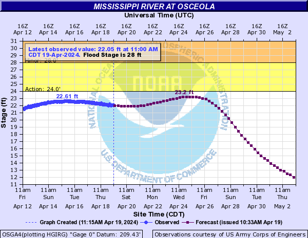
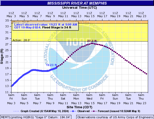
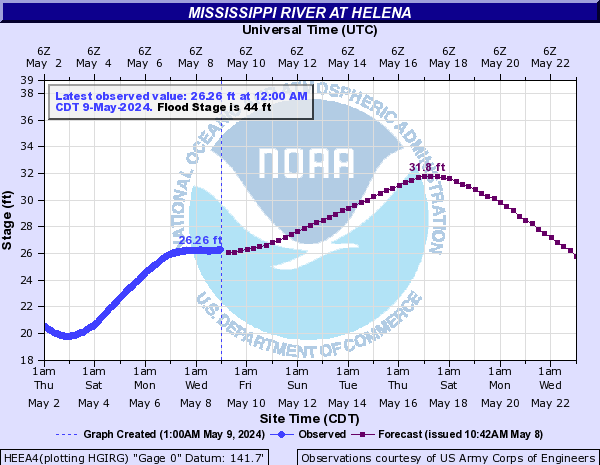
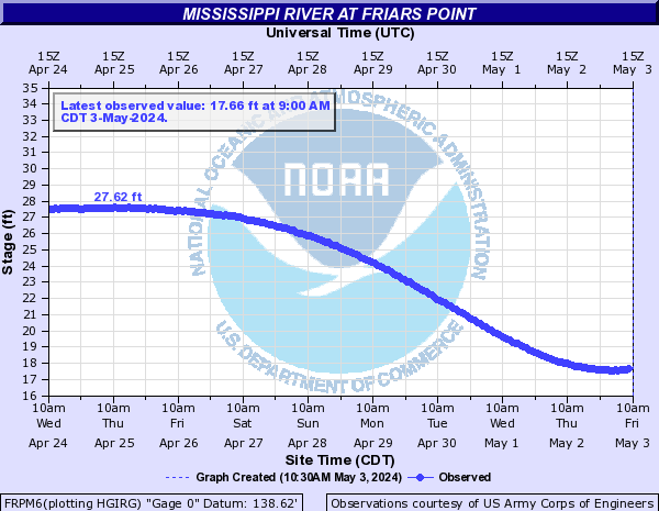
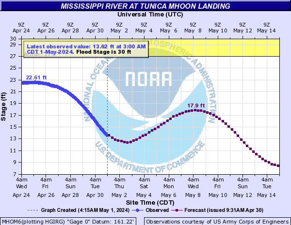
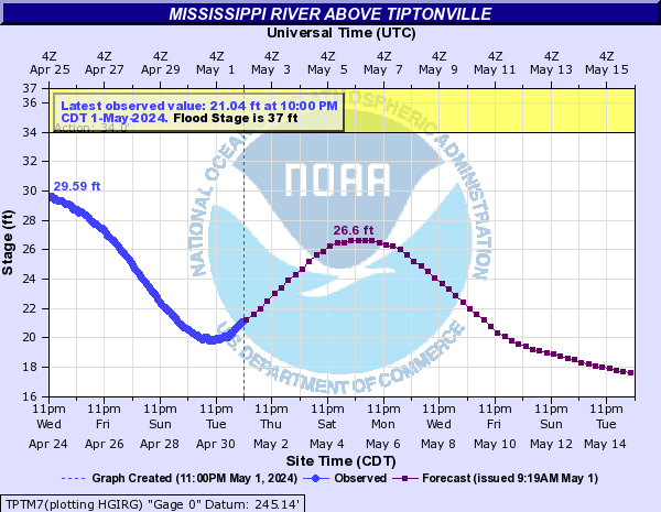
Mississippi River (Click on an image to go to hydrograph webpage)
TPTT1:

CRTM7:

OSGA4:
MEMT1:
TRPM6:

HEEA4:
FRPM6:
MHOM6:
TPTM7:
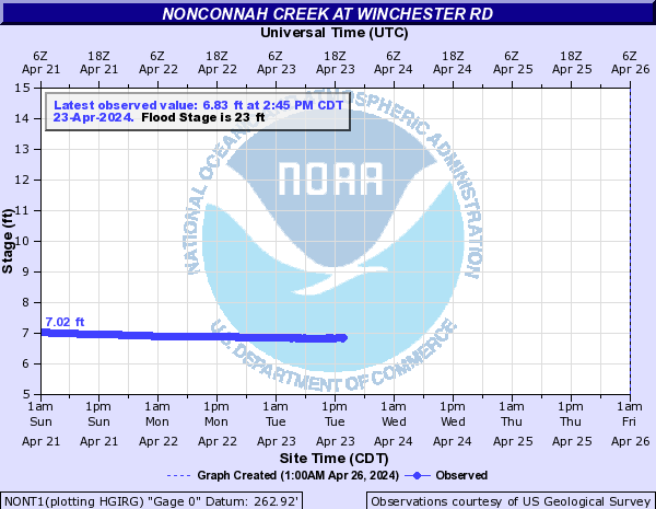
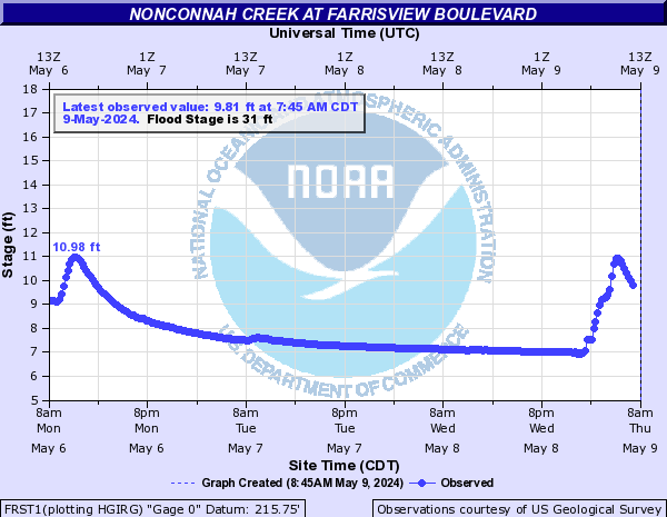
Nonconnah Creek (Click on an image to go to hydrograph webpage)
NONT1:
FRST1:
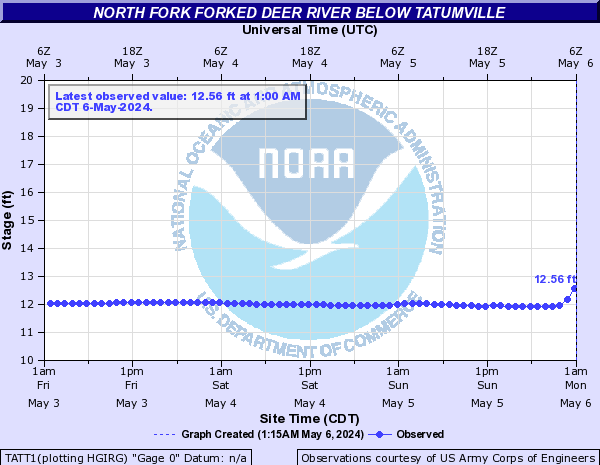
North Fork Forked Deer River (Click on an image to go to hydrograph webpage)
TATT1:
DYET1:

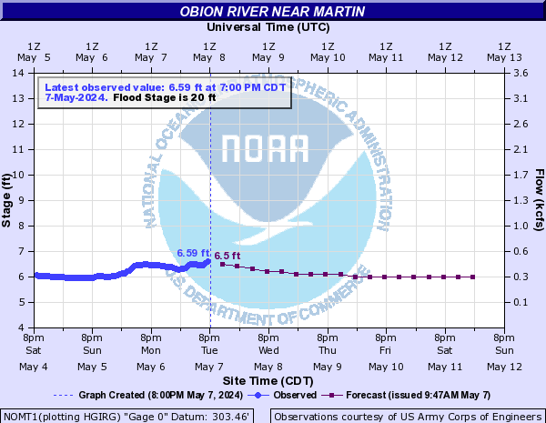
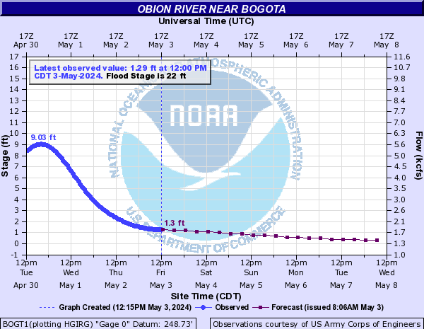
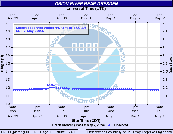
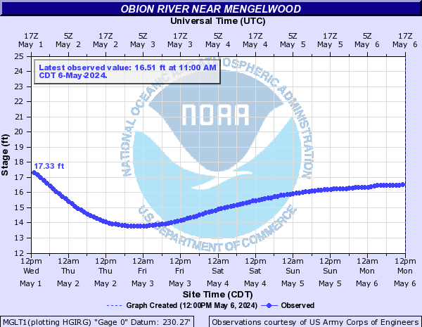
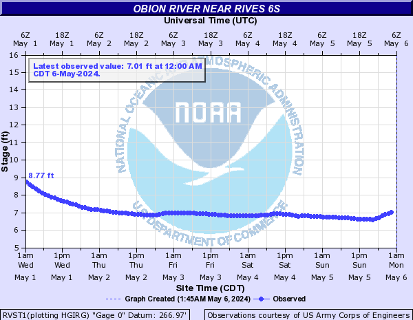
Obion River (Click on an image to go to hydrograph webpage)
PLMT1:

NOMT1:
OBNT1:

BOGT1:
DRST1:
MGLT1:
RVST1:
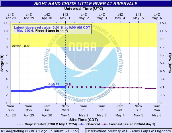
Right Hand Chute Little River (Click on an image to go to hydrograph webpage)
RIGA4:
Skuna River (Click on an image to go to hydrograph webpage)
BRCM6:

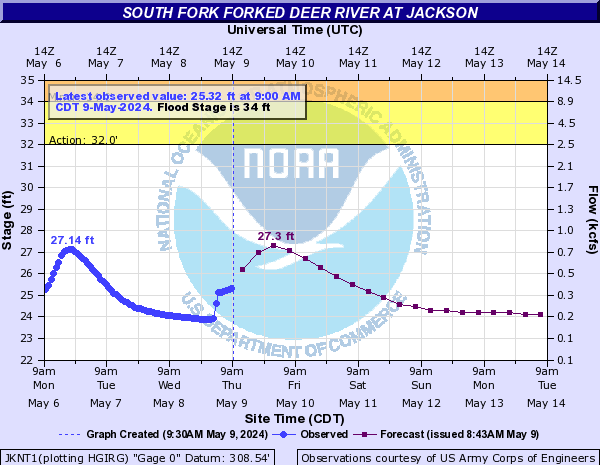
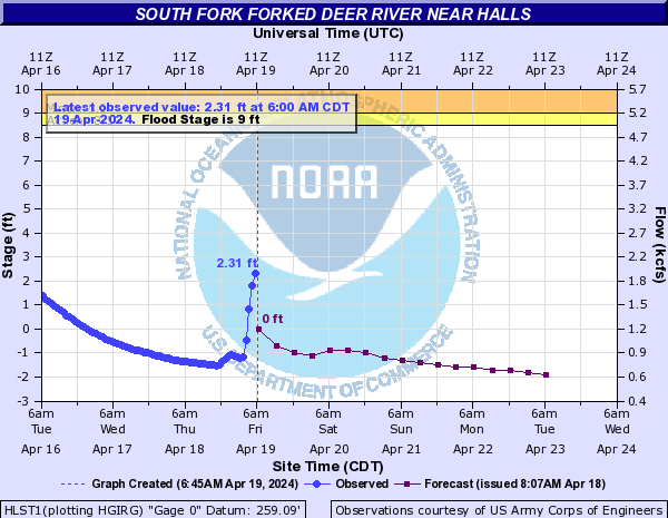
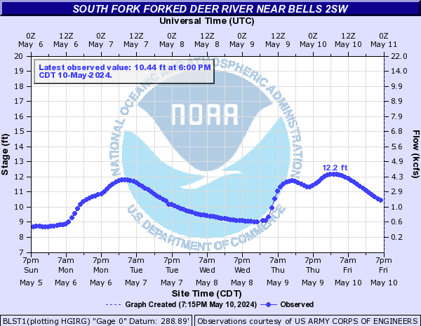
South Fork Forked Deer River (Click on an image to go to hydrograph webpage)
JKNT1:
HLST1:
BLST1:
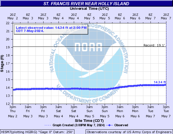
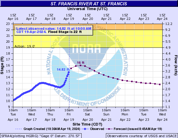
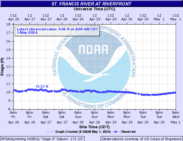
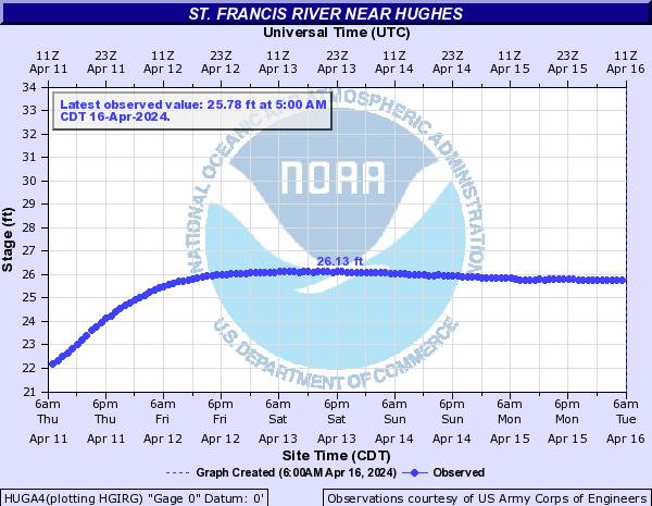
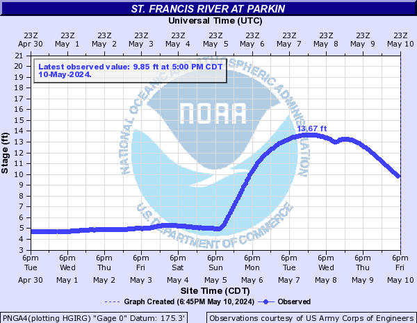
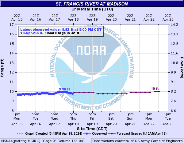
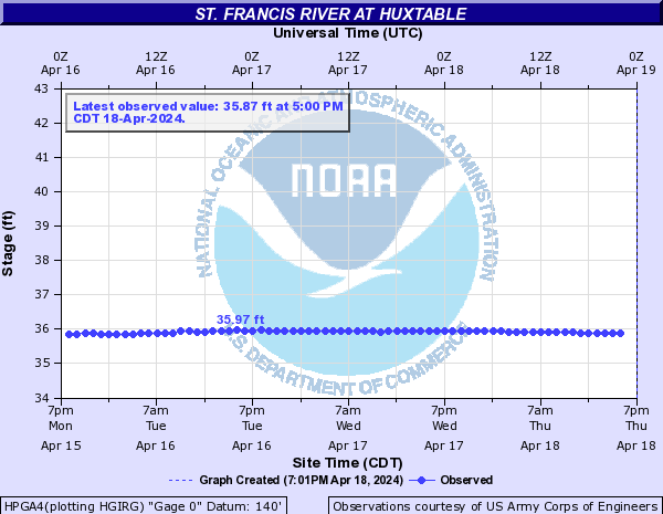
St. Francis River (Click on an image to go to hydrograph webpage)
HISM7:
SFRA4:
LCRA4:

RFGA4:
HUGA4:
MTOA4:

PNGA4:
MSNA4:
MSFA4:

CDGA4:

HPGA4:
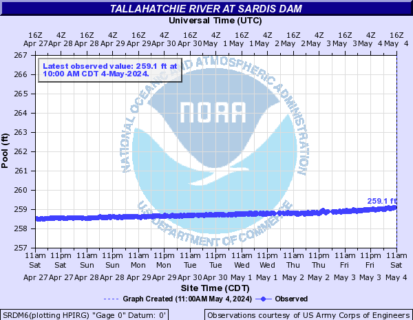
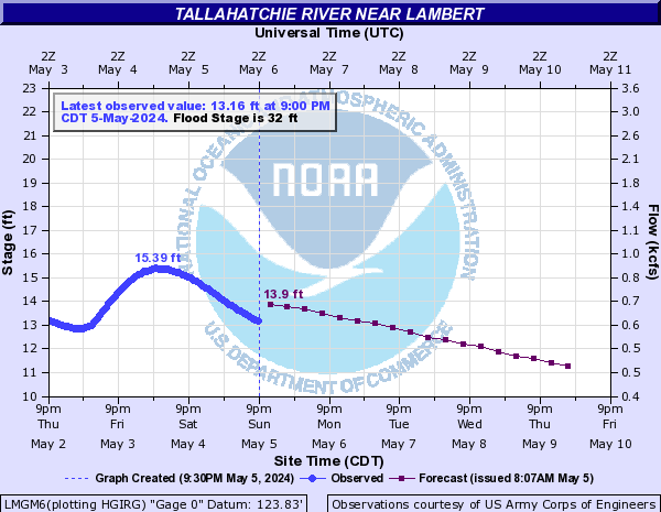
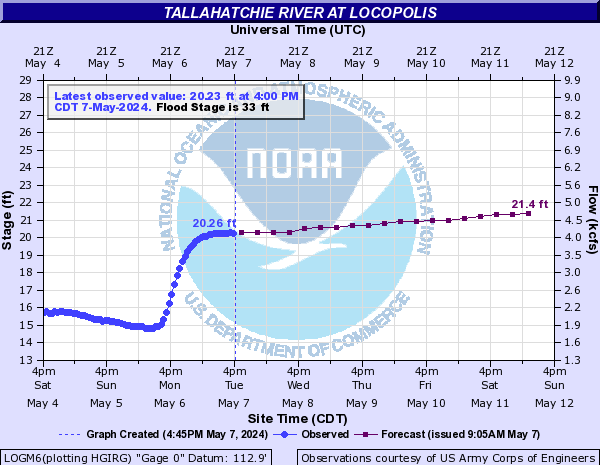
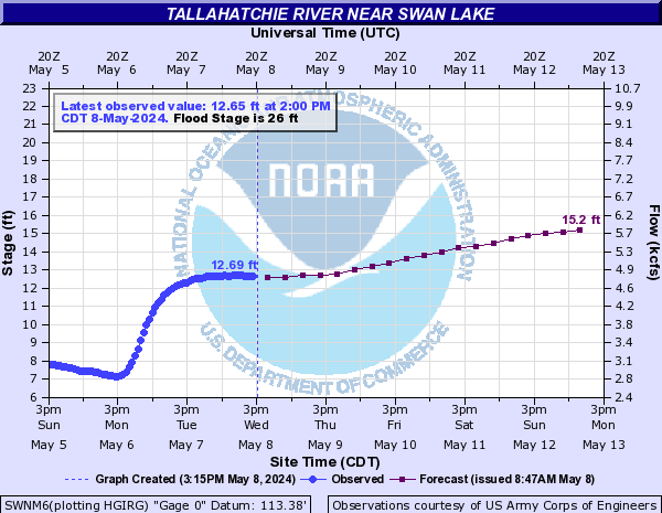
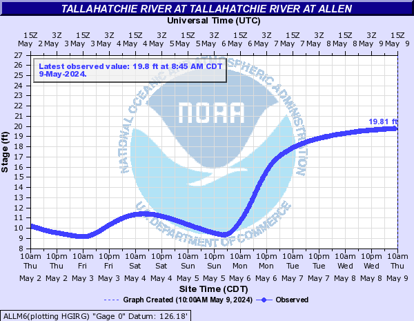
Tallahatchie River (Click on an image to go to hydrograph webpage)
SRDM6:
LMGM6:
LOGM6:
WEBM6:

SWNM6:
ALLM6:
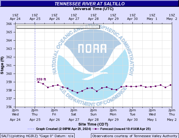
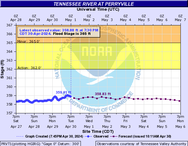
Tennessee River (Click on an image to go to hydrograph webpage)
NJNT1:

PICT1:

SAVT1:

SALT1:
PRVT1:
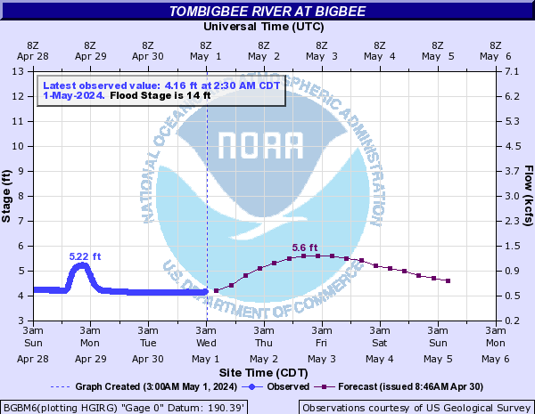
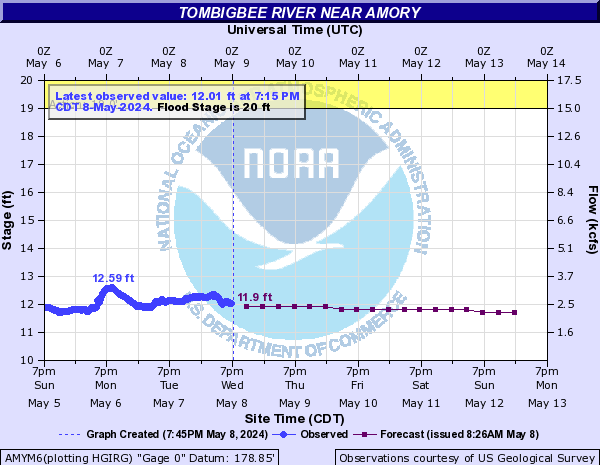
Tombigbee River (Click on an image to go to hydrograph webpage)
FULM6:

BGBM6:
AMYM6:
ABEM6:

Town Creek (Click on an image to go to hydrograph webpage)
TPOM6:

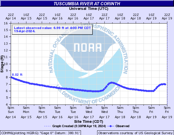
Tuscumbia River (Click on an image to go to hydrograph webpage)
COHM6:
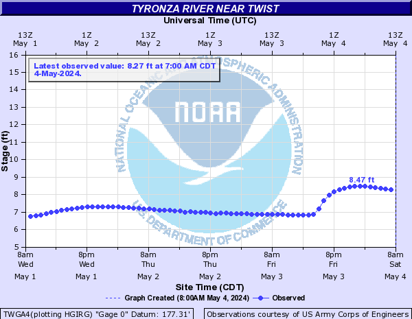
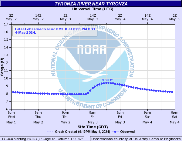
Tyronza River (Click on an image to go to hydrograph webpage)
TWGA4:
TYGA4:
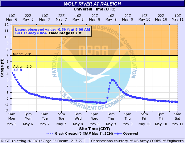
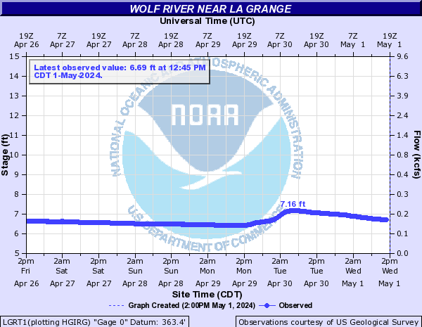
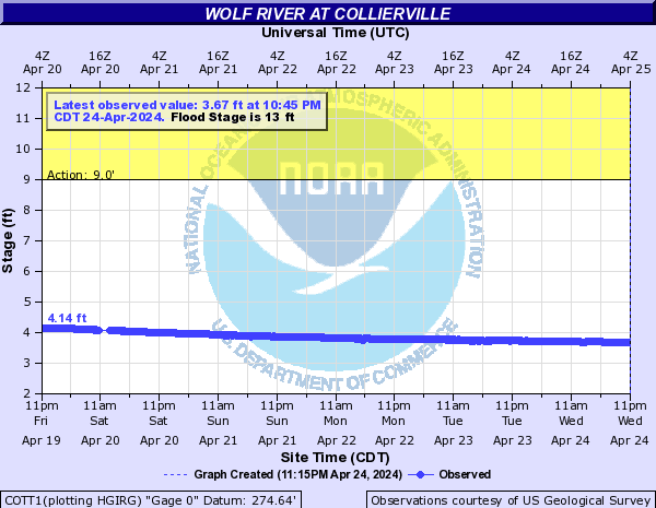
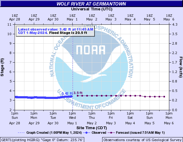
Wolf River (Click on an image to go to hydrograph webpage)
RLGT1:
LGRT1:
ROST1:

COTT1:
GERT1:
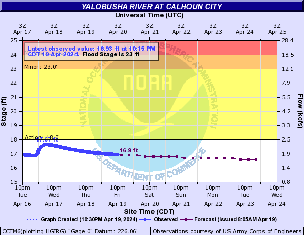
Yalobusha River (Click on an image to go to hydrograph webpage)
CCTM6:
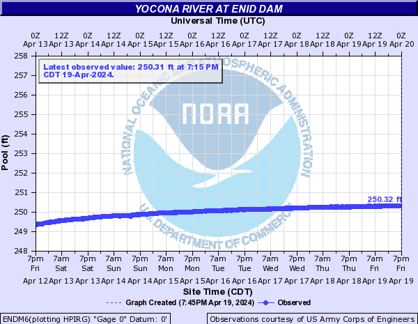
Yocona River (Click on an image to go to hydrograph webpage)
OXDM6:

ENDM6: