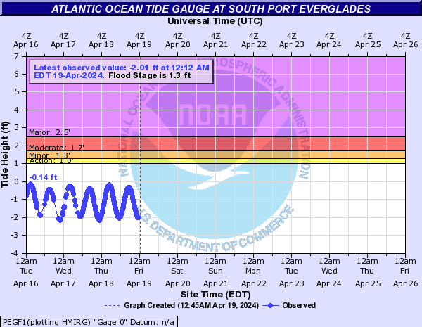
Atlantic Ocean Tide Gauge (Click on an image to go to hydrograph webpage)
LKWF1:

PEGF1:
VAKF1:

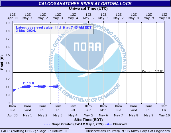
Caloosahatchee River (Click on an image to go to hydrograph webpage)
CACF1:
CCAF1:

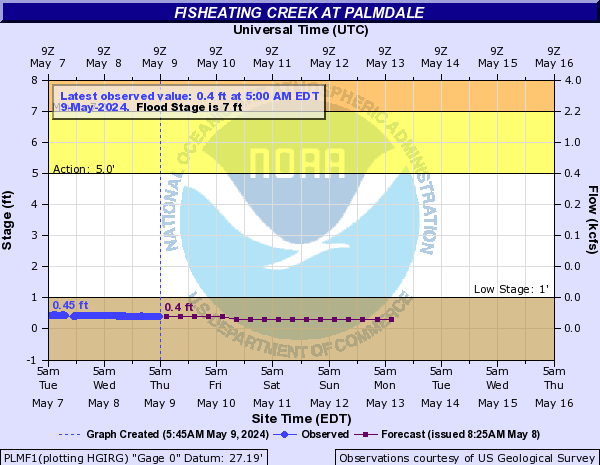
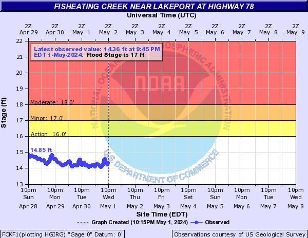
Fisheating Creek (Click on an image to go to hydrograph webpage)
PLMF1:
FCKF1:
Gamble Creek (Click on an image to go to hydrograph webpage)
PGAF1:

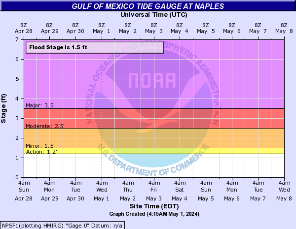
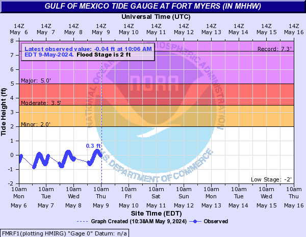
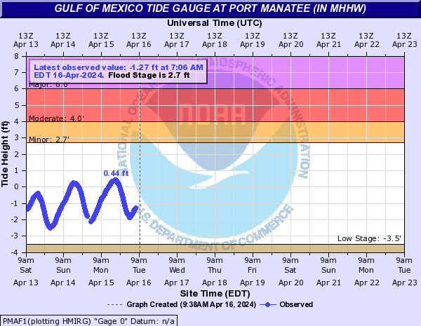
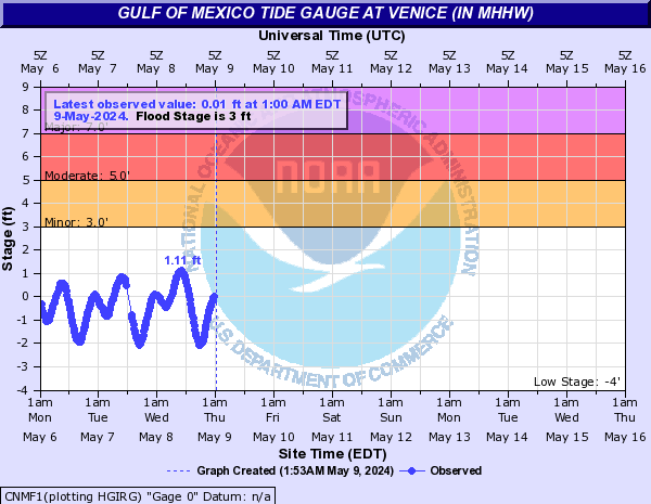
Gulf of Mexico Tide Gauge (Click on an image to go to hydrograph webpage)
NPSF1:
FMRF1:
PMAF1:
CNMF1:
SKTF1:

MRNF1:

Horse Creek (FL) (Click on an image to go to hydrograph webpage)
ARHF1:

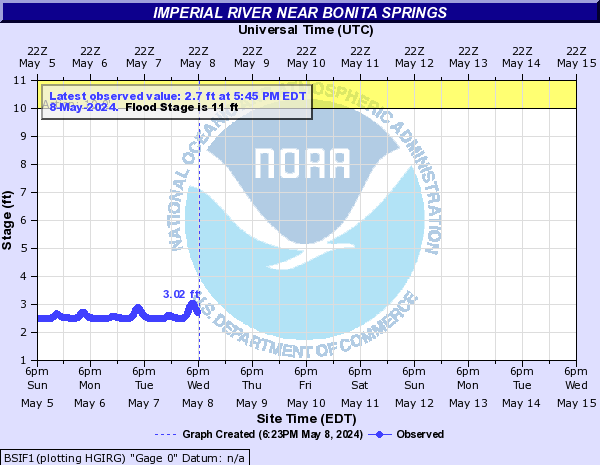
Imperial River (Click on an image to go to hydrograph webpage)
BSIF1:
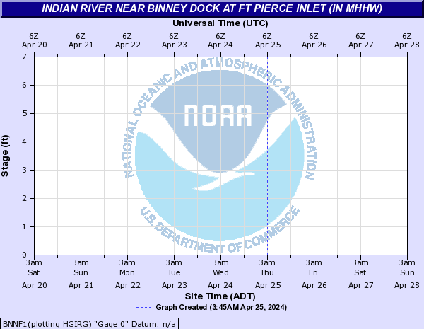
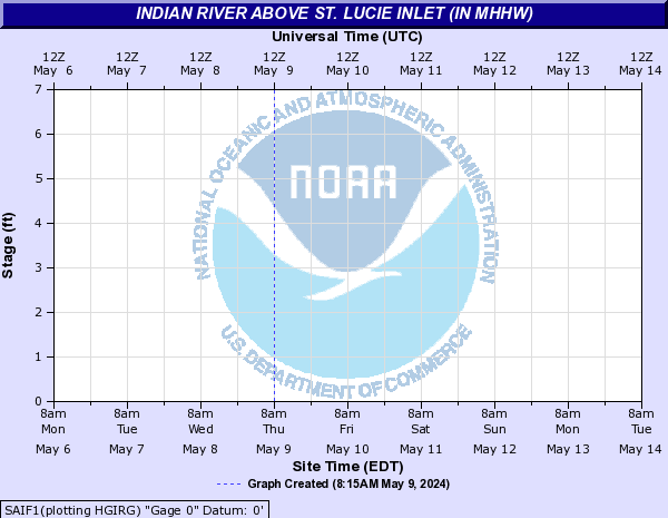
Indian River (Click on an image to go to hydrograph webpage)
BNNF1:
SAIF1:
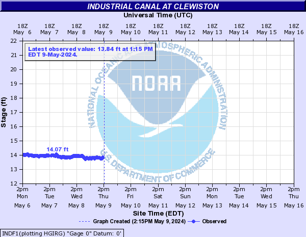
Industrial Canal (Click on an image to go to hydrograph webpage)
INDF1:
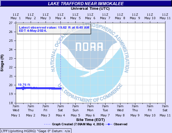
Lake Trafford (Click on an image to go to hydrograph webpage)
LTFF1:
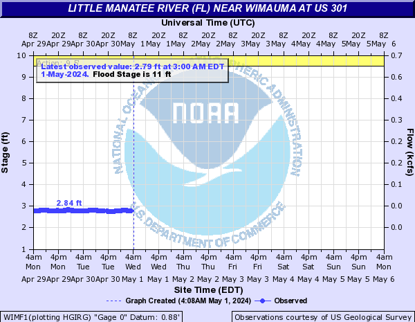
Little Manatee River (FL) (Click on an image to go to hydrograph webpage)
WIMF1:
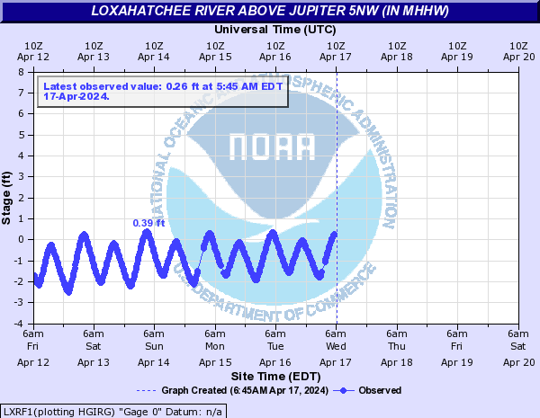
Loxahatchee River (Click on an image to go to hydrograph webpage)
LXRF1:
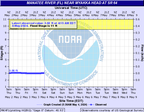
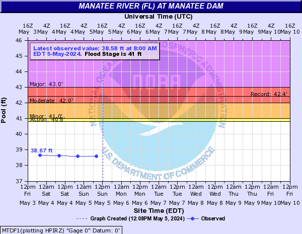
Manatee River (FL) (Click on an image to go to hydrograph webpage)
MKHF1:
MTDF1:
RYEF1:

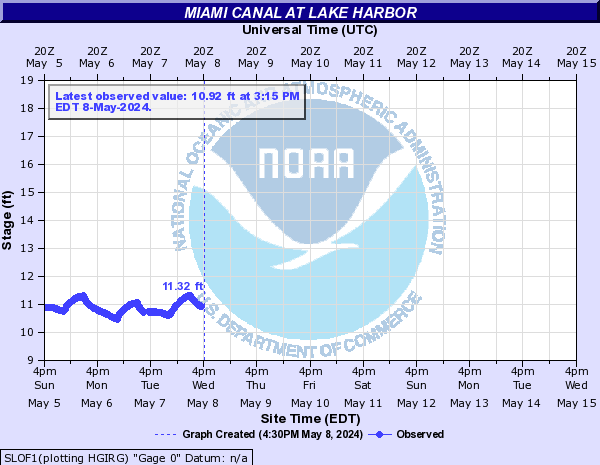
Miami Canal (Click on an image to go to hydrograph webpage)
SLOF1:
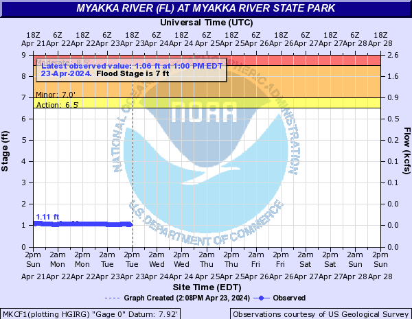
Myakka River (FL) (Click on an image to go to hydrograph webpage)
MKCF1:
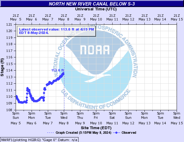
North New River Canal (Click on an image to go to hydrograph webpage)
NWRF1:
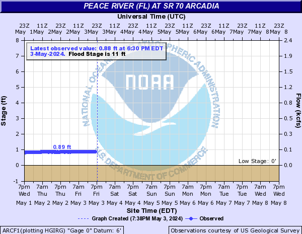
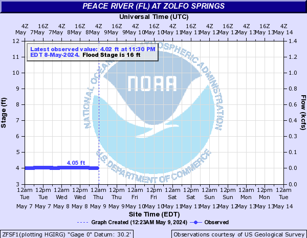
Peace River (FL) (Click on an image to go to hydrograph webpage)
ARCF1:
ZFSF1:
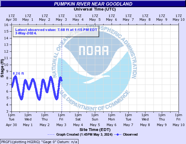
Pumpkin River (Click on an image to go to hydrograph webpage)
PRGF1:
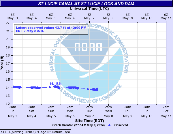
St Lucie Canal (Click on an image to go to hydrograph webpage)
SLLF1:
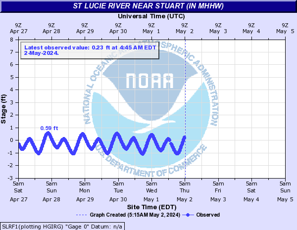
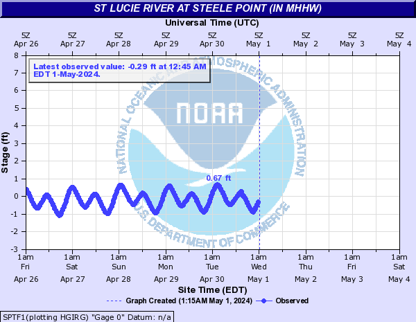
St Lucie River (Click on an image to go to hydrograph webpage)
SLRF1:
SPTF1:
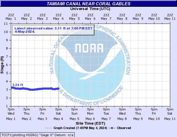
Tamiami Canal (Click on an image to go to hydrograph webpage)
TCCF1:
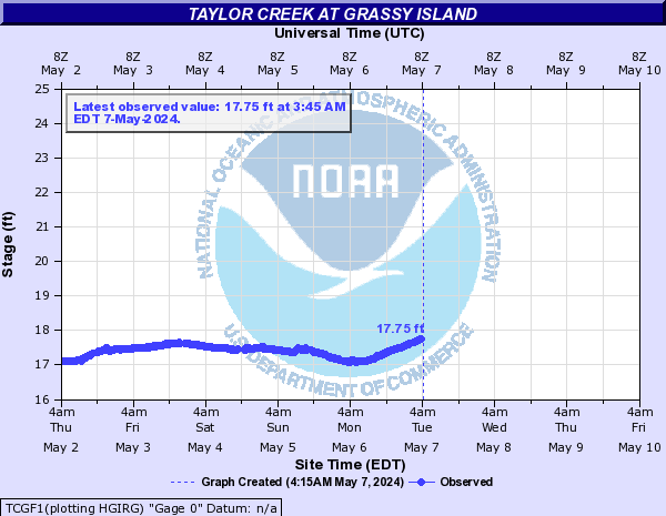
Taylor Creek (Click on an image to go to hydrograph webpage)
TCGF1: