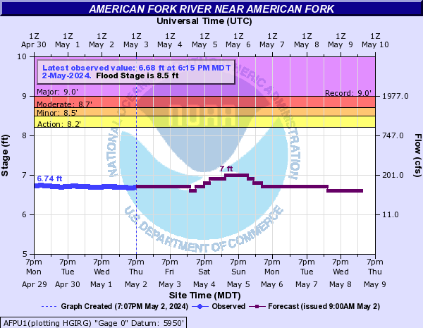
American Fork River (Click on an image to go to hydrograph webpage)
AFPU1:
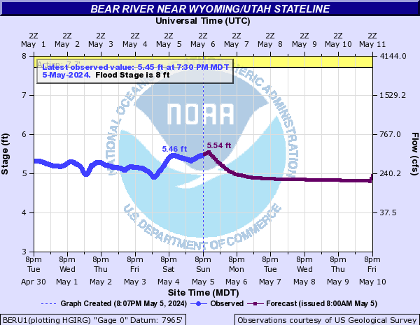
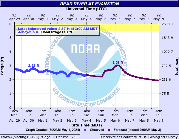
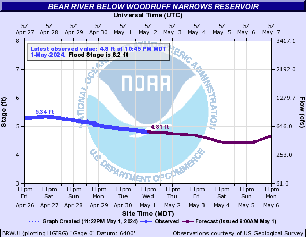
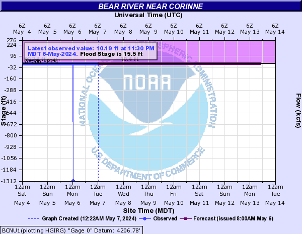
Bear River (Click on an image to go to hydrograph webpage)
BERU1:
EVAW4:
BEAW4:

BRWU1:
BECU1:

BCNU1:
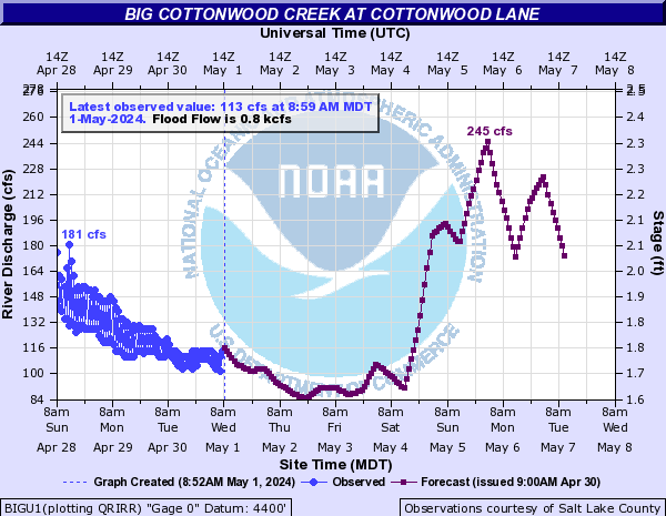
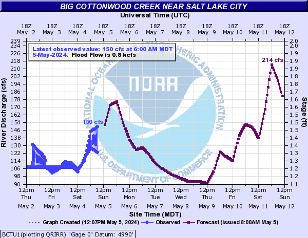
Big Cottonwood Creek (Click on an image to go to hydrograph webpage)
BIGU1:
BCTU1:
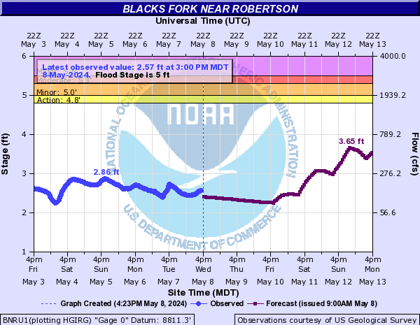
Blacks Fork (Click on an image to go to hydrograph webpage)
BNRU1:
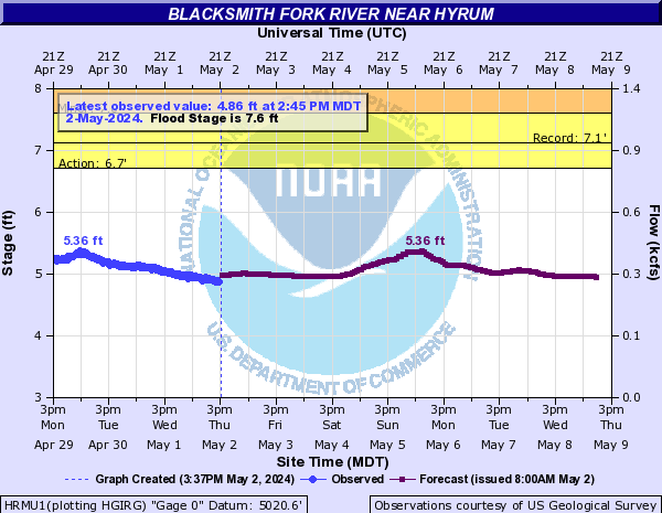
Blacksmith Fork River (Click on an image to go to hydrograph webpage)
HRMU1:
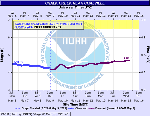
Chalk Creek (Click on an image to go to hydrograph webpage)
CIVU1:
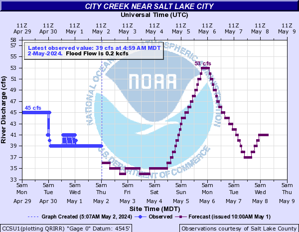
City Creek (Click on an image to go to hydrograph webpage)
CCSU1:
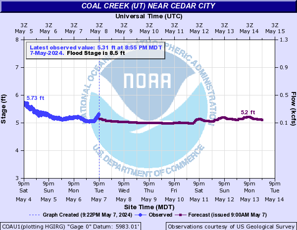
Coal Creek (UT) (Click on an image to go to hydrograph webpage)
COAU1:
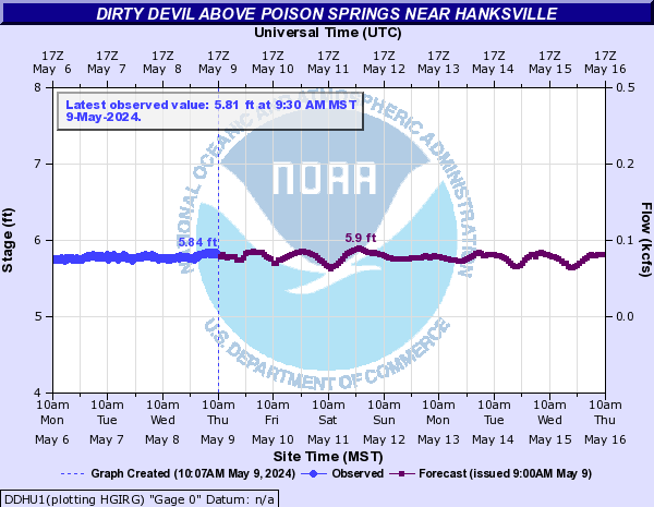
Dirty Devil (Click on an image to go to hydrograph webpage)
DDHU1:
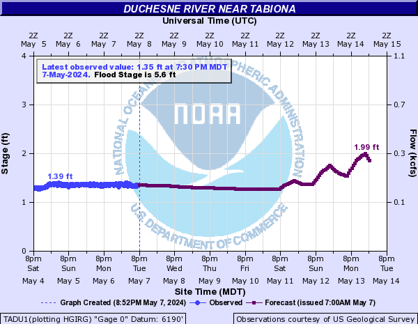
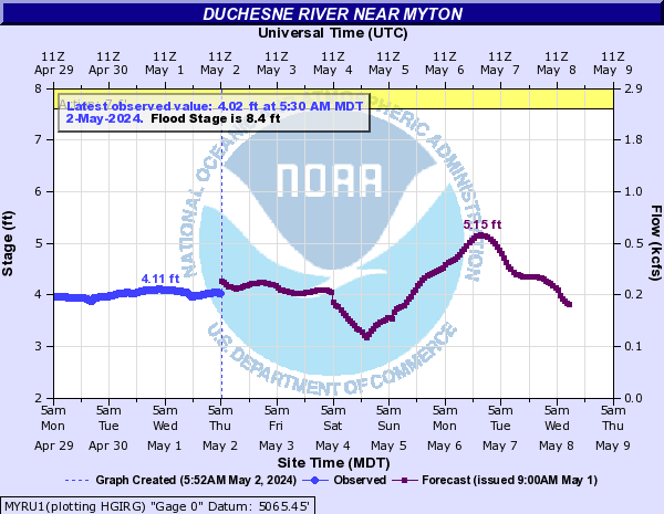
Duchesne River (Click on an image to go to hydrograph webpage)
TADU1:
MYRU1:
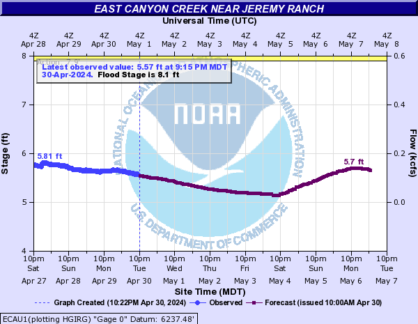
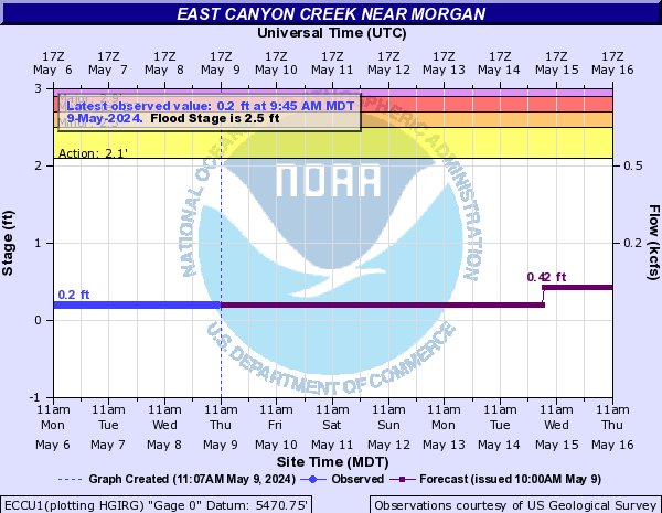
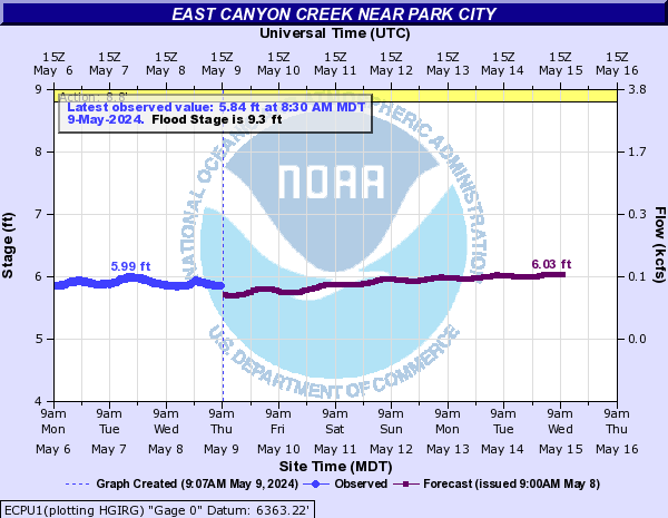
East Canyon Creek (Click on an image to go to hydrograph webpage)
ECAU1:
ECCU1:
ECPU1:
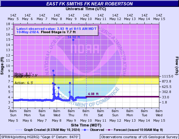
East Fork Smiths Fork (Click on an image to go to hydrograph webpage)
SFRW4:
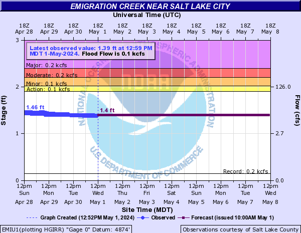
Emigration Creek (Click on an image to go to hydrograph webpage)
EMIU1:
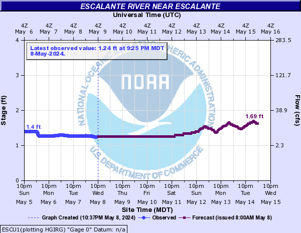
Escalante River (Click on an image to go to hydrograph webpage)
ESCU1:
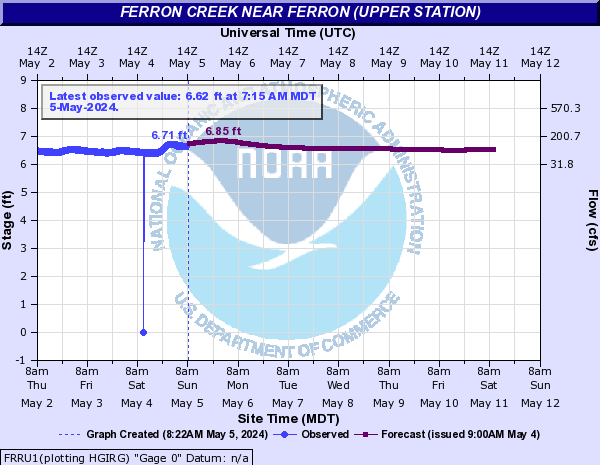
Ferron Creek (Click on an image to go to hydrograph webpage)
FRRU1:
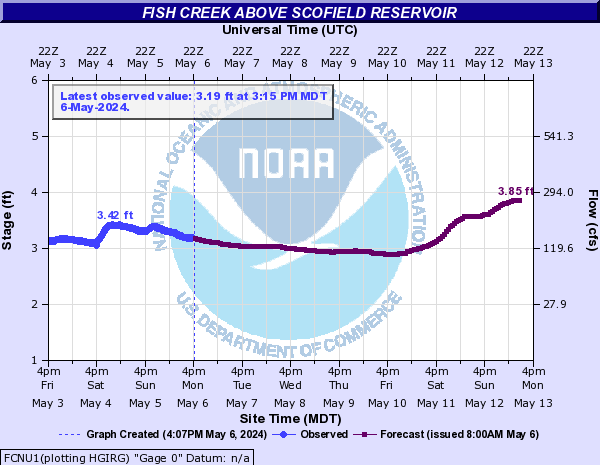
Fish Creek (UT) (Click on an image to go to hydrograph webpage)
FCNU1:
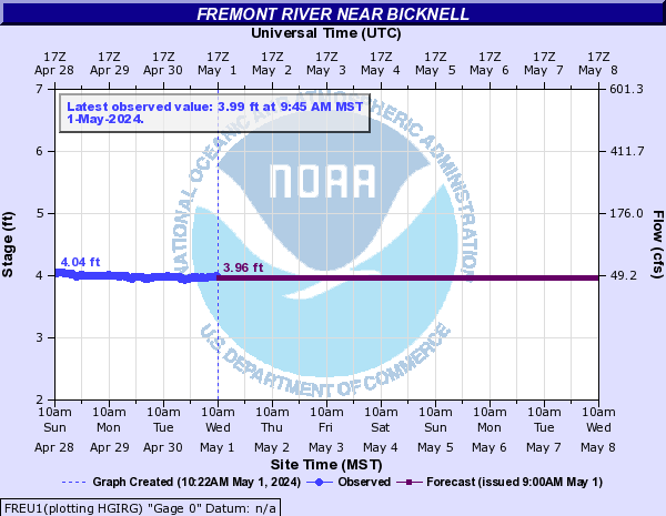
Fremont River (Click on an image to go to hydrograph webpage)
FREU1:
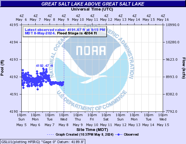
Great Salt Lake (Click on an image to go to hydrograph webpage)
GSLU1:
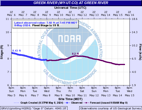
Green River (WY-UT-CO) (Click on an image to go to hydrograph webpage)
GRVU1:
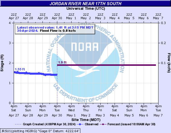
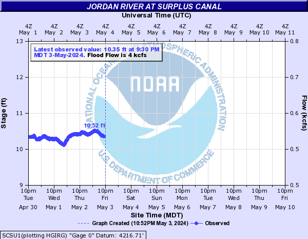
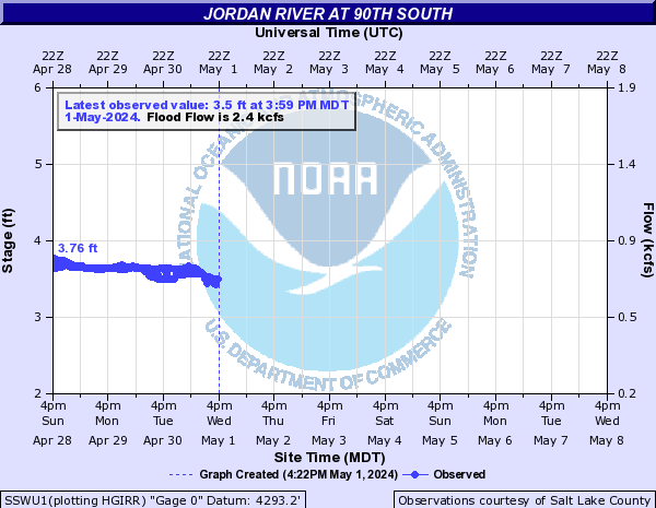
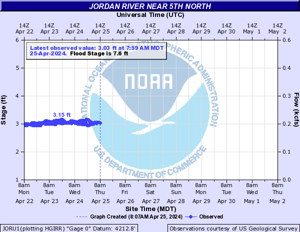
Jordan River (Click on an image to go to hydrograph webpage)
JRSU1:
SCSU1:
SSWU1:
JORU1:
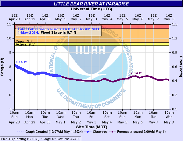
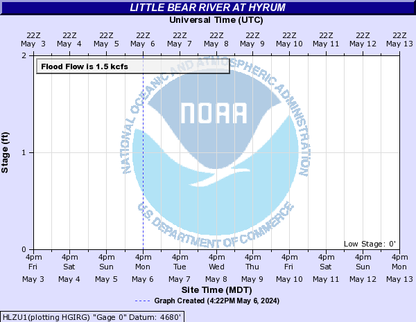
Little Bear River (Click on an image to go to hydrograph webpage)
PRZU1:
HLZU1:
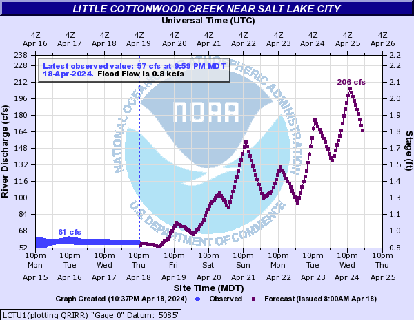
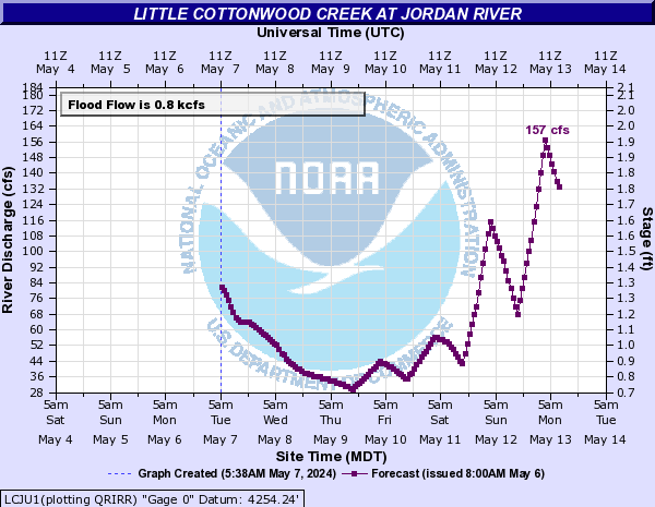
Little Cottonwood Creek (Click on an image to go to hydrograph webpage)
LCTU1:
LCJU1:
LCWU1:

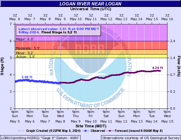
Logan River (Click on an image to go to hydrograph webpage)
LGNU1:
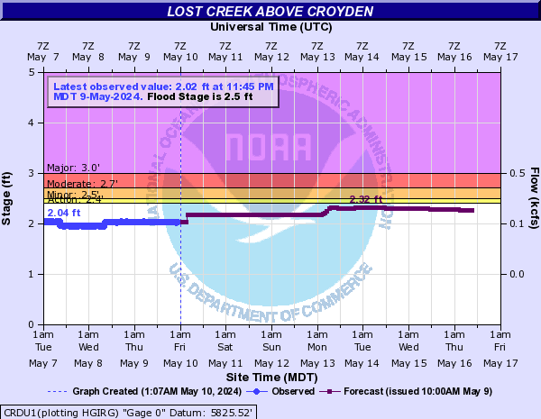
Lost Creek (Click on an image to go to hydrograph webpage)
CRDU1:
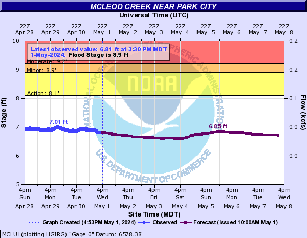
McLeod Creek (Click on an image to go to hydrograph webpage)
MCLU1:
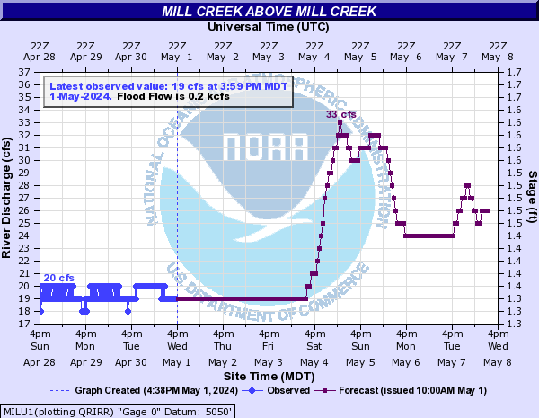
Mill Creek (Click on an image to go to hydrograph webpage)
MILU1:
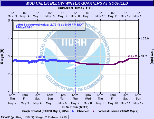
Mud Creek (UT) (Click on an image to go to hydrograph webpage)
MCAU1:
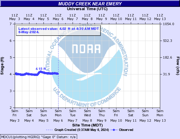
Muddy Creek (UT) (Click on an image to go to hydrograph webpage)
MDCU1:
North Fork Virgin River (Click on an image to go to hydrograph webpage)
NFVU1:

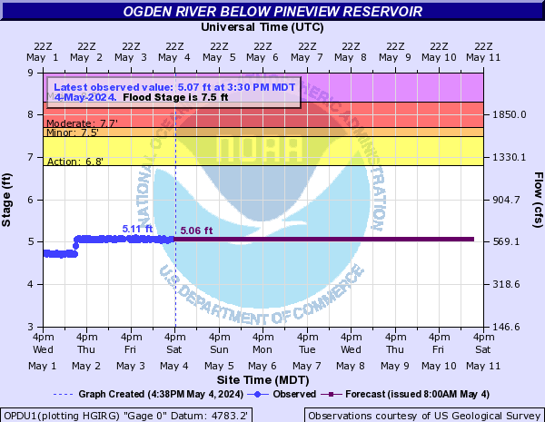
Ogden River (Click on an image to go to hydrograph webpage)
OPDU1:
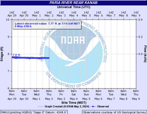
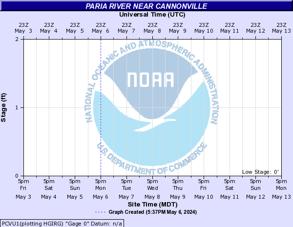
Paria River (Click on an image to go to hydrograph webpage)
PAKU1:
PCVU1:
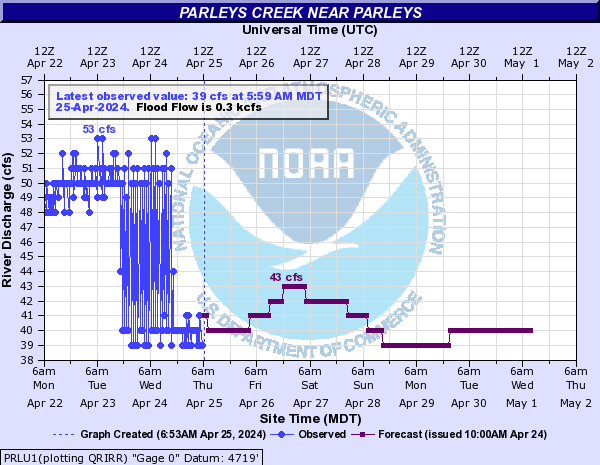
Parleys Creek (Click on an image to go to hydrograph webpage)
PRLU1:
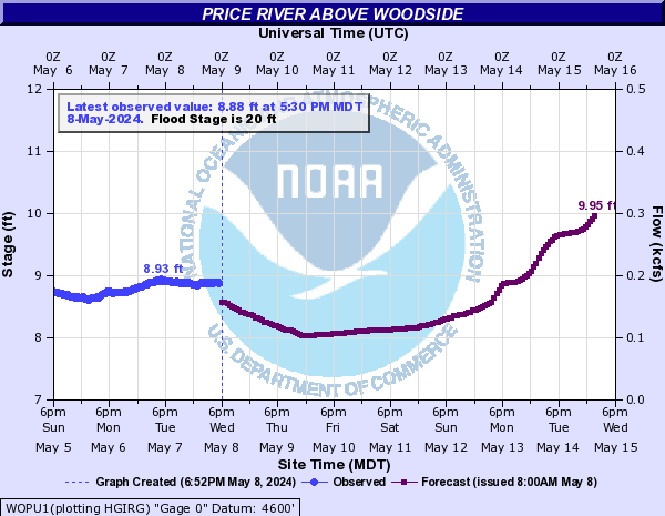
Price River (Click on an image to go to hydrograph webpage)
WOPU1:
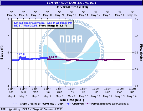
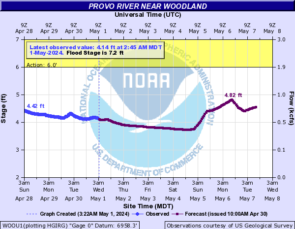
Provo River (Click on an image to go to hydrograph webpage)
PPPU1:
WOOU1:
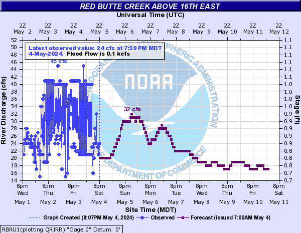
Red Butte Creek (Click on an image to go to hydrograph webpage)
RBRU1:
Rock Creek (Click on an image to go to hydrograph webpage)
ROKU1:

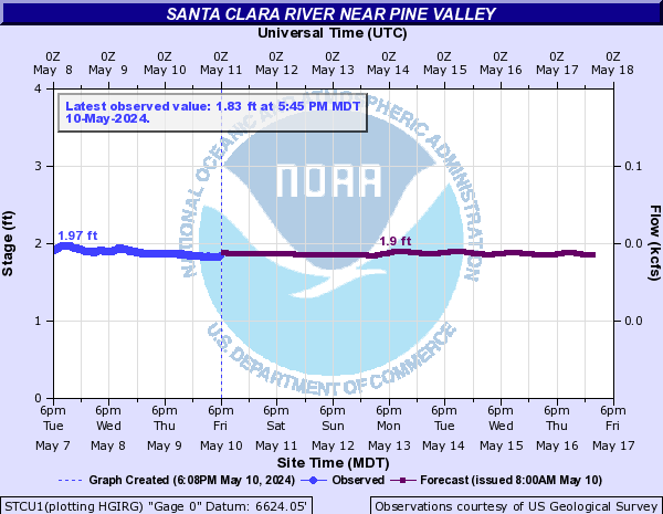
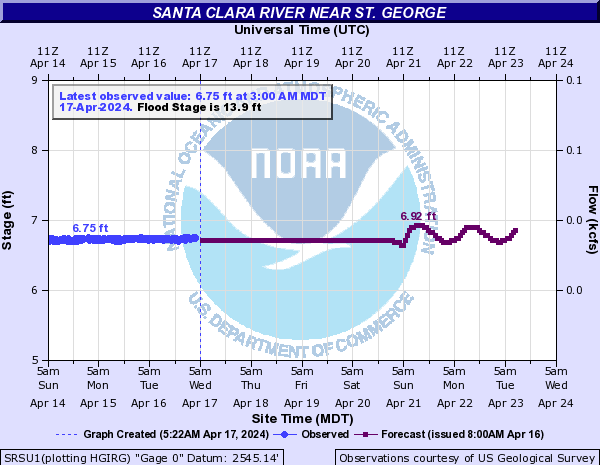
Santa Clara River (Click on an image to go to hydrograph webpage)
STCU1:
SRSU1:
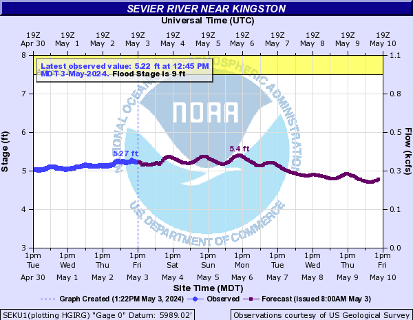
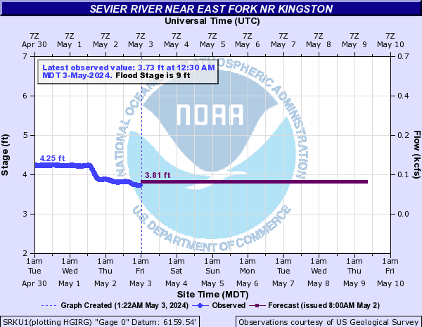
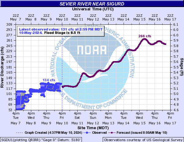
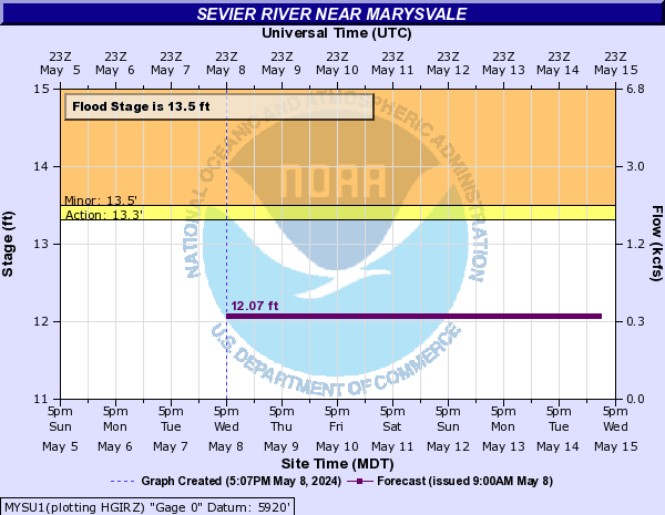
Sevier River (Click on an image to go to hydrograph webpage)
HATU1:

SEKU1:
SRKU1:
SGDU1:
MYSU1:
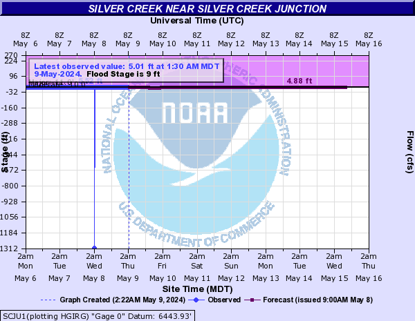
Silver Creek (Click on an image to go to hydrograph webpage)
SCJU1:
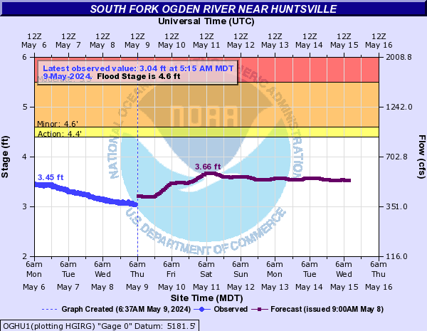
South Fork Ogden River (Click on an image to go to hydrograph webpage)
OGHU1:
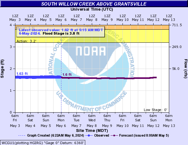
South Willow Creek (Click on an image to go to hydrograph webpage)
WCGU1:
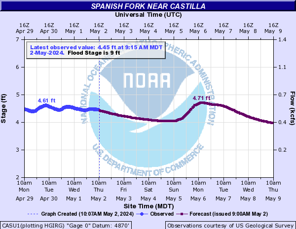
Spanish Fork (Click on an image to go to hydrograph webpage)
CASU1:
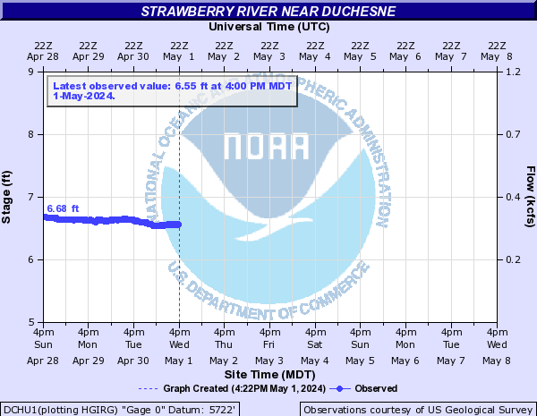
Strawberry River (Click on an image to go to hydrograph webpage)
DCHU1:
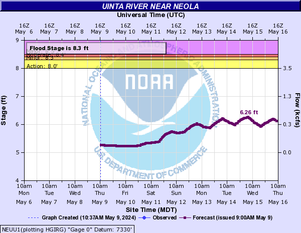
Uinta River (Click on an image to go to hydrograph webpage)
NEUU1:
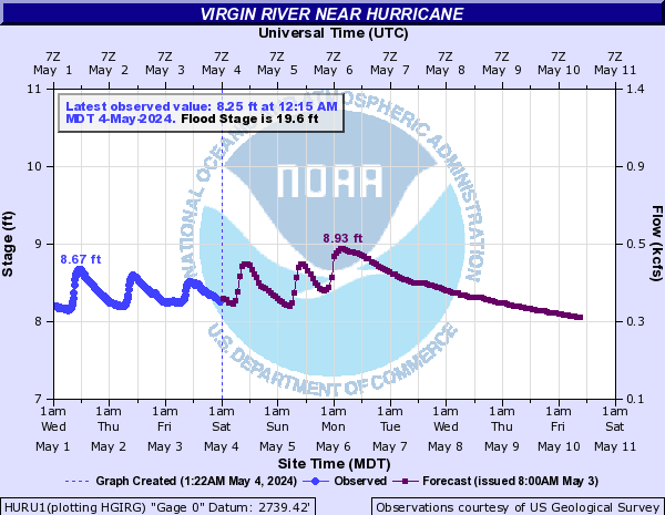
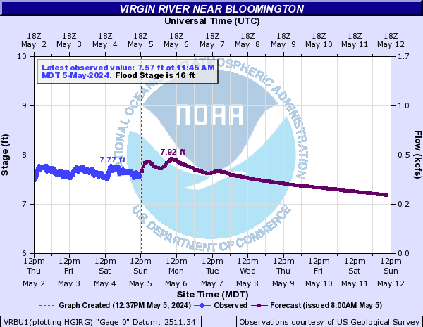
Virgin River (Click on an image to go to hydrograph webpage)
HURU1:
VIRU1:

VRBU1:
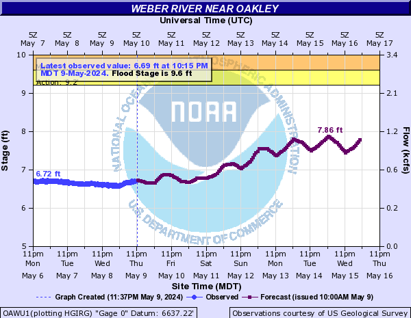
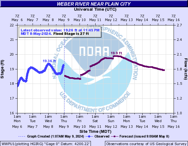
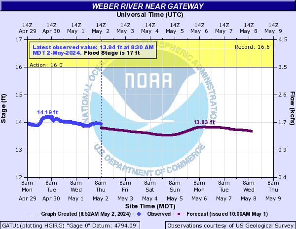
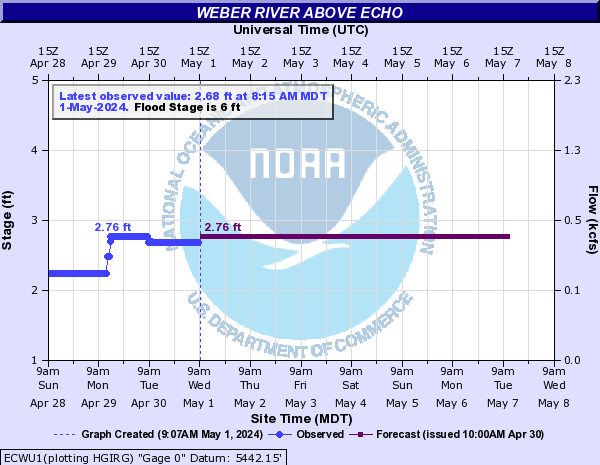
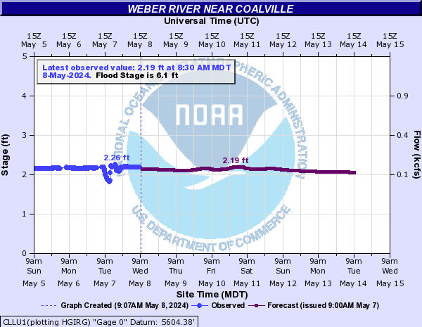
Weber River (Click on an image to go to hydrograph webpage)
OAWU1:
WWPU1:
GATU1:
ECWU1:
CLLU1:
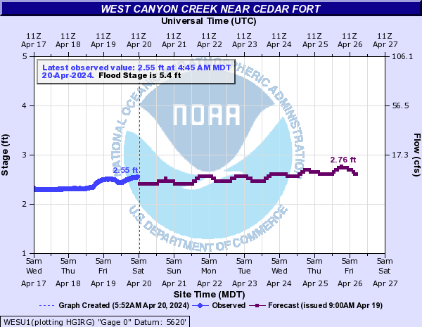
West Canyon Creek (Click on an image to go to hydrograph webpage)
WESU1:
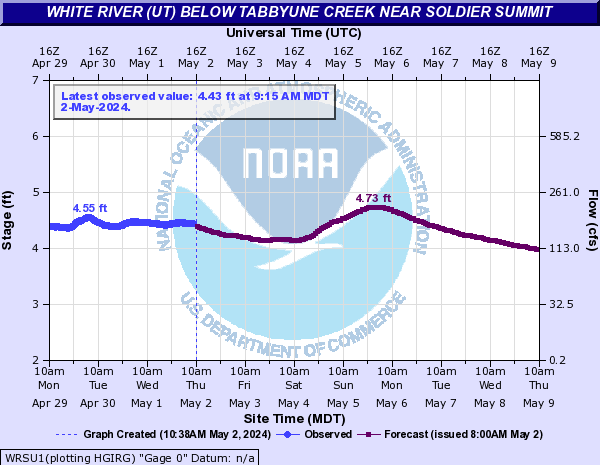
White River (UT) (Click on an image to go to hydrograph webpage)
WRSU1:
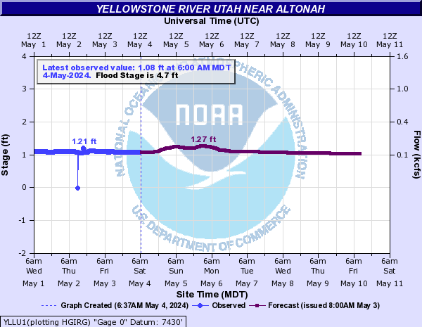
Yellowstone River Utah (Click on an image to go to hydrograph webpage)
YLLU1: