Baraboo River at Kendall Village
Future / Actual / Minor
OWP 2.0 WWA Modal Title
01/11/2021, 10:04 PM UTC through 01/11/2021, 10:04 PM UTC
Sender
Sent
- Upstream gauge unavailableDownstream gauge unavailableGage is out of service. The data partner is working to correct the issue as soon as possible.
Official
CATEGORY STAGE 
Major Flooding 10 ft Moderate Flooding 8.5 ft Minor Flooding 5 ft Action 3.5 ft - Gage is out of service. The data partner is working to correct the issue as soon as possible.
National Water Model Hydrograph
Official NWS streamflow forecasts are produced by NWS hydrologic forecasters for river gauge locations using hydrologic models which are calibrated to that location. This process considers additional guidance and information, including local expertise and experience, to produce the best forecast possible. The NWM output provides supplemental guidance to NWS forecasters and should not be considered an official NWS river forecast.
Flood Impacts
- 10.9 - Estimated level of 2018 flood per longterm resident's high water mark.
- 9.1 - Water flows over Thayer Street.
- 8.5 - Water begins to flow into sidewalk along Thayer Street. River reaches residential homes along Thayer Street.
Gauge Info
| Coordinates | 43.7950, -90.3700 |
| RFC | NCRFC |
| State | WI |
| WFO | ARX |
| County | Monroe |
| Data Provider(s) | |
| Monroe County | Monroe County Climate Change Task Force |
Gauge Location
Recent Crests
| 1. | 4.24 ft | on 05-21-0024 | (P) |
Recent Crests
| 1. | 4.24 ft | on 05-21-0024 | (P) |
Historic Crests
| 1. | 4.24 ft | on 05-21-0024 | (P) |
Historic Crests
| 1. | 4.24 ft | on 05-21-0024 | (P) |


Probability Information
No Images Available
Unique Local Info
Forecasts are not available for the Baraboo River at Kendall Village. Only observed stages are available for this point.
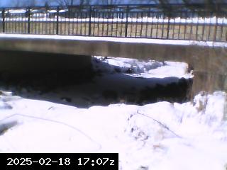
Webcam images, courtesy of Monroe County, are updated daily around noon. Images are designed to update more frequently during times of high water. These river gages are located within coulees across Monroe County, therefore webcam images may not always be available due to poor cell reception at times.
Collaborative Agencies
The National Weather Service prepares its forecasts and other services in collaboration with agencies like the US Geological Survey, US Bureau of Reclamation, US Army Corps of Engineers, Natural Resource Conservation Service, National Park Service, ALERT Users Group, Bureau of Indian Affairs, and many state and local emergency managers across the country. For details, please click here.