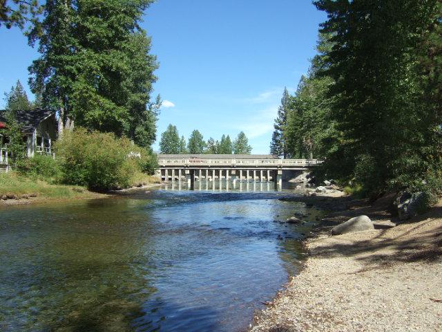
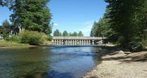
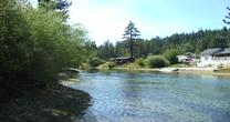
Truckee River at Tahoe City
Future / Actual / Minor
OWP 2.0 WWA Modal Title
01/11/2021, 10:04 PM UTC through 01/11/2021, 10:04 PM UTC
Sender
Sent
- Warning: no valid ratings curve available. Transformations to and from FEET/CFS/KCFS will not happen.
Traces and Thresholds Click to turn on/off display
Observed (OBS) 03/29/2025 6:45 AM PDTLow Threshold: 0 ftCATEGORY STAGE 
Major Flooding 9.5 ft Moderate Flooding 9 ft Minor Flooding 8 ft Action 7 ft Reliability of the Forecast:
NOTE: Forecasts are not available. Only observed stages are available for this point.
Stage may be affected by ice during winter months.
National Water Model Hydrograph
Official NWS streamflow forecasts are produced by NWS hydrologic forecasters for river gauge locations using hydrologic models which are calibrated to that location. This process considers additional guidance and information, including local expertise and experience, to produce the best forecast possible. The NWM output provides supplemental guidance to NWS forecasters and should not be considered an official NWS river forecast.
Flood Impacts
- 9.5 - Major Flood Stage. Major flooding between Tahoe City and Alpine Meadows mipacting homes, bridges, businesses and infrastructure. near maximum reservoir release from Lake Tahoe. Most recent date of maximum full lake release was January 1997.
- 9 - Moderate Flood Stage. Moderate flooding between Tahoe City and Alpine Meadows impacting low bridges, landscapes and a few buildings.
- 8 - Flood Stage; Minor flooding between Tahoe City and Alpoine Meadows. Some inundation of low lying properties incluidng crawlspaces. River level approaching lowest bridges where trapped debris could cause additional impacts. Extended portions of the bike path are flooded. Flow very similar to April 2018 and slightly below high flow releases in April 2017.
Gauge Info
| Coordinates | 39.1663, -120.144 |
| RFC | CNRFC |
| State | CA |
| WFO | REV |
| County | Placer |
| Data Provider(s) | |
| US Geological Survey | USGS--Water Resources of the United States |
| USGS | 10337500 |
Gauge Location
Recent Crests
| 1. | 7.98 ft | on 04-10-2018 |
| 2. | 8.25 ft | on 04-26-2017 |
| 3. | 9.59 ft | on 01-02-1997 |
| 4. | 8.45 ft | on 05-21-1996 |
| 5. | 8.84 ft | on 03-13-1986 |
Recent Crests
| 1. | 7.98 ft | on 04-10-2018 |
| 2. | 8.25 ft | on 04-26-2017 |
| 3. | 9.59 ft | on 01-02-1997 |
| 4. | 8.45 ft | on 05-21-1996 |
| 5. | 8.84 ft | on 03-13-1986 |
| 6. | 8.47 ft | on 12-26-1983 |
| 7. | 9.32 ft | on 06-19-1969 |
Historic Crests
| 1. | 9.59 ft | on 01-02-1997 |
| 2. | 9.32 ft | on 06-19-1969 |
| 3. | 8.84 ft | on 03-13-1986 |
| 4. | 8.47 ft | on 12-26-1983 |
| 5. | 8.45 ft | on 05-21-1996 |
Historic Crests
| 1. | 9.59 ft | on 01-02-1997 |
| 2. | 9.32 ft | on 06-19-1969 |
| 3. | 8.84 ft | on 03-13-1986 |
| 4. | 8.47 ft | on 12-26-1983 |
| 5. | 8.45 ft | on 05-21-1996 |
| 6. | 8.25 ft | on 04-26-2017 |
| 7. | 7.98 ft | on 04-10-2018 |
Vertical Datum Table
| type | NGVD29 |
|---|---|
| major Flooding | 6226.09 ft |
| moderate Flooding | 6225.59 ft |
| minor Flooding | 6224.59 ft |
| action | 6223.59 ft |
| Latest Value | 6218.81 ft |
| Gauge Zero | 6216.59 ft |

Probability Information
No Images Available
Collaborative Agencies
The National Weather Service prepares its forecasts and other services in collaboration with agencies like the US Geological Survey, US Bureau of Reclamation, US Army Corps of Engineers, Natural Resource Conservation Service, National Park Service, ALERT Users Group, Bureau of Indian Affairs, and many state and local emergency managers across the country. For details, please click here.
Resources
Hydrologic Resource Links
- River Forecast Centers
- Text Products
- Past Precipitation
- Forecast Precipitation
- California-Nevada River Forecast Center Homepage
- USGS Real-Time Hydrologic Data for Nevada
- USGS Real-Time Hydrologic Data for California
- NWS Climate Prediction Center: Outlook Maps, Graphs & Tables
- NV NRCS Snow Program
- Inundation Mapping Locations
- California Data Exchange
- Guide to NWS Hydrologic Information on the Web
Additional Resource Links
- NWS Precipitation and River Forecasting
- Area Hydrographs
- NWS Headquarters, Silver Spring MD
- NWS Western Region Headquarters, Salt Lake City UT
- Western Regional Climate Center, Reno NV
- NWS Forecast Office Homepage, Reno NV
- NOAA Snow Information Center
- Flood Smart Web Page
- FEMA Flood Insurance Program
- FEMA Flood Insurance Rate Maps Interface