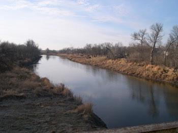
Souris River near Towner
Future / Actual / Minor
OWP 2.0 WWA Modal Title
01/11/2021, 10:04 PM UTC through 01/11/2021, 10:04 PM UTC
Sender
Sent
- Warning: no valid ratings curve available. Transformations to and from FEET/CFS/KCFS will not happen.
National Water Model Hydrograph
Official NWS streamflow forecasts are produced by NWS hydrologic forecasters for river gauge locations using hydrologic models which are calibrated to that location. This process considers additional guidance and information, including local expertise and experience, to produce the best forecast possible. The NWM output provides supplemental guidance to NWS forecasters and should not be considered an official NWS river forecast.
Flood Impacts
- 1461 - Damage begins at farmer's structures. Ditching on the left side of the river appears to be able to handle a significant amount of water. Water leaving the banks would most likely stay in this ditch.
- 1458 - Major flooding.
- 1457.8 - At around 56.6 ft the eastbound lane of Highway 2 near SW of Towner gets water on it (westbound remains dry) and Highway 14 immediately south of Highway 2 is closed due to high water.
Gauge Location
Recent Crests
| 1. | 1457.82 ft | on 06-11-2013 |
| 2. | 1459.95 ft | on 06-28-2011 |
| 3. | 1457.52 ft | on 04-19-2009 |
| 4. | 1453.02 ft | on 06-04-2007 |
| 5. | 1455.42 ft | on 07-06-2005 |
Recent Crests
| 1. | 1457.82 ft | on 06-11-2013 |
| 2. | 1459.95 ft | on 06-28-2011 |
| 3. | 1457.52 ft | on 04-19-2009 |
| 4. | 1453.02 ft | on 06-04-2007 |
| 5. | 1455.42 ft | on 07-06-2005 |
| 6. | 1455.02 ft | on 06-06-2005 |
| 7. | 1454.22 ft | on 04-06-2005 |
| 8. | 1450.92 ft | on 03-31-2004 |
| 9. | 1452.22 ft | on 05-12-2003 |
| 10. | 1450.72 ft | on 03-25-2003 |
| 11. | 1455.92 ft | on 05-19-2001 |
| 12. | 1455.77 ft | on 05-09-2001 |
| 13. | 1456.42 ft | on 04-03-2001 |
| 14. | 1453.12 ft | on 05-10-2000 |
| 15. | 1453.22 ft | on 08-19-1999 |
| 16. | 1454.12 ft | on 07-22-1999 |
| 17. | 1456.72 ft | on 05-23-1999 |
| 18. | 1456.72 ft | on 03-29-1999 |
| 19. | 1454.12 ft | on 04-04-1998 |
| 20. | 1455.02 ft | on 04-08-1997 |
| 21. | 1457.72 ft | on 04-22-1996 |
| 22. | 1456.02 ft | on 03-27-1996 |
| 23. | 1456.72 ft | on 03-29-1995 |
| 24. | 1451.22 ft | on 10-30-1994 |
| 25. | 1455.22 ft | on 06-24-1994 |
| 26. | 1455.62 ft | on 03-27-1994 |
| 27. | 1445.67 ft | on 12-04-1993 |
| 28. | 1455.62 ft | on 08-02-1993 |
| 29. | 1456.62 ft | on 04-03-1987 |
| 30. | 1454.42 ft | on 05-10-1984 |
| 31. | 1455.67 ft | on 04-12-1983 |
| 32. | 1455.80 ft | on 05-04-1982 |
| 33. | 1456.93 ft | on 04-26-1979 |
| 34. | 1456.90 ft | on 04-22-1976 |
| 35. | 1457.92 ft | on 04-01-1976 |
Historic Crests
| 1. | 1459.95 ft | on 06-28-2011 |
| 2. | 1457.92 ft | on 04-01-1976 |
| 3. | 1457.82 ft | on 06-11-2013 |
| 4. | 1457.72 ft | on 04-22-1996 |
| 5. | 1457.52 ft | on 04-19-2009 |
Historic Crests
| 1. | 1459.95 ft | on 06-28-2011 |
| 2. | 1457.92 ft | on 04-01-1976 |
| 3. | 1457.82 ft | on 06-11-2013 |
| 4. | 1457.72 ft | on 04-22-1996 |
| 5. | 1457.52 ft | on 04-19-2009 |
| 6. | 1456.93 ft | on 04-26-1979 |
| 7. | 1456.90 ft | on 04-22-1976 |
| 8. | 1456.72 ft | on 03-29-1995 |
| 9. | 1456.72 ft | on 05-23-1999 |
| 10. | 1456.72 ft | on 03-29-1999 |
| 11. | 1456.62 ft | on 04-03-1987 |
| 12. | 1456.42 ft | on 04-03-2001 |
| 13. | 1456.02 ft | on 03-27-1996 |
| 14. | 1455.92 ft | on 05-19-2001 |
| 15. | 1455.80 ft | on 05-04-1982 |
| 16. | 1455.77 ft | on 05-09-2001 |
| 17. | 1455.67 ft | on 04-12-1983 |
| 18. | 1455.62 ft | on 08-02-1993 |
| 19. | 1455.62 ft | on 03-27-1994 |
| 20. | 1455.42 ft | on 07-06-2005 |
| 21. | 1455.22 ft | on 06-24-1994 |
| 22. | 1455.02 ft | on 06-06-2005 |
| 23. | 1455.02 ft | on 04-08-1997 |
| 24. | 1454.42 ft | on 05-10-1984 |
| 25. | 1454.22 ft | on 04-06-2005 |
| 26. | 1454.12 ft | on 04-04-1998 |
| 27. | 1454.12 ft | on 07-22-1999 |
| 28. | 1453.22 ft | on 08-19-1999 |
| 29. | 1453.12 ft | on 05-10-2000 |
| 30. | 1453.02 ft | on 06-04-2007 |
| 31. | 1452.22 ft | on 05-12-2003 |
| 32. | 1451.22 ft | on 10-30-1994 |
| 33. | 1450.92 ft | on 03-31-2004 |
| 34. | 1450.72 ft | on 03-25-2003 |
| 35. | 1445.67 ft | on 12-04-1993 |
Vertical Datum Table
| type | NAVD88 |
|---|---|
| major Flooding | 1458.00 ft |
| moderate Flooding | 1456.00 ft |
| minor Flooding | 1454.00 ft |
| action | 1453.00 ft |
| Latest Value | N/A |
| Gauge Zero | 0.00 ft |


Unique Local Info
Collaborative Agencies
The National Weather Service prepares its forecasts and other services in collaboration with agencies like the US Geological Survey, US Bureau of Reclamation, US Army Corps of Engineers, Natural Resource Conservation Service, National Park Service, ALERT Users Group, Bureau of Indian Affairs, and many state and local emergency managers across the country. For details, please click here.