Skip Navigation Link weather.gov  
NOAA logo - Click to go to the NOAA homepage National Weather Service NWS logo - Click to go to the NWS homepage
Advanced Hydrologic Prediction Service
Image background of Navigation bar Left
Navigation Bar End Cap


This probabilistic forecast is issued by the Lower Mississippi River Forecast Center.
tab left off Hydrograph tab right off tab left off River at a Glance tab right off tab left off Download tab right off tab left on tab right on
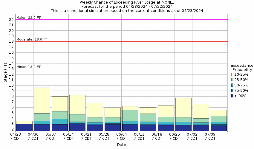
About this graph
Forecasts for the Tickfaw River at Montpelier are issued routinely year-round.
Return to Area Map

Upstream Gauge - at Liverpool Upstream Gauge Downstream Gauge Downstream Gauge - at Holden
Zoom Level:15
Flood Categories (in feet)
Major Flood Stage: 22
Moderate Flood Stage: 18
Flood Stage: 13
Action Stage: 12
Low Stage (in feet): -9999

Historic Crests
(1) 25.84 ft on 08/12/2016
(2) 22.31 ft on 05/23/1974
(3) 22.10 ft on 04/07/1983
(4) 20.18 ft on 04/22/1977
(5) 19.85 ft on 04/23/1979
Show More Historic Crests

(P): Preliminary values subject to further review.

Recent Crests
(1) 14.13 ft on 08/25/2022
(2) 15.56 ft on 09/18/2021
(3) 13.60 ft on 04/16/2021
(4) 14.39 ft on 05/10/2019
(5) 15.30 ft on 12/28/2018
Show More Recent Crests

(P): Preliminary values subject to further review.

Low Water Records
(1) 10.00 ft on 10/10/1997
KML Image
Gauge LocationGauge Map Marker
Disclaimer
Latitude/Longitude Disclaimer: The gauge location shown in the above map is the approximate location based on the latitude/longitude coordinates provided to the NWS by the gauge owner.
Flood Impacts & Photos Collapse
If you notice any errors in the below information, please contact our Webmaster
25.84 Flood of Record occurred on August 12, 2016. The roadway at the center span of the Highway 16 bridge will be under water and the bridge closed. Highway 16 and Highway 43 will likely be closed. Secondary roads within a mile of the river will be under water and closed to traffic.
20 At 20 feet water will reach the undercarriage of the Highway 16 bridge. Approaches to the bridge will be under water. Highway 16 will likely be closed. Secondary roads within a mile of the river will be under water and closed to traffic.
18 The river channel will expand to about one half mile wide for several miles downstream from Montpelier. Secondary roads west of Louisiana Highway 43 will be under water and likely to be closed to traffic. Woodlands and farmland near the river will remain inundated.
15 Woodlands and farmland near the river will be inundated. Livestock and farm equipment should be moved to higher ground.
13 The low banks will overflow threatening commercial interests near the river with flooding.
12.5 Forestry and sand and gravel operations will be curtailed.

Other Real-time and/or Archive Data Sources:

Collaborative Agencies Collapse
The National Weather Service prepares its forecasts and other services in collaboration with agencies like the US Geological Survey, US Bureau of Reclamation, US Army Corps of Engineers, Natural Resource Conservation Service, National Park Service, ALERT Users Group, Bureau of Indian Affairs, and many state and local emergency managers across the country. For details, please click here.
NWS Information
National Weather Service
New Orleans/Baton Rouge Weather Forecast Office
62300 Airport Rd.
Slidell, LA 70460-5243
(504) 522-7330
Ask Questions/Webmaster
Page last modified: 2-Nov-2020 7:29 PM
Disclaimer
Credits
Glossary
Privacy Policy
About Us
Career Opportunities