Historic Crests
(1) 74.17 ft on 05/05/2010
(2) 73.12 ft on 05/04/2011
(3) 69.33 ft on 03/04/2019
(4) 66.15 ft on 02/16/1989
(5) 64.87 ft on 01/01/1991
(6) 64.28 ft on 02/05/1990
(7) 62.94 ft on 12/27/1987
(8) 61.60 ft on 03/01/1987
(P): Preliminary values subject to further review.
Recent Crests
(1) 69.33 ft on 03/04/2019
(2) 73.12 ft on 05/04/2011
(3) 74.17 ft on 05/05/2010
(4) 64.87 ft on 01/01/1991
(5) 64.28 ft on 02/05/1990
(6) 66.15 ft on 02/16/1989
(7) 62.94 ft on 12/27/1987
(8) 61.60 ft on 03/01/1987
(P): Preliminary values subject to further review.
Latitude/Longitude Disclaimer: The gauge location shown in the above map
is the approximate location based on the latitude/longitude coordinates
provided to the NWS by the gauge owner.
Flood Impacts & Photos
If you notice any errors in the below information, please contact our Webmaster
75
Widespread flooding continues along the river. In Dover, locations impacted include Hwy 79, Hwy 49, Bellwood Landing Rd, Cross Creek Rd, Frank Earhart Rd, River Rd, Mallard Rd, Lewis Circle Rd, and Lakeland Dr. In Bumpus Mills, Hummingbird Hollow Rd is flooded, and near Indian Mound Cub Creek Rd, Commissary Hollow Rd, and Lee Hollow Rd are flooded. In Cumberland City, Atkinson Dr, TN-149, Wildcat Creek Rd, Wallace St, Dougherty St, and areas near the power plant are flooded.
73
Widespread flooding along the Cumberland River continues to impact many locations near Dover, Bumpus Mills, Indian Mound, and Cumberland City. Many main highways are also flooded including Hwy 79 north of the river and Hwy 49 near South Cross Creek in Dover. In Cumberland City water is covering portions of TN-149 and the railroad track east of town.
71
Significant flooding continues to impact locations near Bellwood Landing Rd, Cross Creek Rd, Frank Earhart Rd near Mud Hill Rd, River Rd west of Hwy 79, Mallard Rd, Lewis Circle Rd, Lakeland Dr, Hummingbird Hollow Rd near Antioch Rd, Cub Creek Rd at Boiler Hill, Commissary Hollow Rd, Lee Hollow Rd, Atkinson Dr, Wildcat Creek Rd east of Hwy 46, Wallace St, and Dougherty St. Water approaches the Cumberland Power Plant, portions of TN-149, and the railroad track east of Cumberland City.
70
Significant flooding is occurring across Stewart County with many roads and access areas covered by water. Impacted locations include Bellwood Landing Rd, Cross Creek Rd, Frank Earhart Rd near Mud Hill Rd, River Rd west of Hwy 79, Hummingbird Hollow Rd near Antioch Rd southwest of Bumpus Mills, Mallard Rd, Lewis Circle Rd, Lee Hollow Rd, Lakeland Dr, Atkinson Dr, TN-149, and Wildcat Creek Rd east of Hwy 46. Ferry operations at Hwy 46 are discontinued.
69
Flood waters continue to cover many roads and boat launch areas across Stewart County. Impacted locations include Bellwood Landing Rd, Cross Creek Rd, Frank Earhart Rd near Mud Hill Rd, River Rd west of Hwy 79, Hummingbird Hollow Rd near Antioch Rd southwest of Bumpus Mills, Mud Hill Rd, Mallard Rd, Lewis Circle Rd, Lee Hollow Rd, Lakeland Dr, Atkinson Dr, and Wildcat Creek Rd east of Hwy 46. Ferry operations at Hwy 46 may be suspended at higher levels.
67
Flooding continues along the river, impacting many roads which are impassable due to high water. Near Dover water is impacting Bellwood Branch Rd, Cross Creek Rd, Frank Earhart Rd near Mud Hill Rd, and River Rd west of Hwy 79. Water is also impacting boat launch areas on Colson Rd, Fitzhughs Landing Rd, Forrest St, and Dyer Creek Rd. Near Cumberland City and Indian Mound, water continues to impact properties on Atkinson Dr, TN-149, Wildcat Creek Rd east of Hwy 46, and the ferry crossing.
66
Flooding along the river begins in Stewart County, impacting agricultural areas, the adjacent tributaries, and roads near the river, many of which become impassable. Near Dover, water affects portions of River Rd west of Hwy 79, Bellwood Branch Rd, Cross Creek Rd, and approaches Eagles Nest Dr near Short Creek Rd. Near Cumberland City and Indian Mound, water impacts areas on Atkinson Dr, TN-149, Lee Hollow Rd, Wildcat Creek Rd east of Highway 46, and the ferry access points on Highway 46.
64
Low lying areas along the river and the adjacent tributaries continue to be inundated, including agricultural areas, roads near the river, and access points. Locations impacted near Dover inculde River Rd between Tom Earhart Rd and the Blue Creek Recreation Area boat ramp, Bellwood Branch Rd near Patricia Cir, Cub Creek Cove, and the Commissary Hollow access point. Near Indian Mound, water is covering Lee Hollow Rd at Dunaway Hollow, and near Cumberland City, Wildcat Creek Rd at Wildcat Creek.
62
Low lying agricultural areas along the river, adjacent tributaries, and river access points are inundated, including River Rd between Tom Earhart Rd and the Blue Creek Recreation Area boat ramp, Bellwood Branch Rd near Patricia Cir, Cub Creek Cove and the Commissay Hollow Accesss point, wildcat Creek Rd at Wildcat Creek, and Lee Hollow Rd at Dunaway Hollow.
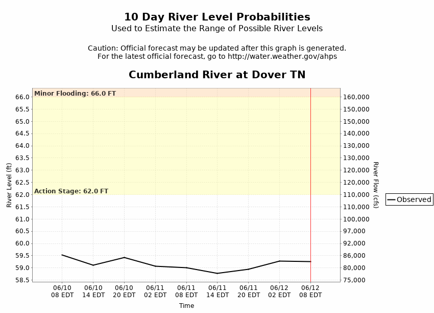
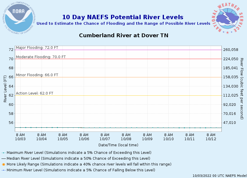
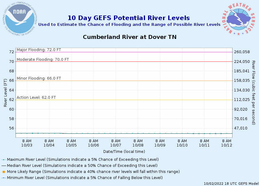
Potential River Levels Used to Estimate the Chance of Flooding and
the Range of Possible River Levels
10 Day (HEFS)
7 Day (NAEFS)
7 Day (GEFS)
Note: Use the official hydrograph at the top of this web page
for river levels within the next 72 hours.
Click individual graphics to
enlarge.
Collaborative Agencies
The National Weather Service prepares its forecasts and other services in collaboration with agencies like the US Geological Survey, US Bureau of Reclamation, US Army Corps of Engineers, Natural Resource Conservation Service, National Park Service, ALERT Users Group, Bureau of Indian Affairs, and many state and local emergency managers across the country. For details, please click here.
NWS Information
National Weather Service
Nashville Weather Forecast Office
500 Weather Station Road
Old Hickory, TN 37138
(615) 754-4633 Ask Questions/Webmaster
Page last modified: 2-Nov-2020 7:29 PM