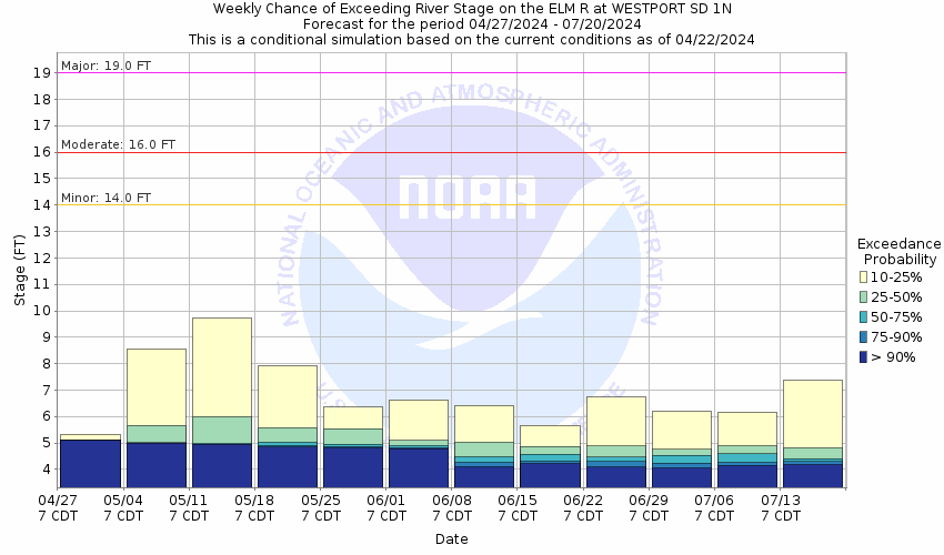
Historic Crests
(1) 22.63 ft on 03/25/2009
(2) 22.11 ft on 04/10/1969
(3) 21.56 ft on 03/30/1997
Show More Historic Crests
(P): Preliminary values subject to further review.
Recent Crests
(1) 14.39 ft on 05/04/2022
(2) 5.49 ft on 10/10/2021
(3) 20.45 ft on 07/27/2020
Show More Recent Crests
(P): Preliminary values subject to further review.
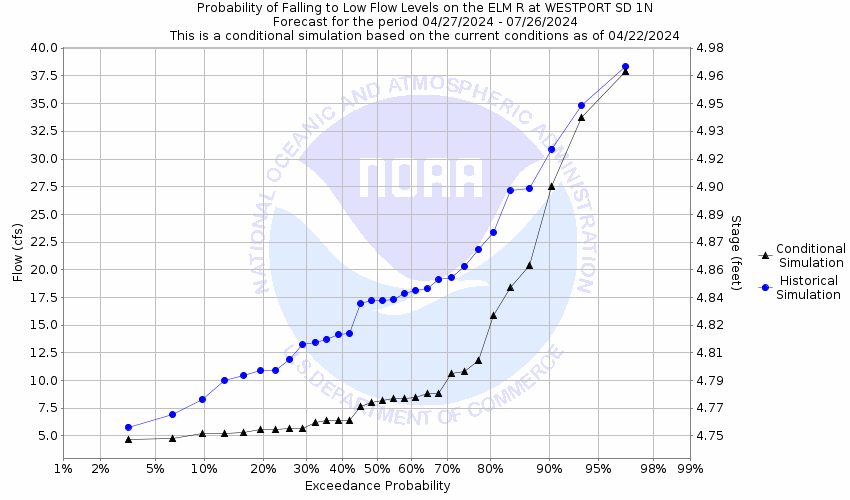
Low Water RecordsCurrently none available.


