Latitude/Longitude Disclaimer: The gauge location shown in the above map
is the approximate location based on the latitude/longitude coordinates
provided to the NWS by the gauge owner.
Flood Impacts & Photos
If you notice any errors in the below information, please contact our Webmaster
28.9
Record flood of June 2006. Extensive inundation of several homes and roads occurred in Equinunk. Extensive flooding of the railroad tracks occurred around Lordville. Homes along Warren Road and Lordville Road were severely flooded.
26
Extensive flooding of homes occurs along Hancock Highway and Lordville Road in Equinunk. Sever flooding also occurs along Riverview Road in Manchester Township, PA. The railroad on the NY side of the river floods around Lordville. Backwater flooding along Humphries Brook, Factory and Equinunk Creeks may be severe.
23.5
Water will inundate a part of Lordville Road in Equinunk and a few properties along the lower end of Riverview Road in Manchester Township. Backwater flooding along Humphries Brook, Factory and Equinunk Creeks may affect properties.
20
Flooding of lowlands near the river is extensive. Backyards of some homes in Equinunk will flood.
18
Considerable out of bank flooding with impact only to lowland grass and wooded areas along the river.
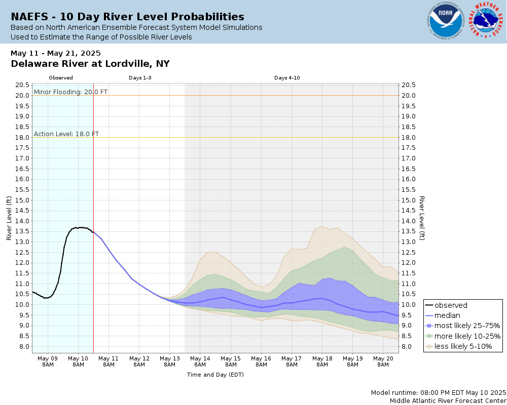
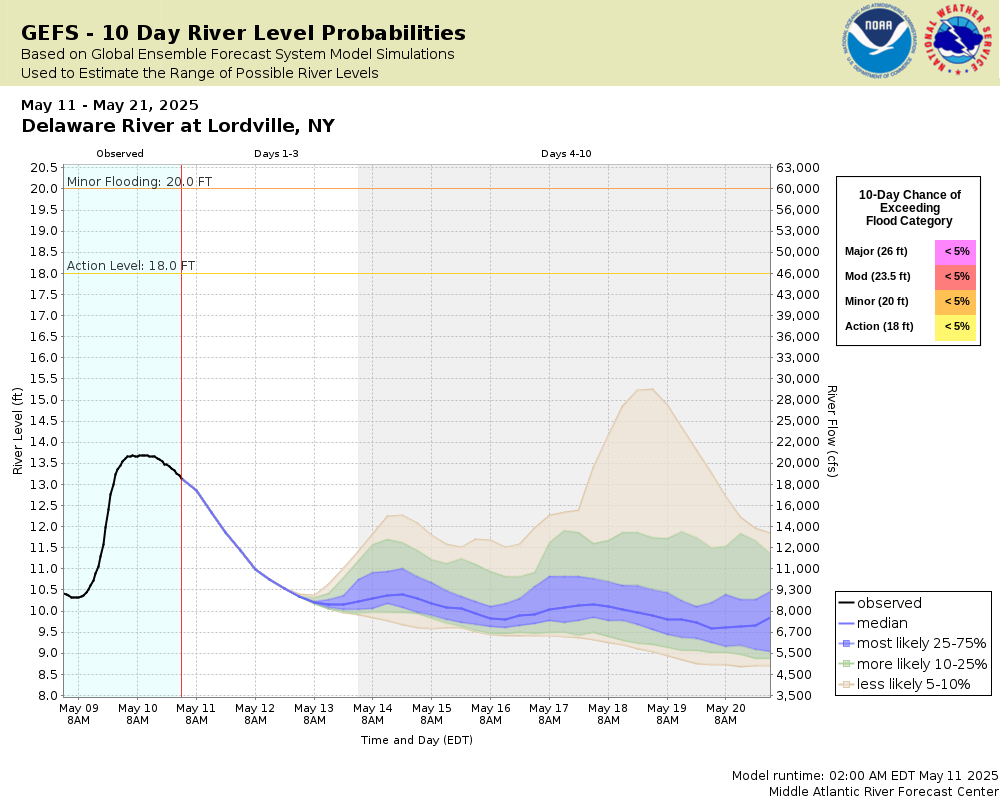
Potential River Levels Used to Estimate the Chance of Flooding and
the Range of Possible River Levels
10 Day (HEFS)
7 Day (NAEFS)
7 Day (GEFS)
Note: Use the official hydrograph at the top of this web page
for river levels within the next 72 Hours.
Click individual graphics to
enlarge.
Collaborative Agencies
The National Weather Service prepares its forecasts and other services in collaboration with agencies like the US Geological Survey, US Bureau of Reclamation, US Army Corps of Engineers, Natural Resource Conservation Service, National Park Service, ALERT Users Group, Bureau of Indian Affairs, and many state and local emergency managers across the country. For details, please click here.
NWS Information
National Weather Service
Binghamton Weather Forecast Office
32 Dawes Drive
Johnson City, NY 13790
(607) 729-1597 Ask Questions/Webmaster
Page last modified: 2-Nov-2020 7:30 PM