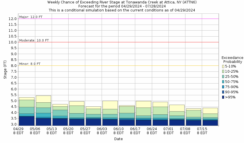
Historic Crests
(1) 12.70 ft on 07/08/1998
(2) 12.00 ft on 06/23/1972
(3) 9.62 ft on 11/06/2017
(4) 9.27 ft on 07/13/2017
(5) 9.25 ft on 12/29/1985 Show More Historic Crests
(P): Preliminary values subject to further review.
Latitude/Longitude Disclaimer: The gauge location shown in the above map
is the approximate location based on the latitude/longitude coordinates
provided to the NWS by the gauge owner.
Flood Impacts & Photos
If you notice any errors in the below information, please contact our Webmaster
12
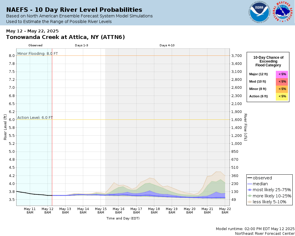
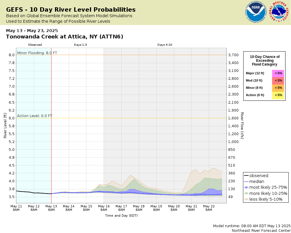
Major flooding, widespread residential and commercial flooding on Prospect, North, Water, Main, Exchange, and Washington Streets. Residential flooding on Dunbar Road south of the village.
10
Moderate flood, extensive flooding on Prospect Street impacting the water treatment plant. Some residential flooding on Water and North Streets and the south end of Exchange Street in Attica village.
8
Flood stage, flooding begins on Prospect Street north of the bridge which may impact a commercial plaza there. Flooding on the Attica rodeo grounds and youth athletic field on Exchange Street.
6
Action stage, high flows. Minor impact possible on some rural roads along the creek from Attica northward to Alexander.
The National Weather Service prepares its forecasts and other services in collaboration with agencies like the US Geological Survey, US Bureau of Reclamation, US Army Corps of Engineers, Natural Resource Conservation Service, National Park Service, ALERT Users Group, Bureau of Indian Affairs, and many state and local emergency managers across the country. For details, please click here.
NWS Information
National Weather Service
Buffalo Weather Forecast Office
587 Aero Drive
Buffalo, NY 14225-1405
(716) 565-0204 Ask Questions/Webmaster
Page last modified: 2-Nov-2020 7:30 PM