Latitude/Longitude Disclaimer: The gauge location shown in the above map
is the approximate location based on the latitude/longitude coordinates
provided to the NWS by the gauge owner.
Flood Impacts & Photos
If you notice any errors in the below information, please contact our Webmaster
692
Widespread flooding of lakefront property along East Lake and West Lake Roads. The city pier innundated...some flooding of commercial property on Lakeshore Drive.
691
Moderate flooding to low lying lakefront property along all shores...some structures along East Lake and West Lake Roads impacted.
690
Flood stage...Flooding begins to some low lying residential structures along the lake.
689
Elevated lake level with minor flooding of lawns and docks.
Additional Information
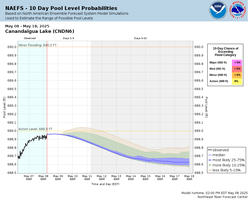
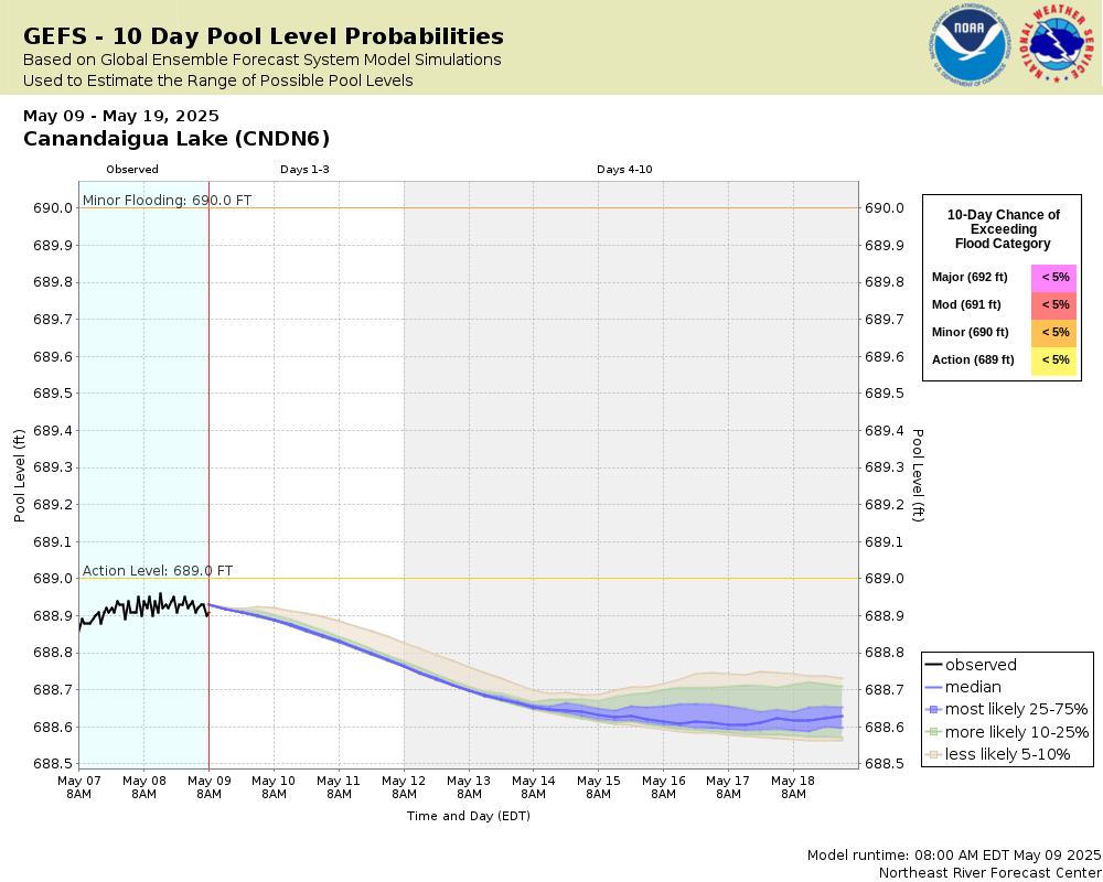
Potential River Levels - Used to
Potential River Levels Used to Estimate the Chance of Flooding and
the Range of Possible River Levels
3 Day (SREF)
7 Day (NAEFS)
7 Day (GEFS)
Note: Use the official hydrograph at the top of this web page
for river levels within the next 48 hours.
The National Weather Service prepares its forecasts and other services in collaboration with agencies like the US Geological Survey, US Bureau of Reclamation, US Army Corps of Engineers, Natural Resource Conservation Service, National Park Service, ALERT Users Group, Bureau of Indian Affairs, and many state and local emergency managers across the country. For details, please click here.
NWS Information
National Weather Service
Buffalo Weather Forecast Office
587 Aero Drive
Buffalo, NY 14225-1405
(716) 565-0204 Ask Questions/Webmaster
Page last modified: 2-Nov-2020 7:30 PM