Skip Navigation Link weather.gov  
NOAA logo - Click to go to the NOAA homepage National Weather Service NWS logo - Click to go to the NWS homepage
Advanced Hydrologic Prediction Service
Image background of Navigation bar Left
Navigation Bar End Cap


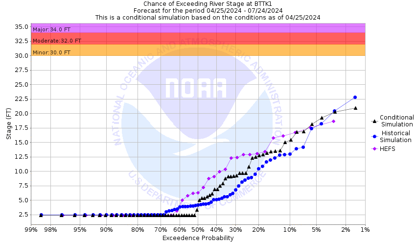
This probabilistic forecast is issued by the Arkansas Red-Basin River Forecast Center.
tab left off Hydrograph tab right off tab left off River at a Glance tab right off tab left off Download tab right off tab left on tab right on
About this graph
Forecasts for the Pawnee River near Burdett are issued as needed during times of high water, but are not routinely available.

Vertical Datum updated from NGVD29 to NAVD88 by gauge owner.

Return to Area Map

Zoom Level:16
Flood Categories (in feet)
Major Flood Stage: 34
Moderate Flood Stage: 32
Flood Stage: 30
Action Stage: 27
Low Stage (in feet): -9999

Historic Crests
(1) 27.38 ft on 07/21/1993
(2) 26.21 ft on 07/02/2004
(3) 21.72 ft on 07/03/2016
(4) 21.28 ft on 05/30/2015
(5) 20.96 ft on 10/05/2017
Show More Historic Crests

(P): Preliminary values subject to further review.

Recent Crests
(1) 11.19 ft on 03/24/2021
(2) 11.19 ft on 03/24/2021
(3) 17.70 ft on 05/24/2019
(4) 14.01 ft on 05/08/2019
(5) 20.96 ft on 10/05/2017
Show More Recent Crests

(P): Preliminary values subject to further review.

Low Water Records
Currently none available.
KML Image
Gauge LocationGauge Map Marker
Disclaimer
Latitude/Longitude Disclaimer: The gauge location shown in the above map is the approximate location based on the latitude/longitude coordinates provided to the NWS by the gauge owner.
Flood Impacts & Photos Collapse
If you notice any errors in the below information, please contact our Webmaster
34 Flood waters of two feet or more will inundate agricultural land up to a distance of 1/4 mile from the main river channel near the vicinity of the river gage.
32 Prepare for floodwaters to move onto agricultural land adjacent to Pawnee Creek throughout most of eastern Hodgeman County.
30 Expect minor overflows of Pawnee Creek to occur on the first terrace immediately adjacent to the main river channel.
27 Expect low water road crossings along Pawnee Creek to become impassable. Do not attempt to cross flooded roadways...Turn around, don't drown!

Other Real-time and/or Archive Data Sources:

Collaborative Agencies Collapse
The National Weather Service prepares its forecasts and other services in collaboration with agencies like the US Geological Survey, US Bureau of Reclamation, US Army Corps of Engineers, Natural Resource Conservation Service, National Park Service, ALERT Users Group, Bureau of Indian Affairs, and many state and local emergency managers across the country. For details, please click here.
NWS Information
National Weather Service
Dodge City Weather Forecast Office
104 Airport Rd
Dodge City, KS 67801
(620) 225-6514
Ask Questions/Webmaster
Page last modified: 2-Nov-2020 7:29 PM
Disclaimer
Credits
Glossary
Privacy Policy
About Us
Career Opportunities