Latitude/Longitude Disclaimer: The gauge location shown in the above map
is the approximate location based on the latitude/longitude coordinates
provided to the NWS by the gauge owner.
Flood Impacts & Photos
If you notice any errors in the below information, please contact our Webmaster
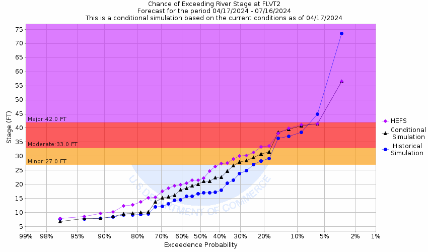
42
The river goes over the bridge at County Road 117, and will cause County Road 127 to become flooded and impassable. Calaveras Creek will go over the bridge at County Road 128. Homes in low spots close to the San Antonio River may become threatened.
33
Secondary roads near the floodplain may become flooded and impassable. Extensive flooding occurs in lowest portions of Floresville City Park.
27
Floodwaters begin to impact lower portions of Floresville City Park.
21
Water exceeds the lowest banks along the San Antonio River
The National Weather Service prepares its forecasts and other services in collaboration with agencies like the US Geological Survey, US Bureau of Reclamation, US Army Corps of Engineers, Natural Resource Conservation Service, National Park Service, ALERT Users Group, Bureau of Indian Affairs, and many state and local emergency managers across the country. For details, please click here.
NWS Information
National Weather Service
Austin/San Antonio Weather Forecast Office
2090 Airport Road
New Braunfels, TX 78130
(830) 629-0130 Ask Questions/Webmaster
Page last modified: 2-Nov-2020 7:29 PM