Latitude/Longitude Disclaimer: The gauge location shown in the above map
is the approximate location based on the latitude/longitude coordinates
provided to the NWS by the gauge owner.
Flood Impacts & Photos
If you notice any errors in the below information, please contact our Webmaster
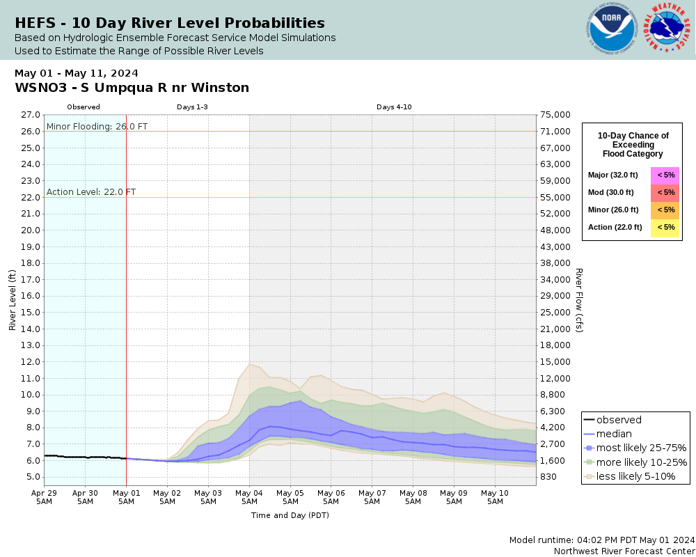
32
Significant flooding can be expected from south of the town of Dillard downstream to the civil bend area near Winston and through Greed to the Little Valley area. Flooding can also be expected in the Myrtle Creek vicinity along Interstate 5. Severe bank erosion can be expected along the South Umpqua River and also flooded railroad beds in some areas along the South Umpqua River in the vicinity of Winston.
30
A good portion of Highway 99 is flooded south of the town of Dillard along with homes and businesses along Highway 99 south of Dillard and along the South Umpqua River. Some street flooding is also possible in the town of Dillard.
29
Highway 99 near the town of Dillard begins to flood. Expect flooding of homes and businesses along Highway 99 and the South Umpqua River in the vicinity of Dillard.
28
Expect widespread low-land and agricultural flooding from Winston downstream toward the Happy Valley Road area.
26
The South Umpqua River is at flood stage. Low-land flooding can be expected from Winston upstream to Dillard.
The National Weather Service prepares its forecasts and other services in collaboration with agencies like the US Geological Survey, US Bureau of Reclamation, US Army Corps of Engineers, Natural Resource Conservation Service, National Park Service, ALERT Users Group, Bureau of Indian Affairs, and many state and local emergency managers across the country. For details, please click here.
NWS Information
National Weather Service
Medford Weather Forecast Office
4003 Cirrus Drive
Medford, OR 97504-4198
(541) 776-4303 Ask Questions/Webmaster
Page last modified: 2-Nov-2020 7:27 PM