Skip Navigation Link weather.gov  
NOAA logo - Click to go to the NOAA homepage National Weather Service NWS logo - Click to go to the NWS homepage
Advanced Hydrologic Prediction Service
Image background of Navigation bar Left
Navigation Bar End Cap


This probabilistic forecast is issued by the California Nevada River Forecast Center.
tab left off Hydrograph tab right off tab left off River at a Glance tab right off tab left off Download tab right off tab left on tab right on
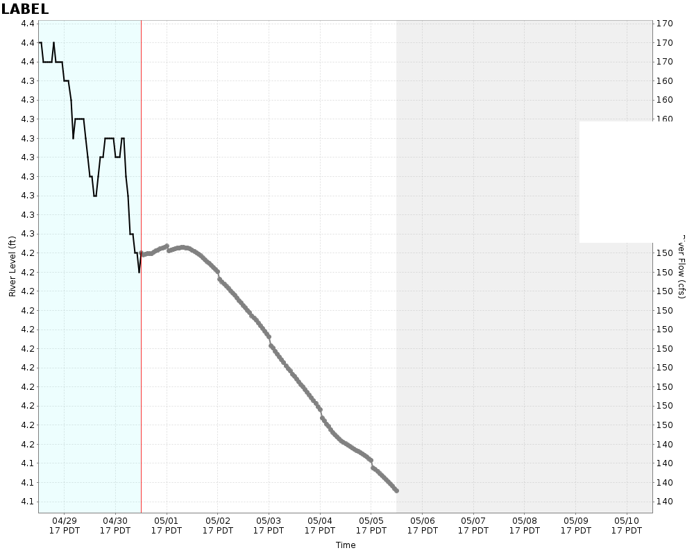
Experimental Short Range Forecast Uncertainty (AHPS) - External Links: Product Description Document | Customer Survey
About this graph
Forecasts for the Pajaro River at Chittenden are issued routinely year-round.
Return to Area Map

Zoom Level:16
Flood Categories (in feet)
Major Flood Stage: 27.1
Moderate Flood Stage: 0
Flood Stage: 24.1
Action Stage: 22
Low Stage (in feet): -9999

Historic Crests
(1) 33.73 ft on 02/03/1998
(2) 33.11 ft on 04/03/1958
(3) 32.46 ft on 12/24/1955
(4) 32.20 ft on 03/11/1995
(5) 31.30 ft on 02/12/1938
Show More Historic Crests

(P): Preliminary values subject to further review.

Recent Crests
(1) 19.96 ft on 03/23/2023
(2) 29.11 ft on 03/11/2023
(3) 18.43 ft on 03/01/2023
(4) 25.78 ft on 01/17/2023
(5) 27.66 ft on 01/10/2023
Show More Recent Crests

(P): Preliminary values subject to further review.

Low Water Records
Currently none available.
KML Image
Gauge LocationGauge Map Marker
Disclaimer
Latitude/Longitude Disclaimer: The gauge location shown in the above map is the approximate location based on the latitude/longitude coordinates provided to the NWS by the gauge owner.
Flood Impacts & Photos Collapse
If you notice any errors in the below information, please contact our Webmaster
33.73 Stage and flow of record. 02/03/1998. 25,100 cfs
29 Levees protecting Watsonville and Pajaro at risk of failure. Flooding throughout the Pajaro Valley.
27.1 Major Flood Stage. Levees protecting Pajaro at risk of overtopping at lowest points or severely strained if sandbagged. Seepage likely throughout the levee system.
25.1 Water levels within 2 feet of top of levee protecting Pajaro.
24.1 Minor Flood Stage. Water levels within 3 feet of top of levee protecting Pajaro. Increased potential for seepage through levee at vulnerable locations.
22 Monitor Stage. Water beginning to rise onto levee slopes.

Other Real-time and/or Archive Data Sources:

Collaborative Agencies Collapse
The National Weather Service prepares its forecasts and other services in collaboration with agencies like the US Geological Survey, US Bureau of Reclamation, US Army Corps of Engineers, Natural Resource Conservation Service, National Park Service, ALERT Users Group, Bureau of Indian Affairs, and many state and local emergency managers across the country. For details, please click here.
NWS Information
National Weather Service
San Francisco Bay Area Weather Forecast Office
21 Grace Hopper Ave, Stop 5
Monterey, CA 93943-5505
(831) 656-1725
Ask Questions/Webmaster
Page last modified: 2-Nov-2020 7:27 PM
Disclaimer
Credits
Glossary
Privacy Policy
About Us
Career Opportunities