Latitude/Longitude Disclaimer: The gauge location shown in the above map
is the approximate location based on the latitude/longitude coordinates
provided to the NWS by the gauge owner.
Flood Impacts & Photos
If you notice any errors in the below information, please contact our Webmaster
50
Numerous homes and businesses will be affected in the western and northern sections of the county.
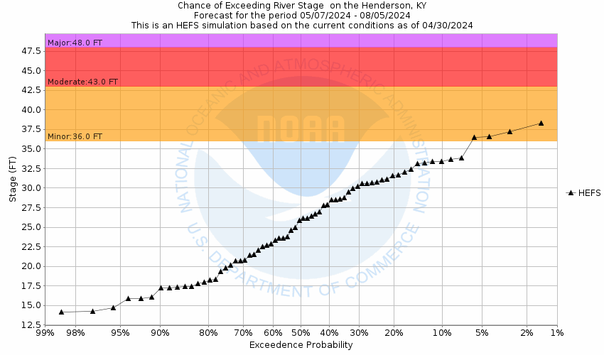
48
Numerous highways will be closed with extensive flooding in Smith Mills, Alzey Bottoms and leading up to Sunset Lane in Henderson. Extensive agricultural lands will be flooded with a few feet of water over the fields, especially in the western and northern sections of the county.
43
Several county roads in the western and northern part of the county flood, leaving many impassable.
36
Several roads begin to flood including: Horseshoe Bend Rd on Hwy 136, Kentucky 268 at the four-mile marker past McDonald Landing Rd, Gray-Adridge Rd, Old River Rd, Green River Rd, Stratman Rd and Wolf Hills Rd.
The National Weather Service prepares its forecasts and other services in collaboration with agencies like the US Geological Survey, US Bureau of Reclamation, US Army Corps of Engineers, Natural Resource Conservation Service, National Park Service, ALERT Users Group, Bureau of Indian Affairs, and many state and local emergency managers across the country. For details, please click here.
NWS Information
National Weather Service
Paducah Weather Forecast Office
8250 Highway 3520
West Paducah, KY 42086-6440
(270) 744-6440 Ask Questions/Webmaster
Page last modified: 2-Nov-2020 7:29 PM