Latitude/Longitude Disclaimer: The gauge location shown in the above map
is the approximate location based on the latitude/longitude coordinates
provided to the NWS by the gauge owner.
Flood Impacts & Photos
If you notice any errors in the below information, please contact our Webmaster
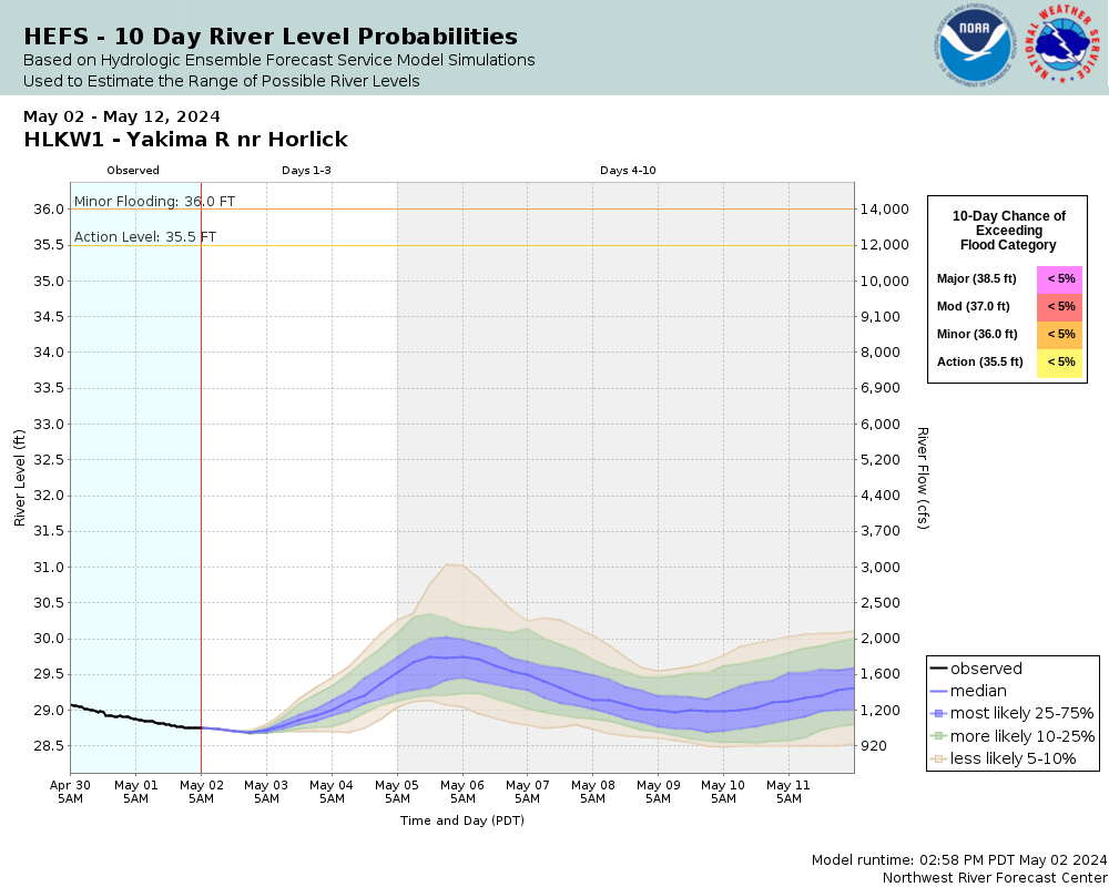
38.5
At this stage, major flooding can be expected in and near Cle Elum, including highways and pasturelands. Levees are subject to major seepage and erosion.
37
At this stage, there will be flooding of areas in and around south Cle Elum, including pastureland in the vicinity of the river. The levees around Cle Elum may develop seepage and water may outflank the south Cle Elum levee.
36
Flood Stage. The river will begin to flood low pasture lands and several roads adjacent to the river.
35.5
Bankfull. The river will be causing minor flooding of low pasturelands along the river.
Collaborative Agencies
The National Weather Service prepares its forecasts and other services in collaboration with agencies like the US Geological Survey, US Bureau of Reclamation, US Army Corps of Engineers, Natural Resource Conservation Service, National Park Service, ALERT Users Group, Bureau of Indian Affairs, and many state and local emergency managers across the country. For details, please click here.
NWS Information
National Weather Service
Pendleton Weather Forecast Office
2001 NW 56th Drive
Pendleton, OR 97801
(541) 276-7832 Ask Questions/Webmaster
Page last modified: 2-Nov-2020 7:27 PM