Skip Navigation Link weather.gov  
NOAA logo - Click to go to the NOAA homepage National Weather Service NWS logo - Click to go to the NWS homepage
Advanced Hydrologic Prediction Service
Image background of Navigation bar Left
Navigation Bar End Cap


This probabilistic forecast is issued by the Northwest River Forecast Center.
tab left off Hydrograph tab right off tab left off River at a Glance tab right off tab left off Download tab right off tab left on tab right on
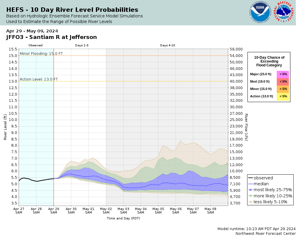
Experimental Short Range Forecast Uncertainty (AHPS) - External Links: Product Description Document | Customer Survey
About this graph
Forecasts for the Santiam River at Jefferson are issued routinely year-round.
Return to Area Map

Downstream Gauge Downstream Gauge - at Salem
Zoom Level:16
Flood Categories (in feet)
Major Flood Stage: 23
Moderate Flood Stage: 19
Flood Stage: 15
Action Stage: 13
Low Stage (in feet): -9999

Historic Crests
(1) 24.22 ft on 12/22/1964
(2) 23.25 ft on 02/07/1996
(3) 22.55 ft on 12/29/1945
(4) 22.50 ft on 11/21/1921
(5) 21.80 ft on 01/07/1948
Show More Historic Crests

(P): Preliminary values subject to further review.

Recent Crests
(1) 15.80 ft on 04/09/2019
(2) 18.35 ft on 01/20/2012
(3) 15.38 ft on 01/17/2011
(4) 15.81 ft on 01/03/2009
(5) 15.20 ft on 11/08/2006
Show More Recent Crests

(P): Preliminary values subject to further review.

Low Water Records
(1) -0.90 ft on 10/03/1939
(2) -0.90 ft on 09/27/1939
(3) -0.60 ft on 10/01/1936
Show More Low Water Records
KML Image
Gauge LocationGauge Map Marker
Disclaimer
Latitude/Longitude Disclaimer: The gauge location shown in the above map is the approximate location based on the latitude/longitude coordinates provided to the NWS by the gauge owner.
Flood Impacts & Photos Collapse
If you notice any errors in the below information, please contact our Webmaster
23 flooding in Jefferson and the highway east of the river is possible, in addition to widespread flooding of lowlands and low lying roadways.
19 expect widespread flooding of lowlands and agricultural areas, along with flooding of some secondary roads.
15 expect widespread lowland and agricultural flooding. Some secondary roads in low lying areas will be flooded at this level.
13 the river is at bankfull level at this point. There may be some areas where water is spilling over the banks near Jefferson.
Photos
(1) USGS gage house with river in the distance
(2) USGS gage house
(3) Downstream view

Other Real-time and/or Archive Data Sources:

Additional Information Collapse
10-day Forecast/Trend, Northwest River Forecast Center
Collaborative Agencies Collapse
The National Weather Service prepares its forecasts and other services in collaboration with agencies like the US Geological Survey, US Bureau of Reclamation, US Army Corps of Engineers, Natural Resource Conservation Service, National Park Service, ALERT Users Group, Bureau of Indian Affairs, and many state and local emergency managers across the country. For details, please click here.
NWS Information
National Weather Service
Portland Weather Forecast Office
5241 NE 122nd Avenue
Portland, OR 97230-1089
(503) 261-9246
Ask Questions/Webmaster
Page last modified: 2-Nov-2020 7:27 PM
Disclaimer
Credits
Glossary
Privacy Policy
About Us
Career Opportunities