Skip Navigation Link weather.gov  
NOAA logo - Click to go to the NOAA homepage National Weather Service NWS logo - Click to go to the NWS homepage
Advanced Hydrologic Prediction Service
Image background of Navigation bar Left
Navigation Bar End Cap


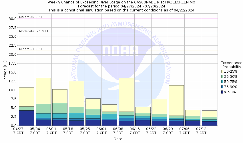
This probabilistic forecast is issued by the Missouri Basin River Forecast Center.
tab left off Hydrograph tab right off tab left off River at a Glance tab right off tab left off Download tab right off tab left on tab right on
About this graph
Forecasts for the Gasconade River near Hazelgreen are issued as needed during times of high water, but are not routinely available.
Return to Area Map

Downstream Gauge Downstream Gauge - at Jerome
Zoom Level:16
Flood Categories (in feet)
Major Flood Stage: 30
Moderate Flood Stage: 26
Flood Stage: 21
Action Stage: 19
Low Stage (in feet): 0.3

Historic Crests
(1) 39.74 ft on 04/30/2017
(2) 34.92 ft on 03/19/2008
(3) 34.46 ft on 12/04/1982
(4) 33.72 ft on 12/28/2015
(5) 30.60 ft on 01/01/1916
Show More Historic Crests

(P): Preliminary values subject to further review.

Recent Crests
(1) 26.21 ft on 03/25/2023 (P)
(2) 25.09 ft on 05/06/2022 (P)
(3) 21.63 ft on 03/21/2020
(4) 25.67 ft on 01/12/2020
(5) 22.48 ft on 05/22/2019
Show More Recent Crests

(P): Preliminary values subject to further review.

Low Water Records
(1) 0.03 ft on 09/04/1956
(2) 0.13 ft on 04/09/1956
(3) 0.35 ft on 10/21/1957
(4) 0.42 ft on 08/12/1957
(5) 0.44 ft on 01/15/1957
Show More Low Water Records
KML Image
Gauge LocationGauge Map Marker
Disclaimer
Latitude/Longitude Disclaimer: The gauge location shown in the above map is the approximate location based on the latitude/longitude coordinates provided to the NWS by the gauge owner.
Flood Impacts & Photos Collapse
If you notice any errors in the below information, please contact our Webmaster
40.08 this is the record crest set on May 1, 2017.
34.92 this is the crest on March 20, 2008. Interstate 44 at mile marker 143 at the Hazelgreen Access is impassable.
34.46 this is the crest reached on December 3, 1982.
32 flood waters impact both lanes of Interstate 44, near the gage site, at mile marker 143.
30 major flooding. Flood waters begins to affect the west bound lanes of Interstate 44 at mile marker 143.
26 moderate flooding begins at the gage site. Flood waters impacts the old State Highway 66 bridge.
21 minor flooding begins at the gage site and mainly affects low lying areas along the river.

Other Real-time and/or Archive Data Sources:

Additional Information Collapse
How low could the river get?
Collaborative Agencies Collapse
The National Weather Service prepares its forecasts and other services in collaboration with agencies like the US Geological Survey, US Bureau of Reclamation, US Army Corps of Engineers, Natural Resource Conservation Service, National Park Service, ALERT Users Group, Bureau of Indian Affairs, and many state and local emergency managers across the country. For details, please click here.
NWS Information
National Weather Service
Springfield Weather Forecast Office
5805 West Highway EE
Springfield, MO 65802-8430
(417) 869-4491
Ask Questions/Webmaster
Page last modified: 2-Nov-2020 7:29 PM
Disclaimer
Credits
Glossary
Privacy Policy
About Us
Career Opportunities