Skip Navigation Link weather.gov  
NOAA logo - Click to go to the NOAA homepage National Weather Service NWS logo - Click to go to the NWS homepage
Advanced Hydrologic Prediction Service
Image background of Navigation bar Left
Navigation Bar End Cap

Little Muskingum At Bloomfield (LNBO1)

Return to Top
Flood Stage: 16 Feet
Latest Stage: 3.38
Current Warnings/Statements/Advisories:None currently.
at Bloomfield
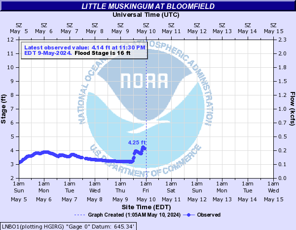
Stage (ft)Flow (kcfs)Observed: 3.05 ft at 6:00PM May 15, 2024Observed: 3.04 ft at 6:30PM May 15, 2024Observed: 3.04 ft at 7:00PM May 15, 2024Observed: 3.04 ft at 7:30PM May 15, 2024Observed: 3.04 ft at 8:00PM May 15, 2024Observed: 3.04 ft at 8:30PM May 15, 2024Observed: 3.04 ft at 9:00PM May 15, 2024Observed: 3.04 ft at 9:30PM May 15, 2024Observed: 3.04 ft at 10:00PM May 15, 2024Observed: 3.04 ft at 10:30PM May 15, 2024Observed: 3.04 ft at 11:00PM May 15, 2024Observed: 3.04 ft at 11:30PM May 15, 2024Observed: 3.04 ft at 12:00AM May 16, 2024Observed: 3.04 ft at 12:30AM May 16, 2024Observed: 3.04 ft at 1:00AM May 16, 2024Observed: 3.04 ft at 1:30AM May 16, 2024Observed: 3.04 ft at 2:00AM May 16, 2024Observed: 3.04 ft at 2:30AM May 16, 2024Observed: 3.04 ft at 3:00AM May 16, 2024Observed: 3.04 ft at 3:30AM May 16, 2024Observed: 3.04 ft at 4:00AM May 16, 2024Observed: 3.03 ft at 4:30AM May 16, 2024Observed: 3.04 ft at 5:00AM May 16, 2024Observed: 3.03 ft at 5:30AM May 16, 2024Observed: 3.03 ft at 6:00AM May 16, 2024Observed: 3.03 ft at 6:30AM May 16, 2024Observed: 3.03 ft at 7:00AM May 16, 2024Observed: 3.03 ft at 7:30AM May 16, 2024Observed: 3.03 ft at 8:00AM May 16, 2024Observed: 3.03 ft at 8:30AM May 16, 2024Observed: 3.02 ft at 9:00AM May 16, 2024Observed: 3.03 ft at 9:30AM May 16, 2024Observed: 3.02 ft at 10:00AM May 16, 2024Observed: 3.02 ft at 10:30AM May 16, 2024Observed: 3.02 ft at 11:00AM May 16, 2024Observed: 3.02 ft at 11:30AM May 16, 2024Observed: 3.01 ft at 12:00PM May 16, 2024Observed: 3.02 ft at 12:30PM May 16, 2024Observed: 3.02 ft at 1:00PM May 16, 2024Observed: 3.01 ft at 1:30PM May 16, 2024Observed: 3.01 ft at 2:00PM May 16, 2024Observed: 3.01 ft at 2:30PM May 16, 2024Observed: 3 ft at 3:00PM May 16, 2024Observed: 3 ft at 3:30PM May 16, 2024Observed: 3 ft at 4:00PM May 16, 2024Observed: 3.01 ft at 4:30PM May 16, 2024Observed: 3 ft at 5:00PM May 16, 2024Observed: 3 ft at 5:30PM May 16, 2024Observed: 3 ft at 6:00PM May 16, 2024Observed: 2.99 ft at 6:30PM May 16, 2024Observed: 3 ft at 7:00PM May 16, 2024Observed: 3 ft at 7:30PM May 16, 2024Observed: 2.99 ft at 8:00PM May 16, 2024Observed: 2.99 ft at 8:30PM May 16, 2024Observed: 2.99 ft at 9:00PM May 16, 2024Observed: 2.99 ft at 9:30PM May 16, 2024Observed: 2.98 ft at 10:00PM May 16, 2024Observed: 2.99 ft at 10:30PM May 16, 2024Observed: 2.98 ft at 11:00PM May 16, 2024Observed: 2.98 ft at 11:30PM May 16, 2024Observed: 2.98 ft at 12:00AM May 17, 2024Observed: 2.98 ft at 12:30AM May 17, 2024Observed: 2.98 ft at 1:00AM May 17, 2024Observed: 2.98 ft at 1:30AM May 17, 2024Observed: 2.98 ft at 2:00AM May 17, 2024Observed: 2.97 ft at 2:30AM May 17, 2024Observed: 2.97 ft at 3:00AM May 17, 2024Observed: 2.97 ft at 3:30AM May 17, 2024Observed: 2.97 ft at 4:00AM May 17, 2024Observed: 2.97 ft at 4:30AM May 17, 2024Observed: 2.96 ft at 5:00AM May 17, 2024Observed: 2.97 ft at 5:30AM May 17, 2024Observed: 2.96 ft at 6:00AM May 17, 2024Observed: 2.96 ft at 6:30AM May 17, 2024Observed: 2.96 ft at 7:00AM May 17, 2024Observed: 2.96 ft at 7:30AM May 17, 2024Observed: 2.96 ft at 8:00AM May 17, 2024Observed: 3 ft at 8:30AM May 17, 2024Observed: 3.03 ft at 9:00AM May 17, 2024Observed: 3.04 ft at 9:30AM May 17, 2024Observed: 3.04 ft at 10:00AM May 17, 2024Observed: 3.04 ft at 10:30AM May 17, 2024Observed: 3.04 ft at 11:00AM May 17, 2024Observed: 3.05 ft at 11:30AM May 17, 2024Observed: 3.1 ft at 12:00PM May 17, 2024Observed: 3.11 ft at 12:30PM May 17, 2024Observed: 3.13 ft at 1:00PM May 17, 2024Observed: 3.13 ft at 1:30PM May 17, 2024Observed: 3.14 ft at 2:00PM May 17, 2024Observed: 3.15 ft at 2:30PM May 17, 2024Observed: 3.15 ft at 3:00PM May 17, 2024Observed: 3.16 ft at 3:30PM May 17, 2024Observed: 3.17 ft at 4:00PM May 17, 2024Observed: 3.16 ft at 4:30PM May 17, 2024Observed: 3.17 ft at 5:00PM May 17, 2024Observed: 3.17 ft at 5:30PM May 17, 2024Observed: 3.18 ft at 6:00PM May 17, 2024Observed: 3.19 ft at 6:30PM May 17, 2024Observed: 3.2 ft at 7:00PM May 17, 2024Observed: 3.2 ft at 7:30PM May 17, 2024Observed: 3.22 ft at 8:00PM May 17, 2024Observed: 3.23 ft at 8:30PM May 17, 2024Observed: 3.68 ft at 9:00PM May 17, 2024Observed: 4.43 ft at 9:30PM May 17, 2024Observed: 5.94 ft at 10:00PM May 17, 2024Observed: 6.25 ft at 10:30PM May 17, 2024Observed: 6.7 ft at 11:00PM May 17, 2024Observed: 6.81 ft at 11:30PM May 17, 2024Observed: 7.02 ft at 12:00AM May 18, 2024Observed: 7.11 ft at 12:30AM May 18, 2024Observed: 7.28 ft at 1:00AM May 18, 2024Observed: 7.36 ft at 1:30AM May 18, 2024Observed: 7.5 ft at 2:00AM May 18, 2024Highest Observation: 7.52 ft at 2:30AM May 18, 2024Highest Observation: 7.52 ft at 3:00AM May 18, 2024Highest Observation: 7.52 ft at 3:30AM May 18, 2024Observed: 7.42 ft at 4:00AM May 18, 2024Observed: 7.34 ft at 4:30AM May 18, 2024Observed: 7.19 ft at 5:00AM May 18, 2024Observed: 7.13 ft at 5:30AM May 18, 2024Observed: 6.92 ft at 6:00AM May 18, 2024Observed: 6.84 ft at 6:30AM May 18, 2024Observed: 6.64 ft at 7:00AM May 18, 2024Observed: 6.55 ft at 7:30AM May 18, 2024Observed: 6.34 ft at 8:00AM May 18, 2024Observed: 6.28 ft at 8:30AM May 18, 2024Observed: 6.08 ft at 9:00AM May 18, 2024Observed: 6.02 ft at 9:30AM May 18, 2024Observed: 5.85 ft at 10:00AM May 18, 2024Observed: 5.79 ft at 10:30AM May 18, 2024Observed: 5.65 ft at 11:00AM May 18, 2024Observed: 5.56 ft at 11:30AM May 18, 2024Observed: 5.45 ft at 12:00PM May 18, 2024Observed: 5.42 ft at 12:30PM May 18, 2024Observed: 5.29 ft at 1:00PM May 18, 2024Observed: 5.28 ft at 1:30PM May 18, 2024Observed: 5.18 ft at 2:00PM May 18, 2024Observed: 5.15 ft at 2:30PM May 18, 2024Observed: 5.08 ft at 3:00PM May 18, 2024Observed: 5.05 ft at 3:30PM May 18, 2024Observed: 5 ft at 4:00PM May 18, 2024Observed: 4.98 ft at 4:30PM May 18, 2024Observed: 4.94 ft at 5:00PM May 18, 2024Observed: 4.93 ft at 5:30PM May 18, 2024Observed: 4.9 ft at 6:00PM May 18, 2024Observed: 4.87 ft at 6:30PM May 18, 2024Observed: 4.82 ft at 7:00PM May 18, 2024Observed: 4.79 ft at 7:30PM May 18, 2024Observed: 4.73 ft at 8:00PM May 18, 2024Observed: 4.71 ft at 8:30PM May 18, 2024Observed: 4.66 ft at 9:00PM May 18, 2024Observed: 4.64 ft at 9:30PM May 18, 2024Observed: 4.58 ft at 10:00PM May 18, 2024Observed: 4.57 ft at 10:30PM May 18, 2024Observed: 4.52 ft at 11:00PM May 18, 2024Observed: 4.5 ft at 11:30PM May 18, 2024Observed: 4.46 ft at 12:00AM May 19, 2024Observed: 4.44 ft at 12:30AM May 19, 2024Observed: 4.43 ft at 1:00AM May 19, 2024Observed: 4.41 ft at 1:30AM May 19, 2024Observed: 4.36 ft at 2:00AM May 19, 2024Observed: 4.36 ft at 2:30AM May 19, 2024Observed: 4.33 ft at 3:00AM May 19, 2024Observed: 4.32 ft at 3:30AM May 19, 2024Observed: 4.27 ft at 4:00AM May 19, 2024Observed: 4.25 ft at 4:30AM May 19, 2024Observed: 4.22 ft at 5:00AM May 19, 2024Observed: 4.21 ft at 5:30AM May 19, 2024Observed: 4.17 ft at 6:00AM May 19, 2024Observed: 4.15 ft at 6:30AM May 19, 2024Observed: 4.13 ft at 7:00AM May 19, 2024Observed: 4.12 ft at 7:30AM May 19, 2024Observed: 4.1 ft at 8:00AM May 19, 2024Observed: 4.09 ft at 8:30AM May 19, 2024Observed: 4.05 ft at 9:00AM May 19, 2024Observed: 4.05 ft at 9:30AM May 19, 2024Observed: 4.03 ft at 10:00AM May 19, 2024Observed: 4.02 ft at 10:30AM May 19, 2024Observed: 3.99 ft at 11:00AM May 19, 2024Observed: 3.99 ft at 11:30AM May 19, 2024Observed: 3.97 ft at 12:00PM May 19, 2024Observed: 3.96 ft at 12:30PM May 19, 2024Observed: 3.93 ft at 1:00PM May 19, 2024Observed: 3.92 ft at 1:30PM May 19, 2024Observed: 3.91 ft at 2:00PM May 19, 2024Observed: 3.9 ft at 2:30PM May 19, 2024Observed: 3.87 ft at 3:00PM May 19, 2024Observed: 3.87 ft at 3:30PM May 19, 2024Observed: 3.85 ft at 4:00PM May 19, 2024Observed: 3.84 ft at 4:30PM May 19, 2024Observed: 3.82 ft at 5:00PM May 19, 2024Observed: 3.81 ft at 5:30PM May 19, 2024Observed: 3.79 ft at 6:00PM May 19, 2024Observed: 3.79 ft at 6:30PM May 19, 2024Observed: 3.77 ft at 7:00PM May 19, 2024Observed: 3.77 ft at 7:30PM May 19, 2024Observed: 3.75 ft at 8:00PM May 19, 2024Observed: 3.74 ft at 8:30PM May 19, 2024Observed: 3.73 ft at 9:00PM May 19, 2024Observed: 3.72 ft at 9:30PM May 19, 2024Observed: 3.71 ft at 10:00PM May 19, 2024Observed: 3.7 ft at 10:30PM May 19, 2024Observed: 3.67 ft at 11:00PM May 19, 2024Observed: 3.68 ft at 11:30PM May 19, 2024Observed: 3.66 ft at 12:00AM May 20, 2024Observed: 3.65 ft at 12:30AM May 20, 2024Observed: 3.64 ft at 1:00AM May 20, 2024Observed: 3.63 ft at 1:30AM May 20, 2024Observed: 3.61 ft at 2:00AM May 20, 2024Observed: 3.61 ft at 2:30AM May 20, 2024Observed: 3.59 ft at 3:00AM May 20, 2024Observed: 3.59 ft at 3:30AM May 20, 2024Observed: 3.57 ft at 4:00AM May 20, 2024Observed: 3.57 ft at 4:30AM May 20, 2024Observed: 3.55 ft at 5:00AM May 20, 2024Observed: 3.55 ft at 5:30AM May 20, 2024Observed: 3.53 ft at 6:00AM May 20, 2024Observed: 3.53 ft at 6:30AM May 20, 2024Observed: 3.52 ft at 7:00AM May 20, 2024Observed: 3.51 ft at 7:30AM May 20, 2024Observed: 3.5 ft at 8:00AM May 20, 2024Observed: 3.5 ft at 8:30AM May 20, 2024Observed: 3.49 ft at 9:00AM May 20, 2024Observed: 3.48 ft at 9:30AM May 20, 2024Observed: 3.47 ft at 10:00AM May 20, 2024Observed: 3.47 ft at 10:30AM May 20, 2024Observed: 3.45 ft at 11:00AM May 20, 2024Observed: 3.45 ft at 11:30AM May 20, 2024Observed: 3.43 ft at 12:00PM May 20, 2024Observed: 3.43 ft at 12:30PM May 20, 2024Observed: 3.42 ft at 1:00PM May 20, 2024Observed: 3.41 ft at 1:30PM May 20, 2024Observed: 3.41 ft at 2:00PM May 20, 2024Observed: 3.4 ft at 2:30PM May 20, 2024Observed: 3.39 ft at 3:00PM May 20, 2024Observed: 3.39 ft at 3:30PM May 20, 2024Observed: 3.38 ft at 4:00PM May 20, 2024Observed: 3.38 ft at 4:30PM May 20, 2024LNBO1(plotting HGIRG) Graph Created (5:35PM May 20, 2024)ObservedLatest observed value: 3.38 ft at 4:30 PM EDT 20-May-2024. Flood Stage is 16 ft
KML Image
Gauge LocationGauge Map Marker
Latitude/Longitude Disclaimer: The gauge location shown in the above map is the approximate location based on the latitude/longitude coordinates provided to the NWS by the gauge owner.
Flood Impacts

If you notice any errors in the below information, please contact our Webmaster

32
Record flooding occurring.
25
House on the left bank and store near the Route 260 bridge starts to flood.
23
Bloomfield Church Road near Little Muskingum River bridge and gage starts to flood.
16
Route 26 near the intersection with Route 260 starts to flood between 16 and 20 feet.
12
Hay field across from the gage and between the river and Route 26 starts to flood.
Flood Categories (in feet)
Major Flood Stage: 32
Moderate Flood Stage: 23
Flood Stage: 16
Action Stage: 12
Low Stage (in feet): -9999

Historic Crests
(1) 32.16 ft on 09/18/2004
(2) 30.78 ft on 06/28/1998
(3) 28.30 ft on 03/02/1997
(4) 28.08 ft on 03/05/1963
(5) 26.26 ft on 05/24/1968
(6) 25.84 ft on 01/12/2018
(7) 25.71 ft on 01/12/2005
(8) 25.68 ft on 02/19/2000
(9) 25.22 ft on 02/26/1979
(10) 25.22 ft on 02/13/1966
Show More Historic Crests

(P): Preliminary values subject to further review.

Recent Crests
(1) 19.89 ft on 01/25/2024 (P)
(2) 21.99 ft on 01/10/2024 (P)
(3) 18.60 ft on 03/24/2023 (P)
(4) 18.38 ft on 06/17/2022 (P)
(5) 19.89 ft on 05/07/2022 (P)
(6) 18.84 ft on 02/25/2022 (P)
(7) 20.64 ft on 02/18/2022 (P)
(8) 23.53 ft on 02/04/2022 (P)
(9) 16.57 ft on 03/01/2021
(10) 20.34 ft on 02/13/2020
Show More Recent Crests

(P): Preliminary values subject to further review.

Low Water Records
(1) 1.40 ft on 09/19/2001
(2) 2.58 ft on 08/21/2008

Observed and Forecast Stages

Observed Data:
Date (UTC)
Stage
Flow
05/20 20:30
3.38 ft
0.118 kcfs
05/20 20:00
3.38 ft
0.118 kcfs
05/20 19:30
3.39 ft
0.12 kcfs
05/20 19:00
3.39 ft
0.12 kcfs
05/20 18:30
3.4 ft
0.122 kcfs
05/20 18:00
3.41 ft
0.124 kcfs
05/20 17:30
3.41 ft
0.124 kcfs
05/20 17:00
3.42 ft
0.125 kcfs
05/20 16:30
3.43 ft
0.127 kcfs
05/20 16:00
3.43 ft
0.127 kcfs
05/20 15:30
3.45 ft
0.131 kcfs
05/20 15:00
3.45 ft
0.131 kcfs
05/20 14:30
3.47 ft
0.134 kcfs
05/20 14:00
3.47 ft
0.134 kcfs
05/20 13:30
3.48 ft
0.136 kcfs
05/20 13:00
3.49 ft
0.138 kcfs
05/20 12:30
3.5 ft
0.14 kcfs
05/20 12:00
3.5 ft
0.14 kcfs
05/20 11:30
3.51 ft
0.142 kcfs
05/20 11:00
3.52 ft
0.143 kcfs
05/20 10:30
3.53 ft
0.145 kcfs
05/20 10:00
3.53 ft
0.145 kcfs
05/20 09:30
3.55 ft
0.149 kcfs
05/20 09:00
3.55 ft
0.149 kcfs
05/20 08:30
3.57 ft
0.153 kcfs
05/20 08:00
3.57 ft
0.153 kcfs
05/20 07:30
3.59 ft
0.157 kcfs
05/20 07:00
3.59 ft
0.157 kcfs
05/20 06:30
3.61 ft
0.161 kcfs
05/20 06:00
3.61 ft
0.161 kcfs
05/20 05:30
3.63 ft
0.165 kcfs
05/20 05:00
3.64 ft
0.167 kcfs
05/20 04:30
3.65 ft
0.169 kcfs
05/20 04:00
3.66 ft
0.171 kcfs
05/20 03:30
3.68 ft
0.174 kcfs
05/20 03:00
3.67 ft
0.172 kcfs
05/20 02:30
3.7 ft
0.178 kcfs
05/20 02:00
3.71 ft
0.18 kcfs
05/20 01:30
3.72 ft
0.181 kcfs
05/20 01:00
3.73 ft
0.183 kcfs
05/20 00:30
3.74 ft
0.185 kcfs
05/20 00:00
3.75 ft
0.187 kcfs
05/19 23:30
3.77 ft
0.191 kcfs
05/19 23:00
3.77 ft
0.191 kcfs
05/19 22:30
3.79 ft
0.195 kcfs
05/19 22:00
3.79 ft
0.195 kcfs
05/19 21:30
3.81 ft
0.199 kcfs
05/19 21:00
3.82 ft
0.202 kcfs
05/19 20:30
3.84 ft
0.206 kcfs
05/19 20:00
3.85 ft
0.208 kcfs
05/19 19:30
3.87 ft
0.212 kcfs
05/19 19:00
3.87 ft
0.212 kcfs
05/19 18:30
3.9 ft
0.218 kcfs
05/19 18:00
3.91 ft
0.22 kcfs
05/19 17:30
3.92 ft
0.223 kcfs
05/19 17:00
3.93 ft
0.225 kcfs
05/19 16:30
3.96 ft
0.231 kcfs
05/19 16:00
3.97 ft
0.233 kcfs
05/19 15:30
3.99 ft
0.237 kcfs
05/19 15:00
3.99 ft
0.237 kcfs
05/19 14:30
4.02 ft
0.244 kcfs
05/19 14:00
4.03 ft
0.246 kcfs
05/19 13:30
4.05 ft
0.25 kcfs
05/19 13:00
4.05 ft
0.25 kcfs
05/19 12:30
4.09 ft
0.259 kcfs
05/19 12:00
4.1 ft
0.261 kcfs
05/19 11:30
4.12 ft
0.265 kcfs
05/19 11:00
4.13 ft
0.267 kcfs
05/19 10:30
4.15 ft
0.272 kcfs
05/19 10:00
4.17 ft
0.277 kcfs
05/19 09:30
4.21 ft
0.286 kcfs
05/19 09:00
4.22 ft
0.289 kcfs
05/19 08:30
4.25 ft
0.296 kcfs
05/19 08:00
4.27 ft
0.301 kcfs
05/19 07:30
4.32 ft
0.313 kcfs
05/19 07:00
4.33 ft
0.316 kcfs
05/19 06:30
4.36 ft
0.324 kcfs
05/19 06:00
4.36 ft
0.324 kcfs
05/19 05:30
4.41 ft
0.336 kcfs
05/19 05:00
4.43 ft
0.342 kcfs
05/19 04:30
4.44 ft
0.344 kcfs
05/19 04:00
4.46 ft
0.349 kcfs
05/19 03:30
4.5 ft
0.358 kcfs
05/19 03:00
4.52 ft
0.362 kcfs
05/19 02:30
4.57 ft
0.373 kcfs
05/19 02:00
4.58 ft
0.376 kcfs
05/19 01:30
4.64 ft
0.389 kcfs
05/19 01:00
4.66 ft
0.393 kcfs
05/19 00:30
4.71 ft
0.405 kcfs
05/19 00:00
4.73 ft
0.41 kcfs
05/18 23:30
4.79 ft
0.424 kcfs
05/18 23:00
4.82 ft
0.432 kcfs
05/18 22:30
4.87 ft
0.443 kcfs
05/18 22:00
4.9 ft
0.45 kcfs
05/18 21:30
4.93 ft
0.457 kcfs
05/18 21:00
4.94 ft
0.459 kcfs
05/18 20:30
4.98 ft
0.468 kcfs
05/18 20:00
5 ft
0.472 kcfs
05/18 19:30
5.05 ft
0.483 kcfs
05/18 19:00
5.08 ft
0.49 kcfs
05/18 18:30
5.15 ft
0.506 kcfs
05/18 18:00
5.18 ft
0.513 kcfs
05/18 17:30
5.28 ft
0.535 kcfs
05/18 17:00
5.29 ft
0.538 kcfs
05/18 16:30
5.42 ft
0.569 kcfs
05/18 16:00
5.45 ft
0.576 kcfs
05/18 15:30
5.56 ft
0.602 kcfs
05/18 15:00
5.65 ft
0.625 kcfs
05/18 14:30
5.79 ft
0.661 kcfs
05/18 14:00
5.85 ft
0.677 kcfs
05/18 13:30
6.02 ft
0.719 kcfs
05/18 13:00
6.08 ft
0.733 kcfs
05/18 12:30
6.28 ft
0.778 kcfs
05/18 12:00
6.34 ft
0.792 kcfs
05/18 11:30
6.55 ft
0.841 kcfs
05/18 11:00
6.64 ft
0.863 kcfs
05/18 10:30
6.84 ft
0.911 kcfs
05/18 10:00
6.92 ft
0.931 kcfs
05/18 09:30
7.13 ft
0.983 kcfs
05/18 09:00
7.19 ft
0.998 kcfs
05/18 08:30
7.34 ft
1.04 kcfs
05/18 08:00
7.42 ft
1.06 kcfs
05/18 07:30
7.52 ft
1.08 kcfs
05/18 07:00
7.52 ft
1.08 kcfs
05/18 06:30
7.52 ft
1.08 kcfs
05/18 06:00
7.5 ft
1.08 kcfs
05/18 05:30
7.36 ft
1.04 kcfs
05/18 05:00
7.28 ft
1.02 kcfs
05/18 04:30
7.11 ft
0.978 kcfs
05/18 04:00
7.02 ft
0.956 kcfs
05/18 03:30
6.81 ft
0.904 kcfs
05/18 03:00
6.7 ft
0.877 kcfs
05/18 02:30
6.25 ft
0.771 kcfs
05/18 02:00
5.94 ft
0.701 kcfs
05/18 01:30
4.43 ft
0.342 kcfs
05/18 01:00
3.68 ft
0.174 kcfs
05/18 00:30
3.23 ft
0.0936 kcfs
05/18 00:00
3.22 ft
0.0919 kcfs
05/17 23:30
3.2 ft
0.0887 kcfs
05/17 23:00
3.2 ft
0.0887 kcfs
05/17 22:30
3.19 ft
0.0871 kcfs
05/17 22:00
3.18 ft
0.0856 kcfs
05/17 21:30
3.17 ft
0.084 kcfs
05/17 21:00
3.17 ft
0.084 kcfs
05/17 20:30
3.16 ft
0.0825 kcfs
05/17 20:00
3.17 ft
0.084 kcfs
05/17 19:30
3.16 ft
0.0825 kcfs
05/17 19:00
3.15 ft
0.081 kcfs
05/17 18:30
3.15 ft
0.081 kcfs
05/17 18:00
3.14 ft
0.0795 kcfs
05/17 17:30
3.13 ft
0.078 kcfs
05/17 17:00
3.13 ft
0.078 kcfs
05/17 16:30
3.11 ft
0.0751 kcfs
05/17 16:00
3.1 ft
0.0737 kcfs
05/17 15:30
3.05 ft
0.067 kcfs
05/17 15:00
3.04 ft
0.0657 kcfs
05/17 14:30
3.04 ft
0.0657 kcfs
05/17 14:00
3.04 ft
0.0657 kcfs
05/17 13:30
3.04 ft
0.0657 kcfs
05/17 13:00
3.03 ft
0.0644 kcfs
05/17 12:30
3 ft
0.0608 kcfs
05/17 12:00
2.96 ft
0.0561 kcfs
05/17 11:30
2.96 ft
0.0561 kcfs
05/17 11:00
2.96 ft
0.0561 kcfs
05/17 10:30
2.96 ft
0.0561 kcfs
05/17 10:00
2.96 ft
0.0561 kcfs
05/17 09:30
2.97 ft
0.0572 kcfs
05/17 09:00
2.96 ft
0.0561 kcfs
05/17 08:30
2.97 ft
0.0572 kcfs
05/17 08:00
2.97 ft
0.0572 kcfs
05/17 07:30
2.97 ft
0.0572 kcfs
05/17 07:00
2.97 ft
0.0572 kcfs
05/17 06:30
2.97 ft
0.0572 kcfs
05/17 06:00
2.98 ft
0.0584 kcfs
05/17 05:30
2.98 ft
0.0584 kcfs
05/17 05:00
2.98 ft
0.0584 kcfs
05/17 04:30
2.98 ft
0.0584 kcfs
05/17 04:00
2.98 ft
0.0584 kcfs
05/17 03:30
2.98 ft
0.0584 kcfs
05/17 03:00
2.98 ft
0.0584 kcfs
05/17 02:30
2.99 ft
0.0596 kcfs
05/17 02:00
2.98 ft
0.0584 kcfs
05/17 01:30
2.99 ft
0.0596 kcfs
05/17 01:00
2.99 ft
0.0596 kcfs
05/17 00:30
2.99 ft
0.0596 kcfs
05/17 00:00
2.99 ft
0.0596 kcfs
05/16 23:30
3 ft
0.0608 kcfs
05/16 23:00
3 ft
0.0608 kcfs
05/16 22:30
2.99 ft
0.0596 kcfs
05/16 22:00
3 ft
0.0608 kcfs
05/16 21:30
3 ft
0.0608 kcfs
05/16 21:00
3 ft
0.0608 kcfs
05/16 20:30
3.01 ft
0.062 kcfs
05/16 20:00
3 ft
0.0608 kcfs
05/16 19:30
3 ft
0.0608 kcfs
05/16 19:00
3 ft
0.0608 kcfs
05/16 18:30
3.01 ft
0.062 kcfs
05/16 18:00
3.01 ft
0.062 kcfs
05/16 17:30
3.01 ft
0.062 kcfs
05/16 17:00
3.02 ft
0.0632 kcfs
05/16 16:30
3.02 ft
0.0632 kcfs
05/16 16:00
3.01 ft
0.062 kcfs
05/16 15:30
3.02 ft
0.0632 kcfs
05/16 15:00
3.02 ft
0.0632 kcfs
05/16 14:30
3.02 ft
0.0632 kcfs
05/16 14:00
3.02 ft
0.0632 kcfs
05/16 13:30
3.03 ft
0.0644 kcfs
05/16 13:00
3.02 ft
0.0632 kcfs
05/16 12:30
3.03 ft
0.0644 kcfs
05/16 12:00
3.03 ft
0.0644 kcfs
05/16 11:30
3.03 ft
0.0644 kcfs
05/16 11:00
3.03 ft
0.0644 kcfs
05/16 10:30
3.03 ft
0.0644 kcfs
05/16 10:00
3.03 ft
0.0644 kcfs
05/16 09:30
3.03 ft
0.0644 kcfs
05/16 09:00
3.04 ft
0.0657 kcfs
05/16 08:30
3.03 ft
0.0644 kcfs
05/16 08:00
3.04 ft
0.0657 kcfs
05/16 07:30
3.04 ft
0.0657 kcfs
05/16 07:00
3.04 ft
0.0657 kcfs
05/16 06:30
3.04 ft
0.0657 kcfs
05/16 06:00
3.04 ft
0.0657 kcfs
05/16 05:30
3.04 ft
0.0657 kcfs
05/16 05:00
3.04 ft
0.0657 kcfs
05/16 04:30
3.04 ft
0.0657 kcfs
05/16 04:00
3.04 ft
0.0657 kcfs
05/16 03:30
3.04 ft
0.0657 kcfs
05/16 03:00
3.04 ft
0.0657 kcfs
05/16 02:30
3.04 ft
0.0657 kcfs
05/16 02:00
3.04 ft
0.0657 kcfs
05/16 01:30
3.04 ft
0.0657 kcfs
05/16 01:00
3.04 ft
0.0657 kcfs
05/16 00:30
3.04 ft
0.0657 kcfs
05/16 00:00
3.04 ft
0.0657 kcfs
05/15 23:30
3.04 ft
0.0657 kcfs
05/15 23:00
3.04 ft
0.0657 kcfs
05/15 22:30
3.04 ft
0.0657 kcfs
05/15 22:00
3.05 ft
0.067 kcfs
05/15 21:30
3.05 ft
0.067 kcfs
05/15 21:00
3.05 ft
0.067 kcfs
05/15 20:30
3.05 ft
0.067 kcfs
05/15 20:00
3.06 ft
0.0683 kcfs
05/15 19:30
3.06 ft
0.0683 kcfs
05/15 19:00
3.06 ft
0.0683 kcfs
05/15 18:30
3.06 ft
0.0683 kcfs
05/15 18:00
3.06 ft
0.0683 kcfs
05/15 17:30
3.06 ft
0.0683 kcfs
05/15 17:00
3.06 ft
0.0683 kcfs
05/15 16:30
3.06 ft
0.0683 kcfs
05/15 16:00
3.06 ft
0.0683 kcfs
05/15 15:30
3.06 ft
0.0683 kcfs
05/15 15:00
3.06 ft
0.0683 kcfs
05/15 14:30
3.07 ft
0.0696 kcfs
05/15 14:00
3.07 ft
0.0696 kcfs
05/15 13:30
3.07 ft
0.0696 kcfs
05/15 13:00
3.07 ft
0.0696 kcfs
05/15 12:30
3.07 ft
0.0696 kcfs
05/15 12:00
3.07 ft
0.0696 kcfs
05/15 11:30
3.07 ft
0.0696 kcfs
05/15 11:00
3.07 ft
0.0696 kcfs
05/15 10:30
3.08 ft
0.071 kcfs
05/15 10:00
3.08 ft
0.071 kcfs
05/15 09:30
3.08 ft
0.071 kcfs
05/15 09:00
3.08 ft
0.071 kcfs
05/15 08:30
3.09 ft
0.0723 kcfs
05/15 08:00
3.09 ft
0.0723 kcfs
05/15 07:30
3.09 ft
0.0723 kcfs
05/15 07:00
3.1 ft
0.0737 kcfs
05/15 06:30
3.1 ft
0.0737 kcfs
05/15 06:00
3.1 ft
0.0737 kcfs
05/15 05:30
3.1 ft
0.0737 kcfs
05/15 05:00
3.11 ft
0.0751 kcfs
05/15 04:30
3.11 ft
0.0751 kcfs
05/15 04:00
3.11 ft
0.0751 kcfs
05/15 03:30
3.11 ft
0.0751 kcfs
05/15 03:00
3.12 ft
0.0766 kcfs
05/15 02:30
3.12 ft
0.0766 kcfs
05/15 02:00
3.12 ft
0.0766 kcfs
05/15 01:30
3.12 ft
0.0766 kcfs
05/15 01:00
3.11 ft
0.0751 kcfs
05/15 00:30
3.12 ft
0.0766 kcfs
05/15 00:00
3.13 ft
0.078 kcfs
05/14 23:30
3.13 ft
0.078 kcfs
05/14 23:00
3.13 ft
0.078 kcfs
05/14 22:30
3.13 ft
0.078 kcfs
05/14 22:00
3.14 ft
0.0795 kcfs
05/14 21:30
3.14 ft
0.0795 kcfs
05/14 21:00
3.14 ft
0.0795 kcfs
05/14 20:30
3.15 ft
0.081 kcfs
05/14 20:00
3.15 ft
0.081 kcfs
05/14 19:30
3.15 ft
0.081 kcfs
05/14 19:00
3.16 ft
0.0825 kcfs
05/14 18:30
3.16 ft
0.0825 kcfs
05/14 18:00
3.16 ft
0.0825 kcfs
05/14 17:30
3.17 ft
0.084 kcfs
05/14 17:00
3.17 ft
0.084 kcfs
05/14 16:30
3.17 ft
0.084 kcfs
05/14 16:00
3.17 ft
0.084 kcfs
05/14 15:30
3.18 ft
0.0856 kcfs
05/14 15:00
3.18 ft
0.0856 kcfs
05/14 14:30
3.18 ft
0.0856 kcfs
05/14 14:00
3.19 ft
0.0871 kcfs
05/14 13:30
3.19 ft
0.0871 kcfs
05/14 13:00
3.19 ft
0.0871 kcfs
05/14 12:30
3.2 ft
0.0887 kcfs
05/14 12:00
3.2 ft
0.0887 kcfs
05/14 11:30
3.21 ft
0.0903 kcfs
05/14 11:00
3.21 ft
0.0903 kcfs
05/14 10:30
3.21 ft
0.0903 kcfs
05/14 10:00
3.21 ft
0.0903 kcfs
05/14 09:30
3.22 ft
0.0919 kcfs
05/14 09:00
3.23 ft
0.0936 kcfs
05/14 08:30
3.23 ft
0.0936 kcfs
05/14 08:00
3.23 ft
0.0936 kcfs
05/14 07:30
3.24 ft
0.0953 kcfs
05/14 07:00
3.24 ft
0.0953 kcfs
05/14 06:30
3.25 ft
0.097 kcfs
05/14 06:00
3.25 ft
0.097 kcfs
05/14 05:30
3.26 ft
0.0985 kcfs
05/14 05:00
3.26 ft
0.0985 kcfs
05/14 04:30
3.27 ft
0.1 kcfs
05/14 04:00
3.27 ft
0.1 kcfs
05/14 03:30
3.27 ft
0.1 kcfs
05/14 03:00
3.28 ft
0.102 kcfs
05/14 02:30
3.29 ft
0.103 kcfs
05/14 02:00
3.28 ft
0.102 kcfs
05/14 01:30
3.29 ft
0.103 kcfs
05/14 01:00
3.3 ft
0.105 kcfs
05/14 00:30
3.31 ft
0.106 kcfs
05/14 00:00
3.31 ft
0.106 kcfs
05/13 23:30
3.31 ft
0.106 kcfs
05/13 23:00
3.32 ft
0.108 kcfs
05/13 22:30
3.33 ft
0.11 kcfs
05/13 22:00
3.33 ft
0.11 kcfs
05/13 21:30
3.33 ft
0.11 kcfs
05/13 21:00
3.34 ft
0.111 kcfs
05/13 20:30
3.35 ft
0.113 kcfs
05/13 20:00
3.36 ft
0.115 kcfs
05/13 19:30
3.36 ft
0.115 kcfs
05/13 19:00
3.37 ft
0.116 kcfs
05/13 18:30
3.38 ft
0.118 kcfs
05/13 18:00
3.38 ft
0.118 kcfs
05/13 17:30
3.4 ft
0.122 kcfs
05/13 17:00
3.39 ft
0.12 kcfs
05/13 16:30
3.41 ft
0.124 kcfs
05/13 16:00
3.41 ft
0.124 kcfs
05/13 15:30
3.42 ft
0.125 kcfs
05/13 15:00
3.44 ft
0.129 kcfs
05/13 14:30
3.44 ft
0.129 kcfs
05/13 14:00
3.45 ft
0.131 kcfs
05/13 13:30
3.46 ft
0.133 kcfs
05/13 13:00
3.47 ft
0.134 kcfs
05/13 12:30
3.48 ft
0.136 kcfs
05/13 12:00
3.48 ft
0.136 kcfs
05/13 11:30
3.5 ft
0.14 kcfs
05/13 11:00
3.5 ft
0.14 kcfs
05/13 10:30
3.52 ft
0.143 kcfs
05/13 10:00
3.52 ft
0.143 kcfs
05/13 09:30
3.54 ft
0.147 kcfs
05/13 09:00
3.53 ft
0.145 kcfs
05/13 08:30
3.55 ft
0.149 kcfs
05/13 08:00
3.55 ft
0.149 kcfs
05/13 07:30
3.57 ft
0.153 kcfs
05/13 07:00
3.57 ft
0.153 kcfs
05/13 06:30
3.59 ft
0.157 kcfs
05/13 06:00
3.59 ft
0.157 kcfs
05/13 05:30
3.6 ft
0.159 kcfs
05/13 05:00
3.61 ft
0.161 kcfs
05/13 04:30
3.61 ft
0.161 kcfs
05/13 04:00
3.62 ft
0.163 kcfs
05/13 03:30
3.63 ft
0.165 kcfs
05/13 03:00
3.64 ft
0.167 kcfs
05/13 02:30
3.65 ft
0.169 kcfs
05/13 02:00
3.65 ft
0.169 kcfs
05/13 01:30
3.66 ft
0.171 kcfs
05/13 01:00
3.67 ft
0.172 kcfs
05/13 00:30
3.69 ft
0.176 kcfs
05/13 00:00
3.69 ft
0.176 kcfs
05/12 23:30
3.71 ft
0.18 kcfs
05/12 23:00
3.71 ft
0.18 kcfs
05/12 22:30
3.73 ft
0.183 kcfs
05/12 22:00
3.73 ft
0.183 kcfs
05/12 21:30
3.75 ft
0.187 kcfs
05/12 21:00
3.76 ft
0.189 kcfs
05/12 20:30
3.77 ft
0.191 kcfs
05/12 20:00
3.78 ft
0.193 kcfs
05/12 19:30
3.79 ft
0.195 kcfs
05/12 19:00
3.8 ft
0.197 kcfs
05/12 18:30
3.79 ft
0.195 kcfs
05/12 18:00
3.81 ft
0.199 kcfs
05/12 17:30
3.81 ft
0.199 kcfs
05/12 17:00
3.81 ft
0.199 kcfs
05/12 16:30
3.8 ft
0.197 kcfs
05/12 16:00
3.8 ft
0.197 kcfs
05/12 15:30
3.79 ft
0.195 kcfs
05/12 15:00
3.78 ft
0.193 kcfs
05/12 14:30
3.77 ft
0.191 kcfs
05/12 14:00
3.77 ft
0.191 kcfs
05/12 13:30
3.78 ft
0.193 kcfs
05/12 13:00
3.77 ft
0.191 kcfs
05/12 12:30
3.78 ft
0.193 kcfs
05/12 12:00
3.78 ft
0.193 kcfs
05/12 11:30
3.78 ft
0.193 kcfs
05/12 11:00
3.78 ft
0.193 kcfs
05/12 10:30
3.78 ft
0.193 kcfs
05/12 10:00
3.78 ft
0.193 kcfs
05/12 09:30
3.77 ft
0.191 kcfs
05/12 09:00
3.77 ft
0.191 kcfs
05/12 08:30
3.76 ft
0.189 kcfs
05/12 08:00
3.77 ft
0.191 kcfs
05/12 07:30
3.75 ft
0.187 kcfs
05/12 07:00
3.74 ft
0.185 kcfs
05/12 06:30
3.72 ft
0.181 kcfs
05/12 06:00
3.71 ft
0.18 kcfs
05/12 05:30
3.67 ft
0.172 kcfs
05/12 05:00
3.67 ft
0.172 kcfs
05/12 04:30
3.63 ft
0.165 kcfs
05/12 04:00
3.63 ft
0.165 kcfs
05/12 03:30
3.61 ft
0.161 kcfs
05/12 03:00
3.6 ft
0.159 kcfs
05/12 02:30
3.59 ft
0.157 kcfs
05/12 02:00
3.59 ft
0.157 kcfs
05/12 01:30
3.58 ft
0.155 kcfs
05/12 01:00
3.58 ft
0.155 kcfs
05/12 00:30
3.57 ft
0.153 kcfs
05/12 00:00
3.57 ft
0.153 kcfs
05/11 23:30
3.58 ft
0.155 kcfs
05/11 23:00
3.58 ft
0.155 kcfs
05/11 22:30
3.59 ft
0.157 kcfs
05/11 22:00
3.59 ft
0.157 kcfs
05/11 21:30
3.59 ft
0.157 kcfs
05/11 21:00
3.59 ft
0.157 kcfs
05/11 20:30
3.55 ft
0.149 kcfs
05/11 20:00
3.54 ft
0.147 kcfs
05/11 19:30
3.51 ft
0.142 kcfs
05/11 19:00
3.49 ft
0.138 kcfs
05/11 18:30
3.48 ft
0.136 kcfs
05/11 18:00
3.48 ft
0.136 kcfs
05/11 17:30
3.46 ft
0.133 kcfs
05/11 17:00
3.46 ft
0.133 kcfs
05/11 16:30
3.45 ft
0.131 kcfs
05/11 16:00
3.45 ft
0.131 kcfs
05/11 15:30
3.45 ft
0.131 kcfs
05/11 15:00
3.45 ft
0.131 kcfs
05/11 14:30
3.47 ft
0.134 kcfs
05/11 14:00
3.46 ft
0.133 kcfs
05/11 13:30
3.48 ft
0.136 kcfs
05/11 13:00
3.48 ft
0.136 kcfs
05/11 12:30
3.5 ft
0.14 kcfs
05/11 12:00
3.5 ft
0.14 kcfs
05/11 11:30
3.52 ft
0.143 kcfs
05/11 11:00
3.52 ft
0.143 kcfs
05/11 10:30
3.53 ft
0.145 kcfs
05/11 10:00
3.54 ft
0.147 kcfs
05/11 09:30
3.55 ft
0.149 kcfs
05/11 09:00
3.56 ft
0.151 kcfs
05/11 08:30
3.57 ft
0.153 kcfs
05/11 08:00
3.57 ft
0.153 kcfs
05/11 07:30
3.59 ft
0.157 kcfs
05/11 07:00
3.59 ft
0.157 kcfs
05/11 06:30
3.61 ft
0.161 kcfs
05/11 06:00
3.61 ft
0.161 kcfs
05/11 05:30
3.63 ft
0.165 kcfs
05/11 05:00
3.63 ft
0.165 kcfs
05/11 04:30
3.64 ft
0.167 kcfs
05/11 04:00
3.65 ft
0.169 kcfs
05/11 03:30
3.66 ft
0.171 kcfs
05/11 03:00
3.67 ft
0.172 kcfs
05/11 02:30
3.68 ft
0.174 kcfs
05/11 02:00
3.68 ft
0.174 kcfs
05/11 01:30
3.69 ft
0.176 kcfs
05/11 01:00
3.69 ft
0.176 kcfs
05/11 00:30
3.69 ft
0.176 kcfs
05/11 00:00
3.69 ft
0.176 kcfs
Forecast Data:
There is no forecast data.
Collaborative Agencies Collapse
The National Weather Service prepares its forecasts and other services in collaboration with agencies like the US Geological Survey, US Bureau of Reclamation, US Army Corps of Engineers, Natural Resource Conservation Service, National Park Service, ALERT Users Group, Bureau of Indian Affairs, and many state and local emergency managers across the country. For details, please click here.
NWS Information
National Weather Service
Charleston Weather Forecast Office
1754 Hendrickson Drive
South Charleston, WV 25303
(304) 356-5885
Ask Questions/Webmaster
Page last modified: 23-Jun-2020 5:17 PM
Disclaimer
Credits
Glossary
Privacy Policy
About Us
Career Opportunities