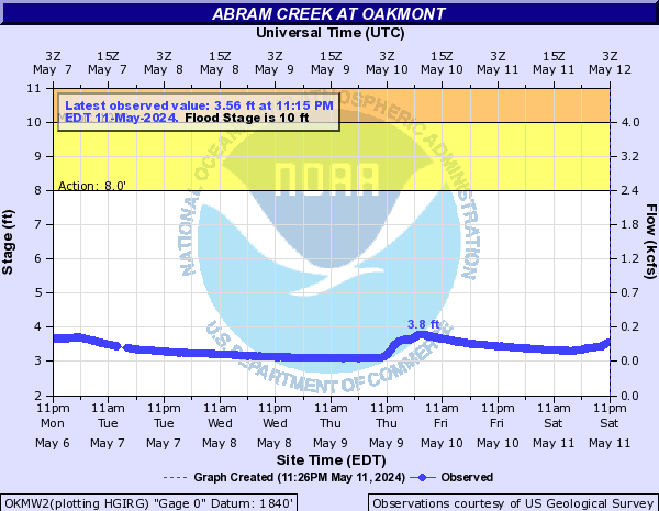
Abram Creek (Click on an image to go to hydrograph webpage)
OKMW2:
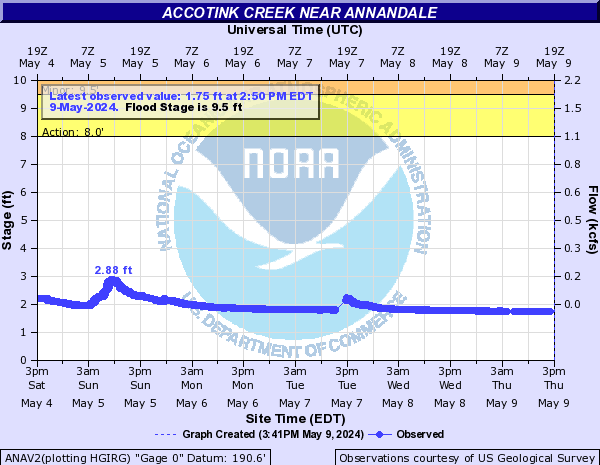
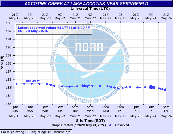
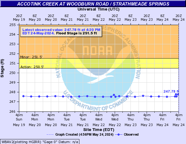
Accotink Creek (Click on an image to go to hydrograph webpage)
ANAV2:
LACV2:
WBAV2:
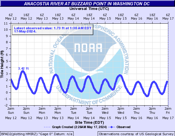
Anacostia River (Click on an image to go to hydrograph webpage)
BLDM2:

ANAD2:

BPAD2:
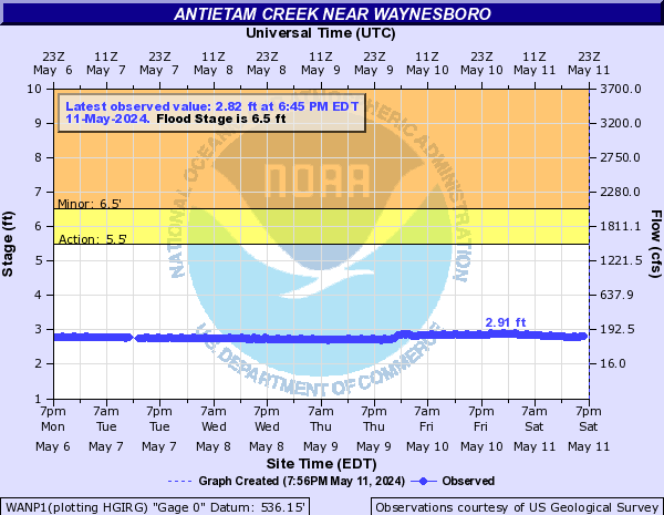
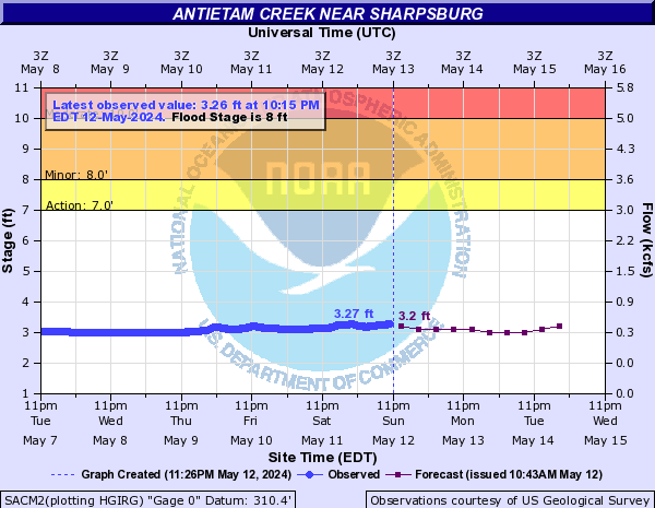
Antietam Creek (Click on an image to go to hydrograph webpage)
WANP1:
SACM2:
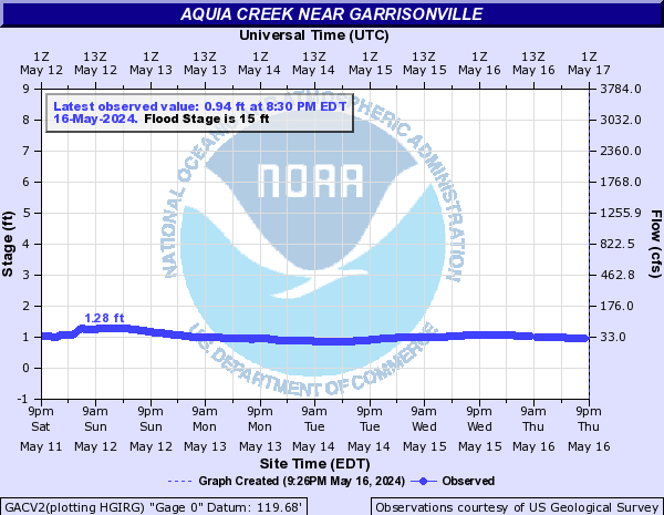
Aquia Creek (Click on an image to go to hydrograph webpage)
GACV2:
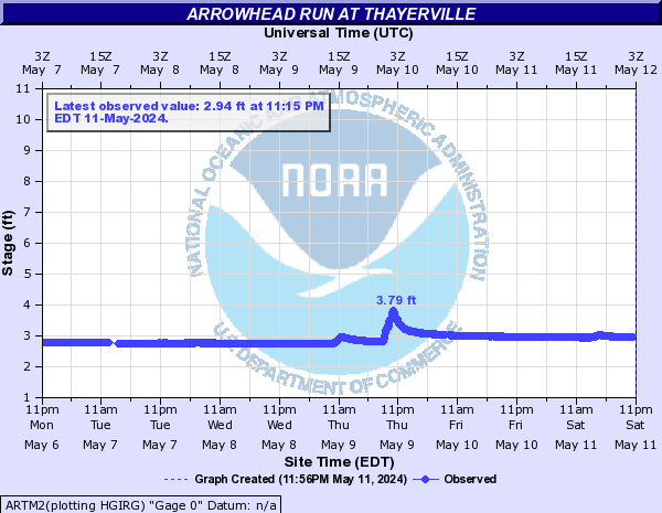
Arrowhead Run (Click on an image to go to hydrograph webpage)
ARTM2:
Back Branch (Click on an image to go to hydrograph webpage)
BRNM2:
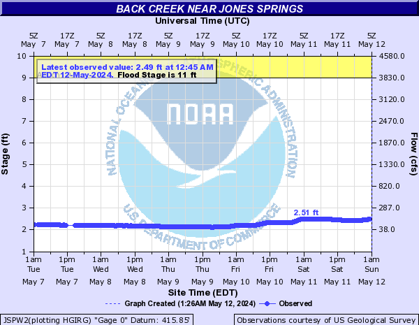
Back Creek (Click on an image to go to hydrograph webpage)
JSPW2:
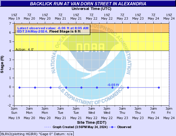
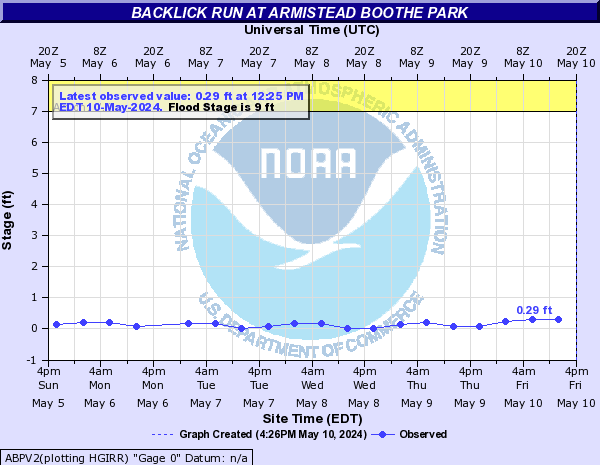
Backlick Run (Click on an image to go to hydrograph webpage)
BLRV2:
ABPV2:
Baisman Run (Click on an image to go to hydrograph webpage)
BRMM2:

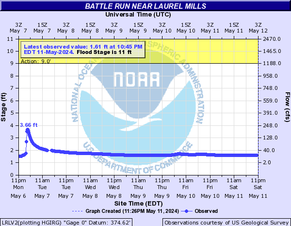
Battle Run (Click on an image to go to hydrograph webpage)
LRLV2:
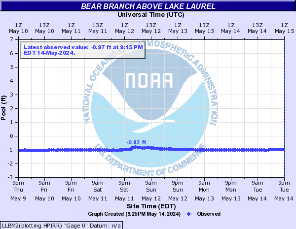
Bear Branch (Click on an image to go to hydrograph webpage)
LLBM2:
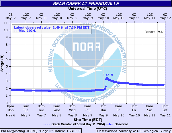
Bear Creek (Click on an image to go to hydrograph webpage)
BRCM2:
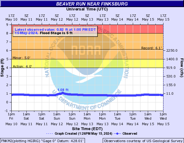
Beaver Run (Click on an image to go to hydrograph webpage)
FNKM2:
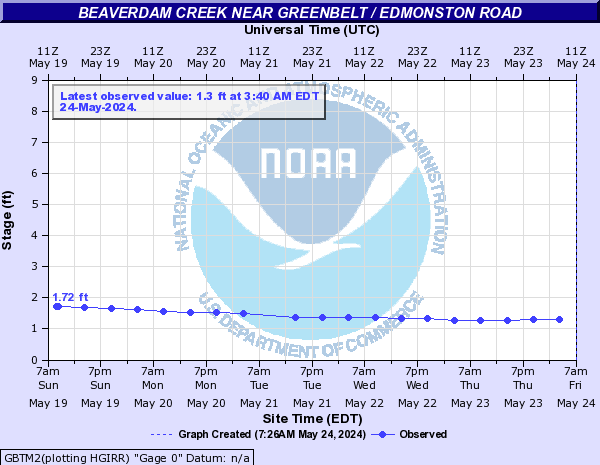
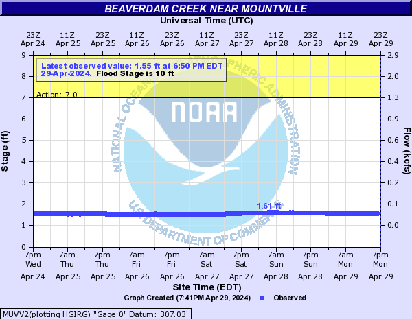
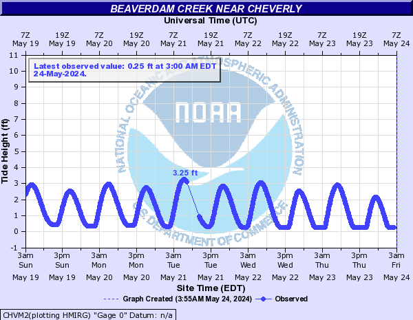
Beaverdam Creek (Click on an image to go to hydrograph webpage)
GBTM2:
MUVV2:
CHVM2:
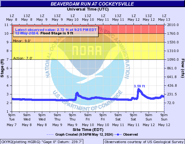
Beaverdam Run (Click on an image to go to hydrograph webpage)
CKYM2:
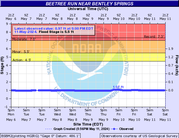
Beetree Run (Click on an image to go to hydrograph webpage)
BSBM2:
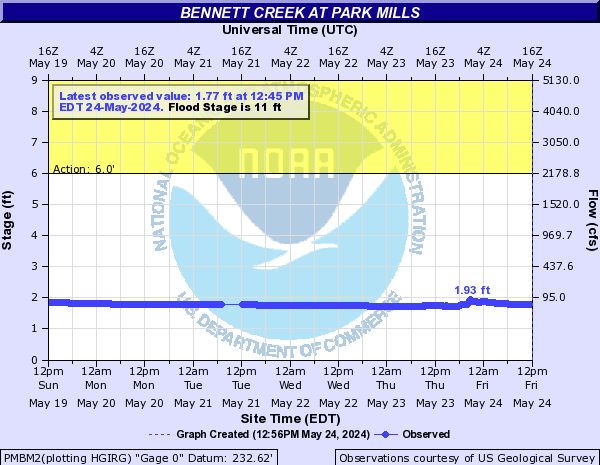
Bennett Creek (Click on an image to go to hydrograph webpage)
PMBM2:
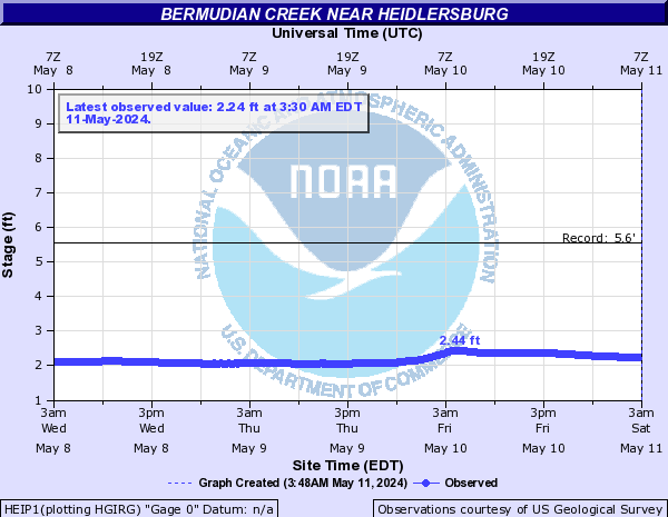
Bermudian Creek (Click on an image to go to hydrograph webpage)
HEIP1:
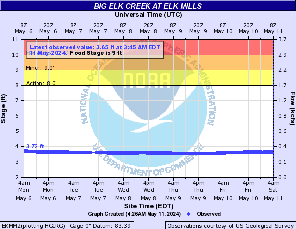
Big Elk Creek (Click on an image to go to hydrograph webpage)
EKMM2:
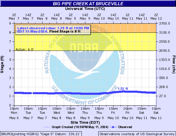
Big Pipe Creek (Click on an image to go to hydrograph webpage)
BRUM2:
Big Spring Run (Click on an image to go to hydrograph webpage)
BSRP1:

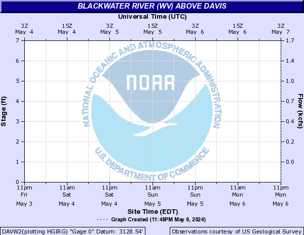
Blackwater River (WV) (Click on an image to go to hydrograph webpage)
BWRW2:
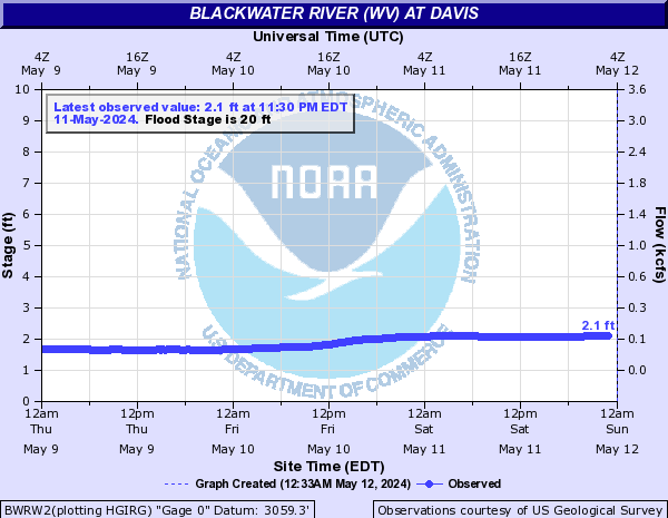
DAVW2:
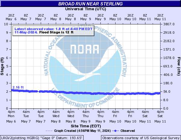
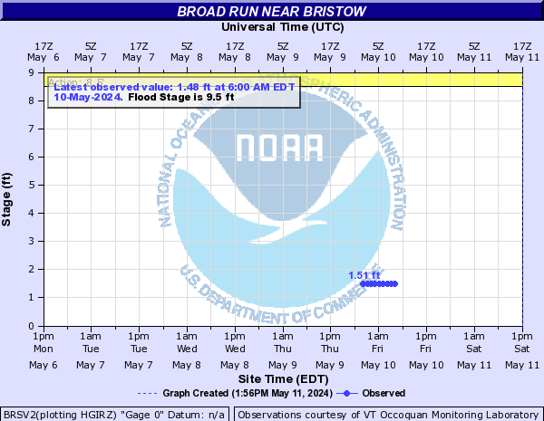
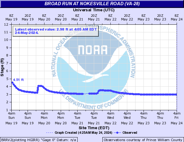
Broad Run (Click on an image to go to hydrograph webpage)
LRGV2:
BKLV2:

BRSV2:
BRRV2:
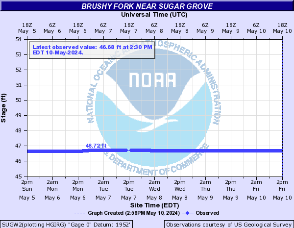
Brushy Fork (Click on an image to go to hydrograph webpage)
SUGW2:
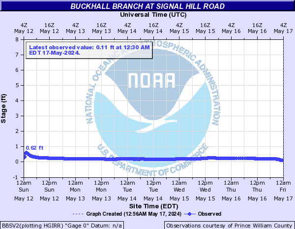
Buckhall Branch (Click on an image to go to hydrograph webpage)
BBSV2:
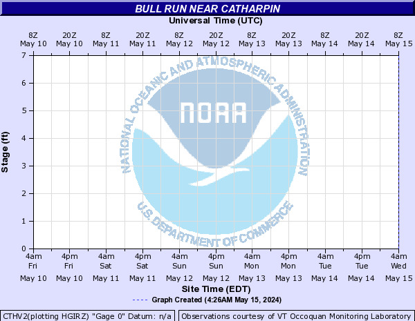
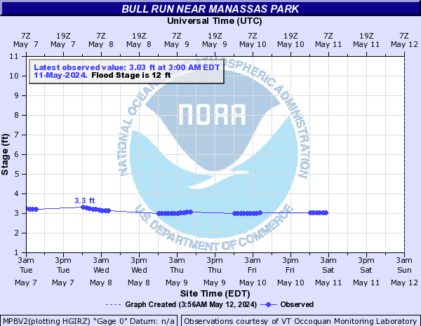
Bull Run (Click on an image to go to hydrograph webpage)
CTHV2:
MPBV2:
Bullpasture River (Click on an image to go to hydrograph webpage)
BPRV2:

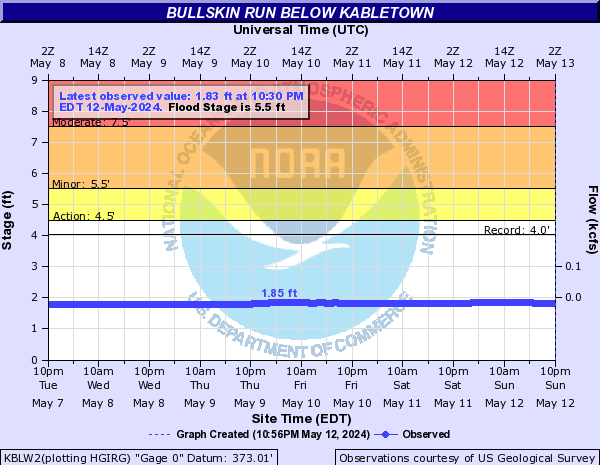
Bullskin Run (Click on an image to go to hydrograph webpage)
KBLW2:
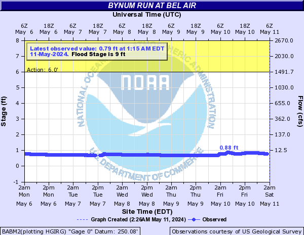
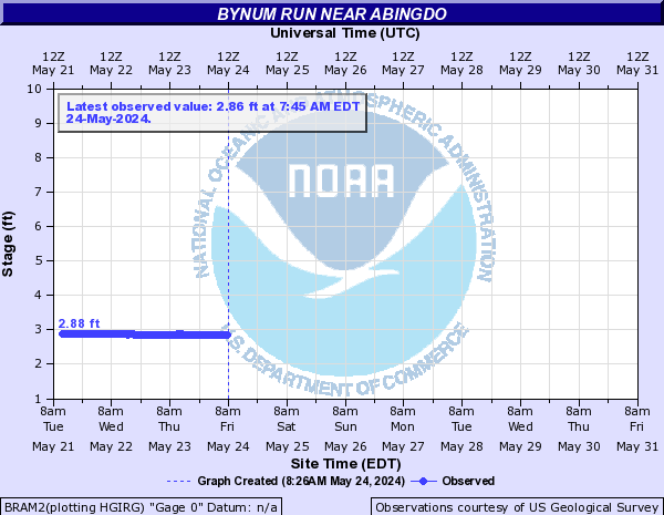
Bynum Run (Click on an image to go to hydrograph webpage)
BABM2:
BRAM2:
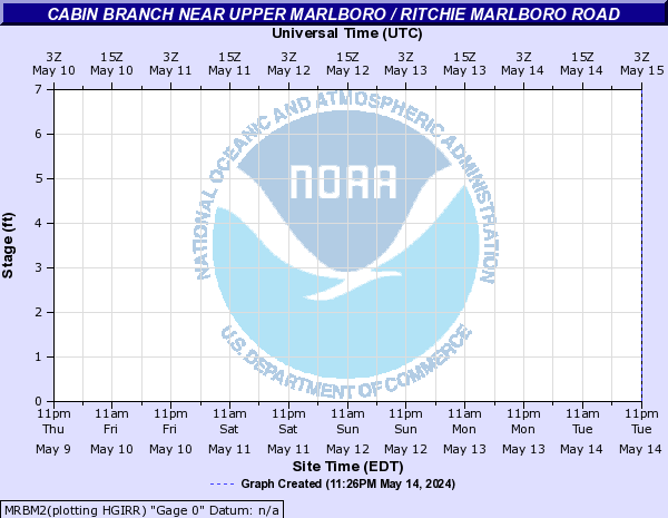
Cabin Branch (Click on an image to go to hydrograph webpage)
MRBM2:
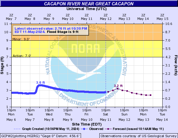
Cacapon River (Click on an image to go to hydrograph webpage)
GCPW2:
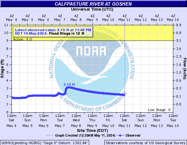
Calfpasture River (Click on an image to go to hydrograph webpage)
GOHV2:
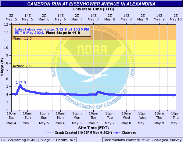
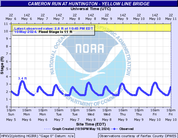
Cameron Run (Click on an image to go to hydrograph webpage)
ACRV2:
CRPV2:
HPKV2:
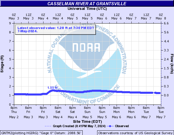
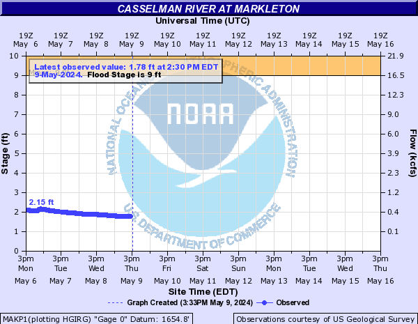
Casselman River (Click on an image to go to hydrograph webpage)
GNTM2:
MAKP1:
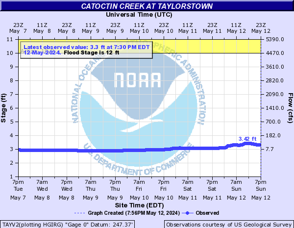
Catoctin Creek (Click on an image to go to hydrograph webpage)
TAYV2:
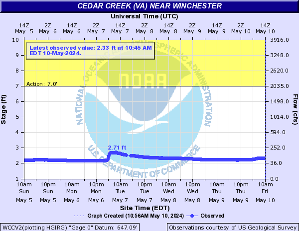
Cedar Creek (VA) (Click on an image to go to hydrograph webpage)
WCCV2:
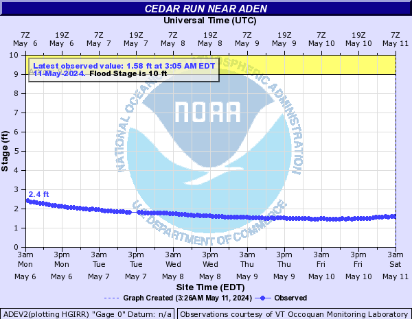
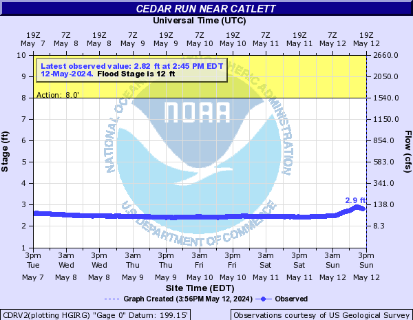
Cedar Run (Click on an image to go to hydrograph webpage)
ADEV2:
CDRV2:
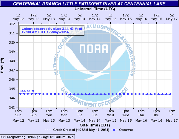
Centennial Branch Little Patuxent River (Click on an image to go to hydrograph webpage)
CBPM2:
Central PA Dams (Click on an image to go to hydrograph webpage)
YRKP1:
YGBP1:
Cheat River (Click on an image to go to hydrograph webpage)
JBOW2:
Cherry Creek (Click on an image to go to hydrograph webpage)
CCMM2:
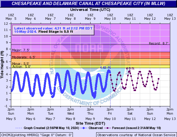
Chesapeake and Delaware Canal (Click on an image to go to hydrograph webpage)
CHCM2:
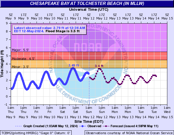
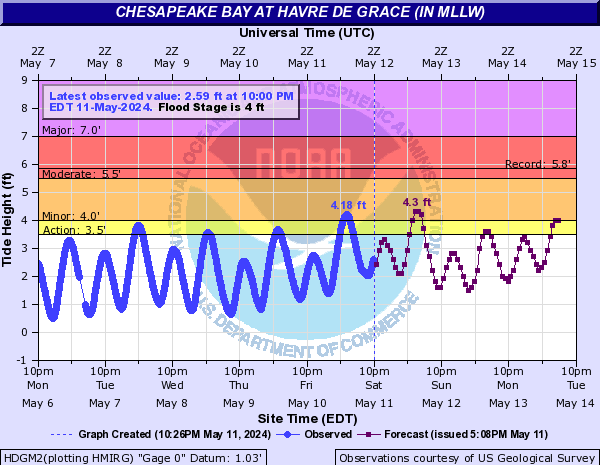
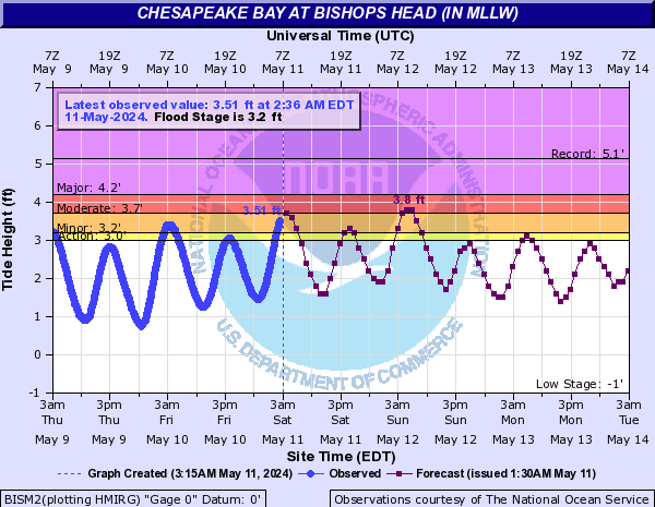
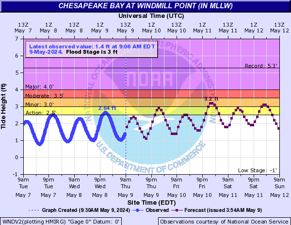
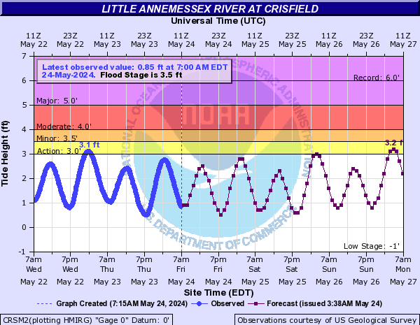
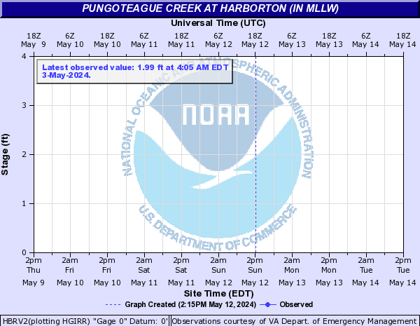
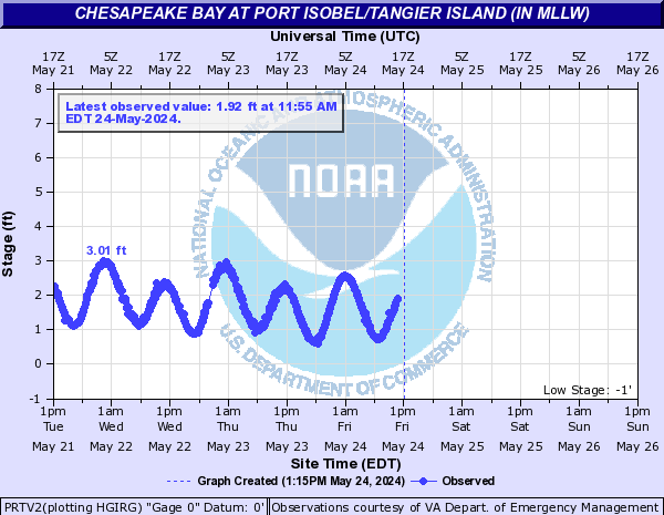
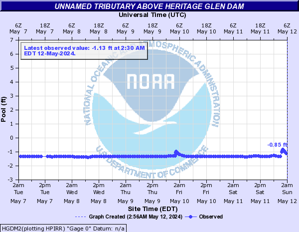
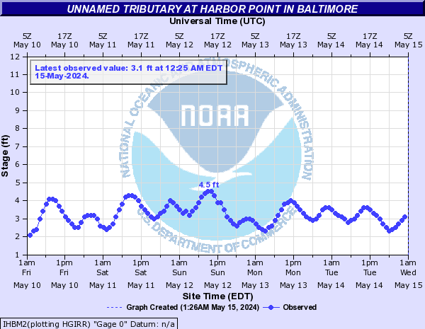
Chesapeake Bay (Click on an image to go to hydrograph webpage)
TCBM2:
HDGM2:
BISM2:
CAMM2:

WNDV2:
CRSM2:
HBRV2:
PRTV2:
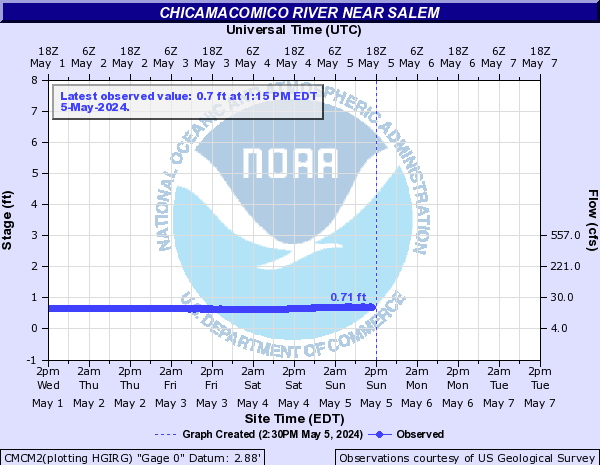
Chicamacomico River (Click on an image to go to hydrograph webpage)
CMCM2:
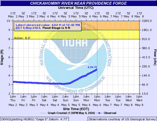
Chickahominy River (Click on an image to go to hydrograph webpage)
CKHV2:
Christians Creek (Click on an image to go to hydrograph webpage)
BRAV2:
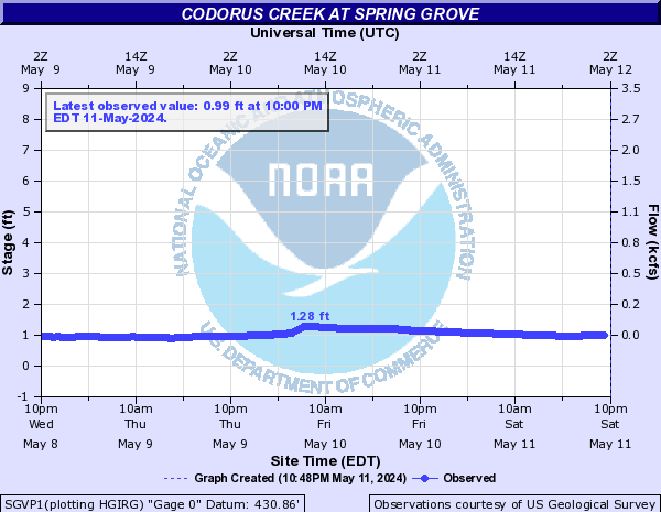
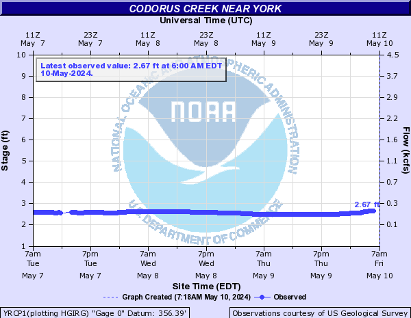
Codorus Creek (Click on an image to go to hydrograph webpage)
SGVP1:
YRCP1:
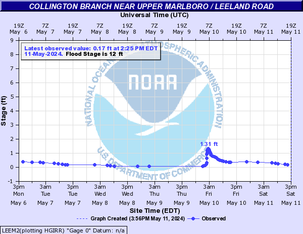
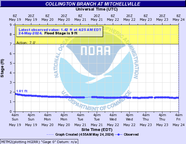
Collington Branch (Click on an image to go to hydrograph webpage)
LEEM2:
MITM2:
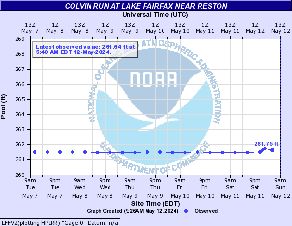
Colvin Run (Click on an image to go to hydrograph webpage)
LFFV2:
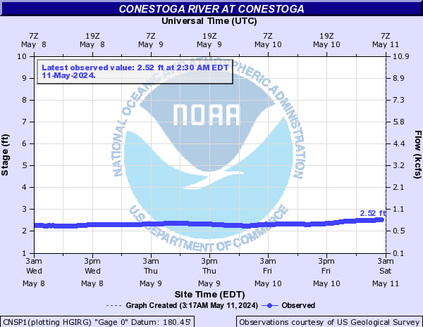
Conestoga River (Click on an image to go to hydrograph webpage)
CNSP1:
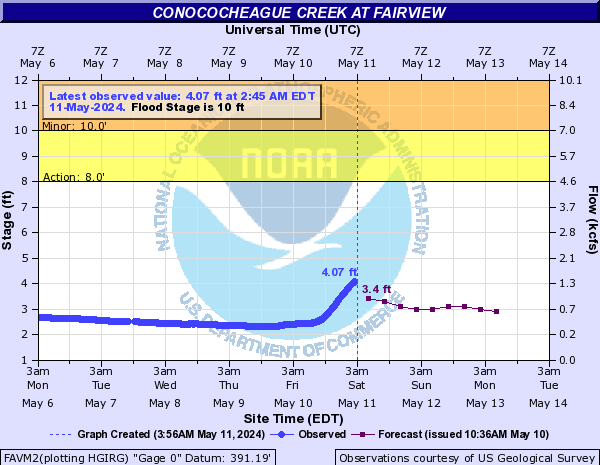
Conococheague Creek (Click on an image to go to hydrograph webpage)
FAVM2:
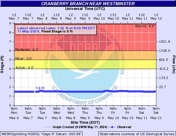
Cranberry Branch (Click on an image to go to hydrograph webpage)
WESM2:
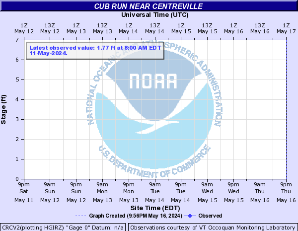
Cub Run (Click on an image to go to hydrograph webpage)
CRCV2:
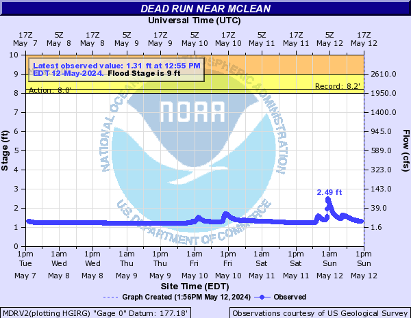
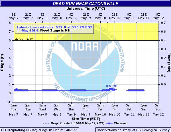
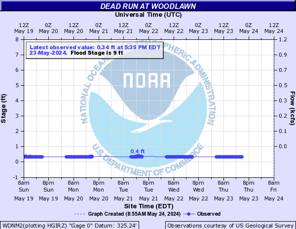
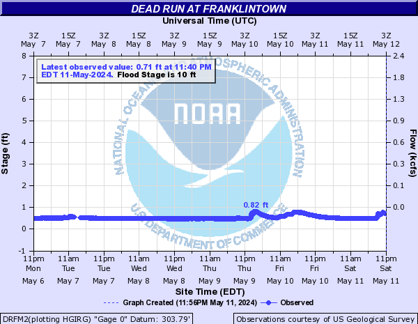
Dead Run (Click on an image to go to hydrograph webpage)
MDRV2:
DEDM2:
WDNM2:
DRFM2:
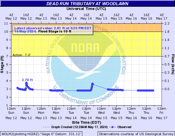
Dead Run Tributary (Click on an image to go to hydrograph webpage)
WDLM2:

WOLM2:
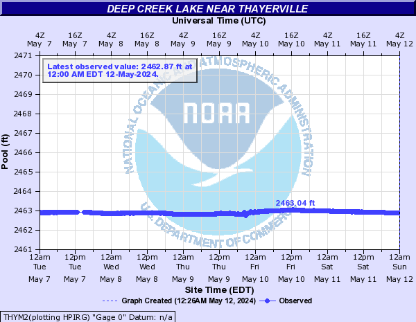
Deep Creek Lake (Click on an image to go to hydrograph webpage)
THYM2:
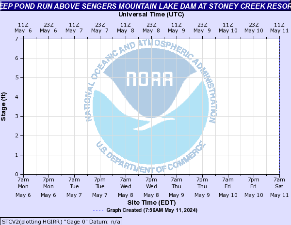
Deep Pond Run (Click on an image to go to hydrograph webpage)
STCV2:
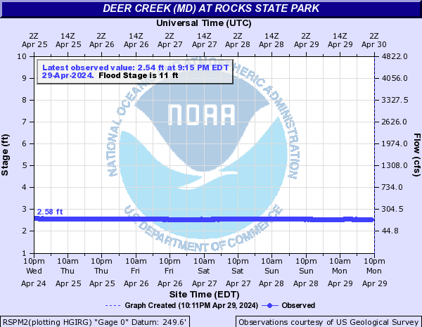
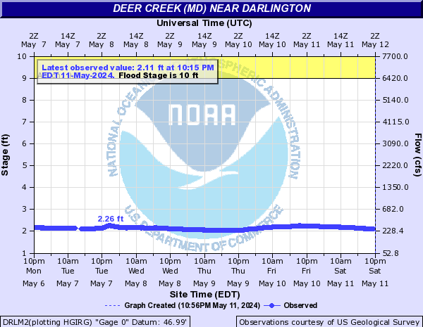
Deer Creek (MD) (Click on an image to go to hydrograph webpage)
RSPM2:
DRLM2:
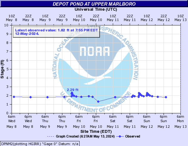
Depot Pond (Click on an image to go to hydrograph webpage)
DPNM2:
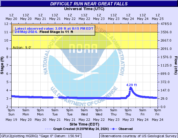
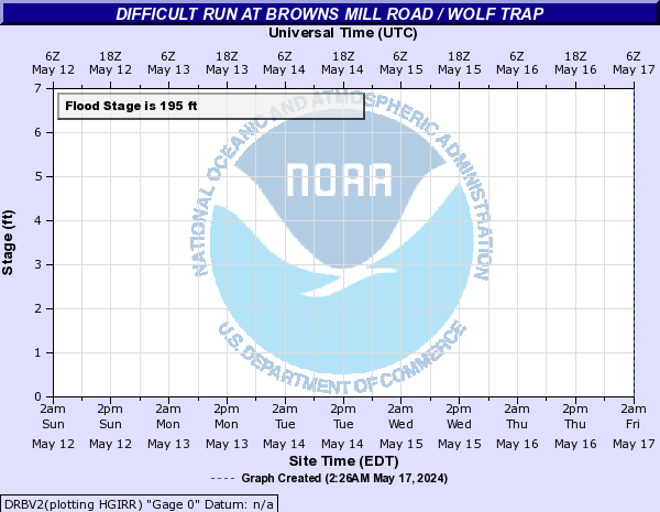
Difficult Run (Click on an image to go to hydrograph webpage)
GFLV2:
DRBV2:
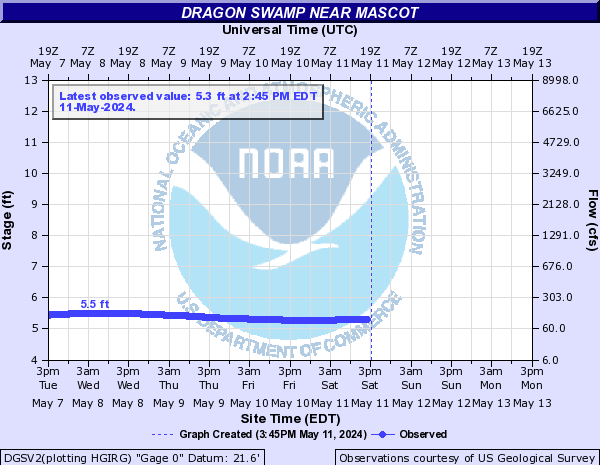
Dragon Swamp (Click on an image to go to hydrograph webpage)
DGSV2:
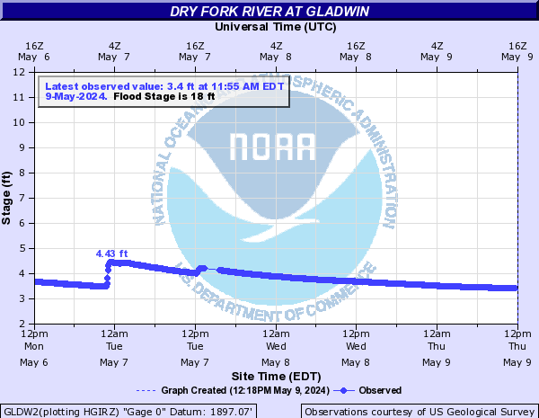
Dry Fork River (Click on an image to go to hydrograph webpage)
GLDW2:
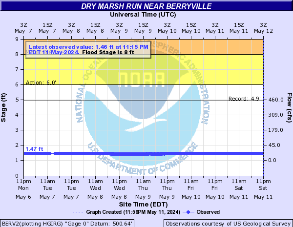
Dry Marsh Run (Click on an image to go to hydrograph webpage)
BERV2:
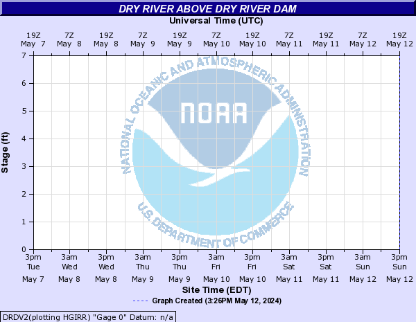
Dry River (Click on an image to go to hydrograph webpage)
DRDV2:
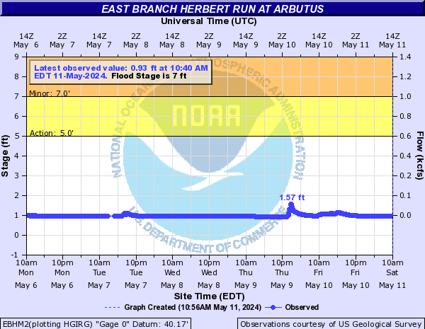
East Branch Herbert Run (Click on an image to go to hydrograph webpage)
EBHM2:
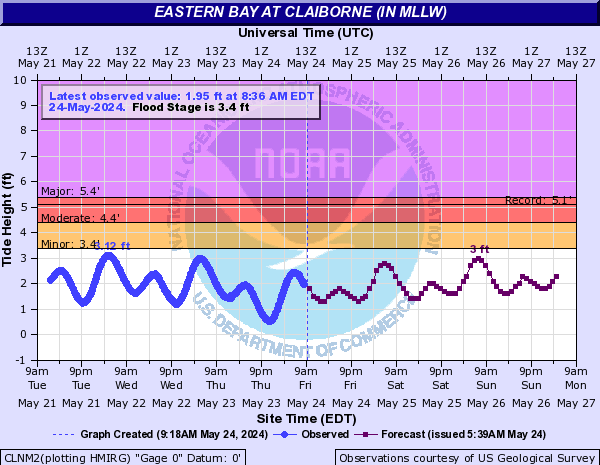
Eastern Bay (Click on an image to go to hydrograph webpage)
CLNM2:
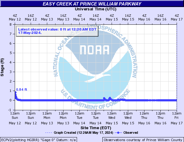
Easy Creek (Click on an image to go to hydrograph webpage)
ECPV2:
Falling Creek (Click on an image to go to hydrograph webpage)
FCLV2:
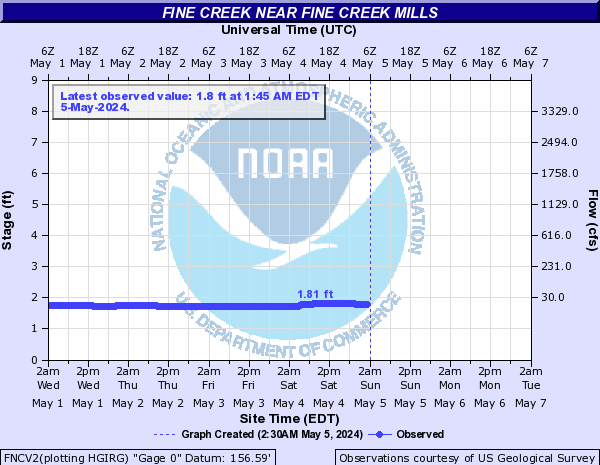
Fine Creek (Click on an image to go to hydrograph webpage)
FNCV2:
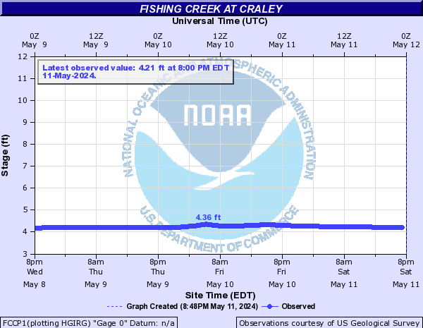
Fishing Creek (Click on an image to go to hydrograph webpage)
FCCP1:
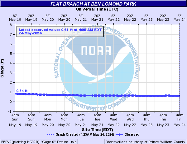
Flat Branch (Click on an image to go to hydrograph webpage)
FBPV2:
FLBV2:
UTFV2:

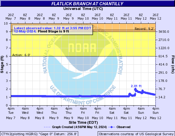
Flatlick Branch (Click on an image to go to hydrograph webpage)
CTYV2:
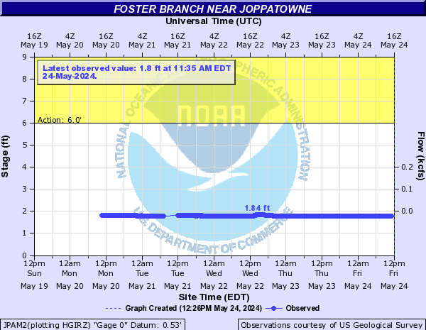
Foster Branch (Click on an image to go to hydrograph webpage)
JPAM2:
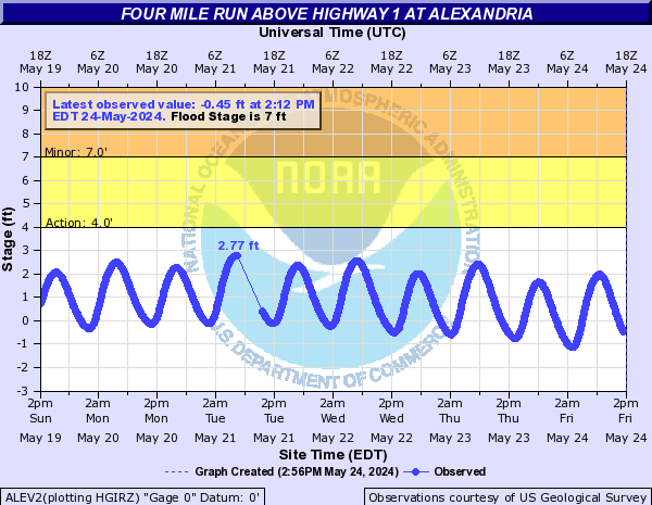
Four Mile Run (Click on an image to go to hydrograph webpage)
AFRV2:
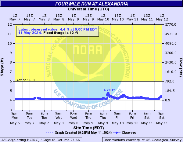
ALEV2:
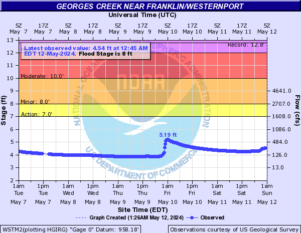
Georges Creek (Click on an image to go to hydrograph webpage)
WSTM2:
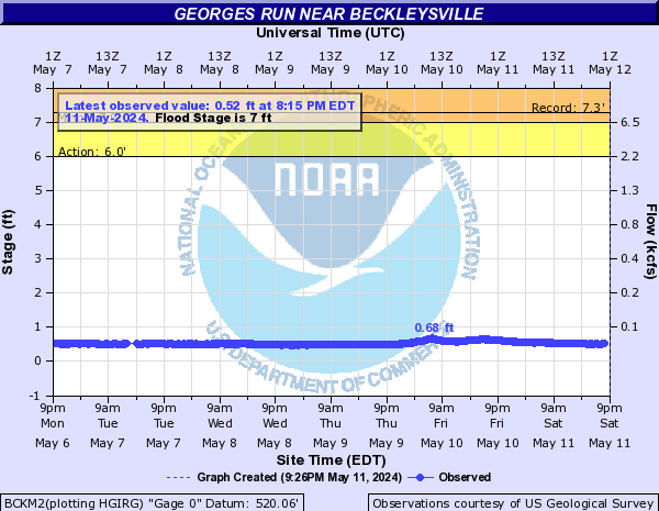
Georges Run (Click on an image to go to hydrograph webpage)
BCKM2:
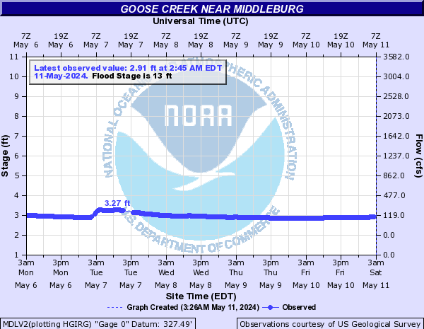
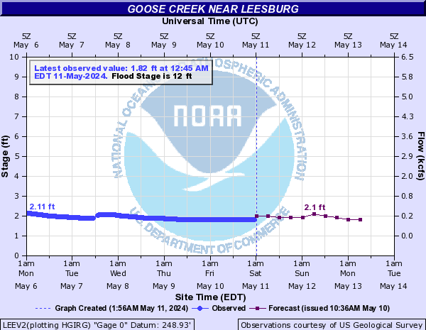
Goose Creek (Click on an image to go to hydrograph webpage)
MDLV2:
LEEV2:
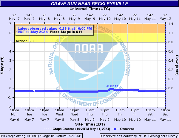
Grave Run (Click on an image to go to hydrograph webpage)
BKYM2:
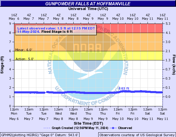
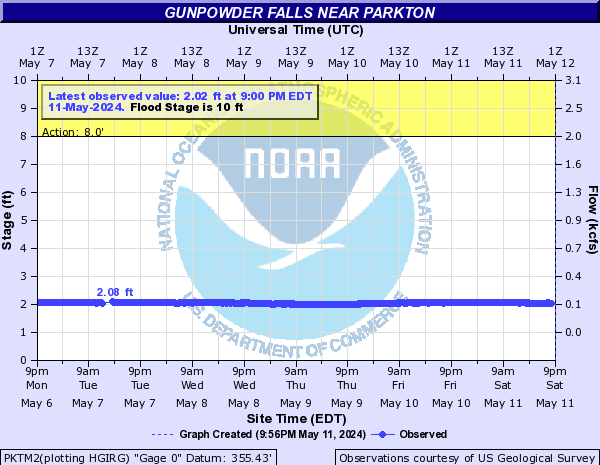
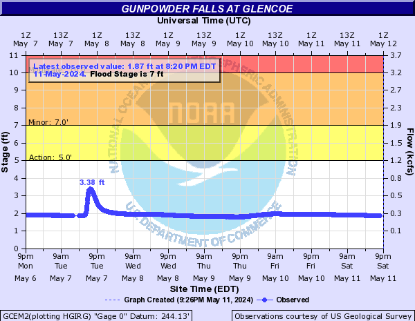
Gunpowder Falls (Click on an image to go to hydrograph webpage)
GFHM2:
PKTM2:
GCEM2:
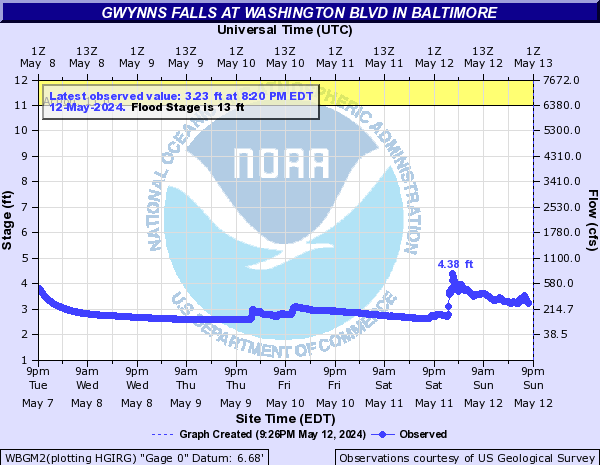
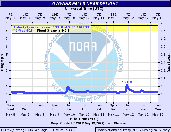
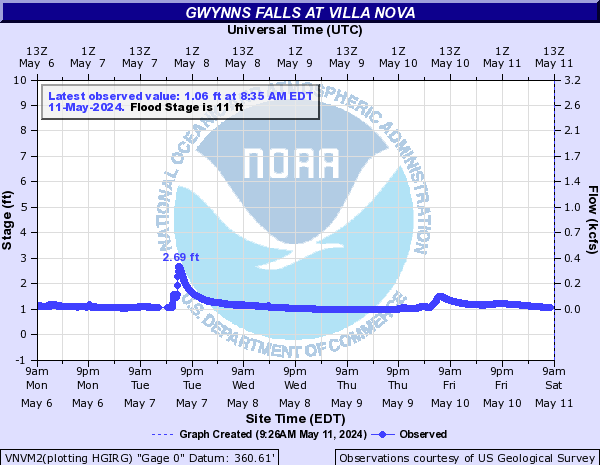
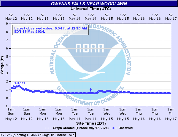
Gwynns Falls (Click on an image to go to hydrograph webpage)
WBGM2:
GLGM2:
DELM2:
VNVM2:
GFAM2:

GFGM2:
Gwynns Falls Tributary (Click on an image to go to hydrograph webpage)
MCDM2:

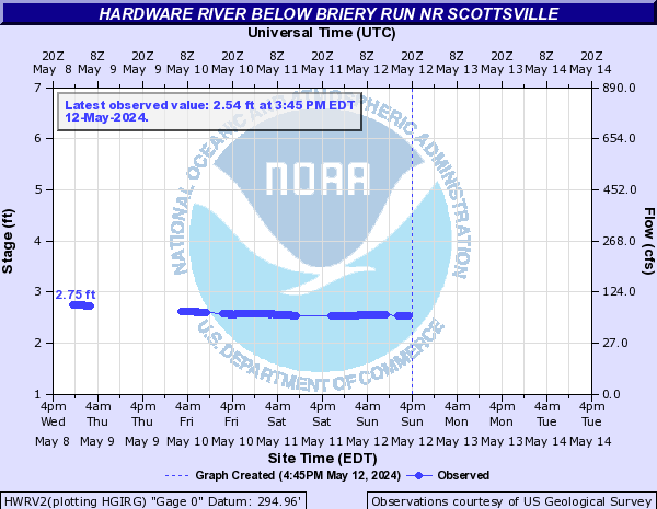
Hardware River (Click on an image to go to hydrograph webpage)
HWRV2:
Harris Creek (Click on an image to go to hydrograph webpage)
HCRV2:

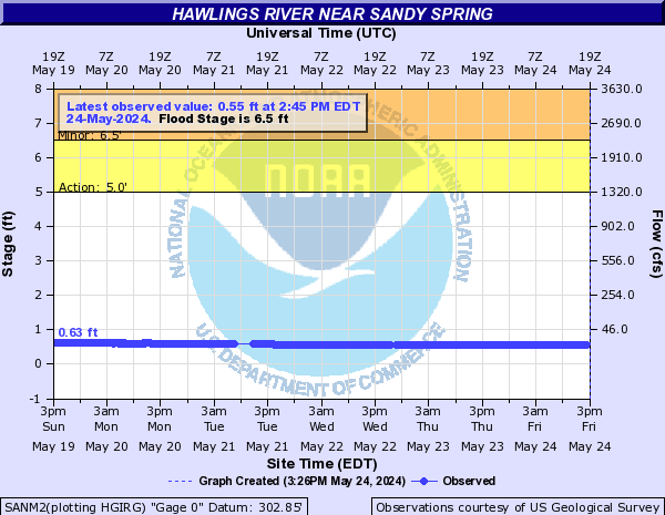
Hawlings River (Click on an image to go to hydrograph webpage)
SANM2:
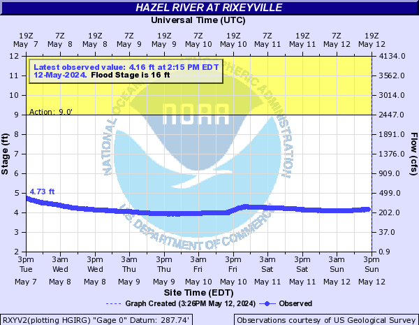
Hazel River (Click on an image to go to hydrograph webpage)
RXYV2:
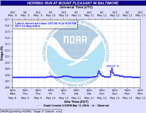
Herring Run (Click on an image to go to hydrograph webpage)
HREM2:
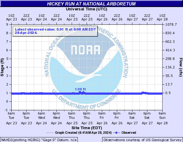
Hickey Run (Click on an image to go to hydrograph webpage)
NAHD2:
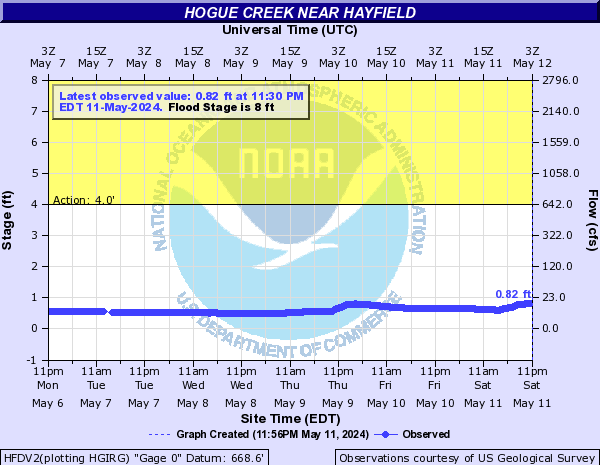
Hogue Creek (Click on an image to go to hydrograph webpage)
HFDV2:
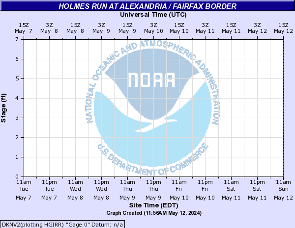
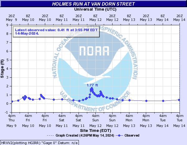
Holmes Run (Click on an image to go to hydrograph webpage)
DKNV2:
HRVV2:
FVLV2:

Hone Quarry Run (Click on an image to go to hydrograph webpage)
HQDV2:

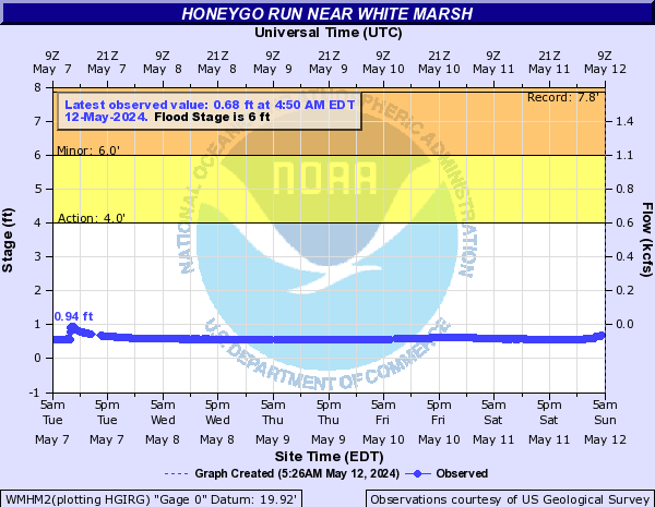
Honeygo Run (Click on an image to go to hydrograph webpage)
WMHM2:
Hooes Run (Click on an image to go to hydrograph webpage)
HROV2:
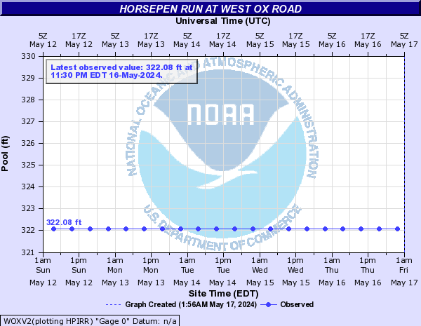
Horsepen Run (Click on an image to go to hydrograph webpage)
WOXV2:
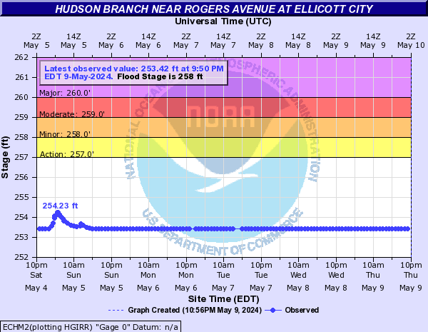
Hudson Branch (Click on an image to go to hydrograph webpage)
ECHM2:
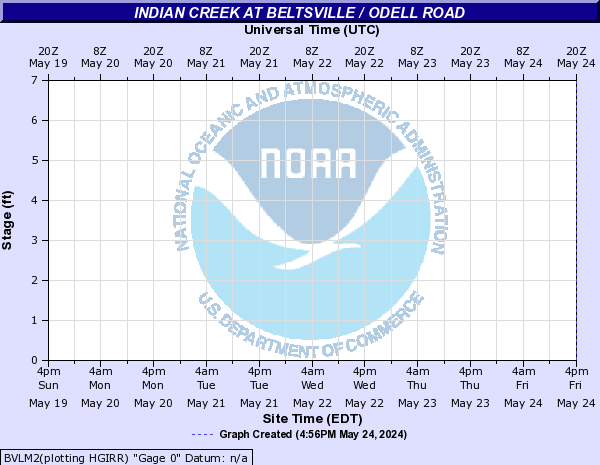
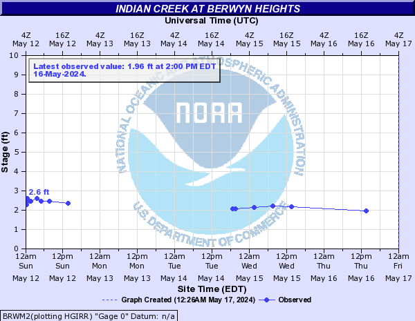
Indian Creek (Click on an image to go to hydrograph webpage)
BVLM2:
BRWM2:
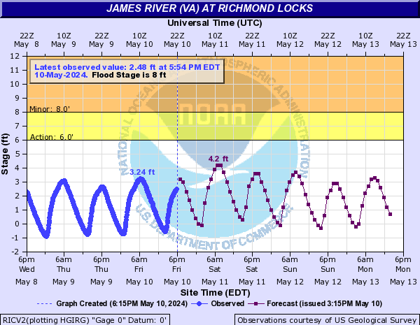
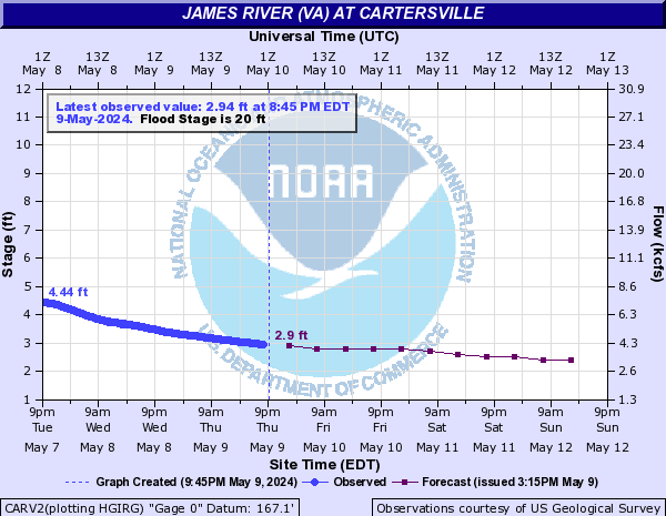
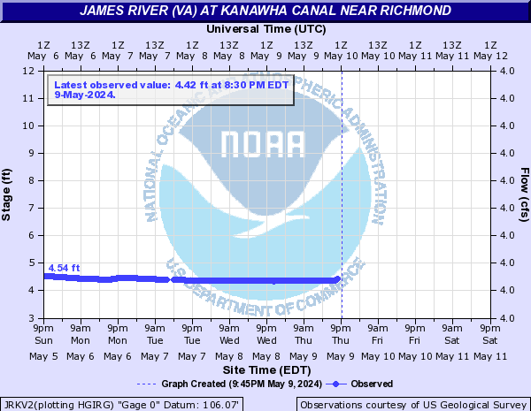
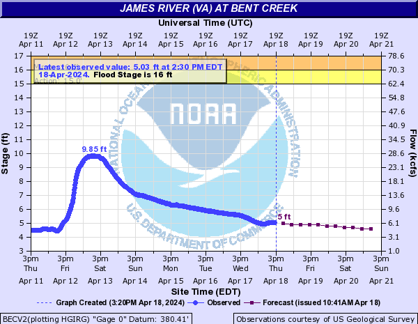
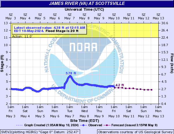
James River (VA) (Click on an image to go to hydrograph webpage)
RICV2:
CARV2:
HRKV2:

JRKV2:
BECV2:
RMDV2:

SVEV2:
BREV2:
James Run (Click on an image to go to hydrograph webpage)
BLCM2:
Jennings Branch (Click on an image to go to hydrograph webpage)
CHHV2:
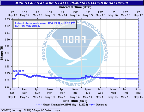
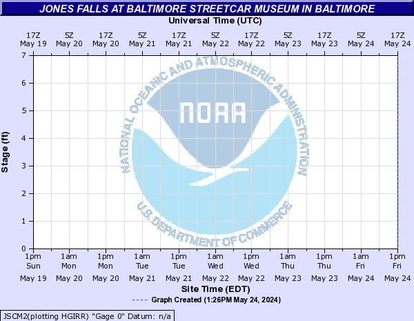
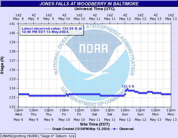
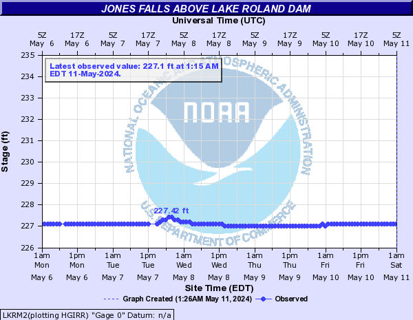
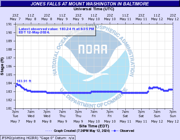
Jones Falls (Click on an image to go to hydrograph webpage)
SRTM2:
JONM2:
JSCM2:
UNAM2:
LKRM2:
JFSM2:
JFTM2:

Jones Hollow (Click on an image to go to hydrograph webpage)
JHDV2:

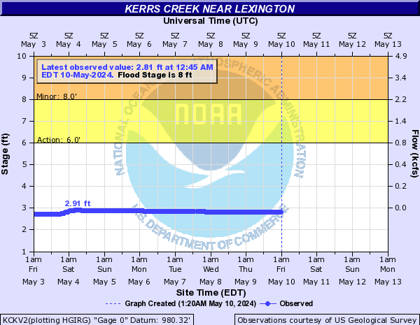
Kerrs Creek (Click on an image to go to hydrograph webpage)
KCKV2:
Kettle Run (Click on an image to go to hydrograph webpage)
BKRV2:

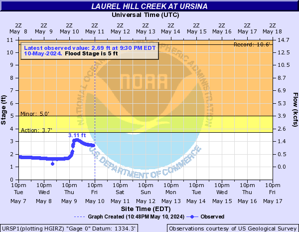
Laurel Hill Creek (Click on an image to go to hydrograph webpage)
URSP1:
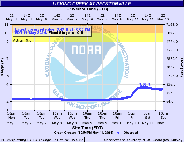
Licking Creek (Click on an image to go to hydrograph webpage)
PECM2:
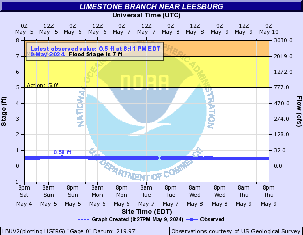
Limestone Branch (Click on an image to go to hydrograph webpage)
LBUV2:
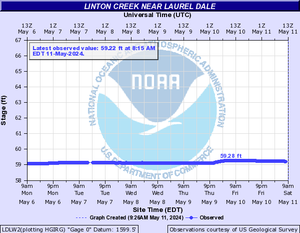
Linton Creek (Click on an image to go to hydrograph webpage)
LDLW2:
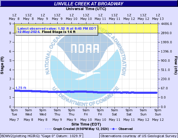
Linville Creek (Click on an image to go to hydrograph webpage)
BDWV2:
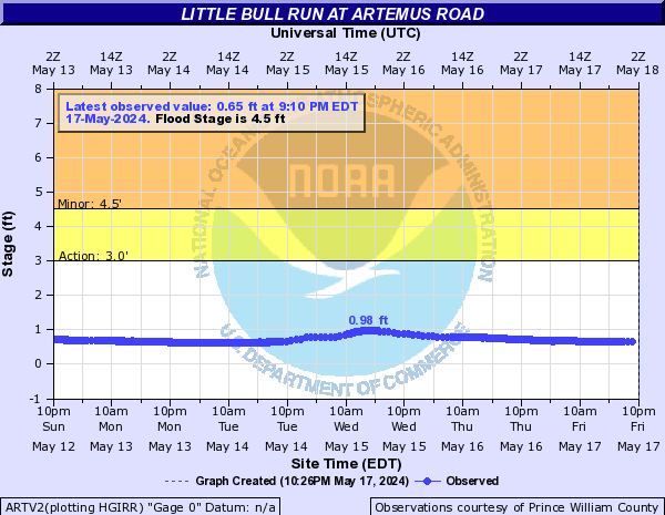
Little Bull Run (Click on an image to go to hydrograph webpage)
ARTV2:
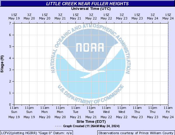
Little Creek (Click on an image to go to hydrograph webpage)
LCUV2:

LCFV2:
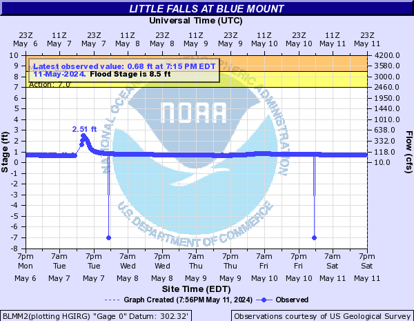
Little Falls (Click on an image to go to hydrograph webpage)
BLMM2:
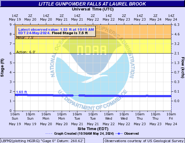
Little Gunpowder Falls (Click on an image to go to hydrograph webpage)
LBFM2:
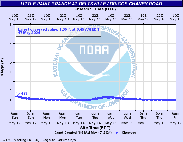
Little Paint Branch (Click on an image to go to hydrograph webpage)
CVTM2:
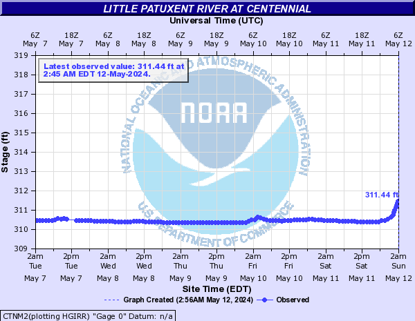
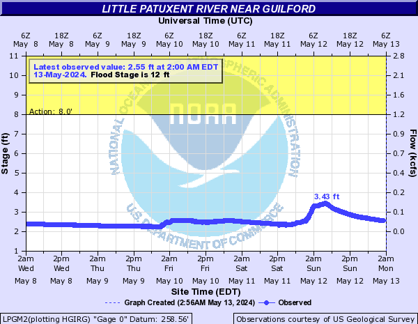
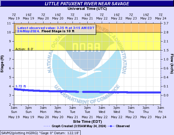
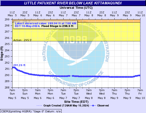
Little Patuxent River (Click on an image to go to hydrograph webpage)
CTNM2:
LPGM2:
SAVM2:
SMPM2:
CSEM2:
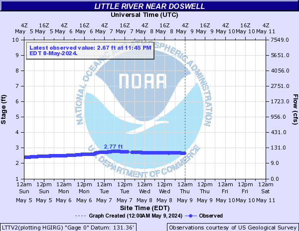
Little River (Click on an image to go to hydrograph webpage)
LTTV2:
HRSV2:

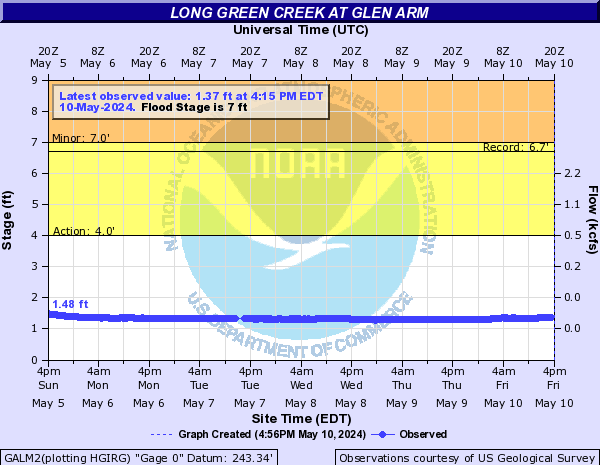
Long Green Creek (Click on an image to go to hydrograph webpage)
GALM2:
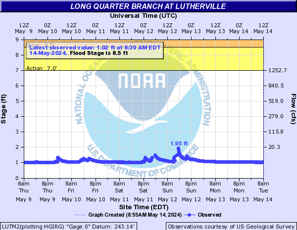
Long Quarter Branch (Click on an image to go to hydrograph webpage)
LUTM2:
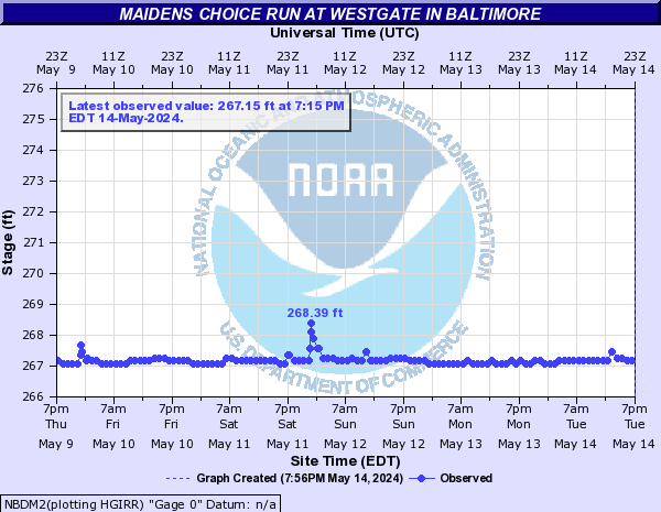
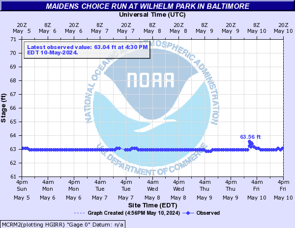
Maidens Choice Run (Click on an image to go to hydrograph webpage)
NBDM2:
MCRM2:
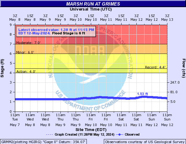
Marsh Run (Click on an image to go to hydrograph webpage)
GRMM2:
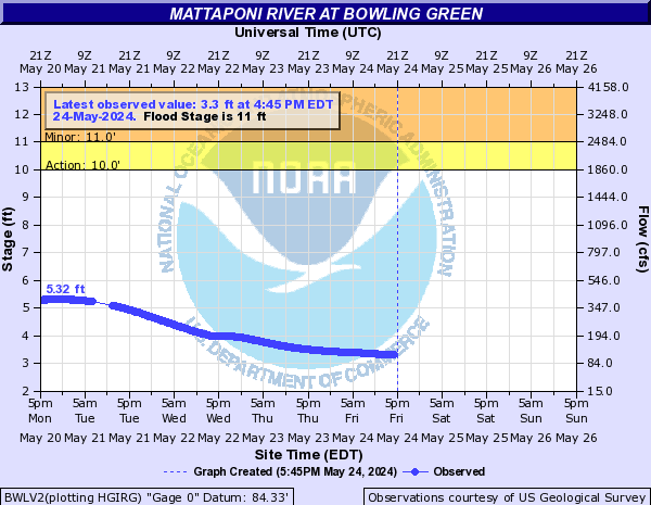
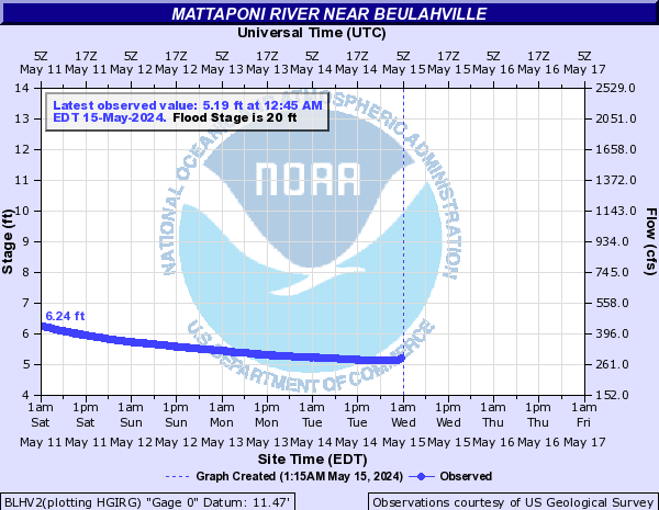
Mattaponi River (Click on an image to go to hydrograph webpage)
BWLV2:
BLHV2:
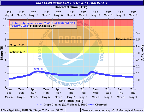
Mattawoman Creek (Click on an image to go to hydrograph webpage)
POMM2:
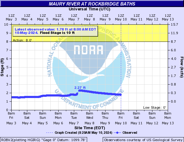
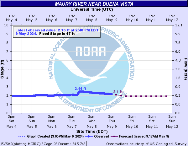
Maury River (Click on an image to go to hydrograph webpage)
ROBV2:
BVSV2:
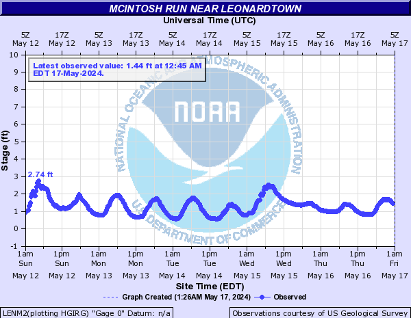
McIntosh Run (Click on an image to go to hydrograph webpage)
LENM2:
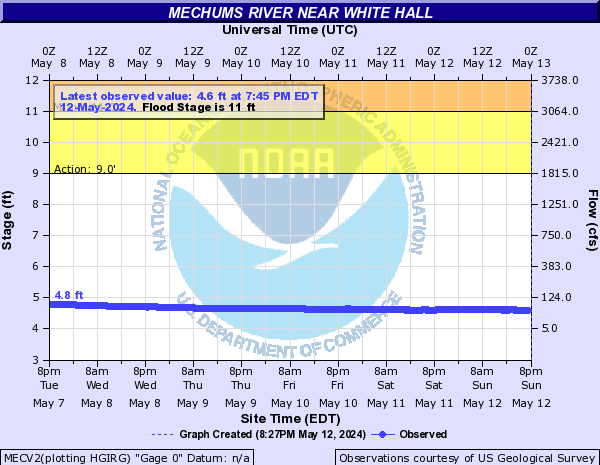
Mechums River (Click on an image to go to hydrograph webpage)
MECV2:
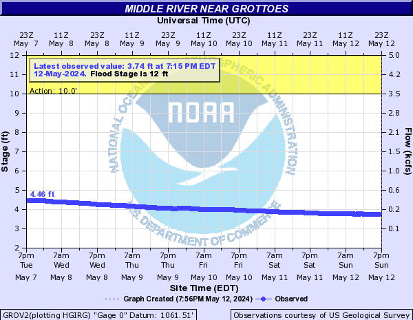
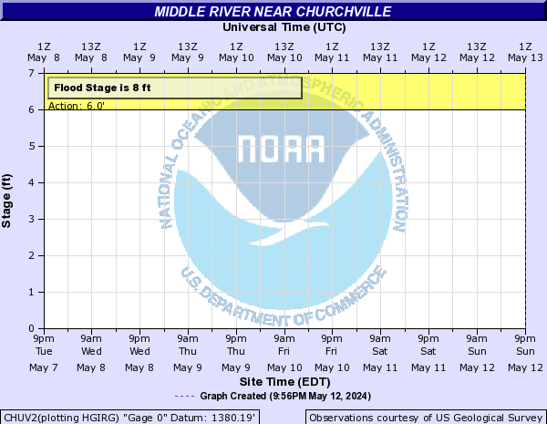
Middle River (Click on an image to go to hydrograph webpage)
GROV2:
CHUV2:
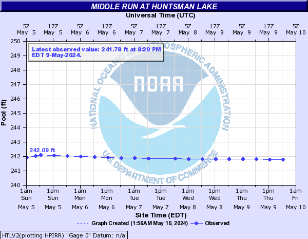
Middle Run (Click on an image to go to hydrograph webpage)
HTLV2:
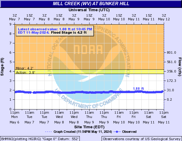
Mill Creek (WV) (Click on an image to go to hydrograph webpage)
BHMW2:
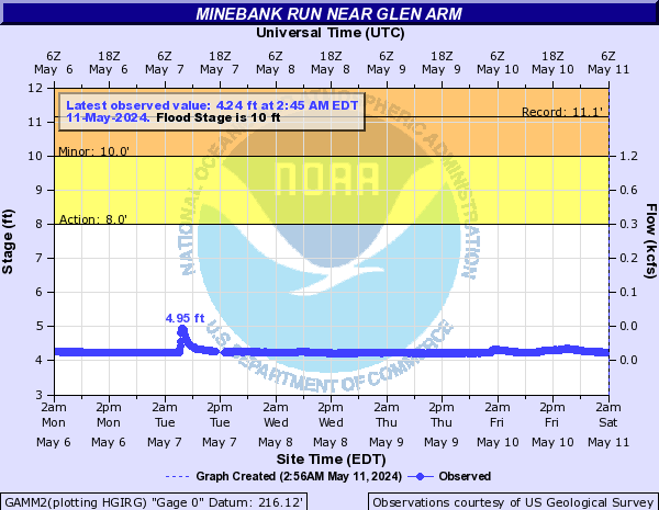
Minebank Run (Click on an image to go to hydrograph webpage)
GAMM2:
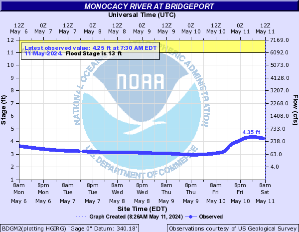
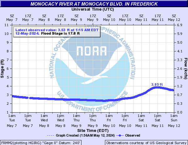
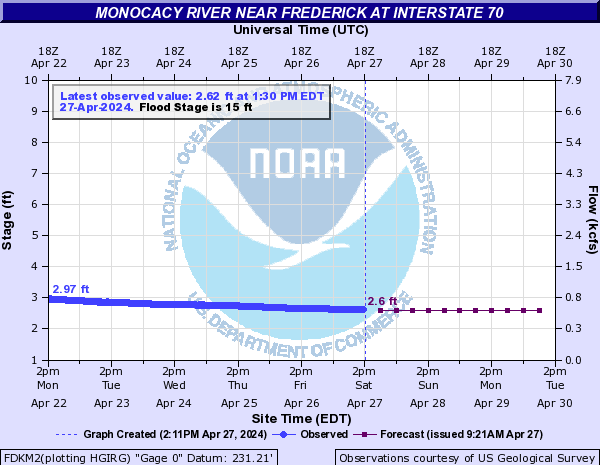
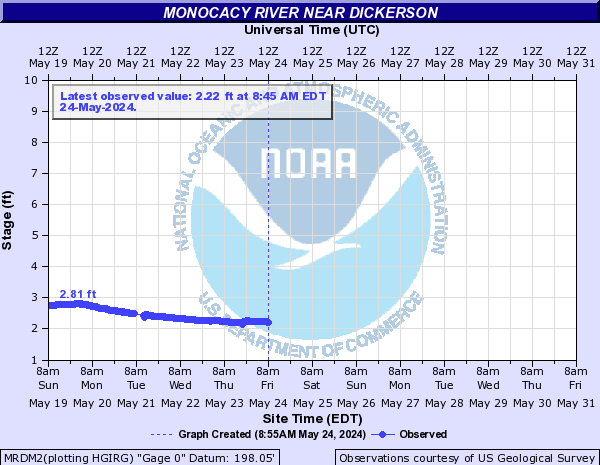
Monocacy River (Click on an image to go to hydrograph webpage)
BDGM2:
FRMM2:
FDKM2:
MRDM2:
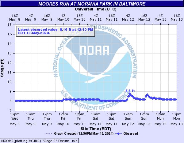
Moores Run (Click on an image to go to hydrograph webpage)
MOOM2:
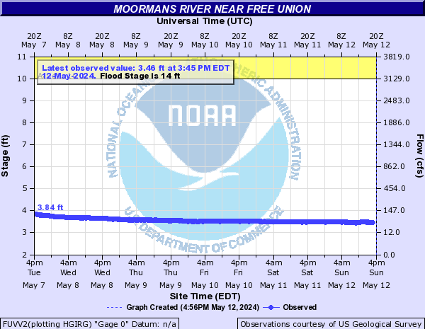
Moormans River (Click on an image to go to hydrograph webpage)
FUVV2:
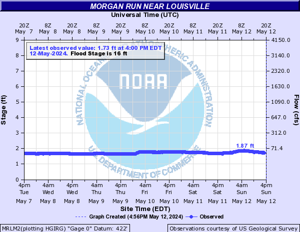
Morgan Run (Click on an image to go to hydrograph webpage)
MRLM2:
Muddy Creek (Click on an image to go to hydrograph webpage)
MUDV2:

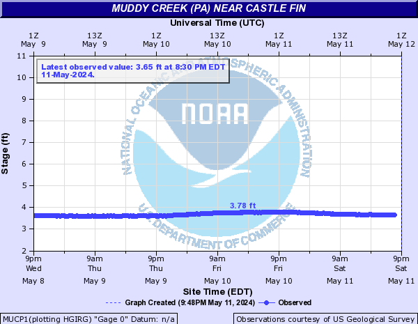
Muddy Creek (PA) (Click on an image to go to hydrograph webpage)
MUCP1:
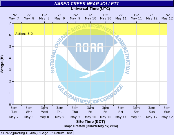
Naked Creek (Click on an image to go to hydrograph webpage)
SHNV2:
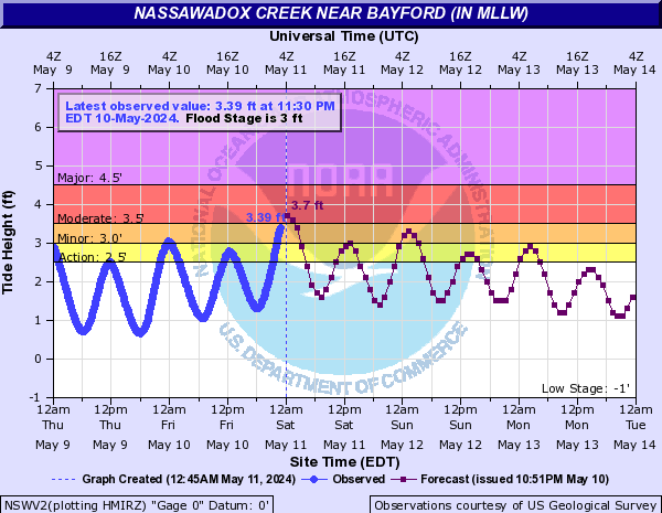
Nassawadox Creek (Click on an image to go to hydrograph webpage)
NSWV2:
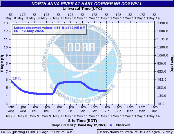
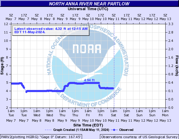
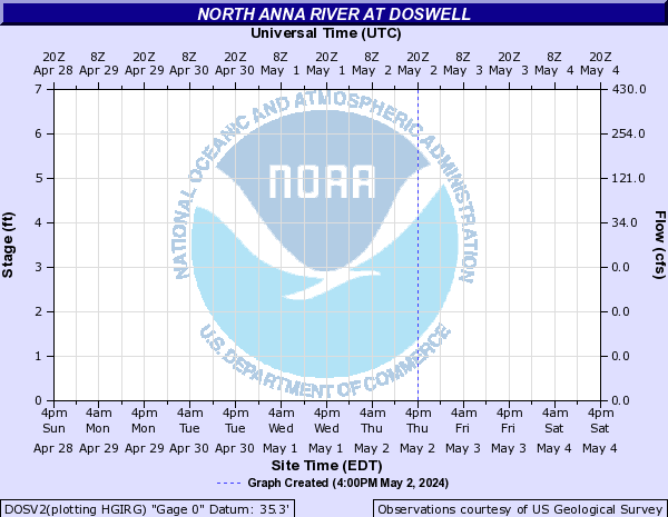
North Anna River (Click on an image to go to hydrograph webpage)
HRCV2:
PARV2:
DOSV2:
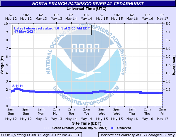
North Branch Patapsco River (Click on an image to go to hydrograph webpage)
MFEM2:

CDHM2:
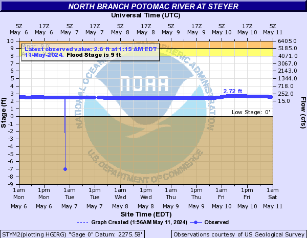
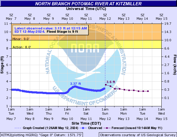
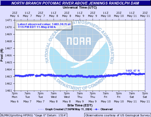
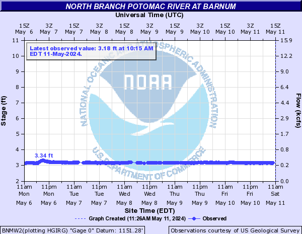
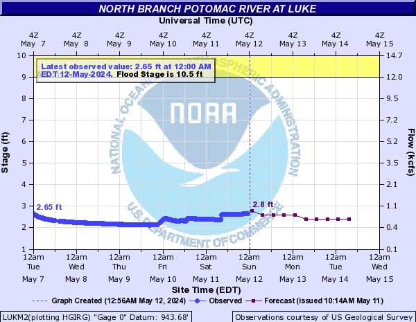
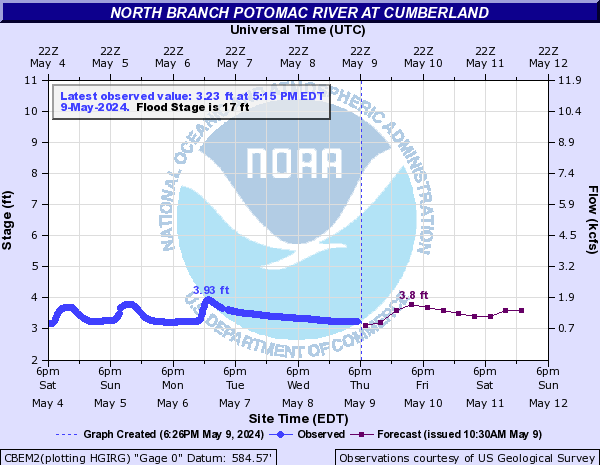
North Branch Potomac River (Click on an image to go to hydrograph webpage)
STYM2:
KITM2:
BLMW2:
BNMW2:
LUKM2:
CBEM2:
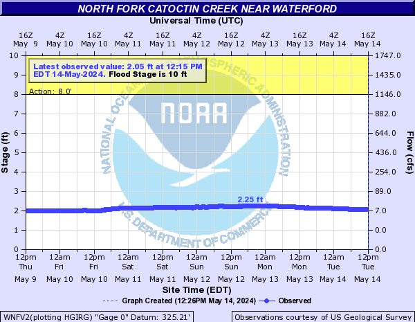
North Fork Catoctin Creek (Click on an image to go to hydrograph webpage)
WNFV2:
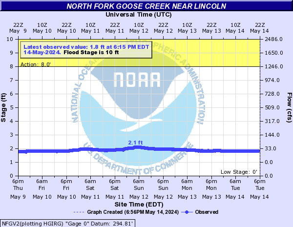
North Fork Goose Creek (Click on an image to go to hydrograph webpage)
NFGV2:
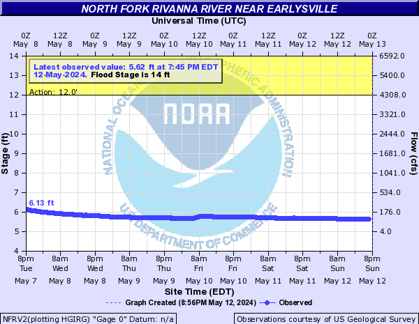
North Fork Rivanna River (Click on an image to go to hydrograph webpage)
NFRV2:
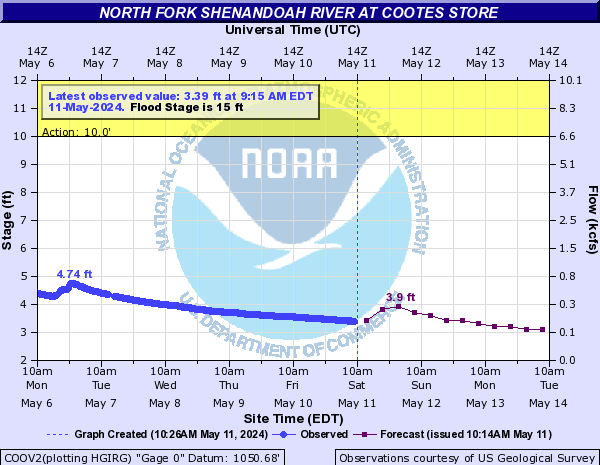
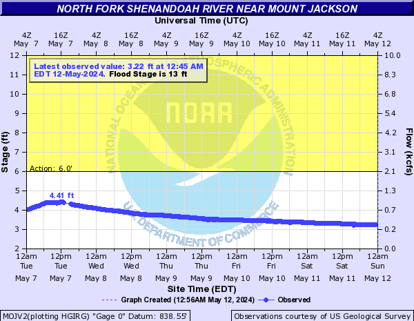
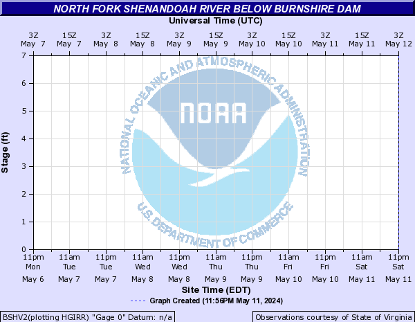
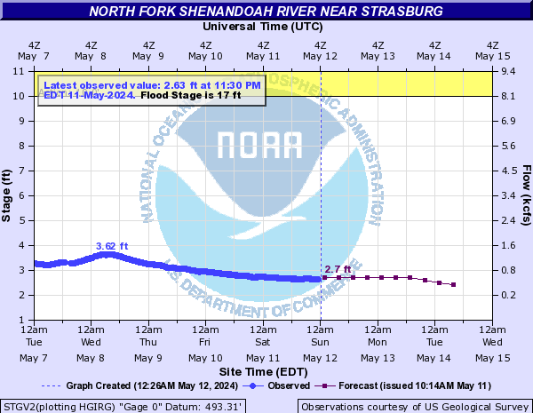
North Fork Shenandoah River (Click on an image to go to hydrograph webpage)
COOV2:
MOJV2:
BSHV2:
STGV2:
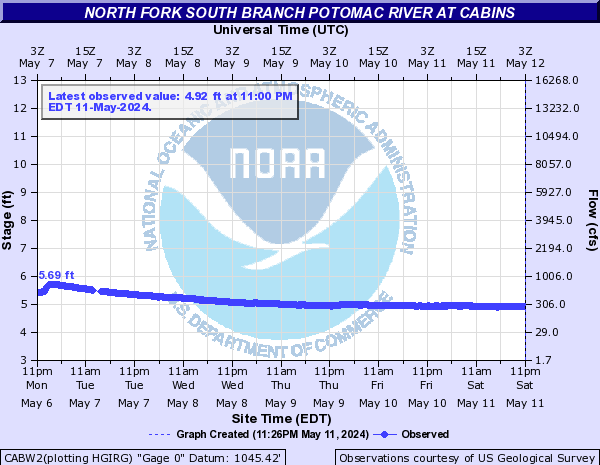
North Fork South Branch Potomac River (Click on an image to go to hydrograph webpage)
CABW2:
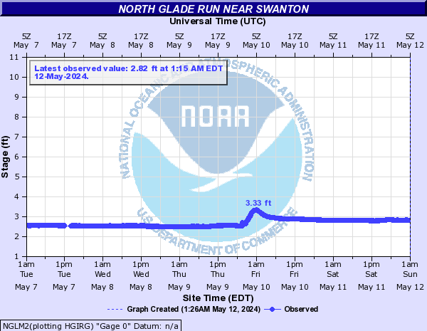
North Glade Run (Click on an image to go to hydrograph webpage)
NGLM2:
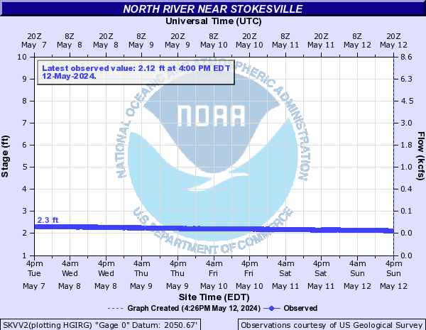
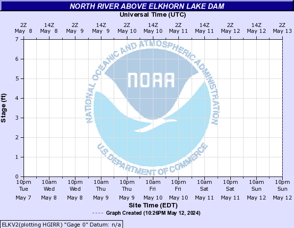
North River (Click on an image to go to hydrograph webpage)
BKTV2:

SKVV2:
ELKV2:
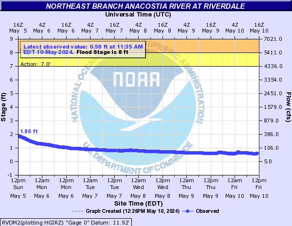
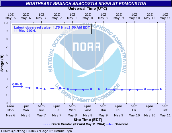
Northeast Branch Anacostia River (Click on an image to go to hydrograph webpage)
RVDM2:
EDMM2:
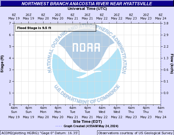
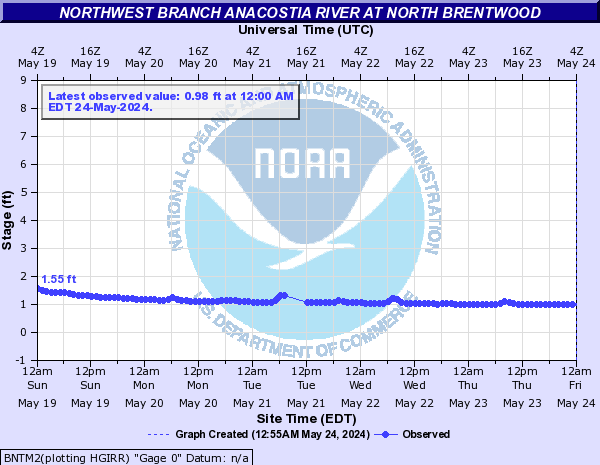
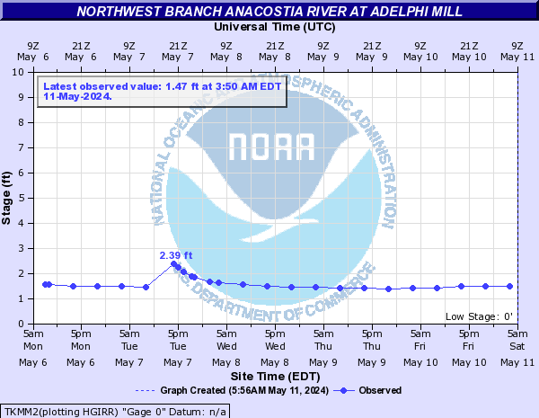
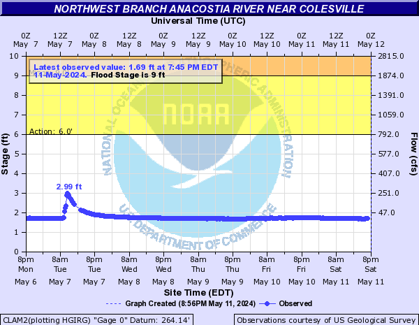
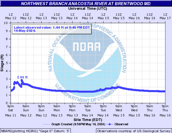
Northwest Branch Anacostia River (Click on an image to go to hydrograph webpage)
ACOM2:
BNTM2:
TKMM2:
CLAM2:
NBAM2:
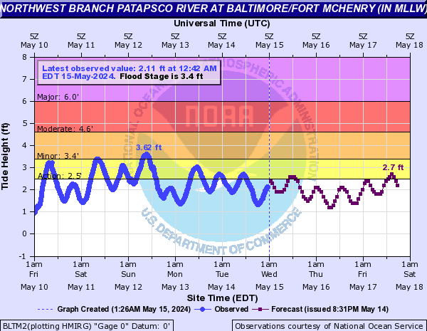
Northwest Branch Patapsco River (Click on an image to go to hydrograph webpage)
BLTM2:
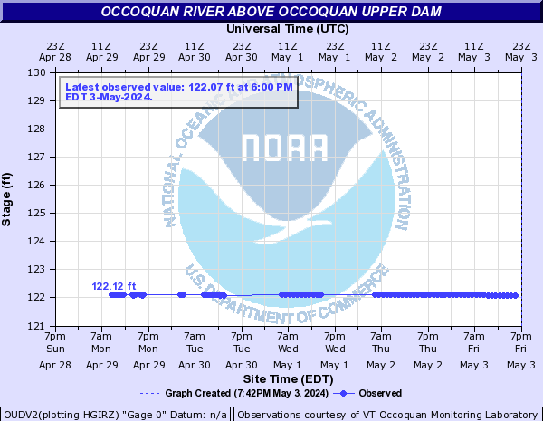
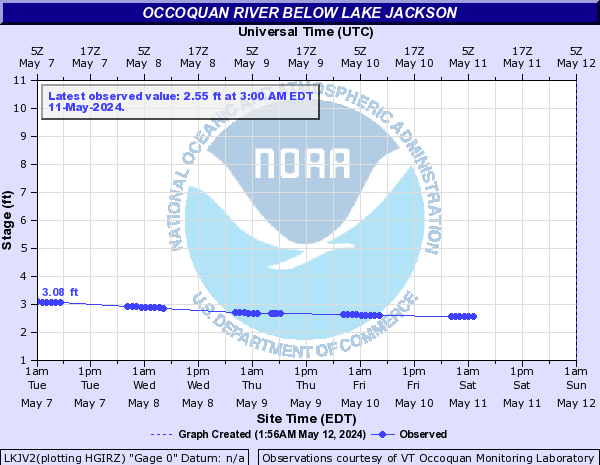
Occoquan River (Click on an image to go to hydrograph webpage)
OUDV2:
LKJV2:
OCRV2:

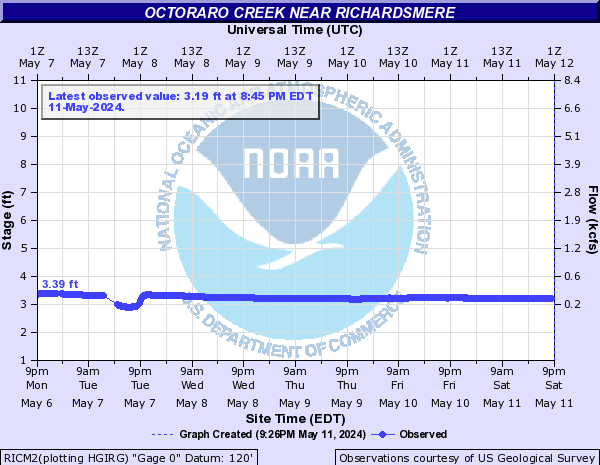
Octoraro Creek (Click on an image to go to hydrograph webpage)
RICM2:
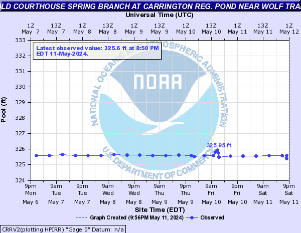
Old Courthouse Spring Branch (Click on an image to go to hydrograph webpage)
CRRV2:
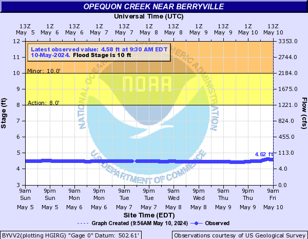
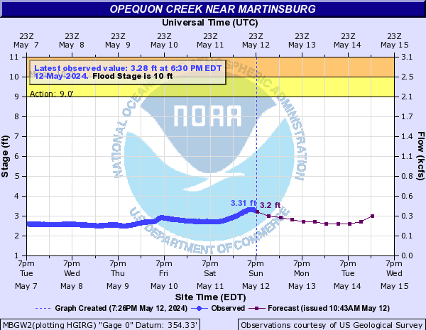
Opequon Creek (Click on an image to go to hydrograph webpage)
BYVV2:
MBGW2:
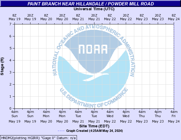
Paint Branch (Click on an image to go to hydrograph webpage)
HNDM2:
CPPM2:

Painter Run (Click on an image to go to hydrograph webpage)
FTAW2:

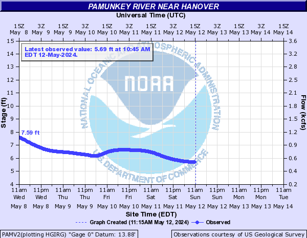
Pamunkey River (Click on an image to go to hydrograph webpage)
PAMV2:
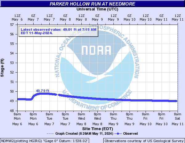
Parker Hollow Run (Click on an image to go to hydrograph webpage)
NDMW2:
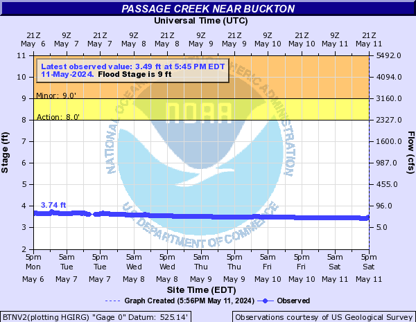
Passage Creek (Click on an image to go to hydrograph webpage)
BTNV2:
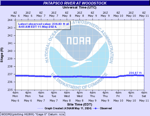
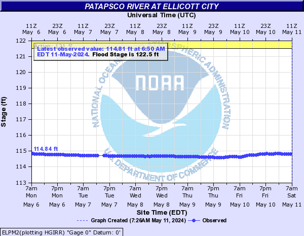
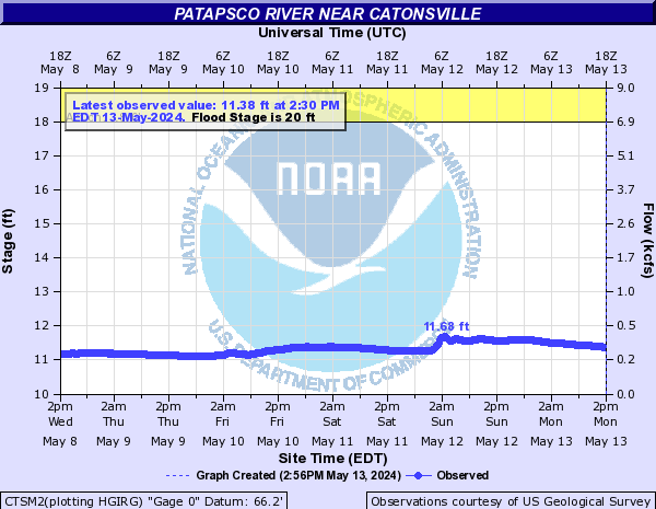
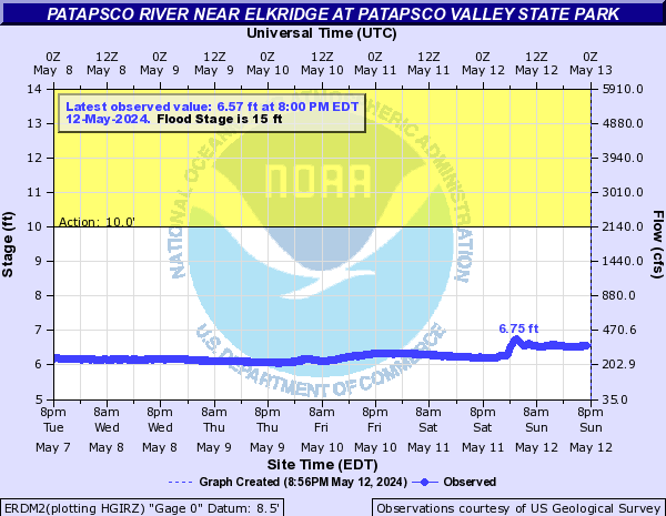
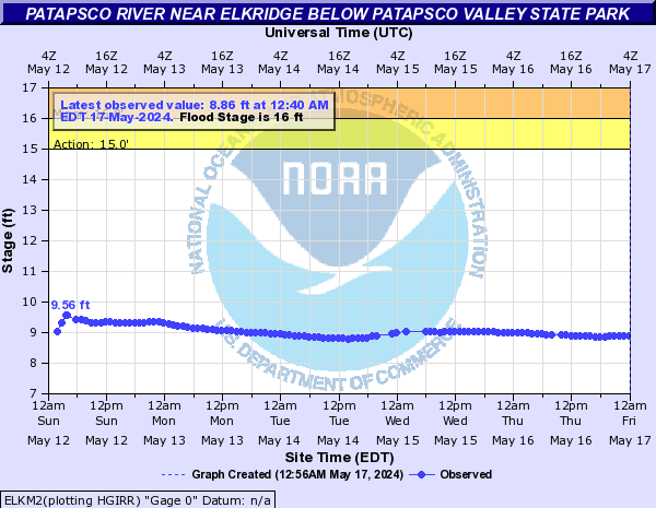
Patapsco River (Click on an image to go to hydrograph webpage)
WOOM2:
PRHM2:

ELPM2:
CTSM2:
ERDM2:
ELKM2:
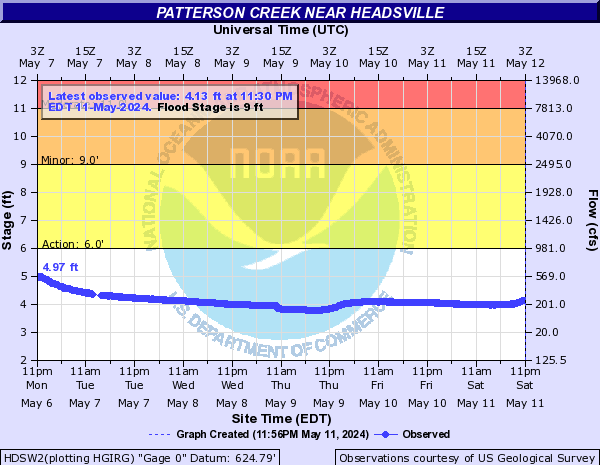
Patterson Creek (Click on an image to go to hydrograph webpage)
HDSW2:
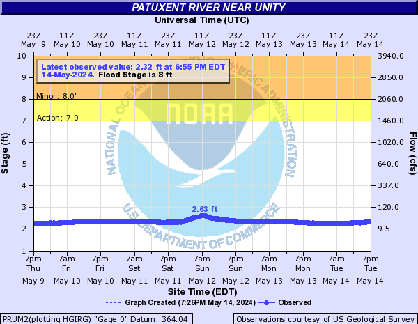
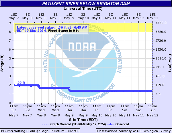
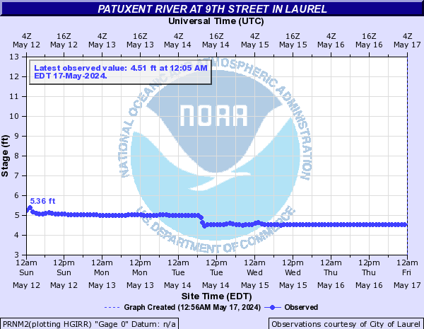
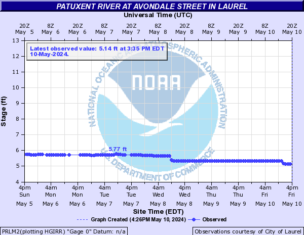
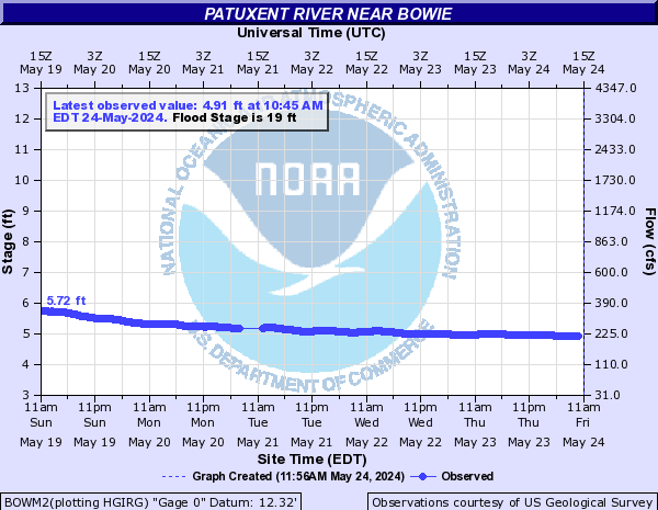
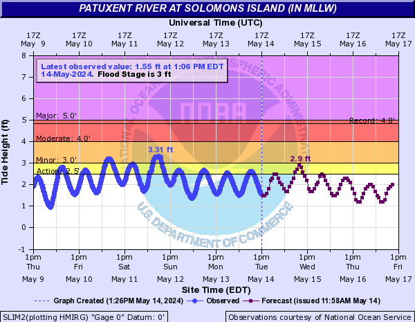
Patuxent River (Click on an image to go to hydrograph webpage)
PRUM2:
BGHM2:
LPRM2:

PRNM2:
PRLM2:
BOWM2:
SLIM2:
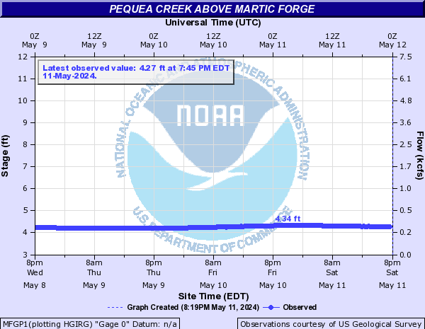
Pequea Creek (Click on an image to go to hydrograph webpage)
MFGP1:
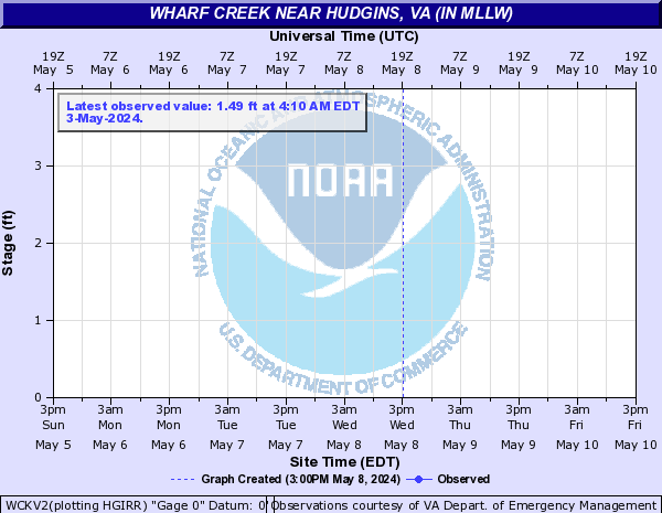
Piankatank River (Click on an image to go to hydrograph webpage)
WCKV2:
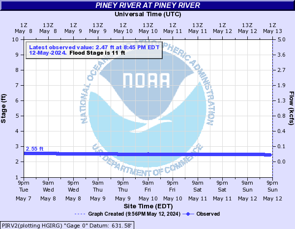
Piney River (Click on an image to go to hydrograph webpage)
PIRV2:
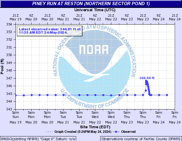
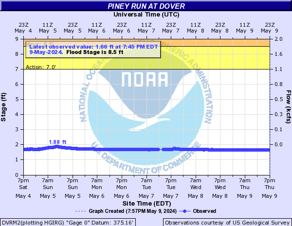
Piney Run (Click on an image to go to hydrograph webpage)
RNSV2:
DVRM2:
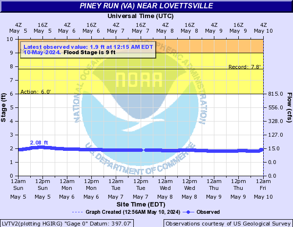
Piney Run (VA) (Click on an image to go to hydrograph webpage)
LVTV2:
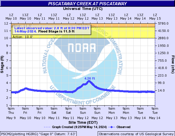
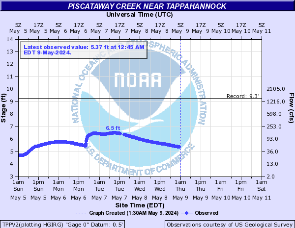
Piscataway Creek (Click on an image to go to hydrograph webpage)
PSCM2:
TPPV2:
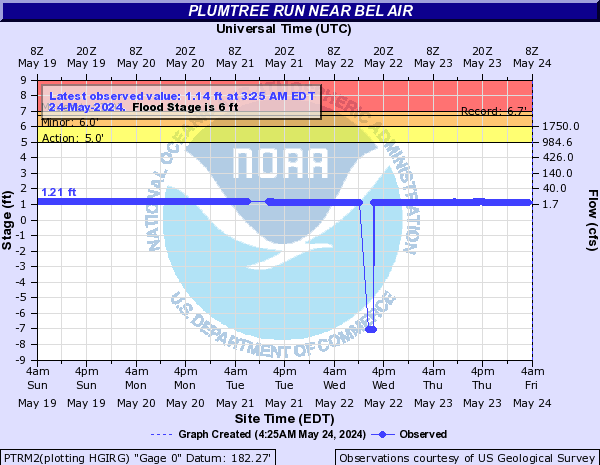
Plumtree Run (Click on an image to go to hydrograph webpage)
PTRM2:
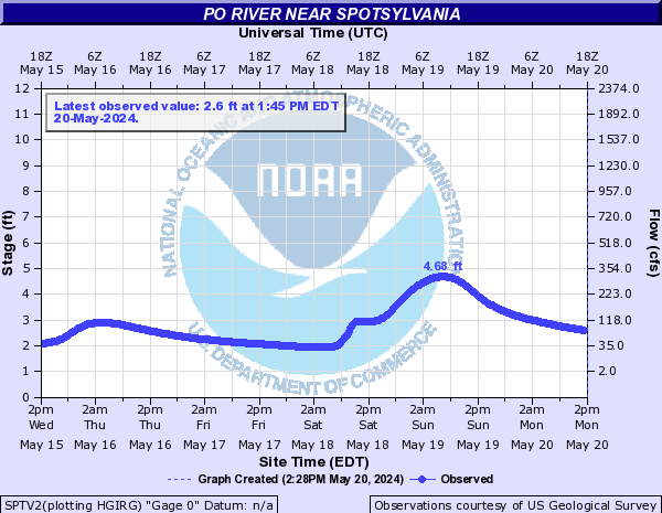
Po River (Click on an image to go to hydrograph webpage)
SPTV2:
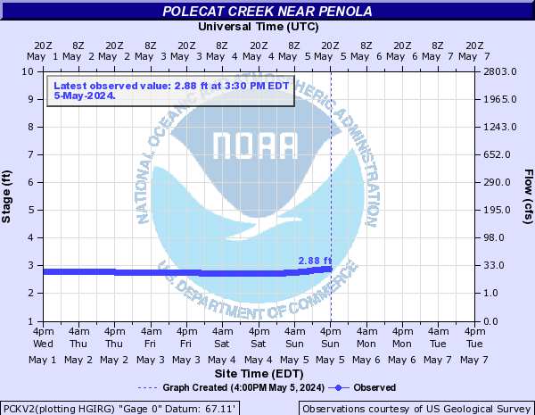
Polecat Creek (Click on an image to go to hydrograph webpage)
PCKV2:
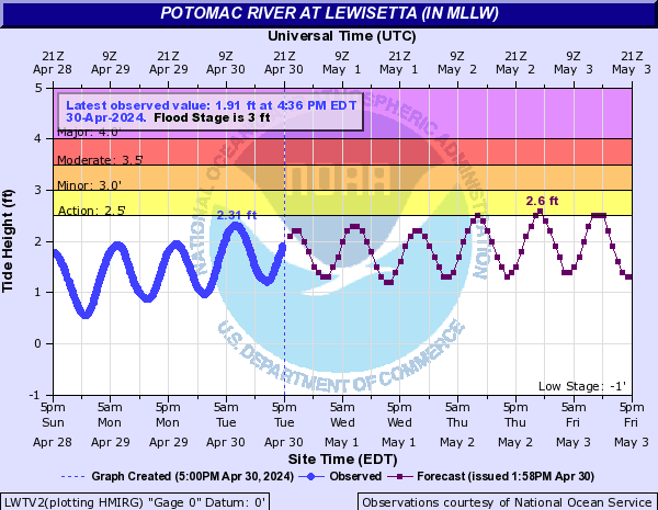
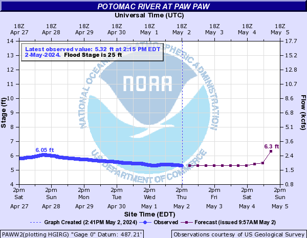
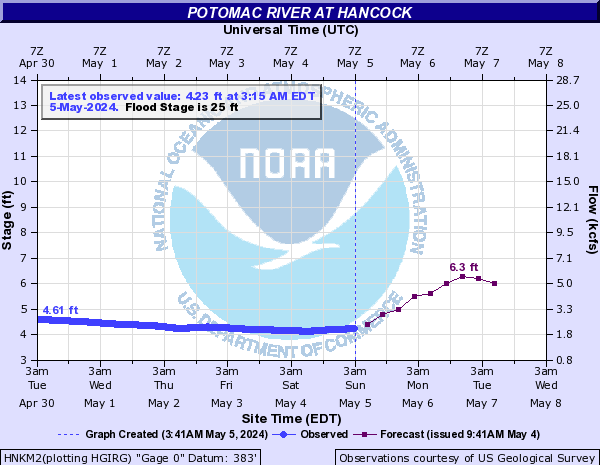
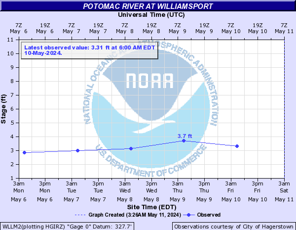
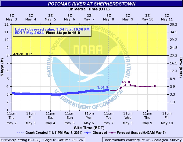
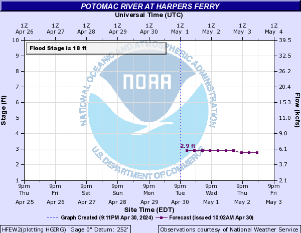
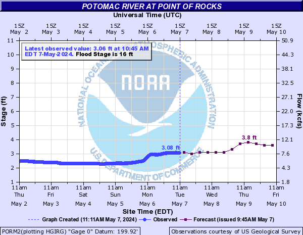
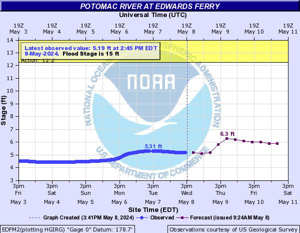
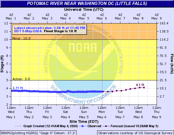
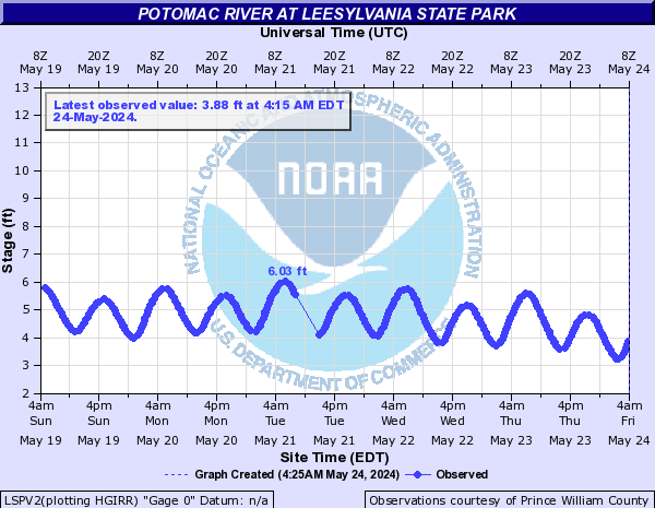
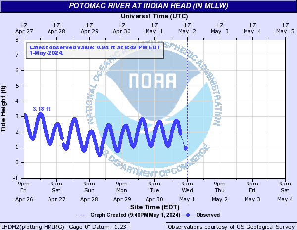
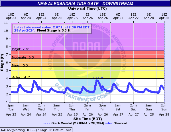
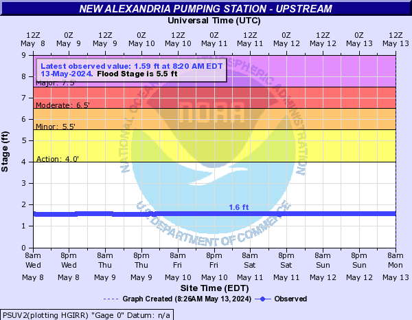
Potomac River (Click on an image to go to hydrograph webpage)
LWTV2:
PAWW2:
HNKM2:
PDFM2:

WLLM2:
SHEW2:
HFEW2:
PORM2:
EDFM2:
BRKM2:
GTND2:

AXTV2:

LSPV2:
IHDM2:
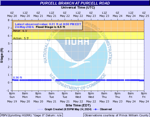
Purcell Branch (Click on an image to go to hydrograph webpage)
PBPV2:
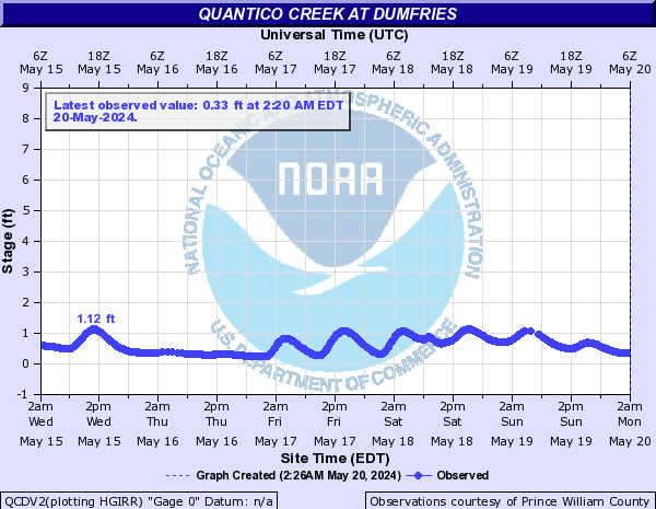
Quantico Creek (Click on an image to go to hydrograph webpage)
QCDV2:
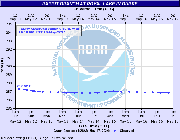
Rabbit Branch (Click on an image to go to hydrograph webpage)
RYLV2:
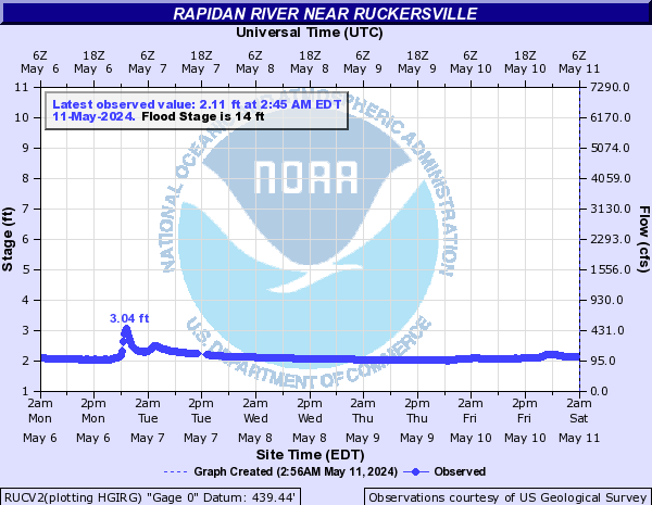
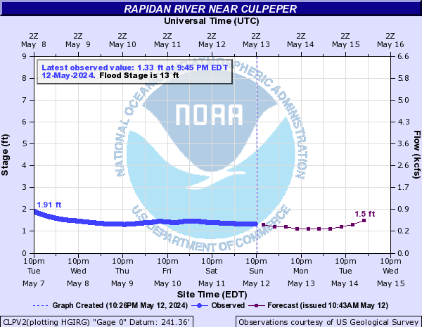
Rapidan River (Click on an image to go to hydrograph webpage)
RUCV2:
CLPV2:
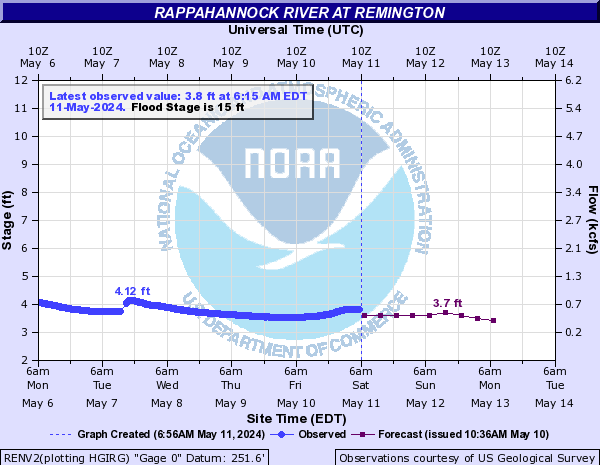
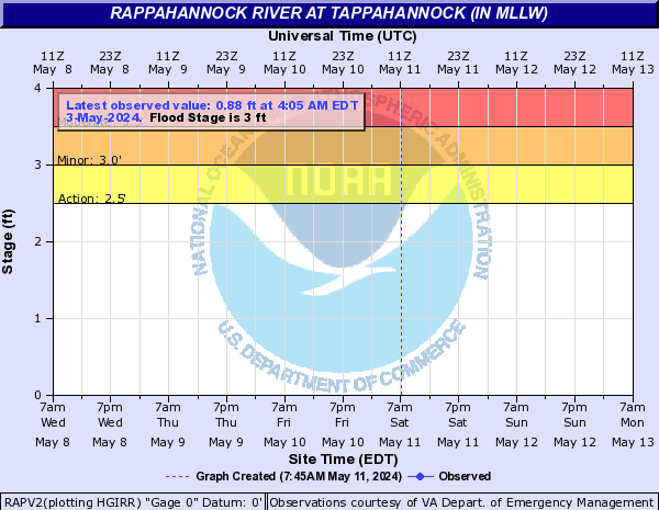
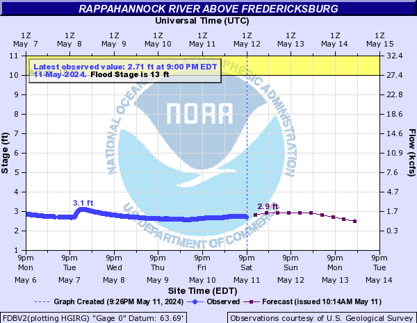
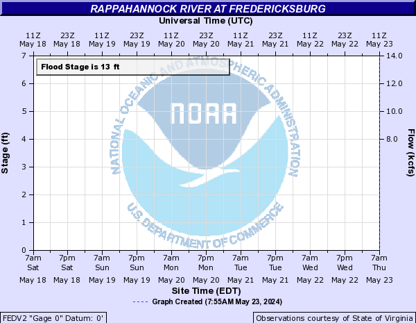
Rappahannock River (Click on an image to go to hydrograph webpage)
RENV2:
RAPV2:
FDBV2:
FEDV2:
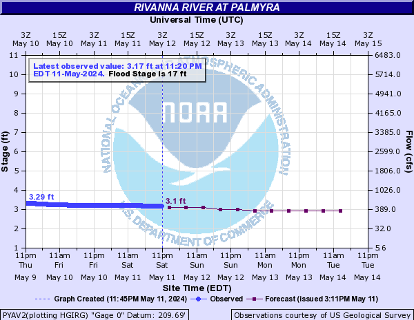
Rivanna River (Click on an image to go to hydrograph webpage)
PYAV2:
Robinson Hollow (Click on an image to go to hydrograph webpage)
RBHV2:
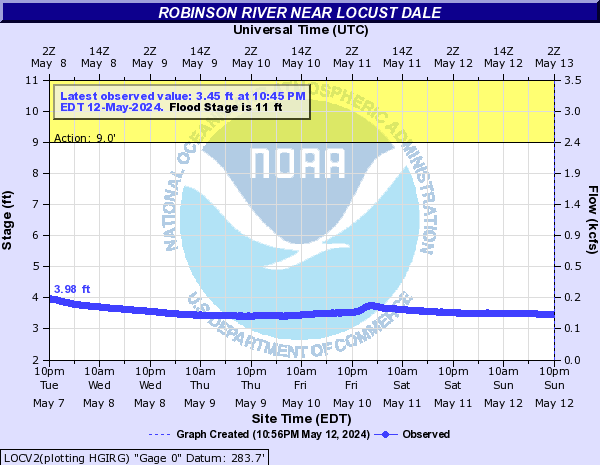
Robinson River (Click on an image to go to hydrograph webpage)
LOCV2:
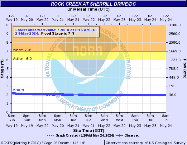
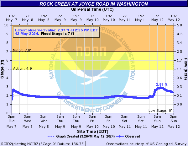
Rock Creek (Click on an image to go to hydrograph webpage)
RCKD2:
RCJD2:
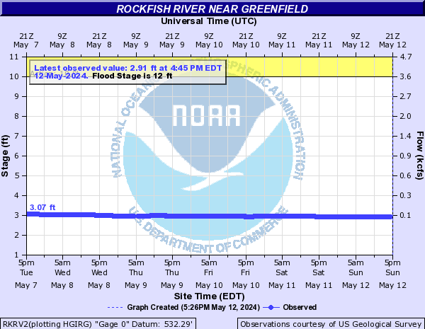
Rockfish River (Click on an image to go to hydrograph webpage)
RKRV2:
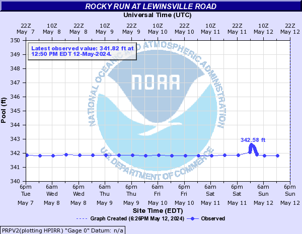
Rocky Run (Click on an image to go to hydrograph webpage)
PRPV2:
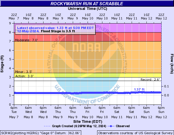
Rockymarsh Run (Click on an image to go to hydrograph webpage)
SCRW2:
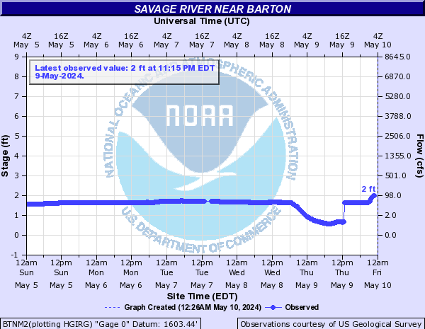
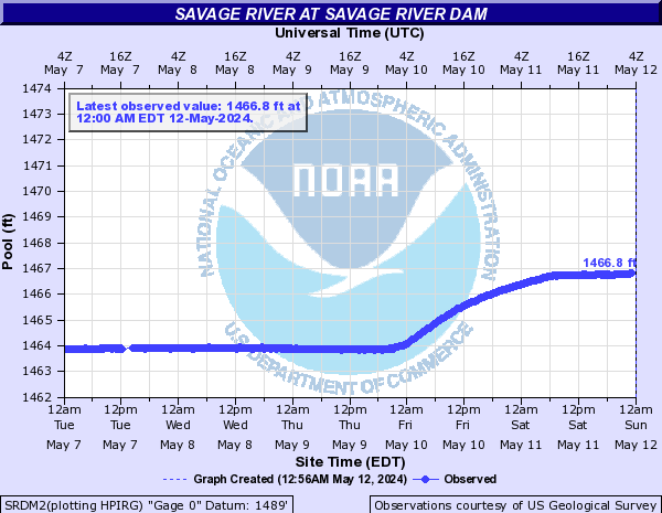
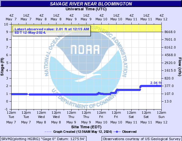
Savage River (Click on an image to go to hydrograph webpage)
BTNM2:
SRDM2:
SRVM2:
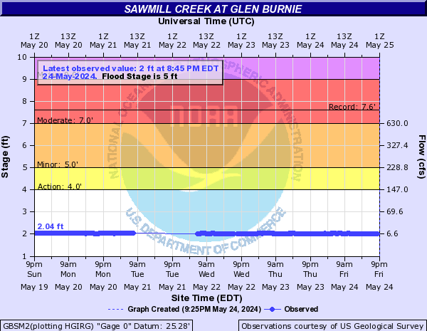
Sawmill Creek (Click on an image to go to hydrograph webpage)
GBSM2:
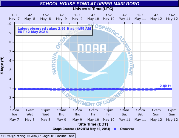
School House Pond (Click on an image to go to hydrograph webpage)
SHPM2:
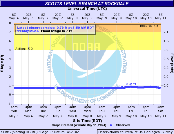
Scotts Level Branch (Click on an image to go to hydrograph webpage)
SLRM2:
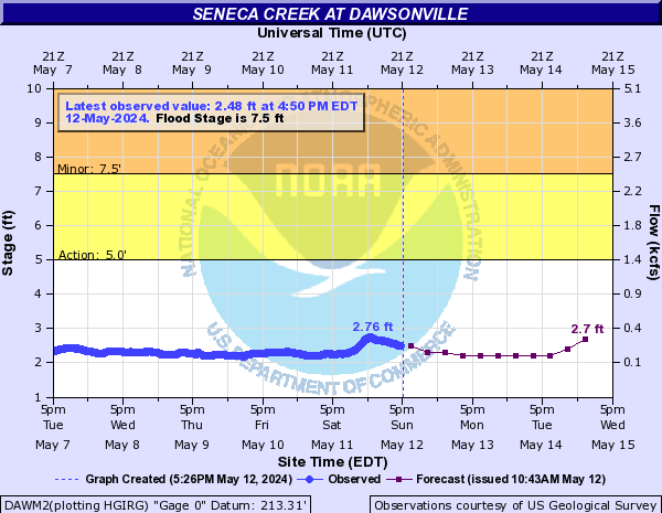
Seneca Creek (Click on an image to go to hydrograph webpage)
DAWM2:
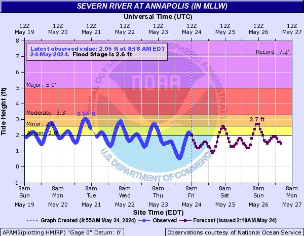
Severn River (Click on an image to go to hydrograph webpage)
APAM2:
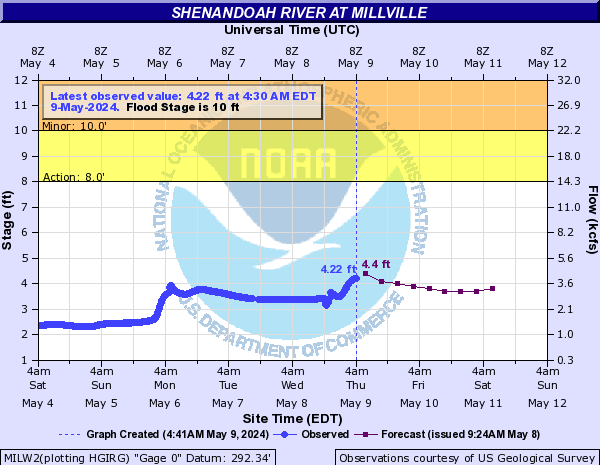
Shenandoah River (Click on an image to go to hydrograph webpage)
MILW2:
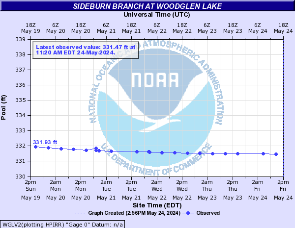
Sideburn Branch (Click on an image to go to hydrograph webpage)
WGLV2:
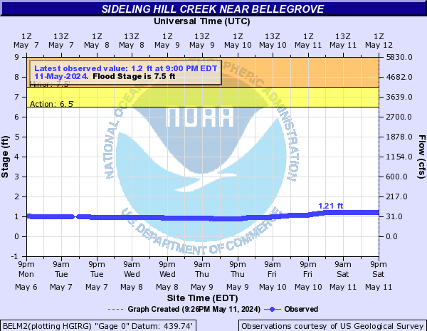
Sideling Hill Creek (Click on an image to go to hydrograph webpage)
BELM2:
Skidmore Fork (Click on an image to go to hydrograph webpage)
TDLV2:
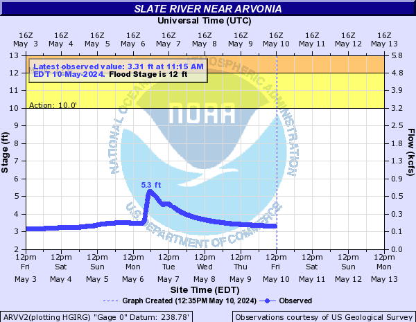
Slate River (Click on an image to go to hydrograph webpage)
ARVV2:
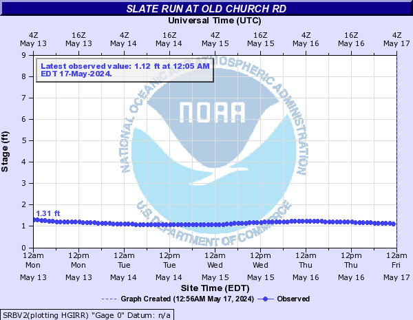
Slate Run (Click on an image to go to hydrograph webpage)
SRBV2:
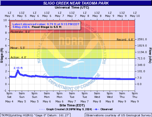
Sligo Creek (Click on an image to go to hydrograph webpage)
TKPM2:
CHLM2:
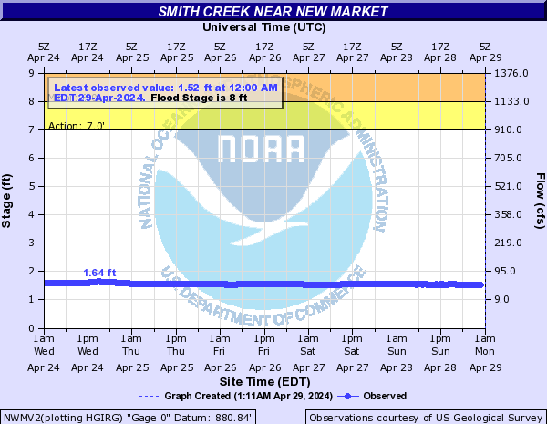
Smith Creek (Click on an image to go to hydrograph webpage)
NWMV2:
Snakeden Branch (Click on an image to go to hydrograph webpage)
SBAV2:

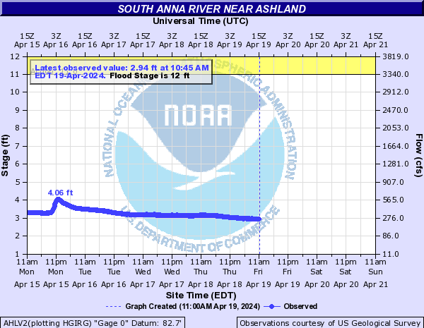
South Anna River (Click on an image to go to hydrograph webpage)
AHLV2:
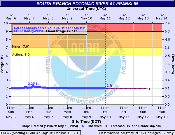
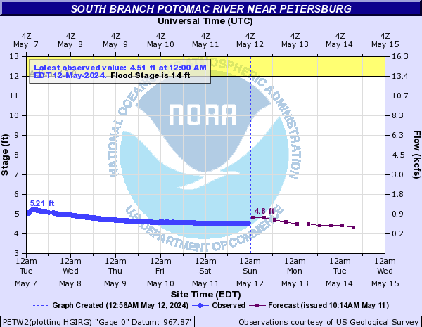
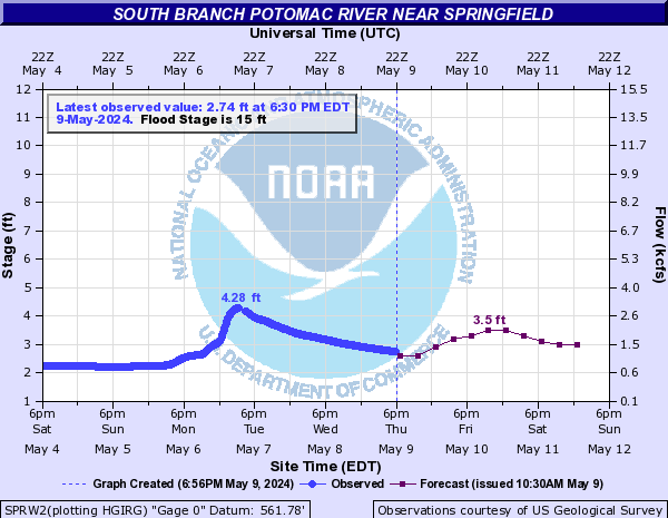
South Branch Potomac River (Click on an image to go to hydrograph webpage)
FKLW2:
PETW2:
SPRW2:
MRFW2:

South Fork Back Creek (Click on an image to go to hydrograph webpage)
SFBV2:

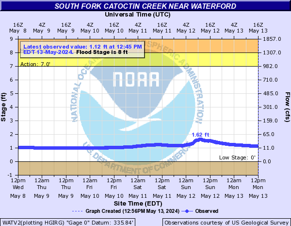
South Fork Catoctin Creek (Click on an image to go to hydrograph webpage)
WATV2:
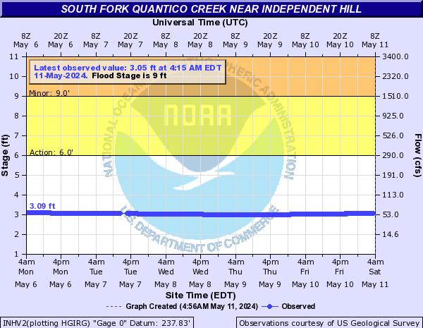
South Fork Quantico Creek (Click on an image to go to hydrograph webpage)
INHV2:
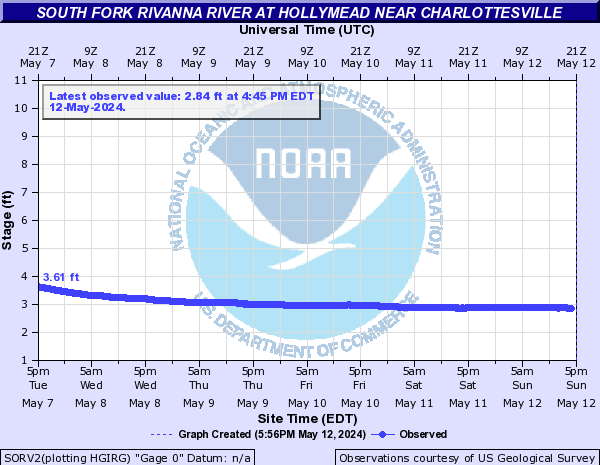
South Fork Rivanna River (Click on an image to go to hydrograph webpage)
SORV2:
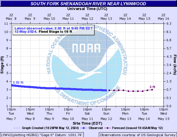
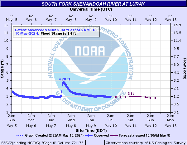
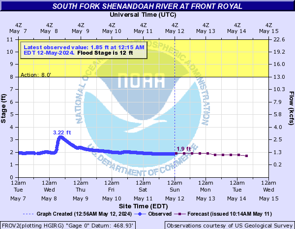
South Fork Shenandoah River (Click on an image to go to hydrograph webpage)
LYWV2:
SFSV2:
FROV2:
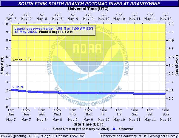
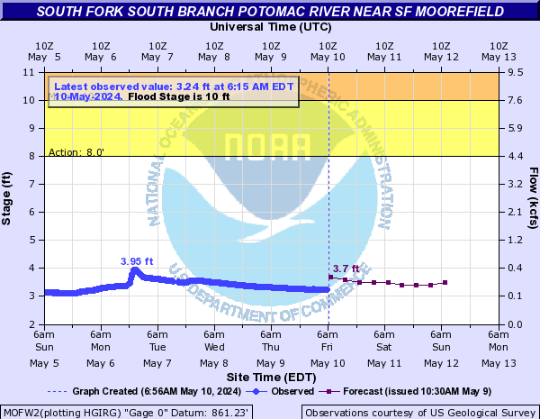
South Fork South Branch Potomac River (Click on an image to go to hydrograph webpage)
BRYW2:
MOFW2:
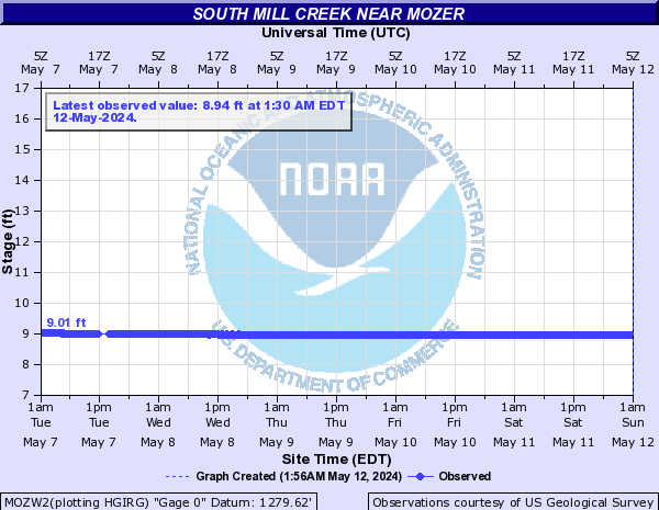
South Mill Creek (Click on an image to go to hydrograph webpage)
MOZW2:
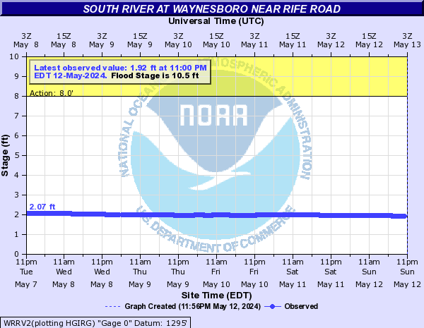
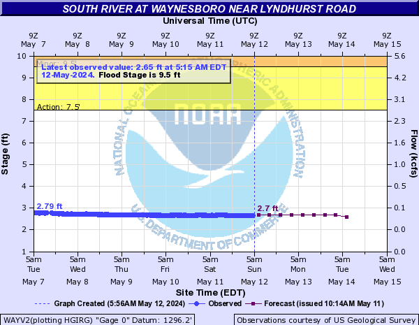
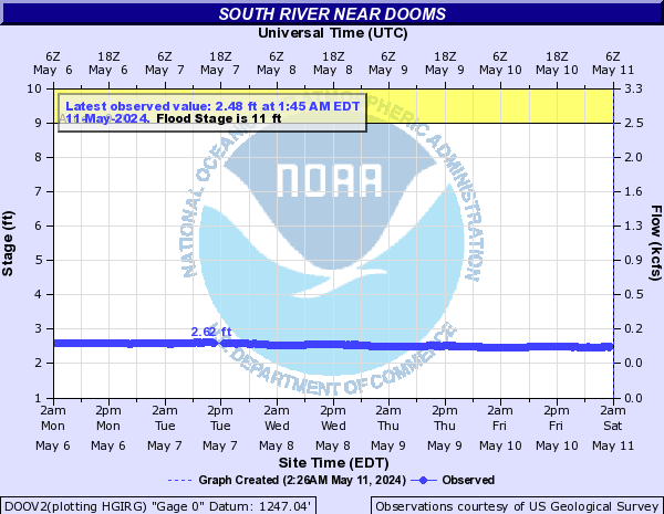
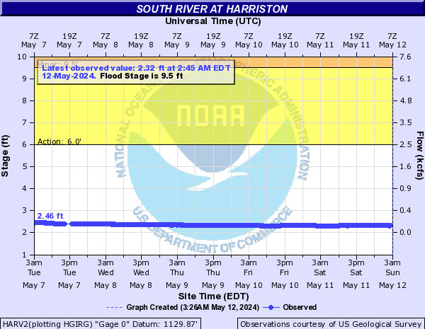
South River (Click on an image to go to hydrograph webpage)
WRRV2:
WAYV2:
DOOV2:
HARV2:
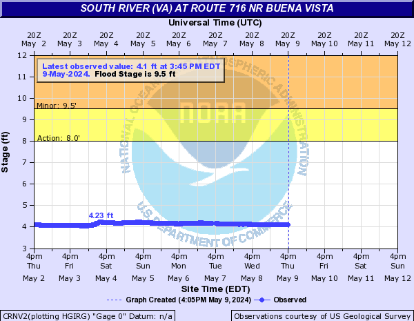
South River (VA) (Click on an image to go to hydrograph webpage)
CRNV2:
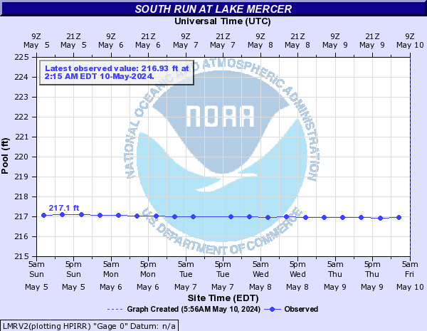
South Run (Click on an image to go to hydrograph webpage)
LMRV2:
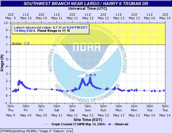
Southwest Branch (Click on an image to go to hydrograph webpage)
HTNM2:
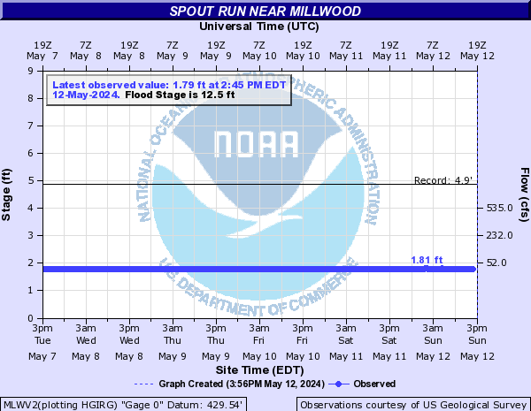
Spout Run (Click on an image to go to hydrograph webpage)
MLWV2:
Spruce Creek (Click on an image to go to hydrograph webpage)
NELV2:
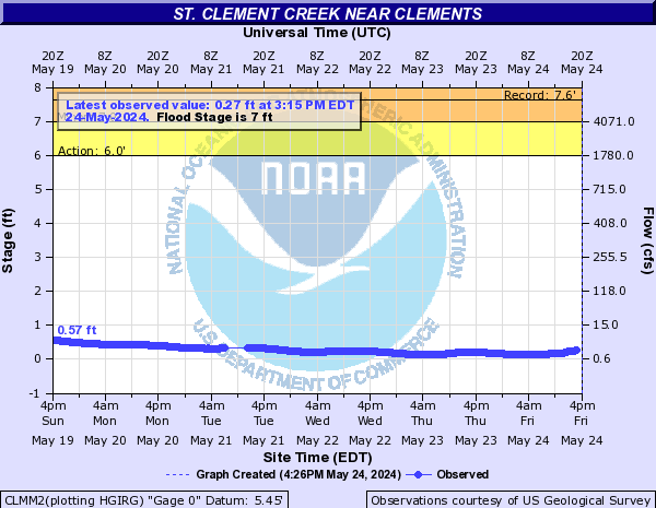
St. Clement Creek (Click on an image to go to hydrograph webpage)
CLMM2:
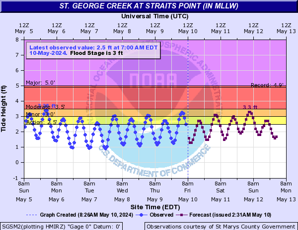
St. George Creek (Click on an image to go to hydrograph webpage)
SGSM2:
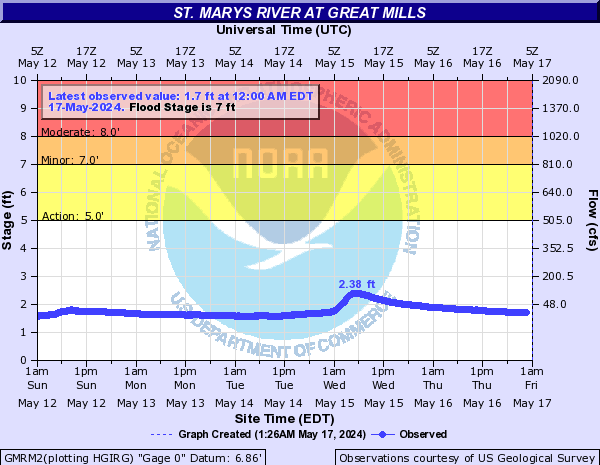
St. Marys River (Click on an image to go to hydrograph webpage)
GMRM2:
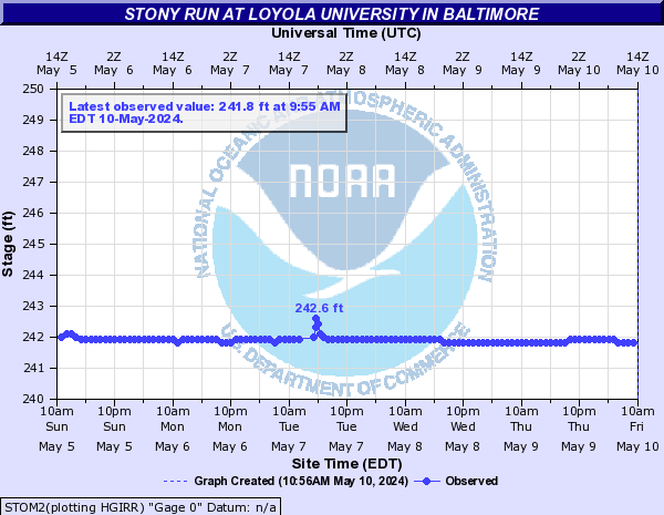
Stony Run (Click on an image to go to hydrograph webpage)
STOM2:
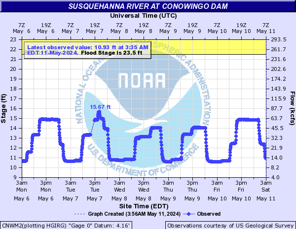
Susquehanna River (Click on an image to go to hydrograph webpage)
CNWM2:
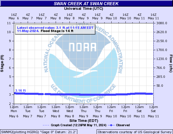
Swan Creek (Click on an image to go to hydrograph webpage)
SWNM2:
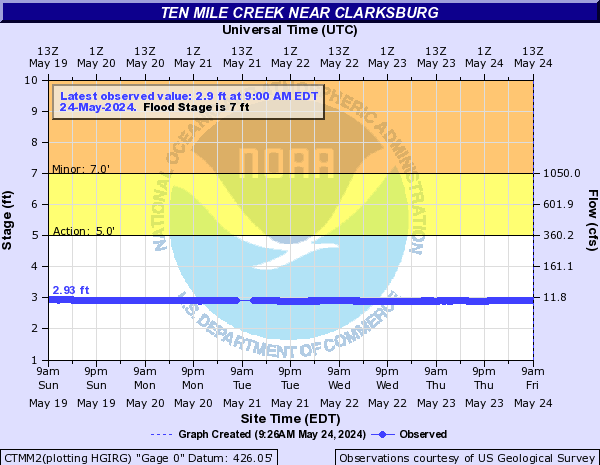
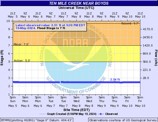
Ten Mile Creek (Click on an image to go to hydrograph webpage)
CTMM2:
BTMM2:
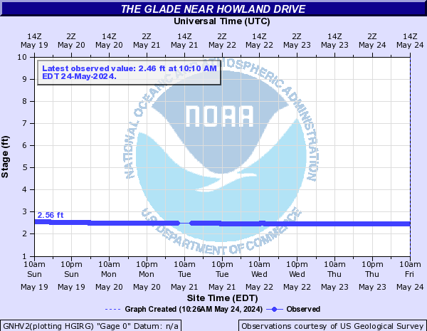
The Glade (Click on an image to go to hydrograph webpage)
GNHV2:
Thornton River (Click on an image to go to hydrograph webpage)
SVTV2:

Toms Branch Back Creek (Click on an image to go to hydrograph webpage)
TBRV2:
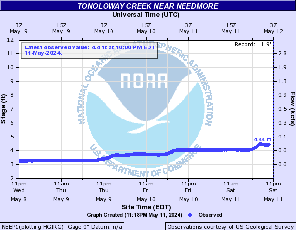
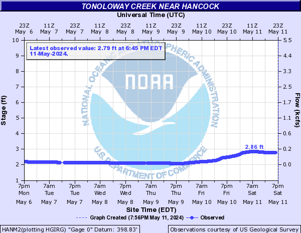
Tonoloway Creek (Click on an image to go to hydrograph webpage)
NEEP1:
HANM2:
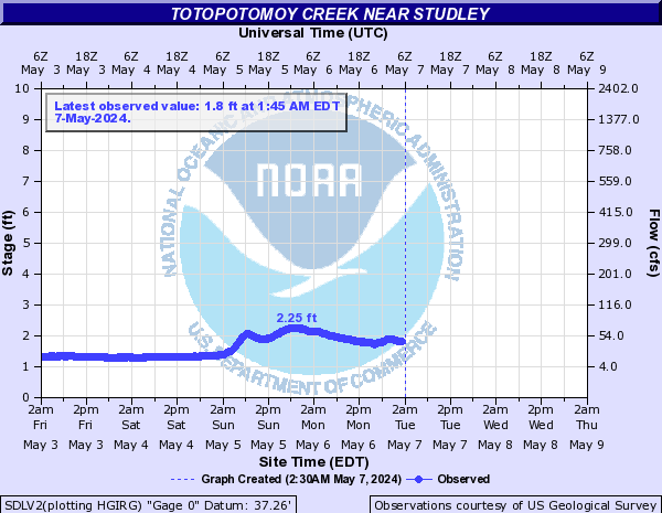
Totopotomoy Creek (Click on an image to go to hydrograph webpage)
SDLV2:
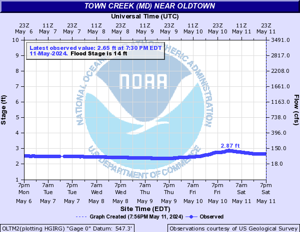
Town Creek (MD) (Click on an image to go to hydrograph webpage)
OLTM2:
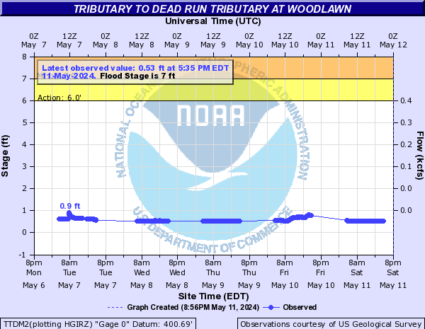
Tributary to Dead Run Tributary (Click on an image to go to hydrograph webpage)
TTDM2:
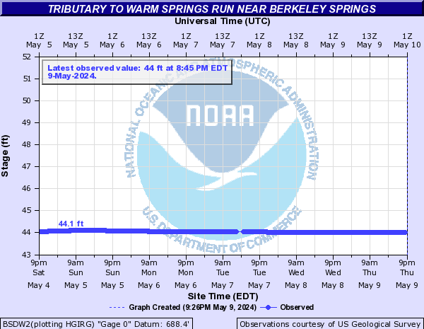
Tributary to Warm Springs Run (Click on an image to go to hydrograph webpage)
BSDW2:
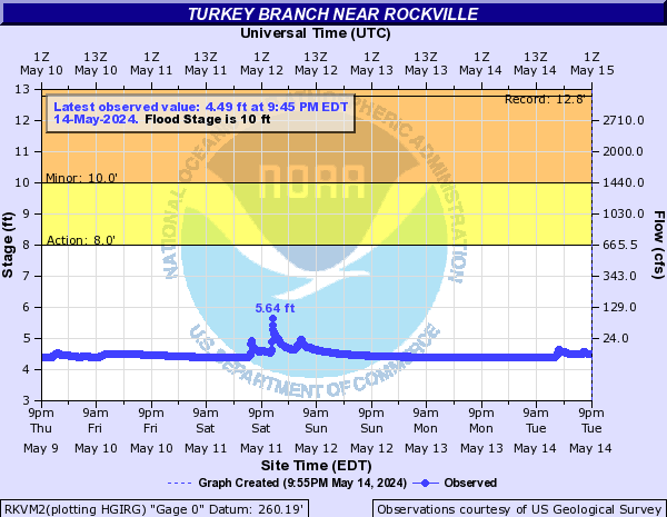
Turkey Branch (Click on an image to go to hydrograph webpage)
RKVM2:
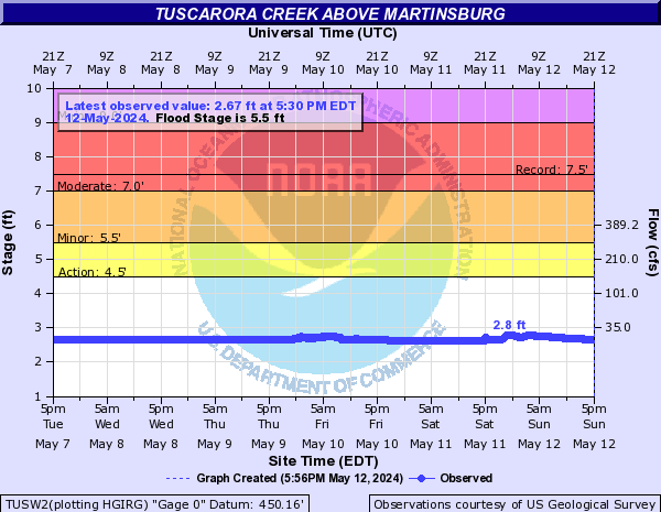
Tuscarora Creek (Click on an image to go to hydrograph webpage)
TUSW2:
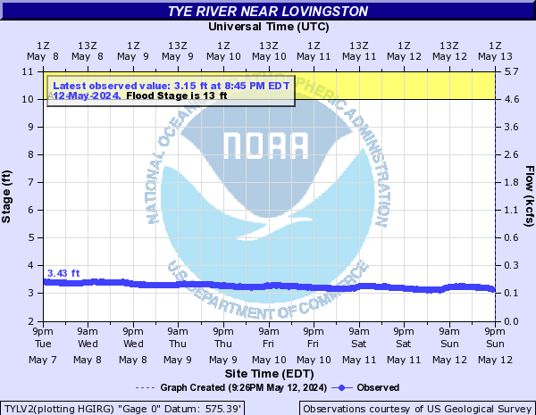
Tye River (Click on an image to go to hydrograph webpage)
TYLV2:
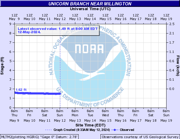
Unicorn Branch (Click on an image to go to hydrograph webpage)
MLTM2:
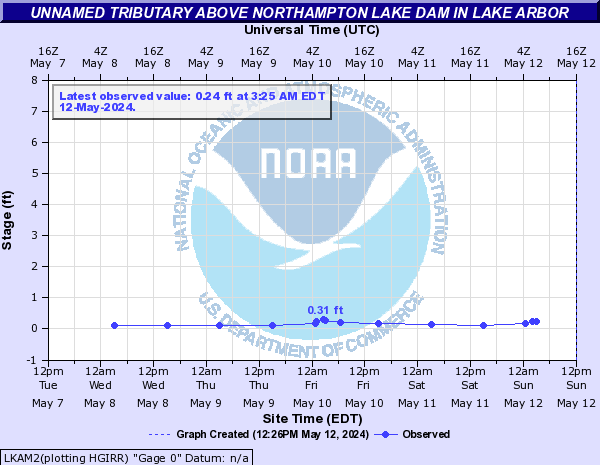
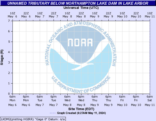
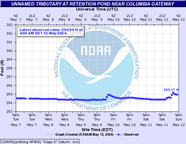
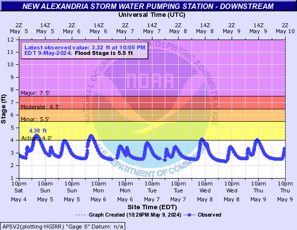
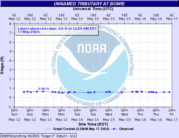
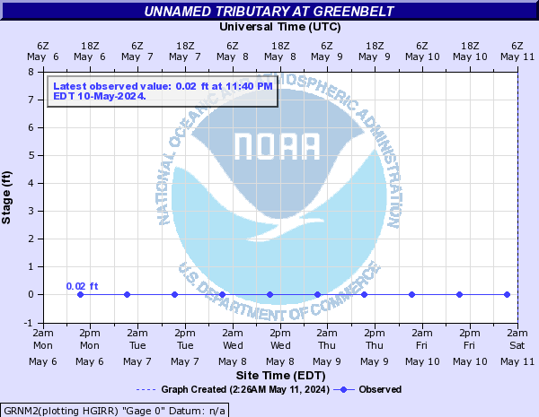
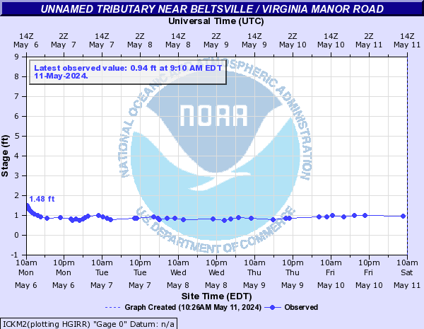
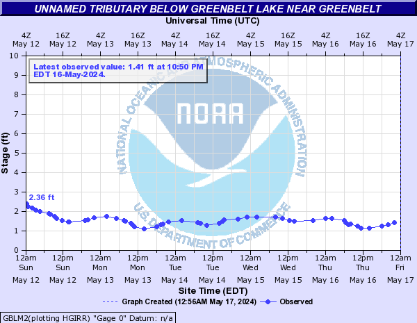
Unnamed Tributary (Click on an image to go to hydrograph webpage)
LKAM2:
LKDM2:
CGWM2:
APSV2:
ATGV2:

BWEM2:
GRNM2:
ICKM2:
NADV2:
PSUV2:
KINV2:

BFXV2:

GBLM2:
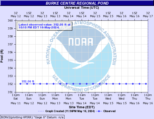
BCNV2:
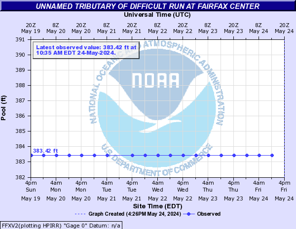
FFXV2:
HMEV2:

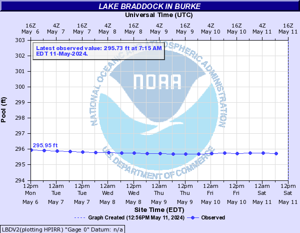
LBDV2:
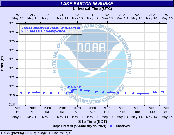
LBTV2:
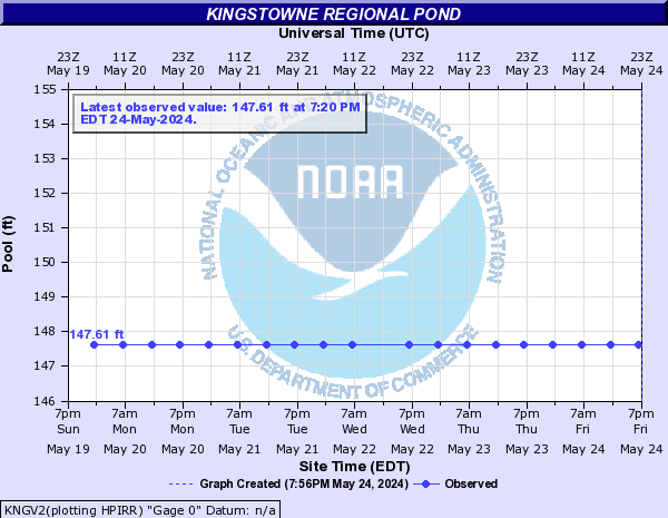
KNGV2:
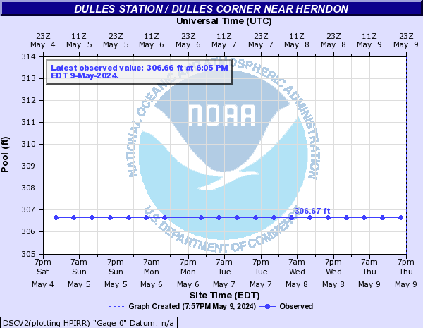
DSCV2:
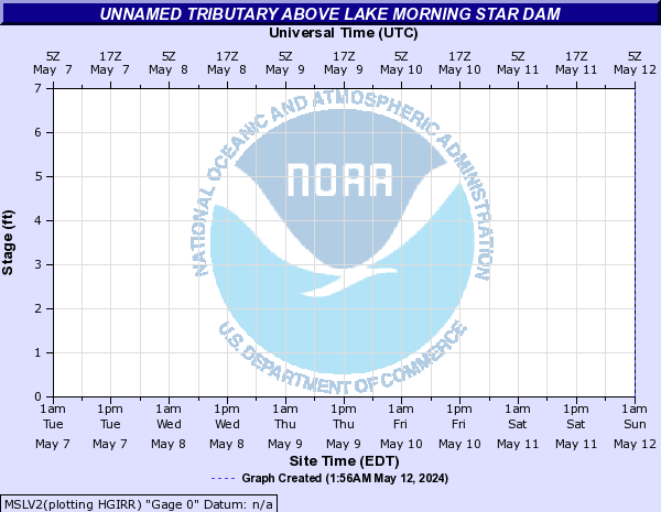
MSLV2:
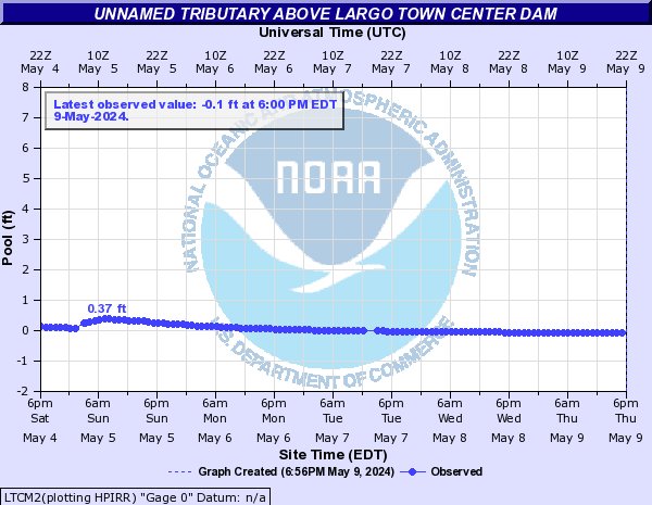
LTCM2:
HGDM2:
IHBM2:
WPRM2:

HPAV2:

Unnamed Tributary to Big Spring Run (Click on an image to go to hydrograph webpage)
UNBP1:
Upper Machodoc Creek (Click on an image to go to hydrograph webpage)
NCDV2:

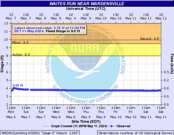
Waites Run (Click on an image to go to hydrograph webpage)
WRDW2:
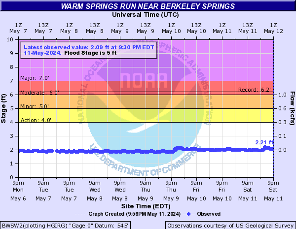
Warm Springs Run (Click on an image to go to hydrograph webpage)
BWSW2:
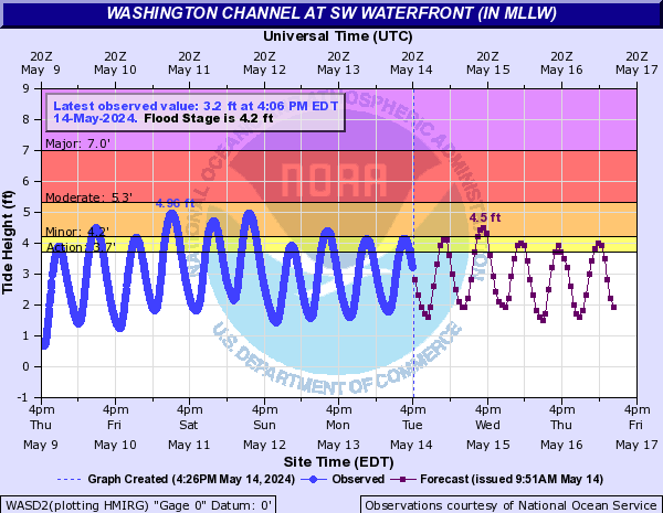
Washington Channel (Click on an image to go to hydrograph webpage)
WASD2:
Watts Branch (Click on an image to go to hydrograph webpage)
WATD2:

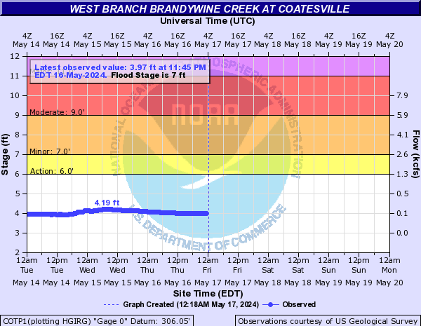
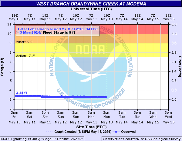
West Branch Brandywine Creek (Click on an image to go to hydrograph webpage)
COTP1:
MODP1:
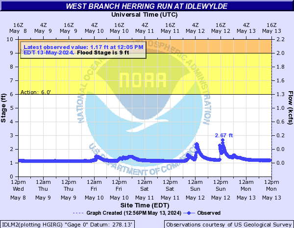
West Branch Herring Run (Click on an image to go to hydrograph webpage)
IDLM2:
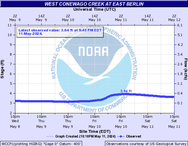
West Conewago Creek (Click on an image to go to hydrograph webpage)
WCCP1:
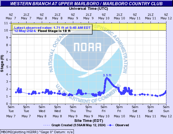
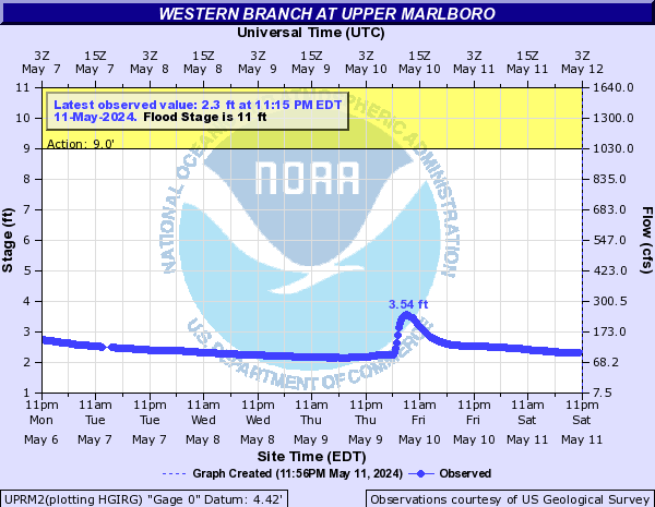
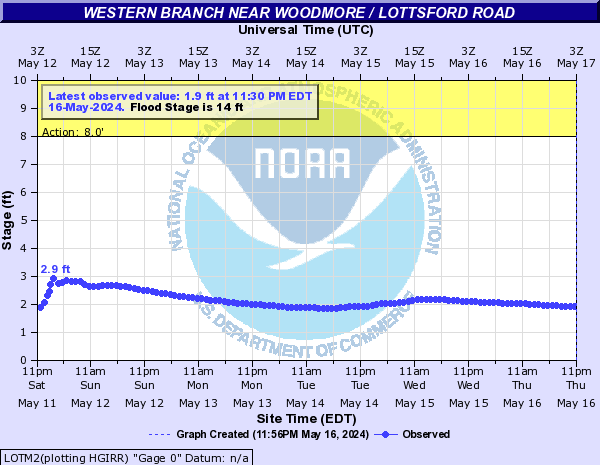
Western Branch (Click on an image to go to hydrograph webpage)
MBOM2:
UPRM2:
LOTM2:
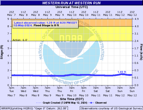
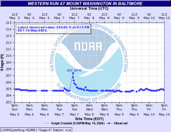
Western Run (Click on an image to go to hydrograph webpage)
WRWM2:
LCHM2:
White Clay Creek (Click on an image to go to hydrograph webpage)
SKVP1:

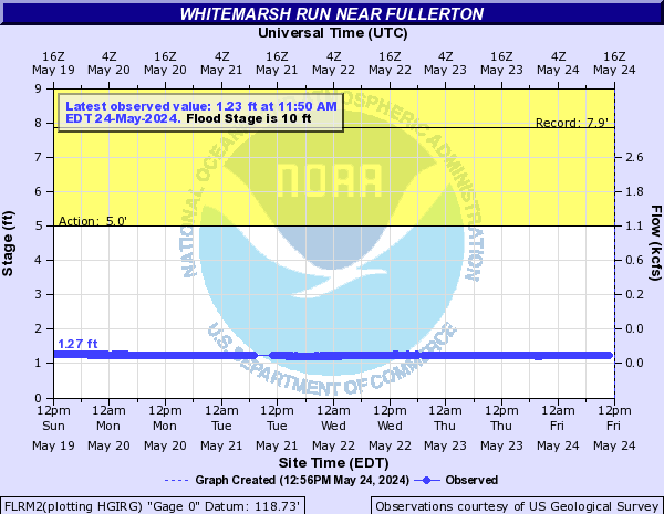
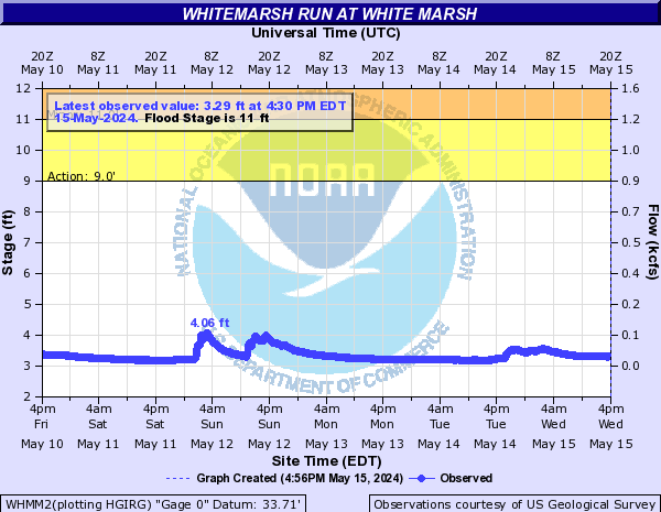
Whitemarsh Run (Click on an image to go to hydrograph webpage)
FLRM2:
WHMM2:
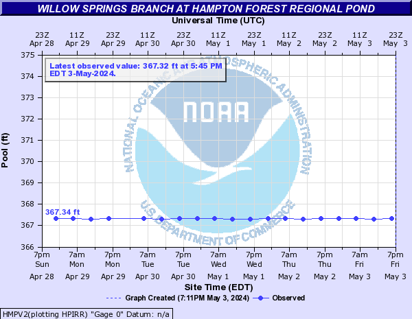
Willow Springs Branch (Click on an image to go to hydrograph webpage)
HMPV2:
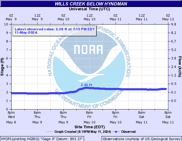
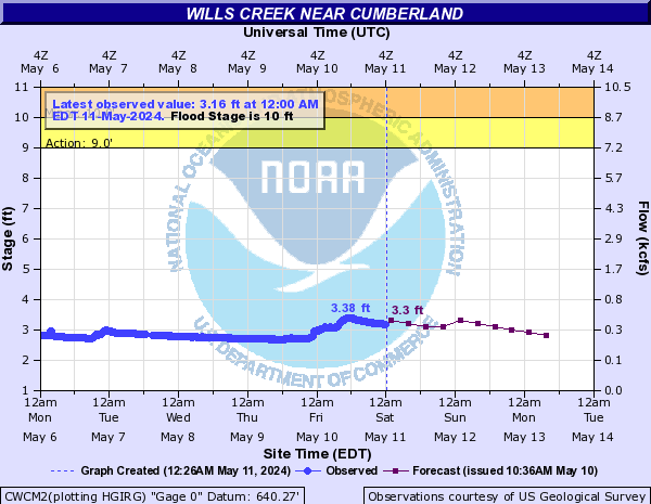
Wills Creek (Click on an image to go to hydrograph webpage)
HYDP1:
CWCM2:
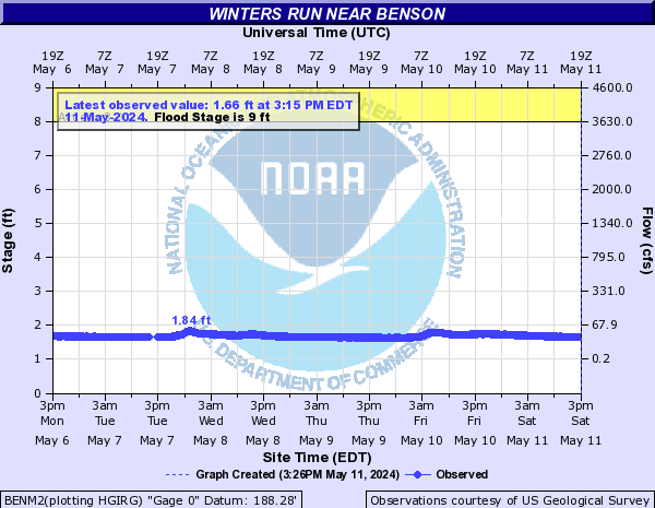
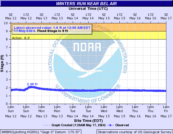
Winters Run (Click on an image to go to hydrograph webpage)
BENM2:
WRBM2:
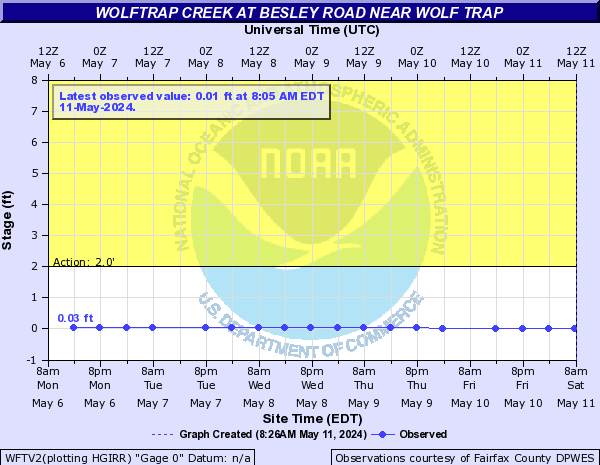
Wolftrap Creek (Click on an image to go to hydrograph webpage)
WFTV2:
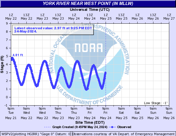
York River (Click on an image to go to hydrograph webpage)
WSPV2:
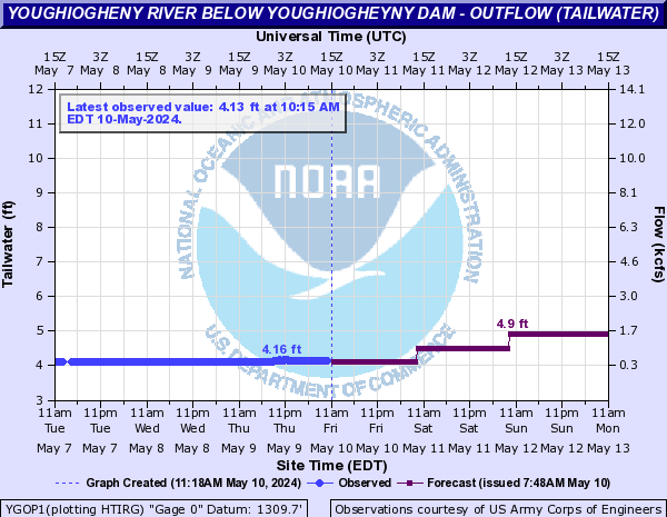
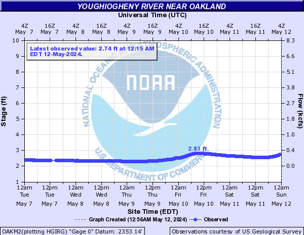
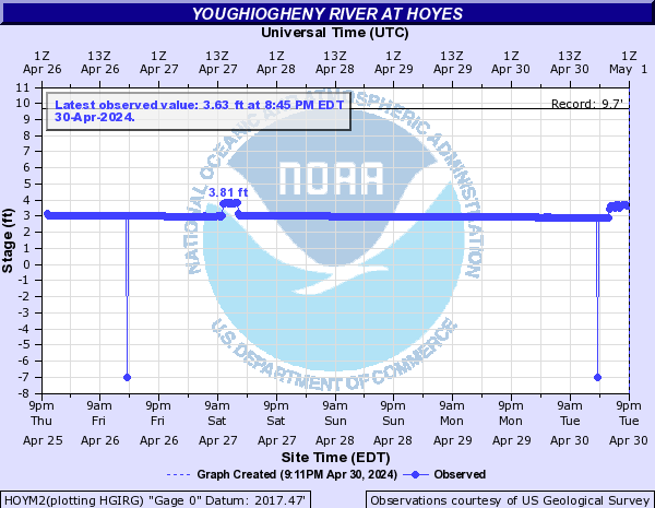
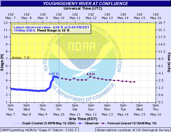
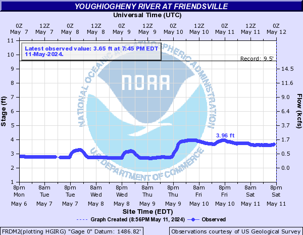
Youghiogheny River (Click on an image to go to hydrograph webpage)
YGOP1:
OAKM2:
HOYM2:
CNFP1:
FRDM2:
OPLP1:

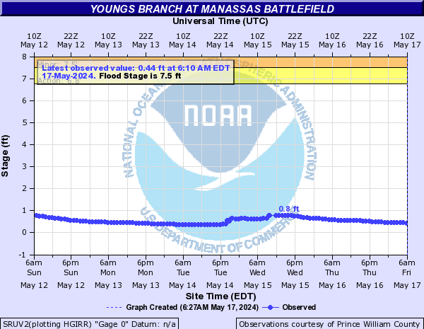
Youngs Branch (Click on an image to go to hydrograph webpage)
SRUV2:
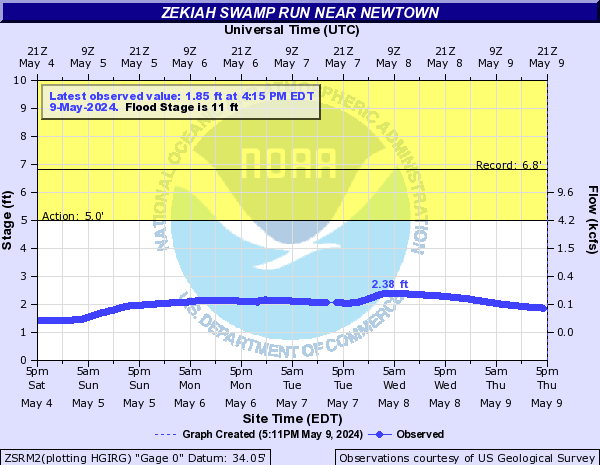
Zekiah Swamp Run (Click on an image to go to hydrograph webpage)
ZSRM2: