Historic Crests
(1) 23.66 ft on 08/17/1940
(2) 21.69 ft on 10/07/1972
(3) 21.28 ft on 09/17/1999
(4) 20.35 ft on 05/28/2003
(5) 20.35 ft on 09/21/2003 Show More Historic Crests
(P): Preliminary values subject to further review.
Recent Crests
(1) 17.53 ft on 01/11/2024 (P)
(2) 14.30 ft on 12/29/2023 (P)
(3) 16.36 ft on 12/19/2023 (P)
(4) 15.87 ft on 02/19/2021
(5) 15.12 ft on 09/19/2020 Show More Recent Crests
(P): Preliminary values subject to further review.
Latitude/Longitude Disclaimer: The gauge location shown in the above map
is the approximate location based on the latitude/longitude coordinates
provided to the NWS by the gauge owner.
Flood Impacts & Photos
If you notice any errors in the below information, please contact our Webmaster
30.9
River stage sensor operating limit
28
Bridge across US Highway 301 begins to flood.
23
Several homes just south of the gage, along US Highway 301 begin to flood.
17
Jarratt boat ramp, approximately 5 miles upstream, has water completely covering the concrete boat launch area.
16
Lowlands between the town of Stony Creek and VA Route 640, along both sides of VA Route 40, are flooded. Also, flood waters from the Nottoway River back up into Stony Creek and flood Main Street between Hailfax Road and Cedar Road.
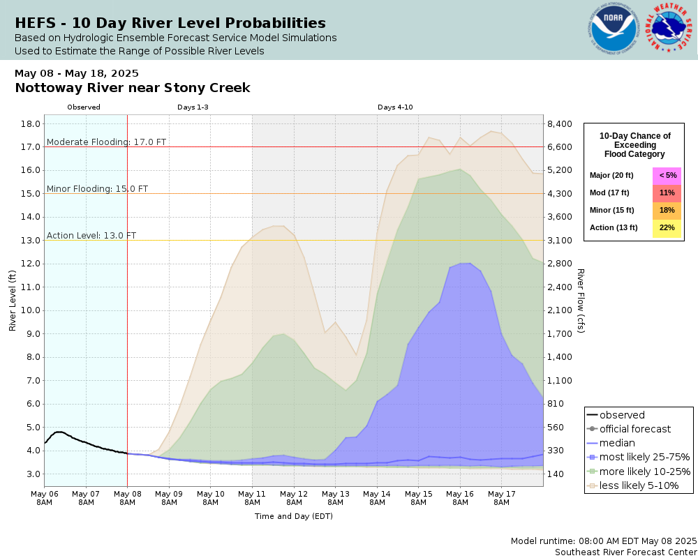
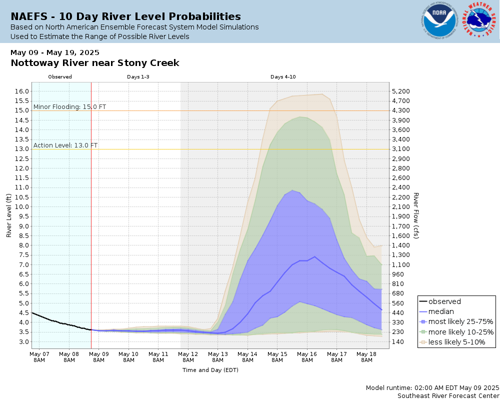
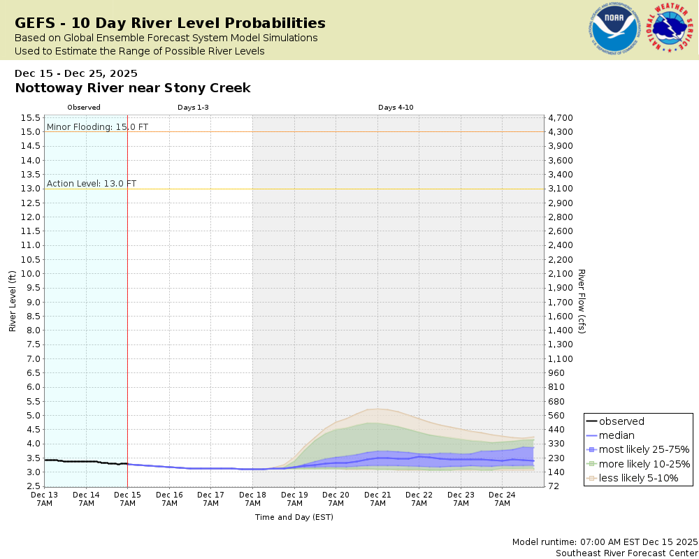
15
Minor flooding of lowlands begins in vicinity of the gage and downstream along VA Route 40.
The National Weather Service prepares its forecasts and other services in collaboration with agencies like the US Geological Survey, US Bureau of Reclamation, US Army Corps of Engineers, Natural Resource Conservation Service, National Park Service, ALERT Users Group, Bureau of Indian Affairs, and many state and local emergency managers across the country. For details, please click here.
NWS Information
National Weather Service
Wakefield Weather Forecast Office
10009 General Mahone Hwy
Wakefield, VA 23888
(757) 899-4200 Ask Questions/Webmaster
Page last modified: 2-Nov-2020 7:30 PM