Forecasts for the Richelieu River at St. Jeans Shoals are issued routinely year-round.Vertical datum for this site is CGVD 28. For more information on CGVD 28,
click here.
Latitude/Longitude Disclaimer: The gauge location shown in the above map
is the approximate location based on the latitude/longitude coordinates
provided to the NWS by the gauge owner.
Additional Information
Potential River Levels - Used to
Potential River Levels Used to Estimate the Chance of Flooding and
the Range of Possible River Levels
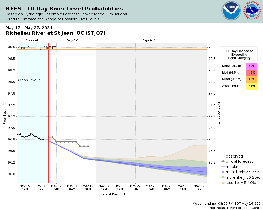
10 Day (HEFS)
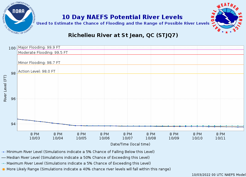
7 Day (NAEFS)
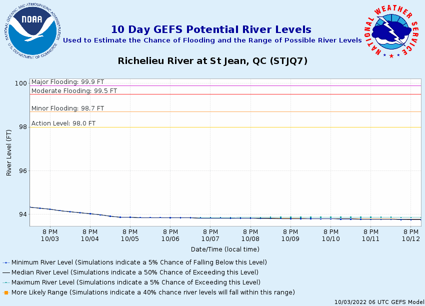
7 Day (GEFS)
Note: Use the official hydrograph at the top of this web page
for river levels within the next 72 hours.
The National Weather Service prepares its forecasts and other services in collaboration with agencies like the US Geological Survey, US Bureau of Reclamation, US Army Corps of Engineers, Natural Resource Conservation Service, National Park Service, ALERT Users Group, Bureau of Indian Affairs, and many state and local emergency managers across the country. For details, please click here.
NWS Information
National Weather Service
Burlington Weather Forecast Office
1200 Airport Drive
South Burlington, VT 05403
(802) 862-2475 Ask Questions/Webmaster
Page last modified: 2-Nov-2020 7:30 PM