Latitude/Longitude Disclaimer: The gauge location shown in the above map
is the approximate location based on the latitude/longitude coordinates
provided to the NWS by the gauge owner.
Flood Impacts & Photos
If you notice any errors in the below information, please contact our Webmaster
10
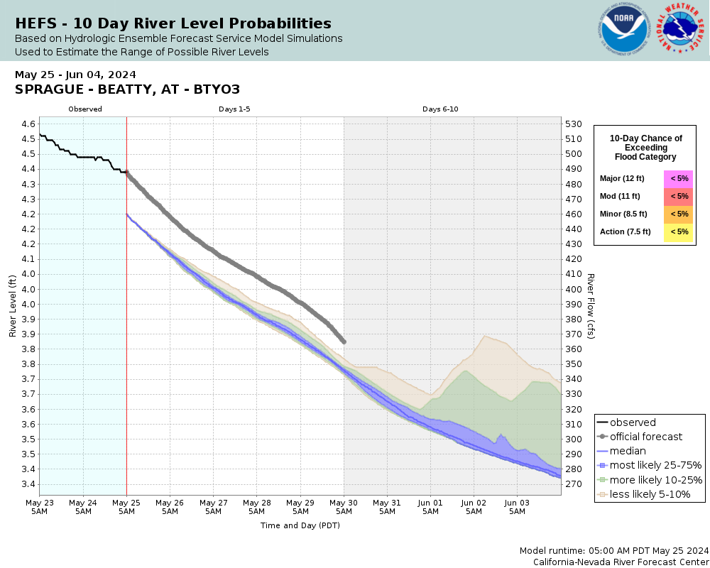
Flooding of numerous homes and other structures along the Sprague River is likely. Some relocations and evacuations have taken place at these river stages in the past.
9
Flooding of structures along the Sprague River in the vicinity of Sprague River, Lone Pine, and down stream can be expected. Widespread agricultural flooding is likely in this area as well.
8
Widespread agricultural flooding can be expected downstream in the Sprague River Valley in the vicinity of Sprague River and Lone Pine.
The National Weather Service prepares its forecasts and other services in collaboration with agencies like the US Geological Survey, US Bureau of Reclamation, US Army Corps of Engineers, Natural Resource Conservation Service, National Park Service, ALERT Users Group, Bureau of Indian Affairs, and many state and local emergency managers across the country. For details, please click here.
NWS Information
National Weather Service
Medford Weather Forecast Office
4003 Cirrus Drive
Medford, OR 97504-4198
(541) 776-4303 Ask Questions/Webmaster
Page last modified: 2-Nov-2020 7:27 PM