Latitude/Longitude Disclaimer: The gauge location shown in the above map
is the approximate location based on the latitude/longitude coordinates
provided to the NWS by the gauge owner.
Flood Impacts & Photos
If you notice any errors in the below information, please contact our Webmaster
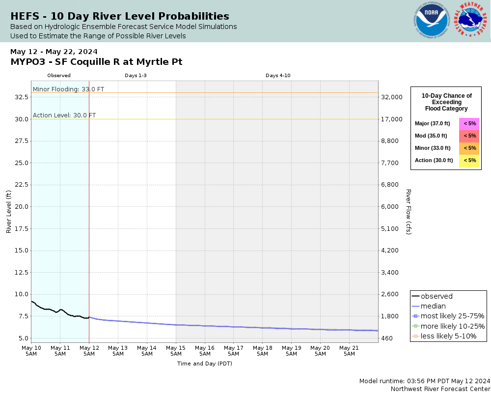
40
Extensive and widespread flooding along and near the South Fork Coquille River can be expected along with damage to houses farms and roads.
37
Extensive road and farmland flooding upstream and downstream of Myrtle Point can be expected. Some residents of low-lying areas in the vicinity of Myrtle Point may be threatened.
35
Expect flooding along some sections of Highway 42 downstream from Myrtle Point and along the highway to Powers. Widespread flooding of agricultural land can be expected.
33
The South Fork Coquille River is at flood stage. Expect flooding of roads west of the Spruce Street Bridge and significant pasture and agricultural land flooding.
32
Numerous areas of farmland become flooded and water nears the roads on the west side of the Spruce Street Bridge in Myrtle Point.
30
Agricultural and pasture land begins to flood. Impacts on cattle grazing are possible.
The National Weather Service prepares its forecasts and other services in collaboration with agencies like the US Geological Survey, US Bureau of Reclamation, US Army Corps of Engineers, Natural Resource Conservation Service, National Park Service, ALERT Users Group, Bureau of Indian Affairs, and many state and local emergency managers across the country. For details, please click here.
NWS Information
National Weather Service
Medford Weather Forecast Office
4003 Cirrus Drive
Medford, OR 97504-4198
(541) 776-4303 Ask Questions/Webmaster
Page last modified: 2-Nov-2020 7:27 PM