Latitude/Longitude Disclaimer: The gauge location shown in the above map
is the approximate location based on the latitude/longitude coordinates
provided to the NWS by the gauge owner.
Flood Impacts & Photos
If you notice any errors in the below information, please contact our Webmaster
34
Water reaches the road surface of the northbound 421 bridge.
30
Water reaches the base of the northbound Highway 421 bridge.
27
Major flooding begins. Flooding reaches Mermaid Point Restaurant on the south bank.
19
Moderate flooding begins. The storm drains on the north bank are inundated and water reaches the water treatment plant. Homes on Riverside Hills Drive are flooded.
17
Water threatens homes upstream on Riverside Hills Drive.
14
Minor flooding begins. The boat launch ramp and wooden deck at Mermaid Point Restaurant are flooded.
13
Action stage. The Cape Fear River reaches bankfull.
Potential River Levels Used to Estimate the Chance of Flooding and
the Range of Possible River Levels
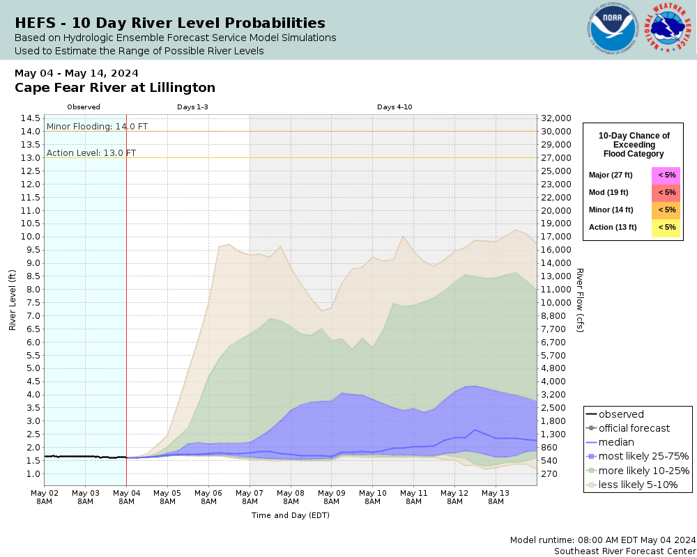
10 Day (HEFS)
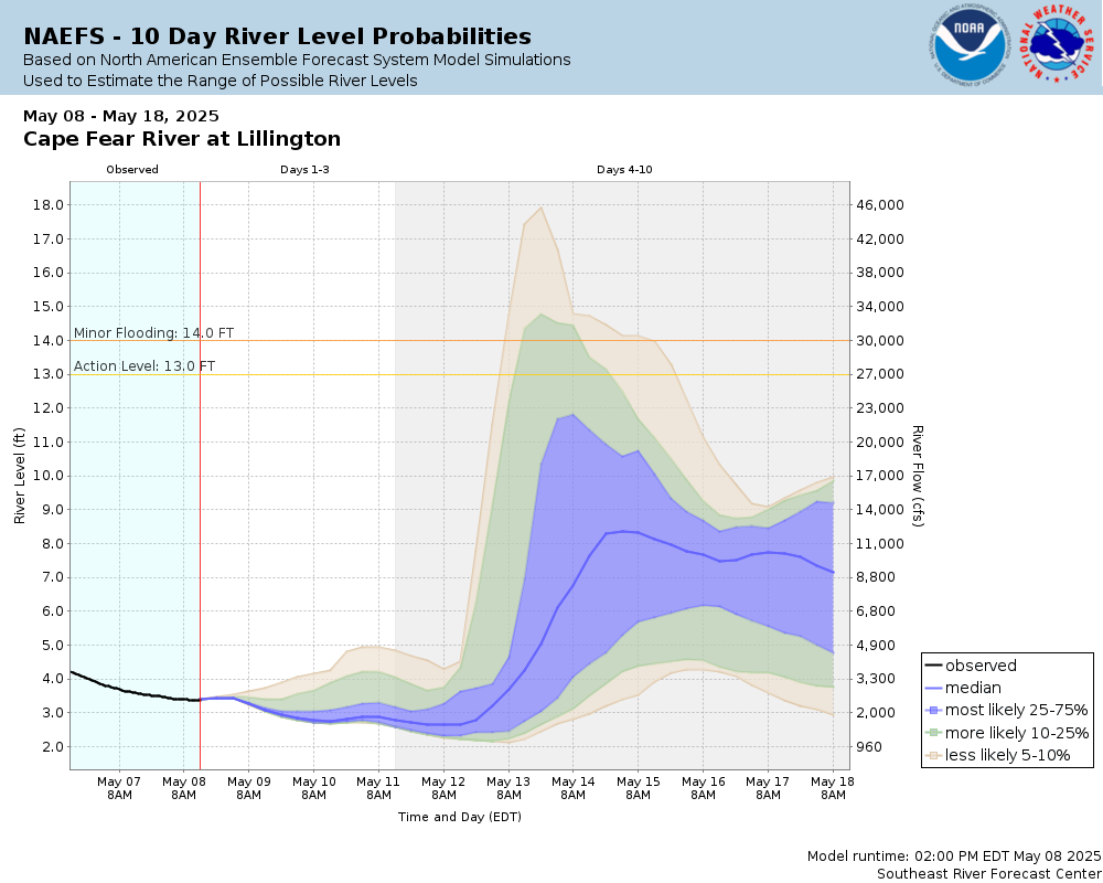
7 Day (NAEFS)
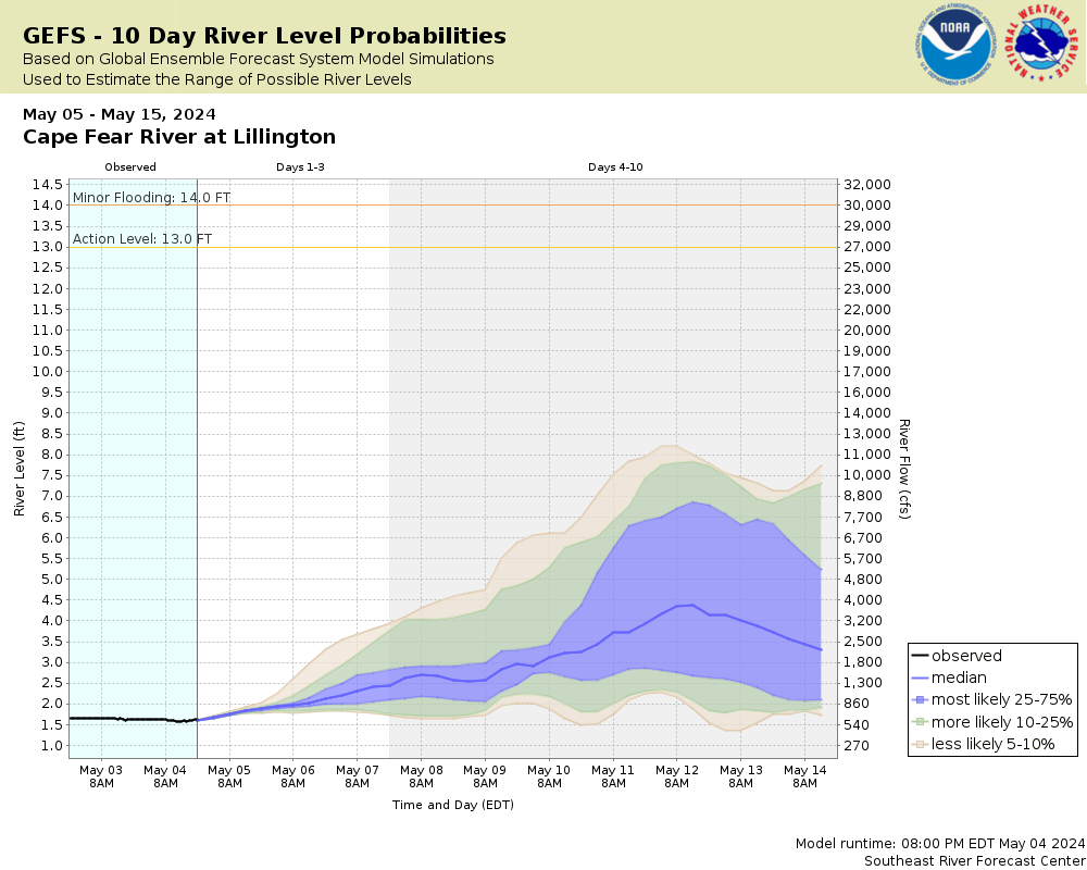
7 Day (GEFS)
Note: Use the official hydrograph at the top of this web page
for river levels within the next 72 Hours.
Collaborative Agencies
The National Weather Service prepares its forecasts and other services in collaboration with agencies like the US Geological Survey, US Bureau of Reclamation, US Army Corps of Engineers, Natural Resource Conservation Service, National Park Service, ALERT Users Group, Bureau of Indian Affairs, and many state and local emergency managers across the country. For details, please click here.
NWS Information
National Weather Service
Raleigh Weather Forecast Office
1005 Capability Drive, Suite 300
Raleigh, NC 27606
(919) 326-1042 Ask Questions/Webmaster
Page last modified: 2-Nov-2020 7:30 PM