Latitude/Longitude Disclaimer: The gauge location shown in the above map
is the approximate location based on the latitude/longitude coordinates
provided to the NWS by the gauge owner.
Flood Impacts & Photos
If you notice any errors in the below information, please contact our Webmaster
31.66
This is the flood of record, set after hurricane Floyd on September 17, 1999.
28
The section of NC97 north of the river floods to about the intersection with US64.
27
Spruce Street at NC97 is flooded.
26
East Virginia Street floods east of the wastewater plant.
25
The on-ramps to US64 at NC97 begin to flood.
23
Several streets west of business US301 are flooded, including E Ridge Street and Melton Drive.
21
Flood stage. Flooding reaches Melton Drive and E Ridge Street.
18
Action stage. Water begins flowing into the city sewer system.
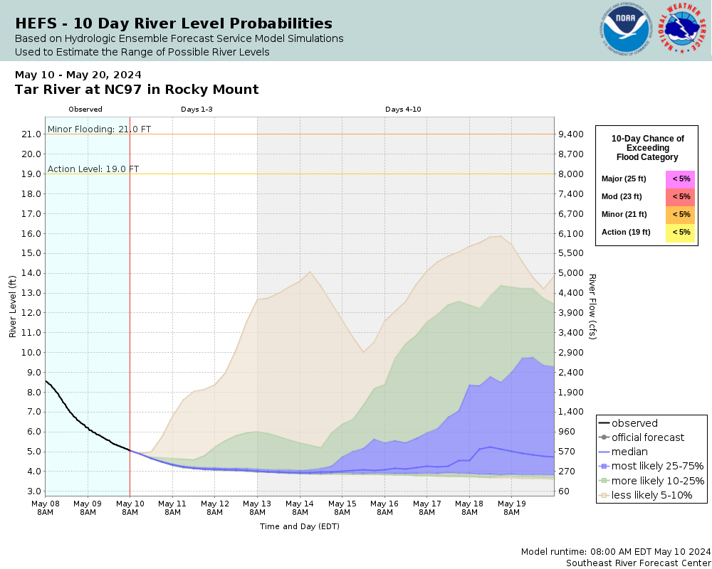
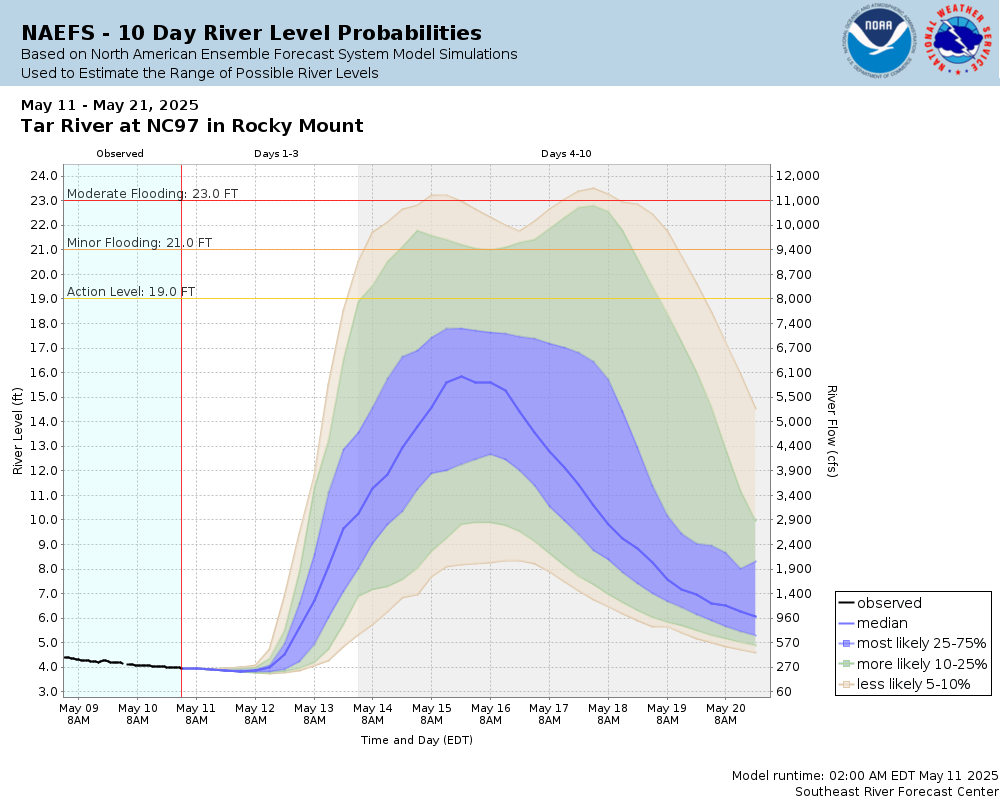
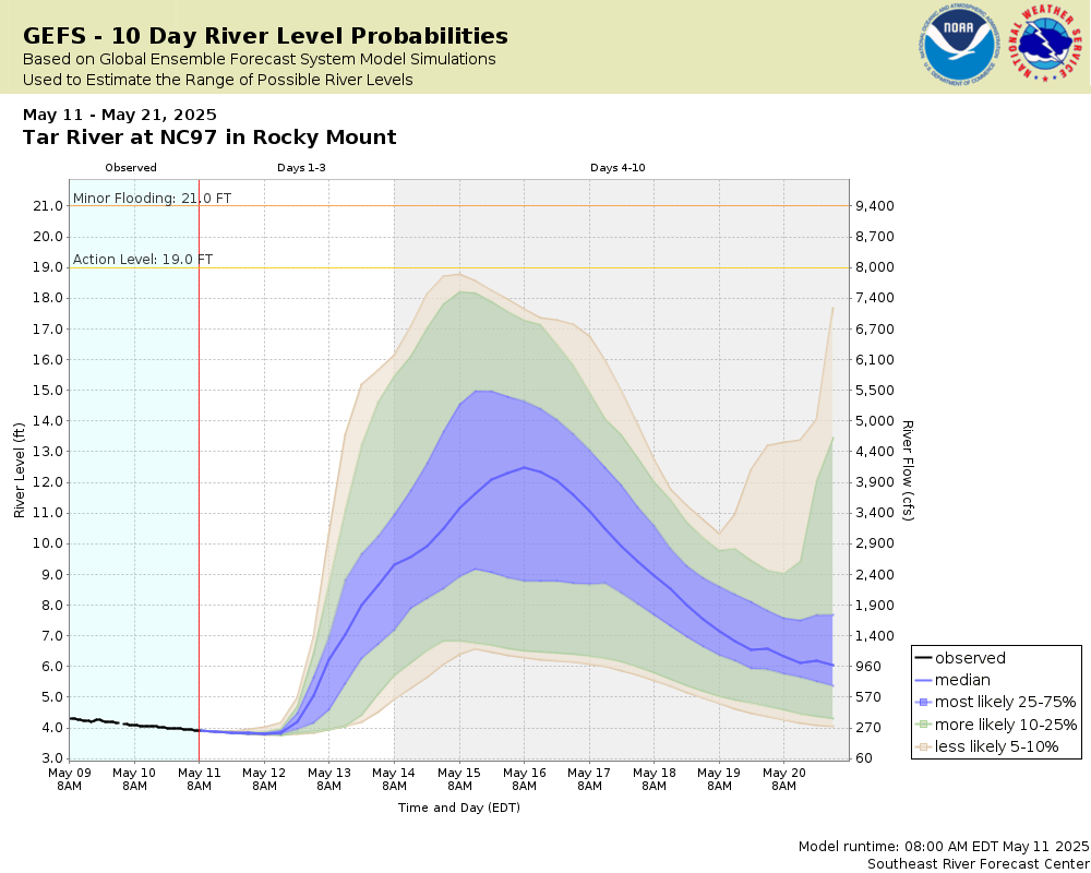
Potential River Levels Used to Estimate the Chance of Flooding and
the Range of Possible River Levels
10 Day (HEFS)
7 Day (NAEFS)
7 Day (GEFS)
Note: Use the official hydrograph at the top of this web page
for river levels within the next 72 Hours.
Collaborative Agencies
The National Weather Service prepares its forecasts and other services in collaboration with agencies like the US Geological Survey, US Bureau of Reclamation, US Army Corps of Engineers, Natural Resource Conservation Service, National Park Service, ALERT Users Group, Bureau of Indian Affairs, and many state and local emergency managers across the country. For details, please click here.
NWS Information
National Weather Service
Raleigh Weather Forecast Office
1005 Capability Drive, Suite 300
Raleigh, NC 27606
(919) 326-1042 Ask Questions/Webmaster
Page last modified: 2-Nov-2020 7:30 PM