Latitude/Longitude Disclaimer: The gauge location shown in the above map
is the approximate location based on the latitude/longitude coordinates
provided to the NWS by the gauge owner.
Flood Impacts & Photos
If you notice any errors in the below information, please contact our Webmaster
10.19
At 10.2 ft, major flooding can be expected in Coal Creek Canyon, the town of Cedar City, and low lying areas of the Cedar City valley.
9.4
At 9.4 ft, moderate flooding can be expected in Coal Creek Canyon, the town of Cedar City, and low lying areas of the Cedar City valley.
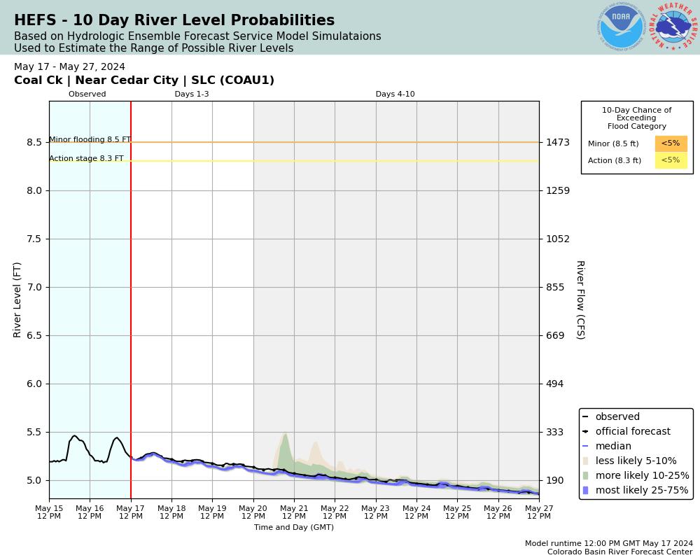
8.5
At 8.5 ft, flooding will occur in the low lying areas of the Cedar City valley. Developed areas may take on water if the flow duration is extended.
The National Weather Service prepares its forecasts and other services in collaboration with agencies like the US Geological Survey, US Bureau of Reclamation, US Army Corps of Engineers, Natural Resource Conservation Service, National Park Service, ALERT Users Group, Bureau of Indian Affairs, and many state and local emergency managers across the country. For details, please click here.
NWS Information
National Weather Service
Salt Lake City Weather Forecast Office
2242 West North Temple
Salt Lake City, UT 84116
(801) 524-5133 Ask Questions/Webmaster
Page last modified: 2-Nov-2020 7:28 PM