Latitude/Longitude Disclaimer: The gauge location shown in the above map
is the approximate location based on the latitude/longitude coordinates
provided to the NWS by the gauge owner.
Flood Impacts & Photos
If you notice any errors in the below information, please contact our Webmaster
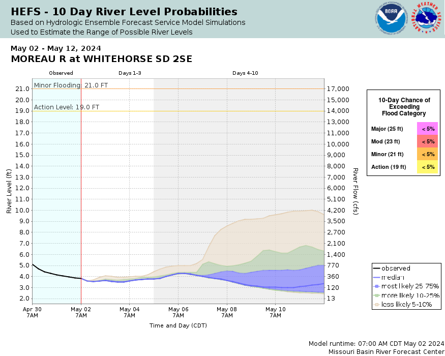
25.8
Major flooding of rural and pasture lands will occur as the banks on both sides of the river will be overtopped
25
The water level will reach the low steel on the highway bridge at the gauging location. Water is over the road on both sides of the bridge
23
Large amounts of pasture land on the right bank of the river are flooded
21
Low-lying pasture lands along the river begin to flood
The National Weather Service prepares its forecasts and other services in collaboration with agencies like the US Geological Survey, US Bureau of Reclamation, US Army Corps of Engineers, Natural Resource Conservation Service, National Park Service, ALERT Users Group, Bureau of Indian Affairs, and many state and local emergency managers across the country. For details, please click here.
NWS Information
National Weather Service
Aberdeen Weather Forecast Office
824 Brown County 14 South
Aberdeen, SD 57401 Ask Questions/Webmaster
Page last modified: 2-Nov-2020 7:29 PM


