Latitude/Longitude Disclaimer: The gauge location shown in the above map
is the approximate location based on the latitude/longitude coordinates
provided to the NWS by the gauge owner.
Flood Impacts & Photos
If you notice any errors in the below information, please contact our Webmaster
11
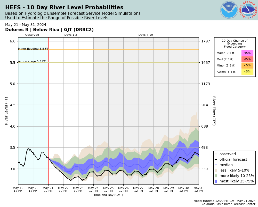
Major flood destruction of homes and property along the Dolores River. River erosion may cause land slides and river debris may damage bridges.
9.5
Major flooding is occurring. Sections of CO 145 are likely washed out.
8.5
Moderate flooding is occurring damaging buildings and property. Portions of CO 145 are impassable due to water.
7.3
Moderate flooding is occurring along the Dolores River between the towns of Rico and Dolores. Water is running over portions of CO 145.
7
The Dolores River nears sections of CO 145. Water is nearing homes and property. River banks are eroding and very unstable.
5.8
Minor flooding is occurring along the Dolores River between the towns of Rico and Dolores. River banks are eroding and becoming unstable. Agricultural land near and along the Dolores River is flooding.
5.5
Some minor flooding of low-lying agricultural land along the Dolores River between Rico and Dolores is likely.
5.4
River reaches bankfull in sections. Water begins to pool in low lying fields and agricultural land near and along the Dolores River.
The National Weather Service prepares its forecasts and other services in collaboration with agencies like the US Geological Survey, US Bureau of Reclamation, US Army Corps of Engineers, Natural Resource Conservation Service, National Park Service, ALERT Users Group, Bureau of Indian Affairs, and many state and local emergency managers across the country. For details, please click here.
NWS Information
National Weather Service
Grand Junction Weather Forecast Office
2844 Aviators Way
Grand Junction, CO 81506
(970) 243-7007 Ask Questions/Webmaster
Page last modified: 2-Nov-2020 7:28 PM