Latitude/Longitude Disclaimer: The gauge location shown in the above map
is the approximate location based on the latitude/longitude coordinates
provided to the NWS by the gauge owner.
Flood Impacts & Photos
If you notice any errors in the below information, please contact our Webmaster
15.2
Expect widespread flooding in the town of Shady Cove. Also expect flooding of businesses, homes, and the Dodge Bridge County Park both upstream and downstream of the gage at Dodge Bridge.
15.2
Expect widespread flooding in the town of Shady Cove. Also expect flooding of businesses, homes, and the Dodge Bridge County Park both upstream and downstream of the gage at Dodge Bridge.
12.8
Expect considerable flooding throughout the town of Shady Cove.
12
Flooding begins in the southern portions of the town of Shady Cove.
11
Expect flooding of structures on the left bank of the Rogue River downstream from the river gage at Dodge Bridge. Widespread low-land flooding likely up and down stream from Dodge Bridge.
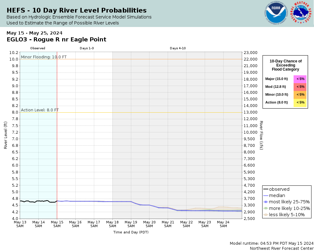
10
Expect flooding of low-lying farm and pasture land.
The National Weather Service prepares its forecasts and other services in collaboration with agencies like the US Geological Survey, US Bureau of Reclamation, US Army Corps of Engineers, Natural Resource Conservation Service, National Park Service, ALERT Users Group, Bureau of Indian Affairs, and many state and local emergency managers across the country. For details, please click here.
NWS Information
National Weather Service
Medford Weather Forecast Office
4003 Cirrus Drive
Medford, OR 97504-4198
(541) 776-4303 Ask Questions/Webmaster
Page last modified: 2-Nov-2020 7:27 PM